A Return to West Winter Action & An Active Pacific NW Pattern
The stage will be set beginning today and lasting into the rest of the week for heavy snow and precipitation for the Pacific NW, Cascades (Northern Intermountain West), and Great Basin.
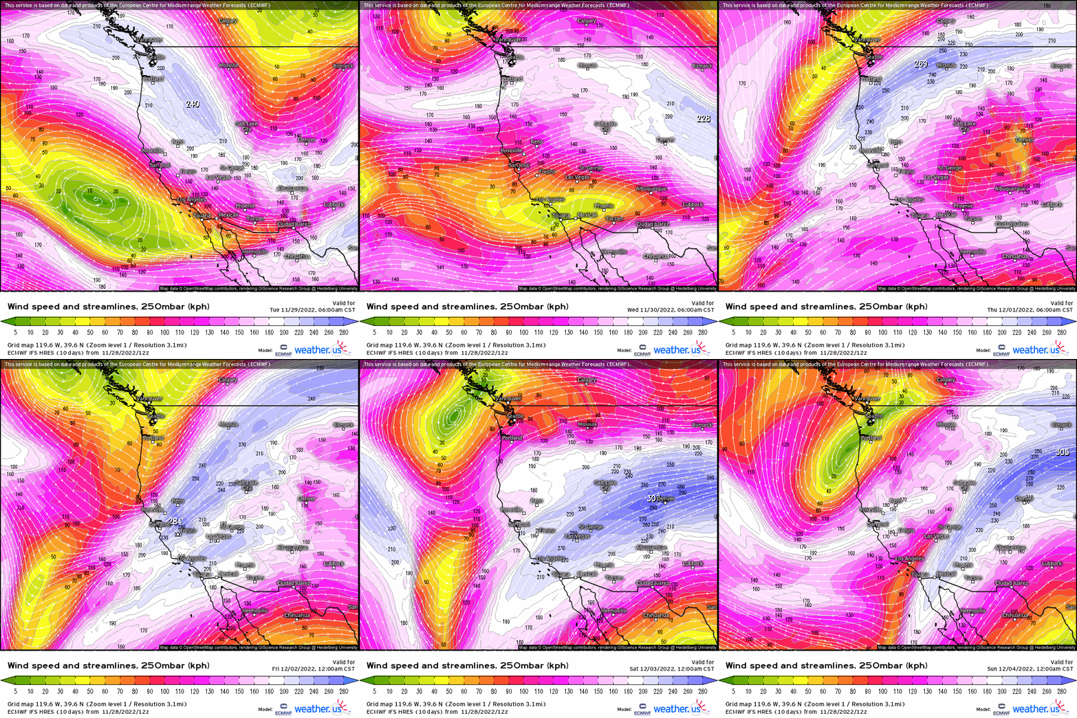
So much so, that places like Seattle may even see snow tonight and tomorrow! Lets dive into the details starting aloft at 250mb. We see the polar jet dip south here, outlining several troughs pinwheeling through beginning today and into this weekend. This shift helps to filter in cold, arctic air! That’ll be the case for the entire northern Rockies, Plains, and even upper portions of the Midwest.
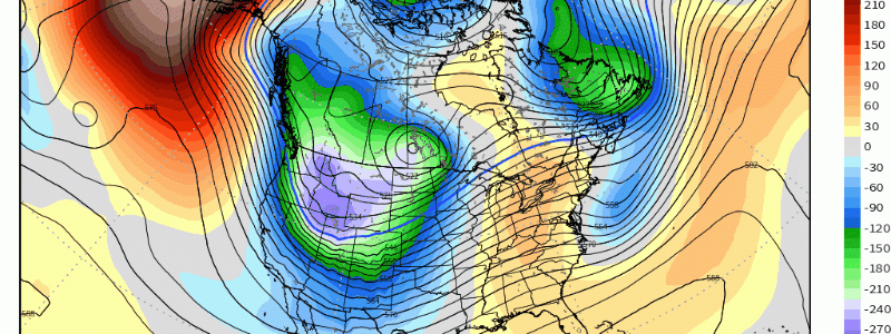
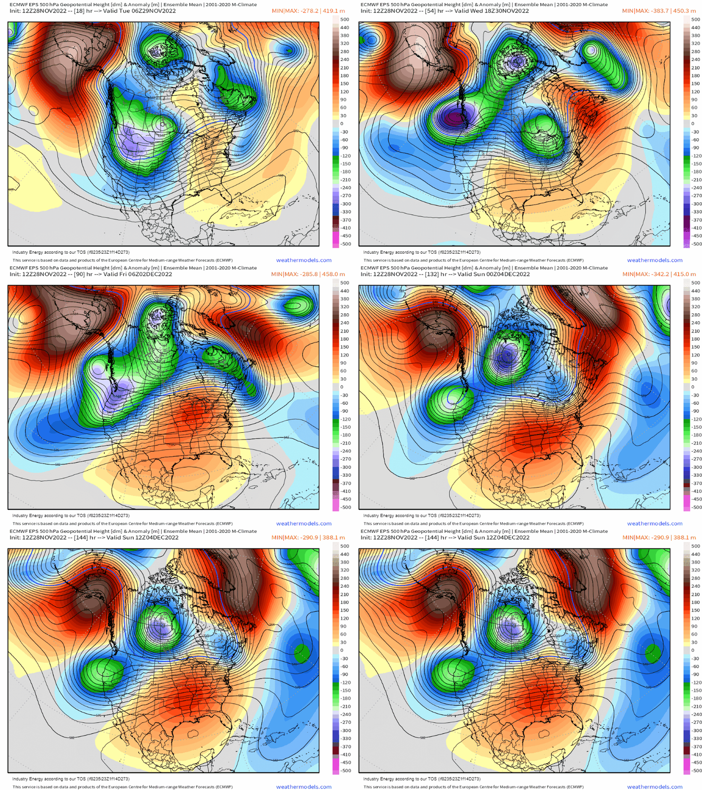
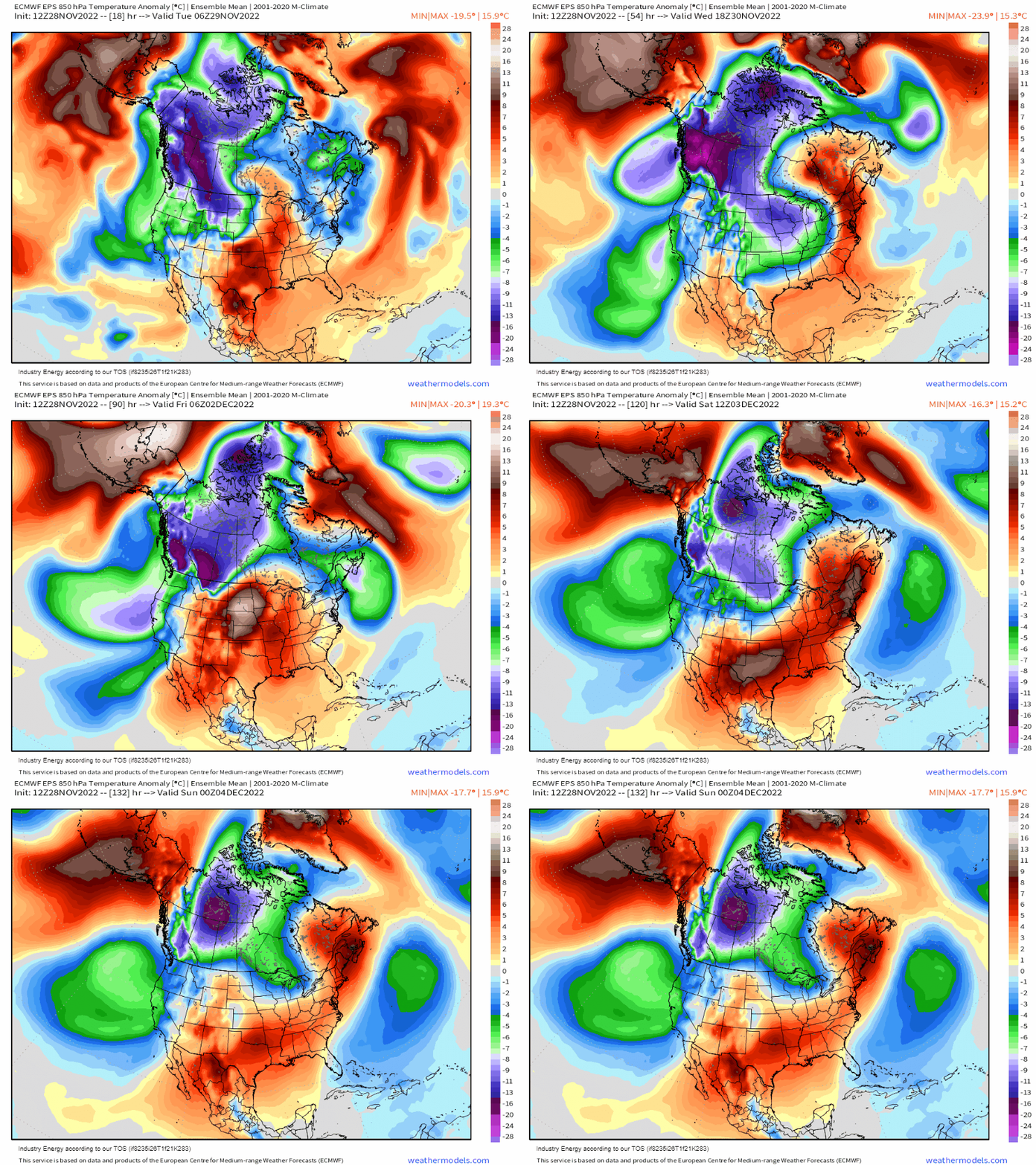
Looking at z500mb, notice several shortwave troughs and ULL’s rotate through continuously across the Pacific NW and Western Canada. This provides the necessary forcing for ascent in order to allow heavy precipitation to transpire. We see this below as ridging across Alaska and the Aleutians reinforce this, along with the 850mb temp anomalies to help reveal the cold, polar arctic air masses dig into the Western portion of the CONUS from the Arctic.
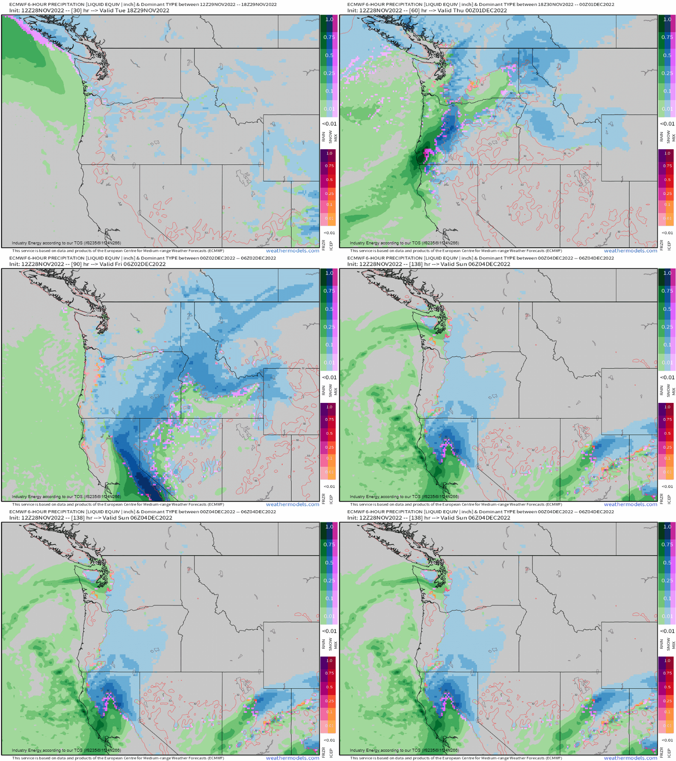
What this translates at the surface displaying Precip-type, is that one system moves through today and into the overnight, pushing out by tomorrow. There’s a good deal of uncertainty regarding Seattle and low-lying places (mean sea level locations) because a difference in a few degrees can dictate a few accumulating inches of snow, or plain rain! Then several systems follow through heading into the weekend providing more rain to places like California, while mountain snows continue.
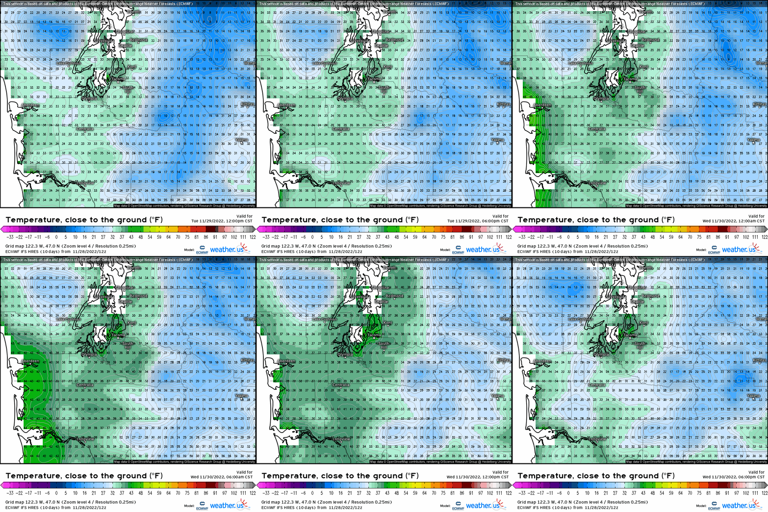
Notice the temperature variability in and around the low-lying elevations surrounding Seattle. Now of course it’s MUCH more than what the surface temperatures show, but the cold air will be worked down toward the surface through this synoptic evolution.
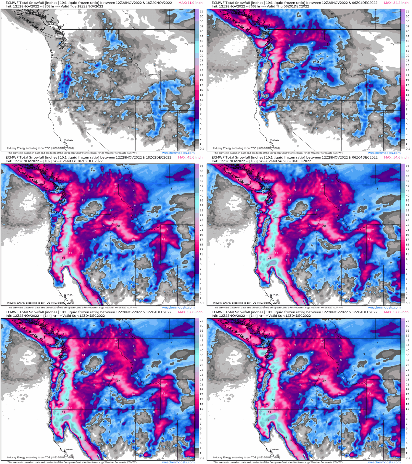
So what does this add up by the end of the week? Well notice Seattle sees verbatim some snow, especially if it gets heavier enough that can even change rain to snow (most likely). We’ll see several feet of snow fall across the Cascades, Sierra Nevada, and a good portion of the Intermountain West! If anything, it makes for fantastic skiing and snowboarding conditions!
