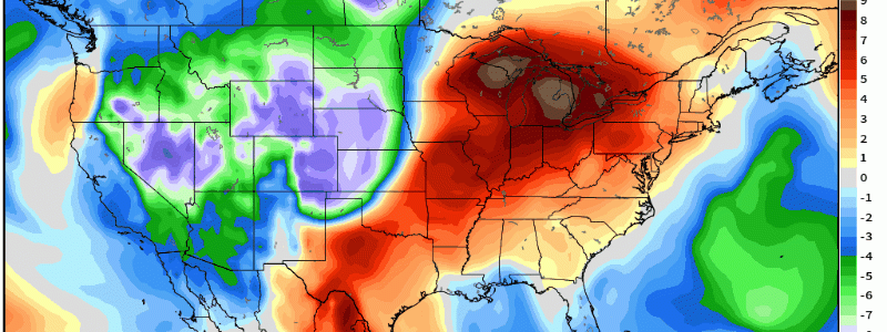
A Return To Unseasonably Cold Temperatures
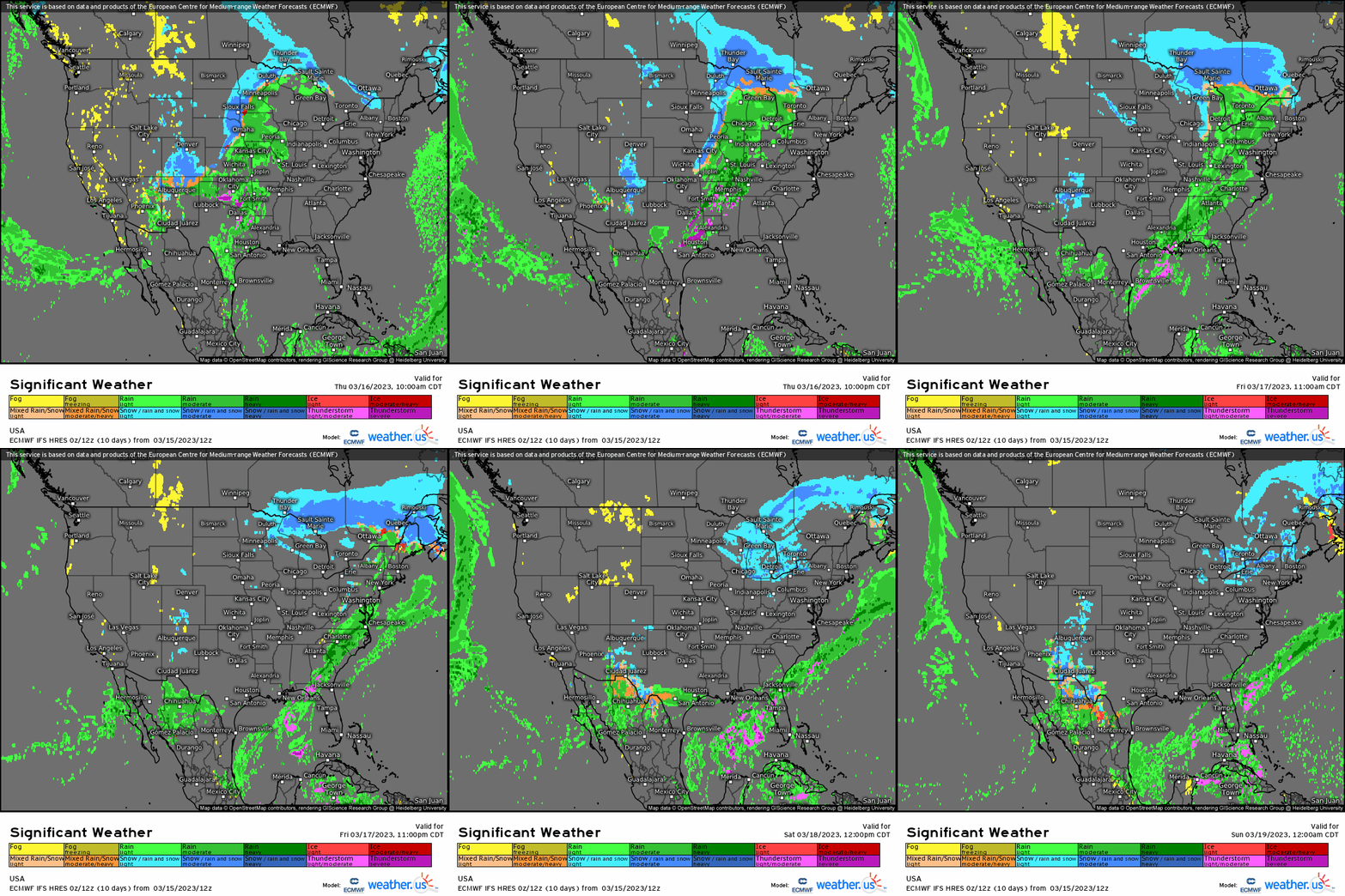
With a long frontal boundary that’ll bisect the CONUS through the Midwest, cyclogenesis will take place with an incipient low that’ll develop along this front and mature into a potent cyclone by the time it reaches the Great Lakes region. Impacts include yet more snow for places like MN, IA, and WI with backend snow showers as cold air advection occurs through the first half of the weekend. As this cyclone shifts into southern Canada, a cold front will sweep eastward allowing for mainly rain out ahead and along it as it surges toward the East Coast. It’s this front in particular, however, that’ll usher in cold temperatures.
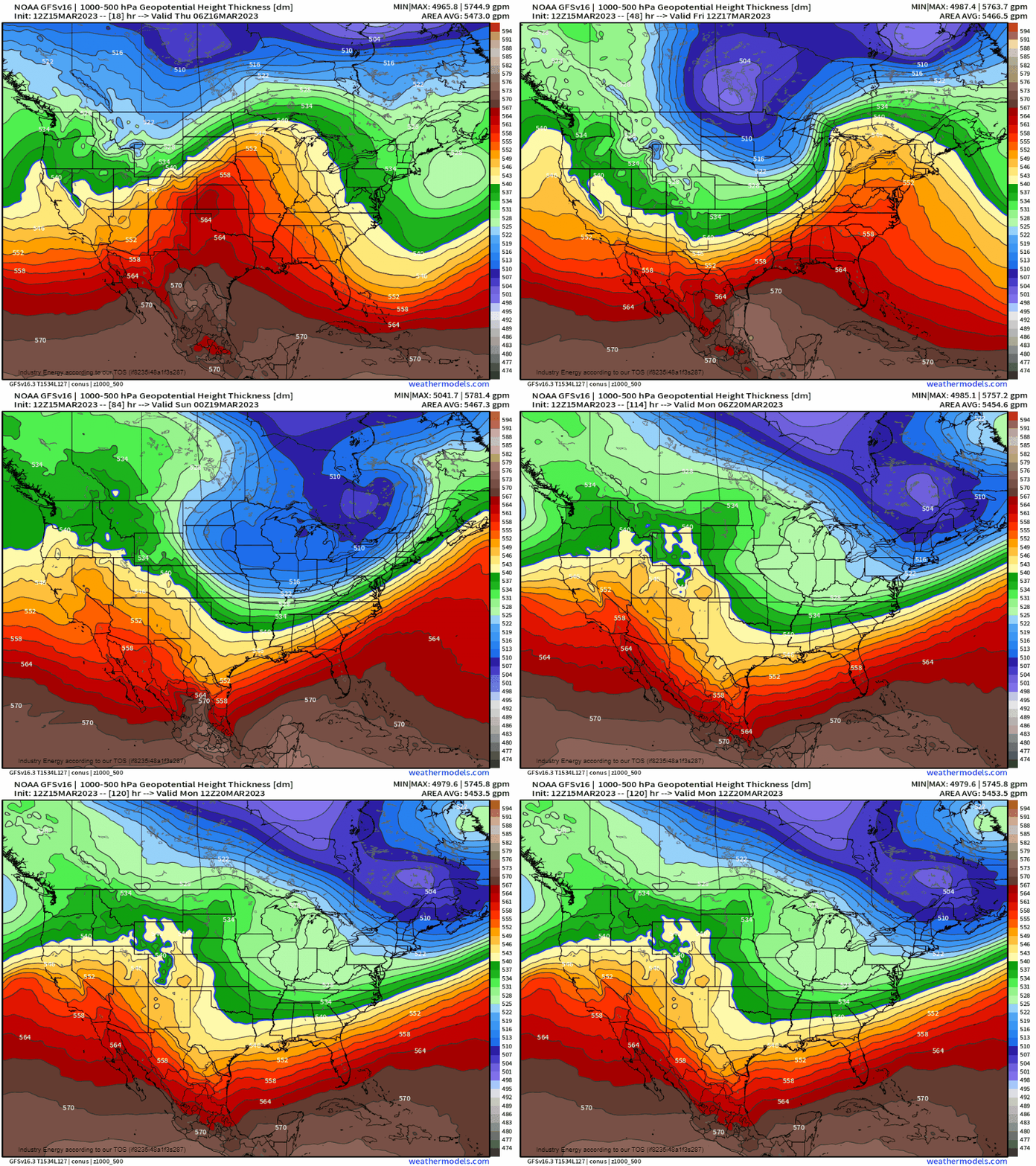
Utilizing a 1000-500mb thickness plot, we can see that as the cyclone shifts away, a sub 510dm mid-level trough shifts southward into the northern Plains before swinging eastward this weekend. With these low heights, it signifies that a modified continental polar air mass will be associated with this trough.
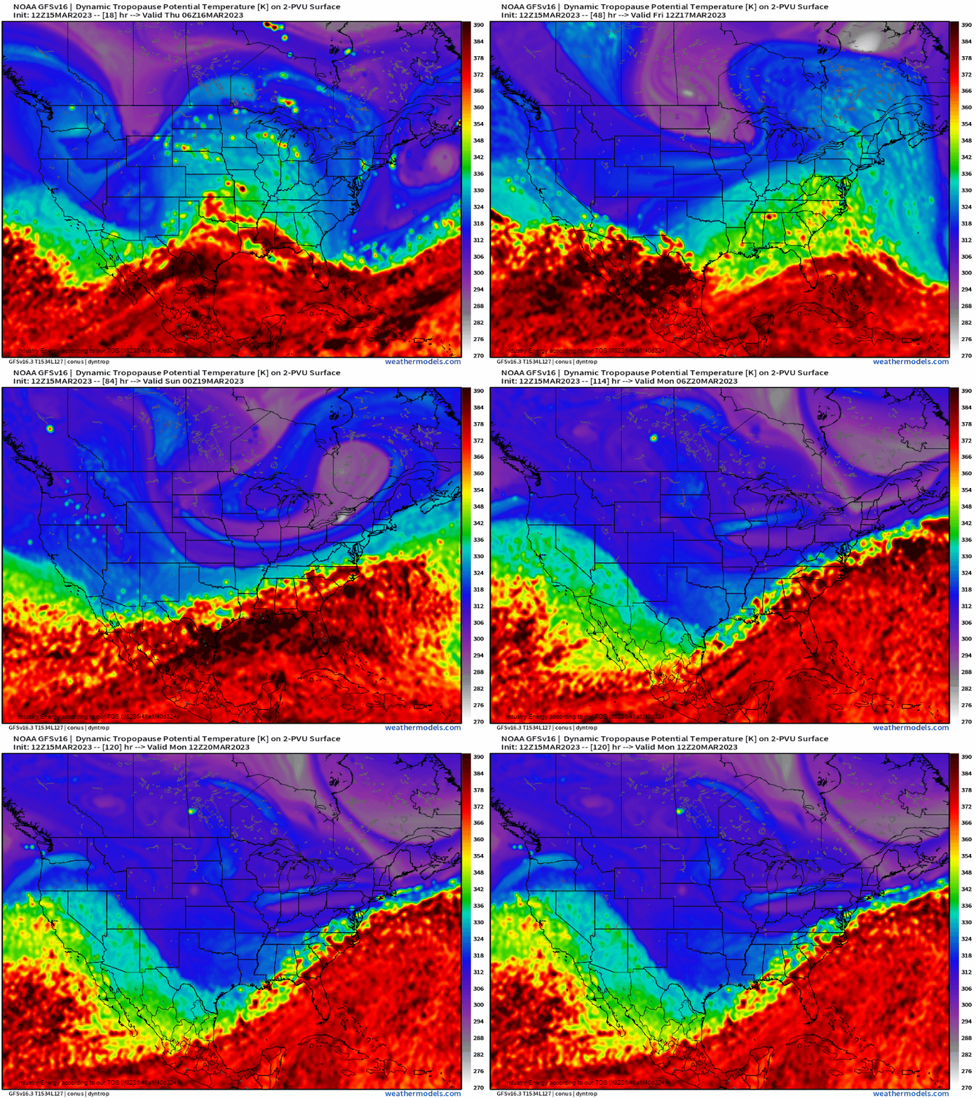
From a dynamic tropopause potential temperature forecasting standpoint: anything below ~ 315K for mid-latitude forecasting (color-matched with deep blue / purple) is indicative of polar air while values near 285K (grey/white) are associated with arctic air. Again, in the context of DT potential temperature, here where the tropopause (boundary that separates the troposphere and the stratosphere) is lower in the atmosphere means that parcels in a vertical distance (DT is a proxy for vertical height in this case) travels less to the ground opposed to a parcel starting much higher up. In essence, a parcel that is lowered adiabatically for a longer distance will result in a higher DT potential temperature value; hence, this is why you see the higher potential temperatures as you head to the tropics because there we know the tropopause is much higher!
Verbatim, we see what looks to be even arctic air mass characteristics in the form of a TPV lobe swipe the northern tier, which does translate to the surface very chilly temperatures and that’s what we’re going to be seeing.
At 850mb, we can see a large dome of cold air cascade southward into the heart of the nation, with 25 – 30 degrees below average at 850mb targeting the Plains, Deep South especially TX, and into the Midwest before moderating as it shifts eastward.
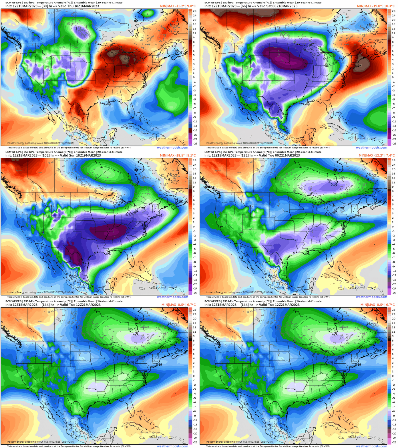
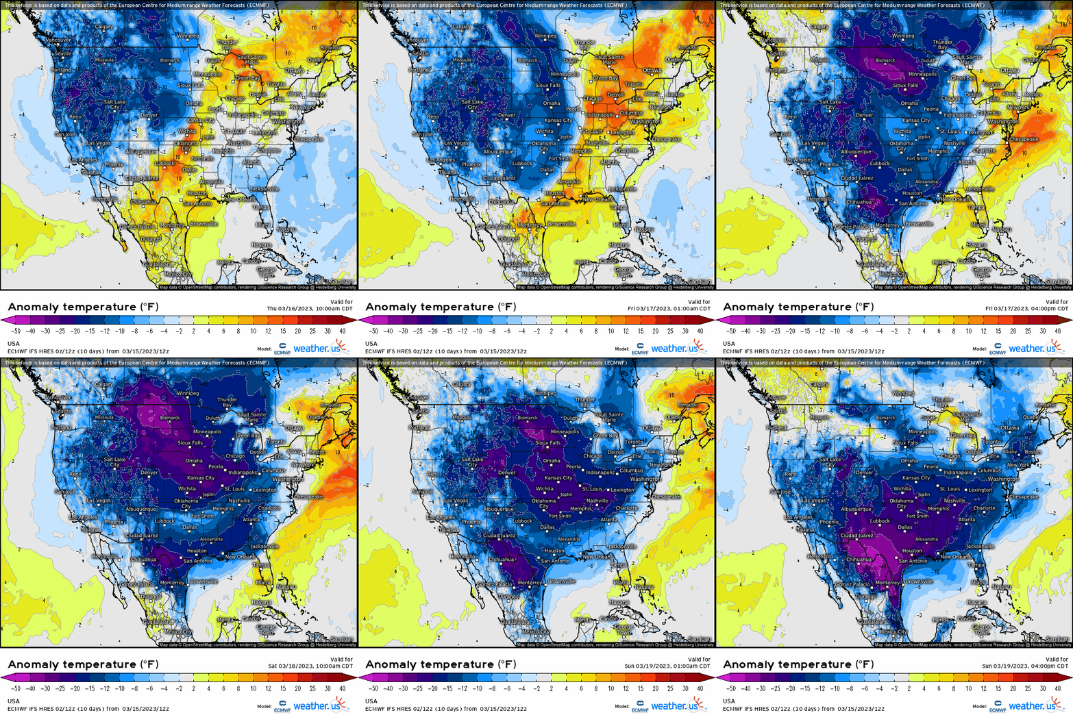
Now as we head to the 2 meter surface temperatures, here we can truly see the magnitude of the cold air work southward. We’re looking at anywhere from 10 to as much as +30 degrees below average for several days into next week! Texas especially will see a direct shot of this chilly air work its way down allowing for nighttime lows around freezing with high’s struggling to get out of the 40’s and 50’s. Elsewhere, for a large majority of the northern Plains, expect widespread temperatures in the single digits and teens for high’s with lows below zero.
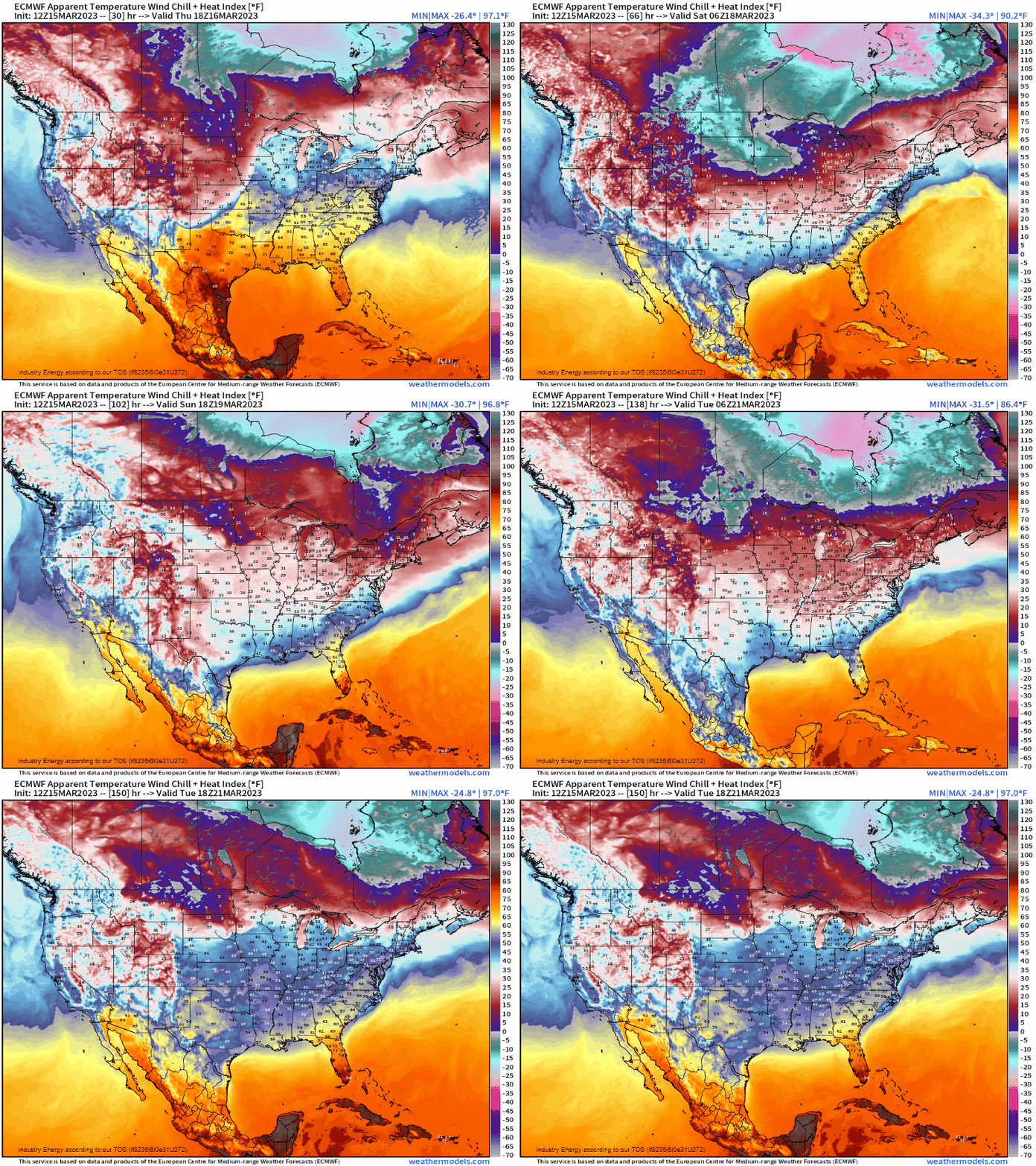
Wind chill values drop anywhere 10 to 20 degrees below zero for locations across the northern Plains and upper Midwest through the weekend before moderating some by early next week.
Further east, this same air mass will moderate as it translates with time toward the East Coast, though will keep temperatures below average for March standards. Unfortunately, signs continue to point to a more active and relatively chilly pattern for the lower 48 as any sign of sustained warmth will have to wait.


