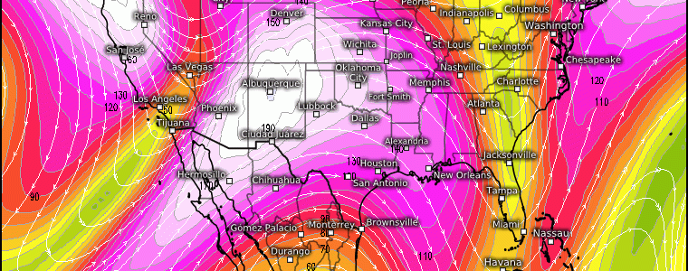
A Return To Atmospheric Rivers For The West Coast Next Week?
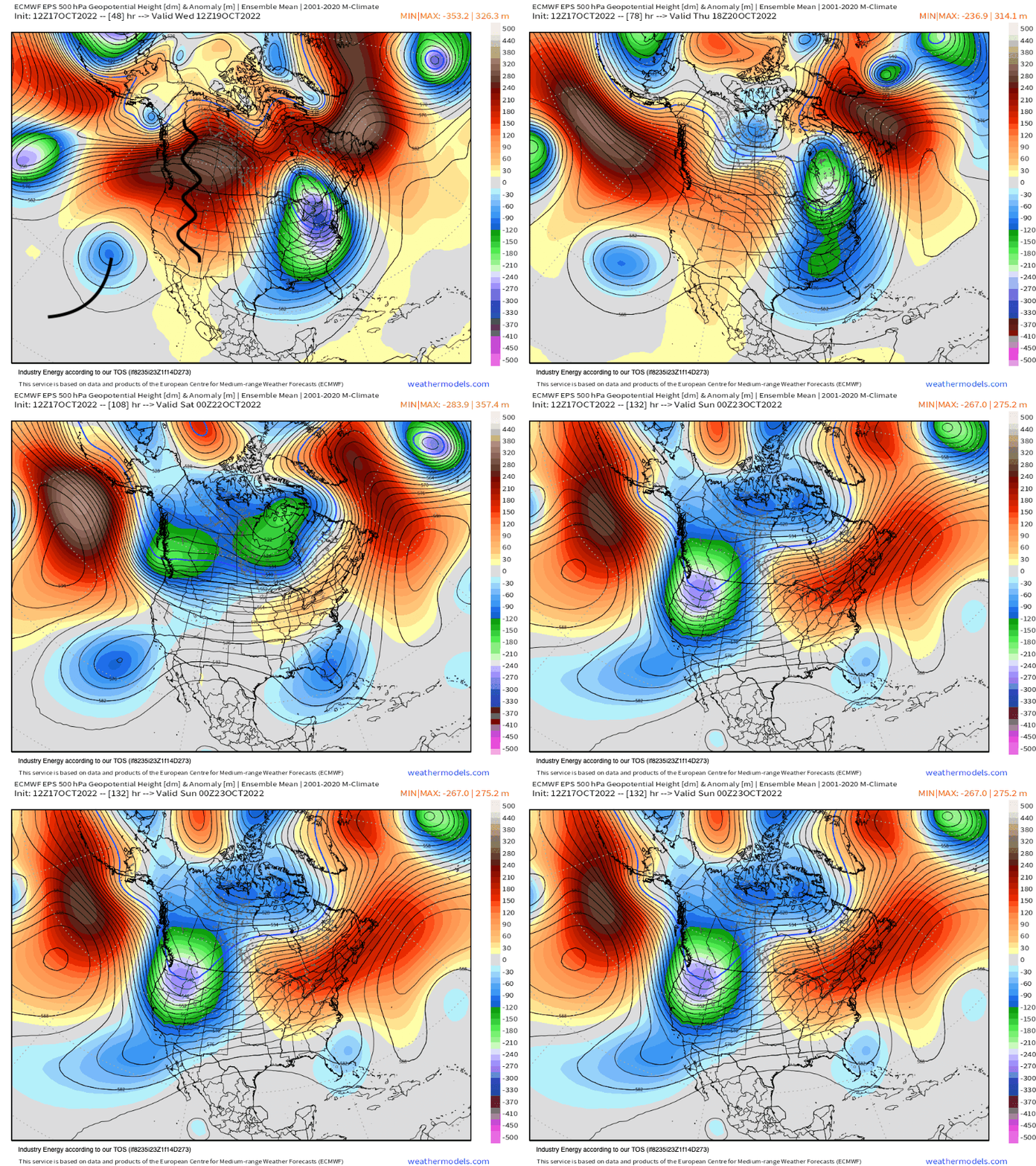
The pattern that I blogged about in my recent medium-long range post will have ramifications that begins later this weekend. As mentioned, the West Coast ridge has already begun to break down and will continue into this weekend while retrograding westward as shown below up toward the Northern Pacific. This synoptic alteration to the Rossby wave guide, sets the stage for a trough to then settle into the West Coast by early next week.
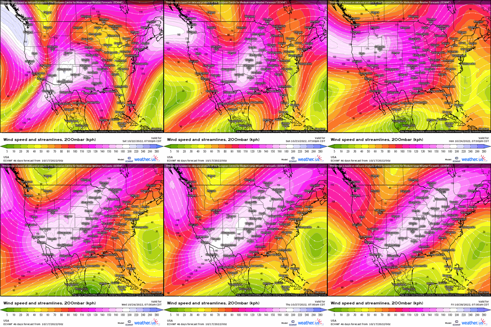
Aloft, lets see what this looks like at 200mb using the ECMWF EPS. The upper level jet shows the mean troughiness allocating into the West and meandering through midweek next week. This not only reveals the mid-upper level trough-ridge pattern, but it’s also responsible for low-level advection of moisture via trough’s orientation, and even outlining the sub-tropical jet feeding eastern Pacific moisture. However, it’s along the West Coast – more specifically Northern California and the Pacific NW, that’ll see a return to what looks poised for atmospheric rivers, or in other words a narrow river of mobile atmospheric water vapor that gets “carried” along with the jet stream.
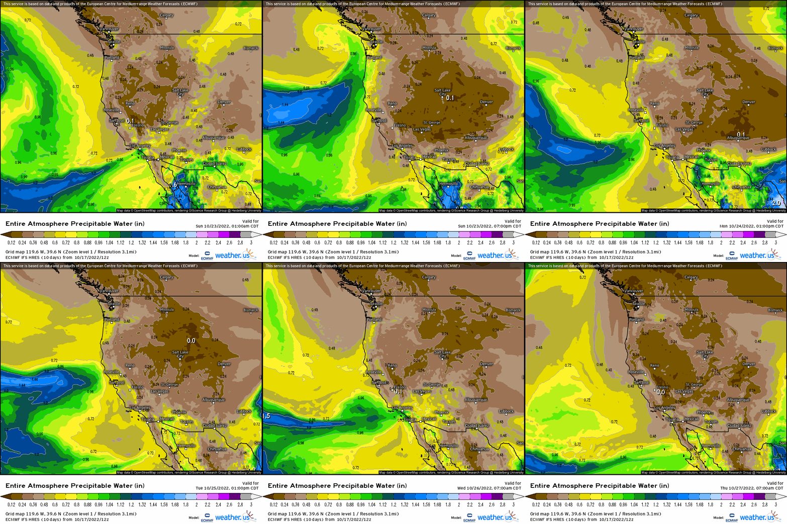
Taking the above and applying it in the form of using precipitable water, watch how it appears to be “waves” of vapor that crash into the West Coast, followed by a continuous plume that focuses across the Northwest.
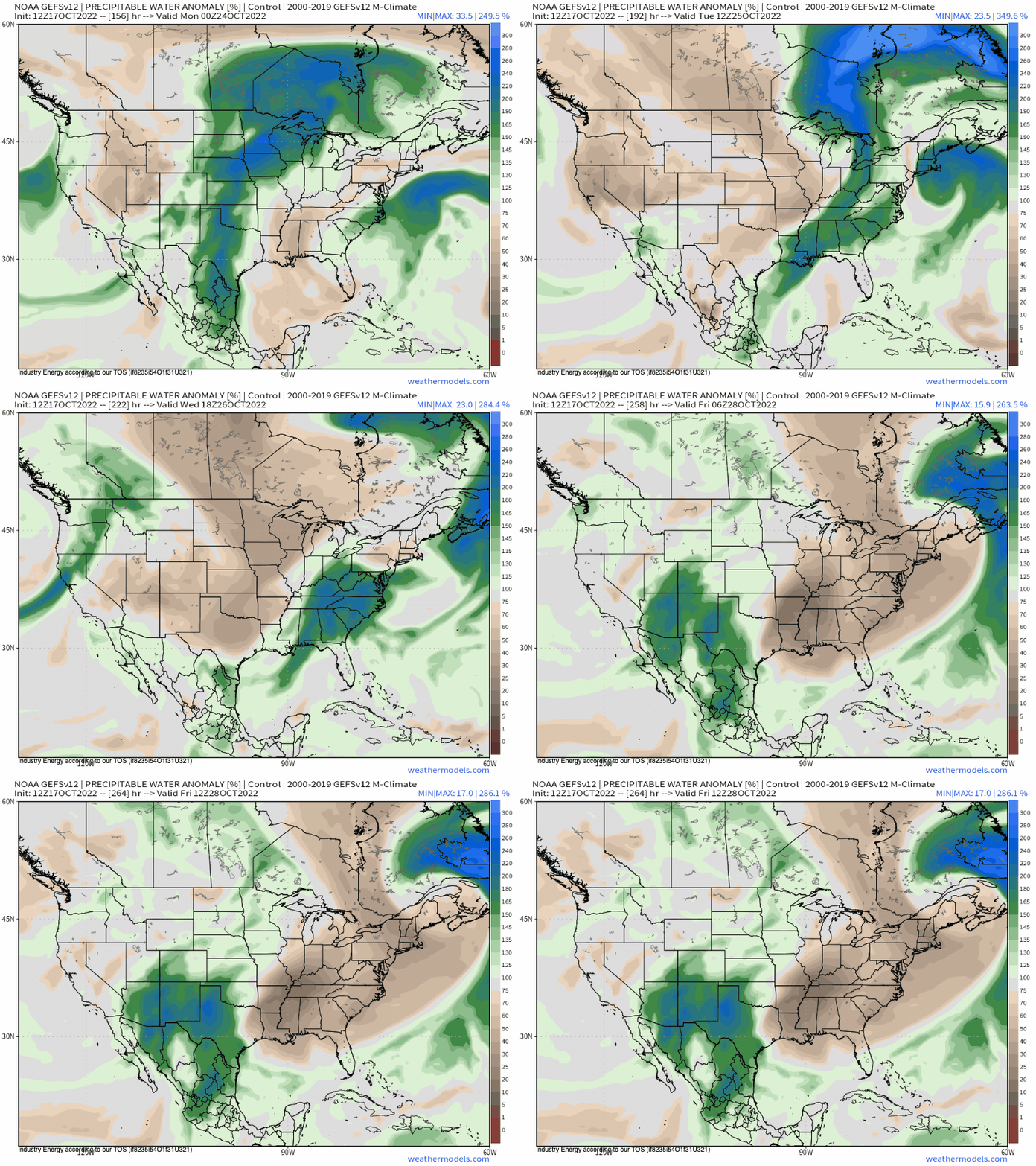
From a PWAT anomaly perspective using the GEFS, you’ll see again waves of nearly 100%, if not greater, PWAT departures from average into California and the Pacific NW.
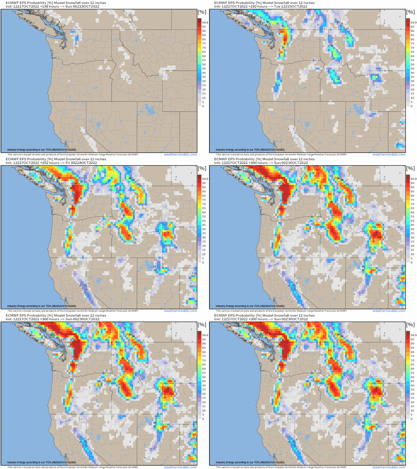
Atmospheric rivers are rather very beneficial in a way that they transport a substantial amount of condensed vapor, whereby it rises orographically and condenses, yielding precipitation in the form of rain and snow. This happens to statistically provide the west coast roughly 30-50% of their yearly total precipitation total rendering water supply. So while there is some uncertainty just how persistent these atmospheric rivers will be next week (i.e. some disagreement magnitude-wise), one thing does appear certain: heavy snowfall and rain are likely, with the former especially across the Sierra Nevada, Cascades, and the Northern Rockies. Speaking of snow, check out the EPS probability of seeing a foot or more through the end of next week. For an ensemble and seeing a large swatch of greater than 90% at this range is rather a significant signal! This has merit given the height pattern as discussed above! Heavy rainfall with several inches of rain and potential flash-flooding issues are a hazard with this type of setup.
Hopefully this ends up delivering since a large majority of the entire West Coast remains in a drought, and could use any precipitation they can get! This pattern is poised to produce in the very least!


