A Return To A Cooler Pattern For A Bit?
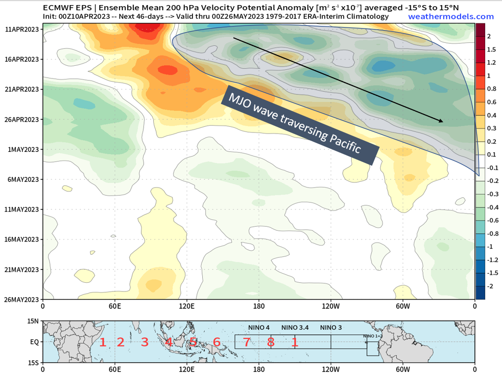
As I like to start off these medium-long range forecasts, I always want to start with the “foundation” and what exactly can influence the pattern across the northern hemisphere. This said foundation is starting off with the state of the tropics, and what the MJO (if there is a coherent wave) may propagate and where to. In this current case, we have a pretty coherent MJO wave emerging from the Western Pacific and propagate eastward across the Pacific, and tour the Western Hemisphere over the next 1-2 weeks. We see this on the hovmoller, where again the blues/greens represent upper-level divergence and that is where our convection is.
Again going off the foundation metaphor, we have composites gathered over time that try to best match what the synoptic upper level pattern was like when the MJO was in a certain position across the tropics. We see verbatim phase 7 into phase 8, which is what we’re going to see occur regarding the MJO phases through mid-April. Here below, a few entities stand out such as the -NAO (positive heights across Greenland into southern Canada) and positive heights across Alaska. Across the CONUS, deep below average heights exist across the Northeast along with troughing off the West Coast. Now, lets compare this to what the ensembles are showing at 500mb.
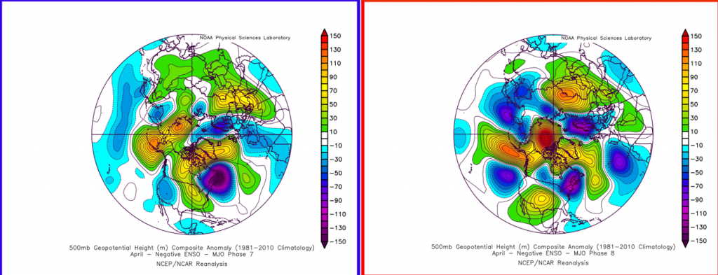
Unsurprisingly, we see our -NAO develop with retrograding heights dipping into Greenland and the Hudson Bay along with positive heights develop across Alaska. Across the U.S., we see a trough develop out across the Great Lakes, Ohio Valley, and Northeast with a ridge forming across the Central U.S., with below average heights off the West Coast. Pretty darn similar don’t ya think?
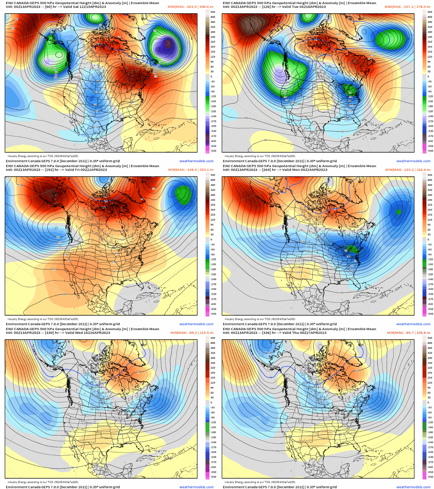
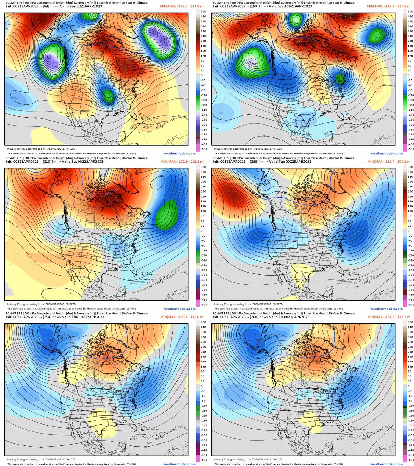
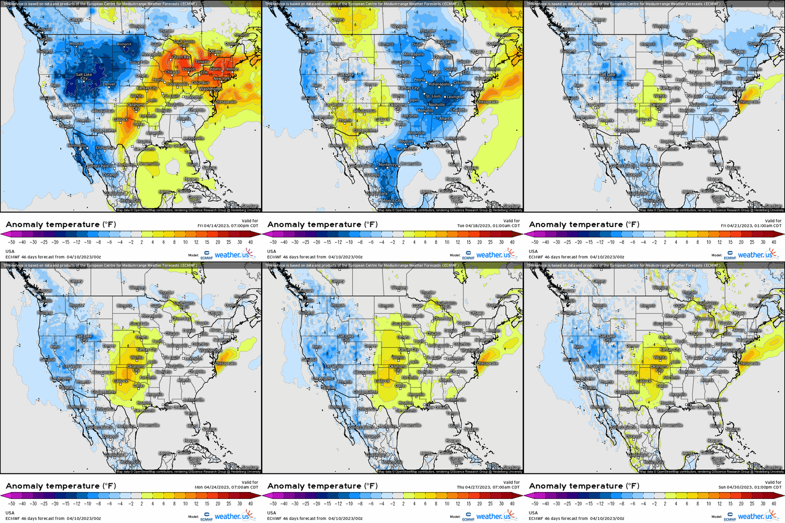
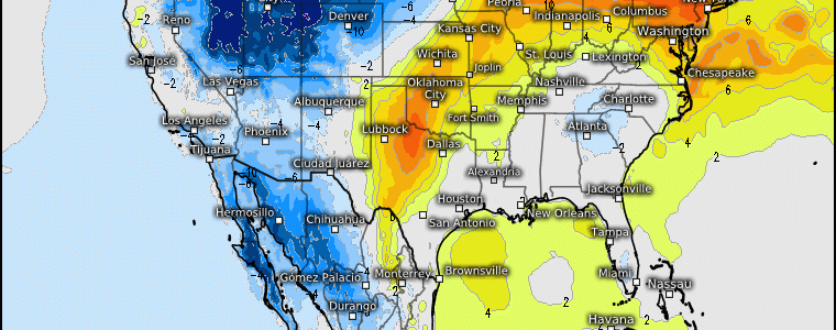
At the surface, this brings us below average temperature risks across the northern Plains, Great Lakes, and into the Northeast. Average to above average across the Plains and Midwest, with a continuation of below average temperatures across the West. Now it’s late April, so below average is all relative here, but the point is that as stated previously, the general pattern going forward isn’t one to “hit-and-hold”; rather, it’s transient with several cool shots but no notable heat as we’ve seen this entire past week! So if you’re maybe wondering for places that have seen record breaking high temperatures and if this just will be the pattern going forward, well to answer that question in a nutshell: no. It does appear likely that come early May we’ll see more in the way of ridging and more widespread above average temperatures, but we’ll reach that point once we get there!
