A Potent Severe Weather Day In The Plains!
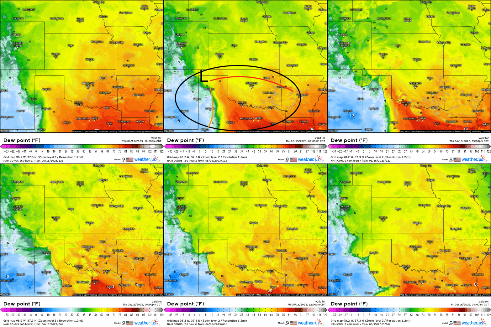
As we look ahead today, especially this afternoon and evening, we see a near classic setup for strong, severe thunderstorms that includes a surface low pressure system with a dryline (that gradually bulges), and a warm sector. Below, here is outlined that setup overlaid with surface dewpoints exceeding 65* F. It’ll be within that eclipse especially, where we’ll see the most significant severe weather hazards.
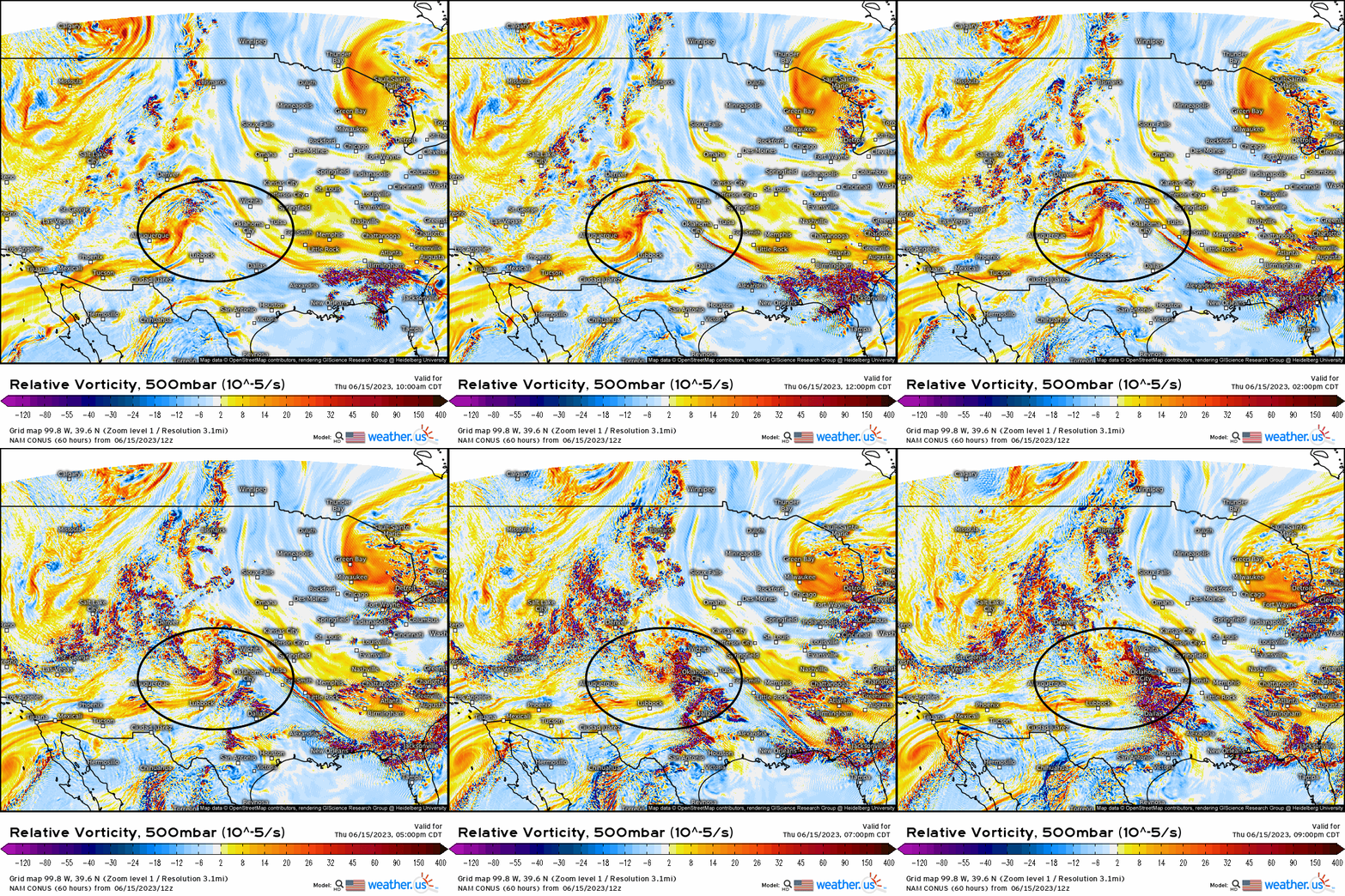
While we have the “trigger” for thunderstorms at the surface, we also have a shortwave trough (outlined below) that’ll pass through this area that helps to augment the vertical motion furthering the support for severe weather today. This shortwave will help to steepen lapse rates with cooling aloft as it swings through, which then further exacerbates a destabilizing boundary layer as moisture pools northward (those higher dewpoints) with solar insolation, and we get instability to rapidly increase.
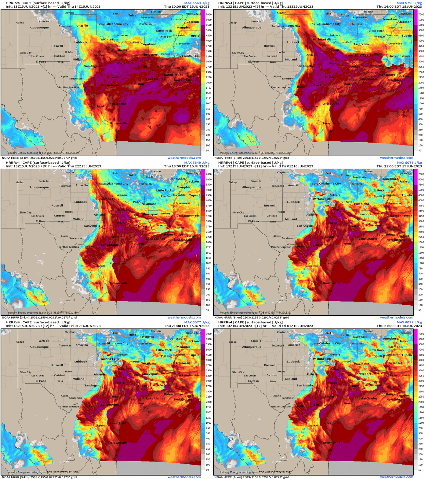
We see that evolution nicely here over the next several hours leading into peak heating by early afternoon. A surge of 2000 j/kg of CAPE bolts northward east of the bulging dryline and south of the warm front, where surface convergence and lift creates a very favorable environment for storms to fire off the dryline and intensify quickly with the plentiful CAPE.
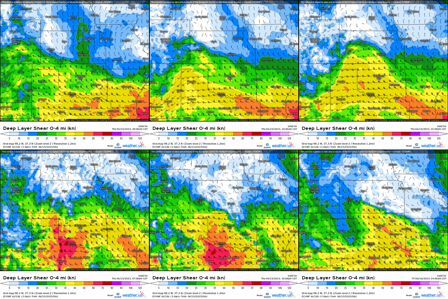
What now makes this setup so potent, and the development of intense supercells is that a belt of 50+ knot deep speed shear will overspread the region from KS to Ark-La-Tex today. Typically for supercell development, we tend to see if we have effective bulk shear (surface to 500mb) of over 25 knots to help keep updrafts separated from downdrafts, and produce rotating updrafts (that ultimately can produce a tornado). Here, we have well over that so it’s for this reason, in conjunction with strong CAPE that makes today such a threatening setup.
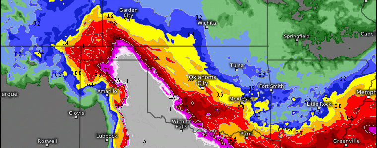
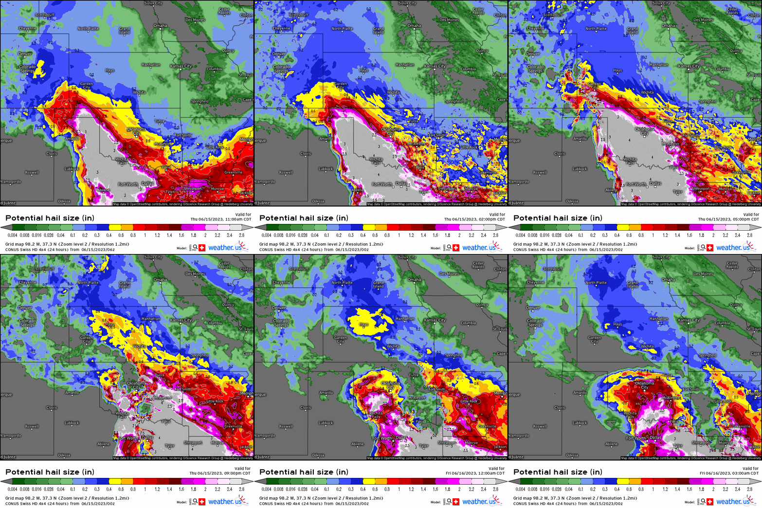
Hazards today will include large hail (baseball size and greater!), significant damaging gusts in excess of 60 mph+, and a few tornadoes with the stronger supercells. Below, we see a large swath of 3”+ hail size potential and astonishingly it covers a large area from the TX and OK panhandles and SW KS, across OK and north northern-central TX.
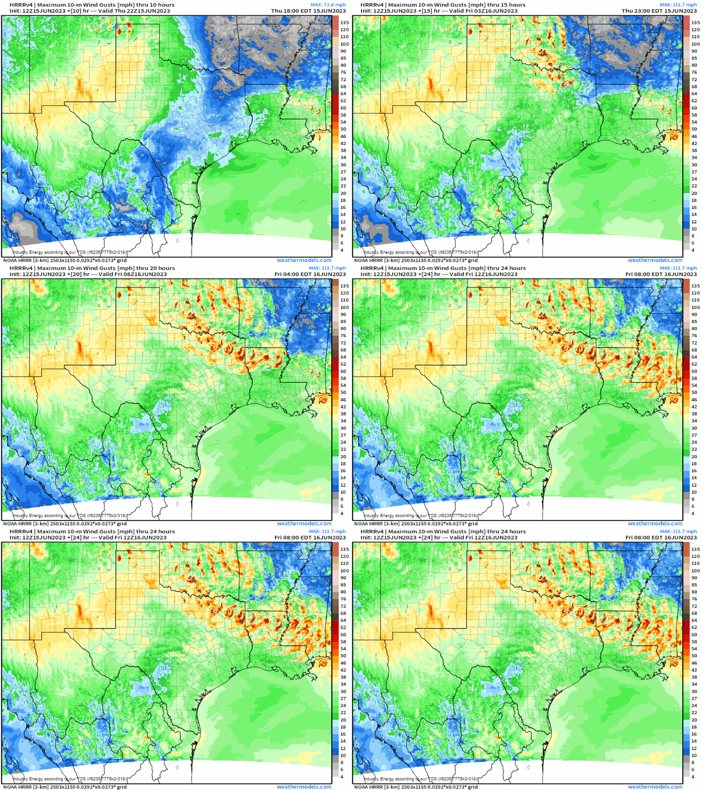
Once we see storms fire this afternoon and strengthen quickly, they’ll be able to produce intense gusts and watch toward the latter half of the animation. Notice how it reveals a pattern of straight line gusts from NE TX into the AR/MS/LA region? What this is showing is a “derecho”, which is a widespread mesoscale complex that comprises a long-lived wind event with rapidly moving thunderstorms. We tend to see these the most during the May-July months, and the setup is there for one to develop this evening and tonight!
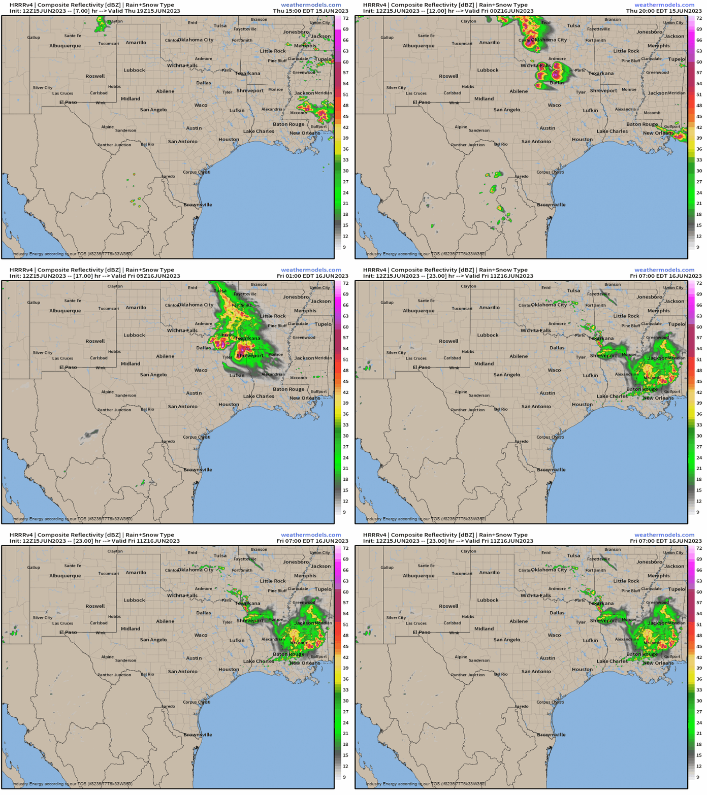
So today, expect storms to fire this afternoon between 3 – 4 PM CST across the TX/OK panhandles, and then progress southeastward this afternoon and evening where we’ll likely see intense supercells develop. Then by late this evening, we’ll see storms merge forming a cluster and this is where we can see a derecho develop and sustain itself given the environment it’s in.
If you reside in this area, please take necessary precautions and make for preparations given the very favorable environment today across the Plains and into the Deep South! Always have a backup plan, as it should be laid out prior to this afternoon, and listen to your local offices and/or broadcast local news for updates and tracking to stay weather aware!


