A Potent Rainmaker This Weekend Across The Northeast & Mid-Atlantic?
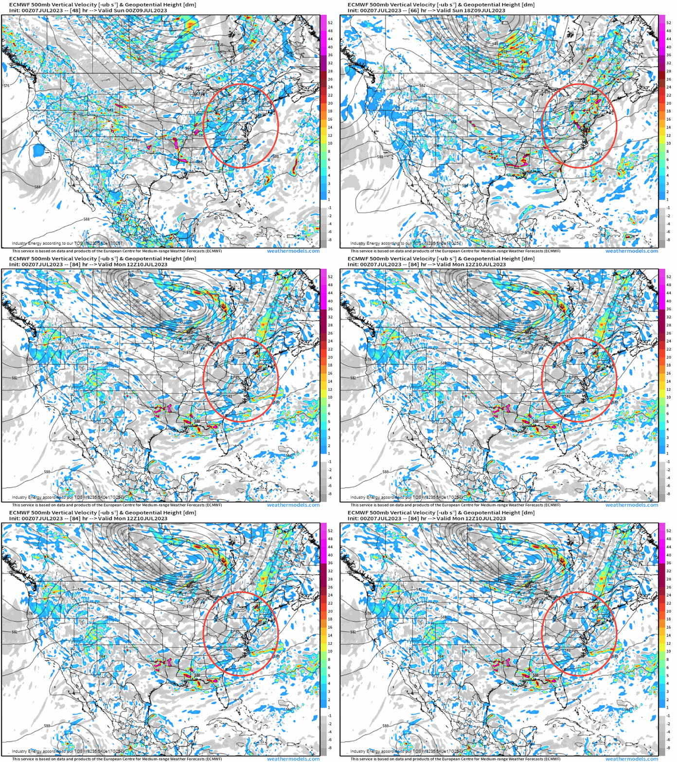
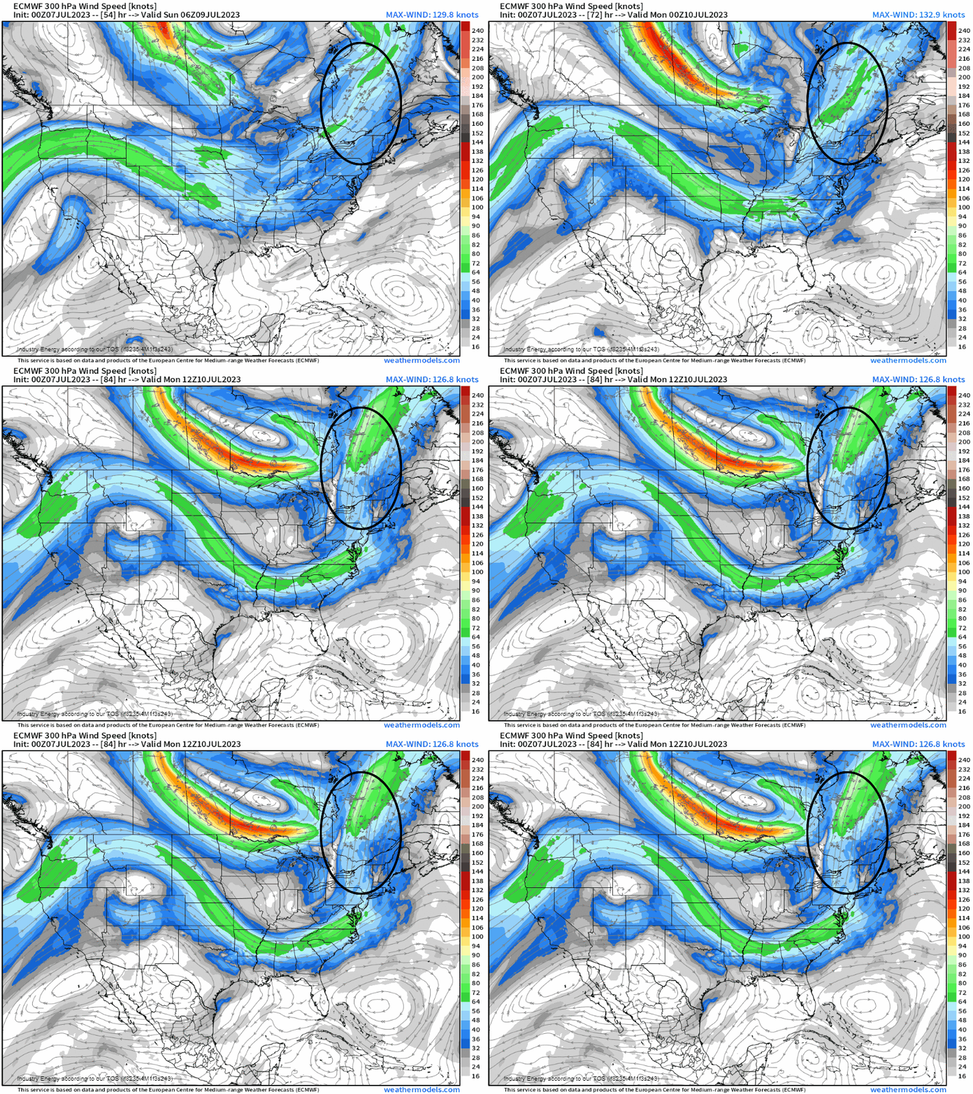
The end of this weekend across the Northeast and Mid-Atlantic could be looking at a potent rainmaker scenario on Sunday thanks to several ingredients that’ll make it rather favorable for heavy rain, showers, and thunderstorms. We begin by looking at the setup aloft at 500mb to identify what our forcing for ascent is in order to create precipitation. We see circled, a notable shortwave that is rounding the base of a longwave trough through the day Sunday, which verbatim is differential vorticity advection – a key ingredient in whether we’ll have rising motion or not. We see that we do indeed have this, so divergence is expected downstream of this trough. In conjunction, at 300mb, what’ll augment divergence even more will be a jet streak that propagates into southeastern Canada as circled in black. The Northeast will be juxtaposed within the right-rear entrance of this jet streak – a favorable position that’ll experience enhanced divergence that helps “pull” mass from the surface.
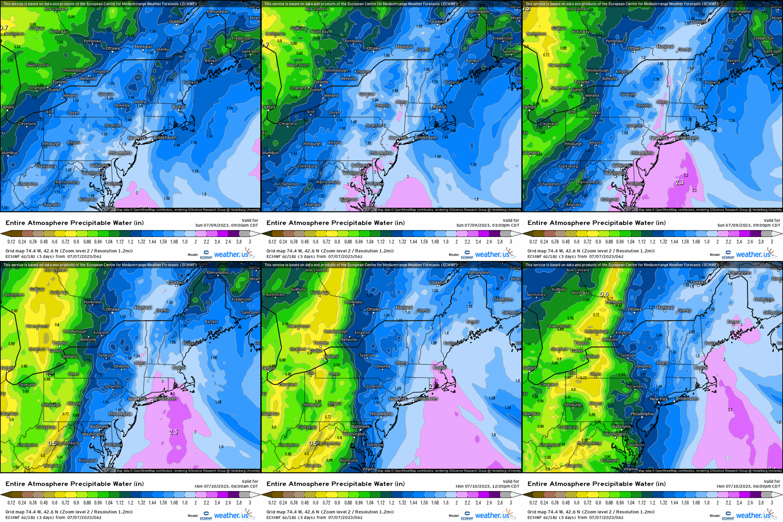
It’s important to have a forcing mechanism, but we also can’t have rising motion and therefore precipitation without moisture. In fact, according to the Storm Prediction Center, areas along I-95 in the Mid-Atlantic and into the Northeast will see record high PWAT values (over 2”) surge out ahead of a cold front, as a warm front surges into the general region by Sunday morning.
So we have divergence aloft, moisture, and now lets analyze a snapshot of the surface. Annotated here verbatim, we see a slowly moving cold front that becomes nearly stationary along the Appalachians. While we saw that at 500mb we had a favorable divergent setup aloft, it doesn’t always mean that precipitation is a guarantee; therefore, we need to see what could be the main forcing trigger within the boundary layer. We know that we’ll have a frontal boundary, which all means we’re going to see precipitation.
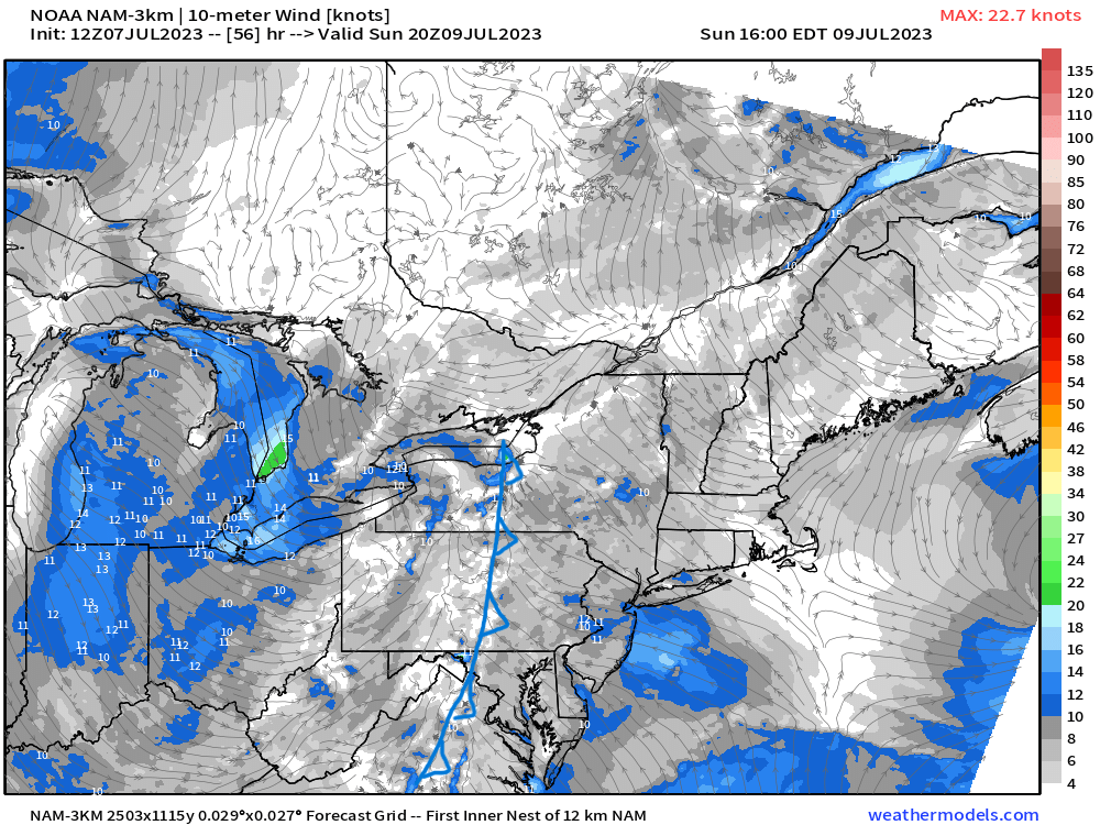
We have what we need for a solid dose of rainfall given: 1. Divergence aloft via jet streak 2. Shortwave trough 3. A forcing “trigger” at the surface 4. Moisture. All together, this creates vertical motion from the necessary lifting forces, and when combined we’ll see an interesting scenario supportive of heavy rainfall that has a high chance of leading to urbanized flooding where most of these two regions have seen a good bit of rainfall in the last few weeks.
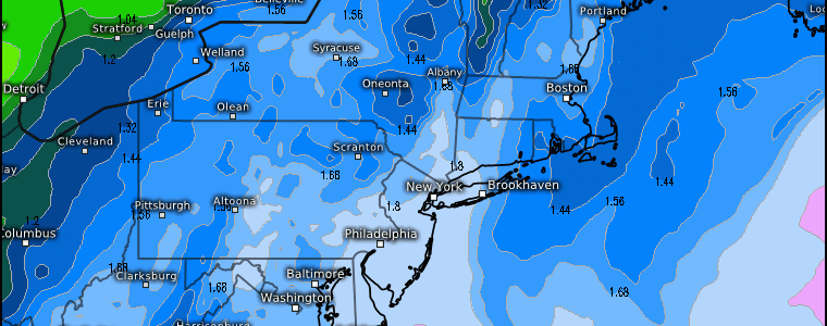
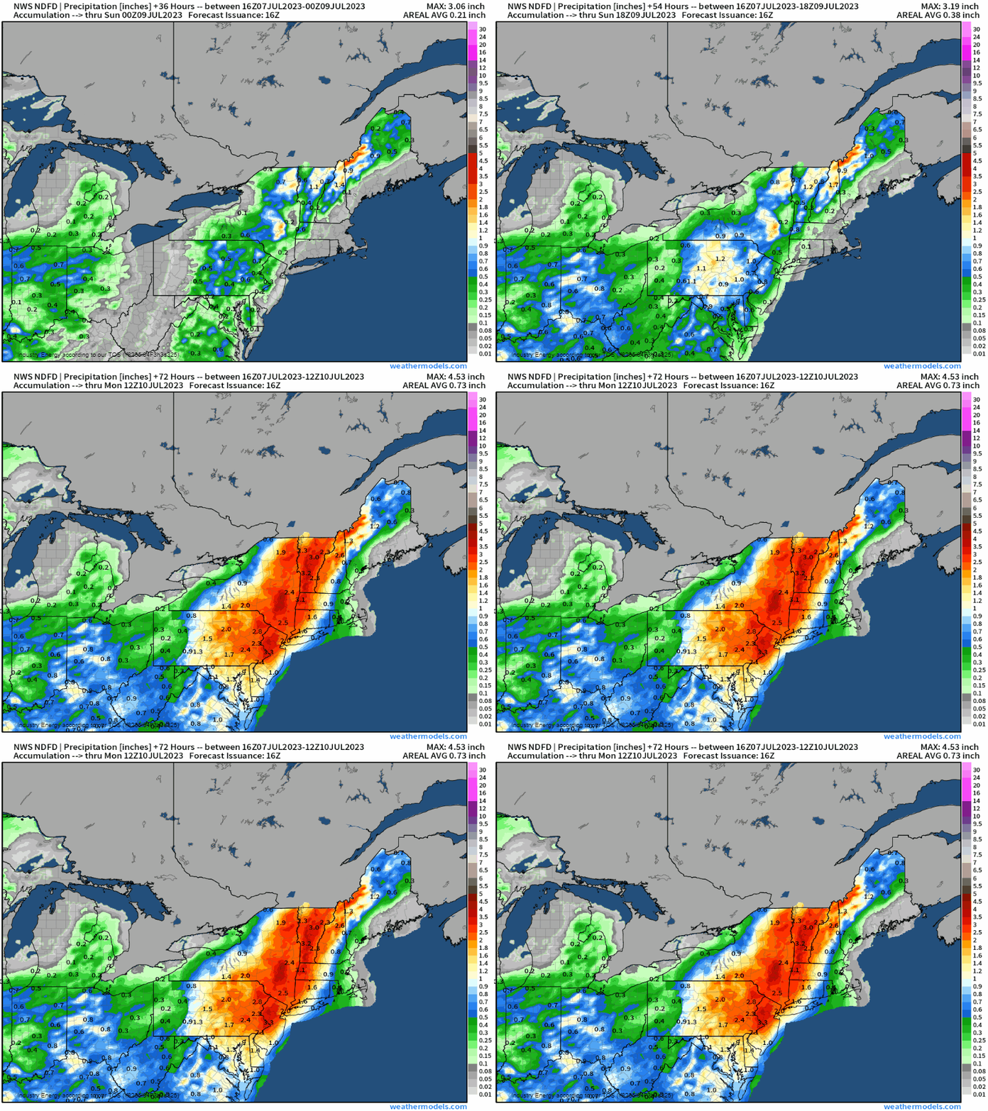
Putting it all together, we’ll see an axis of heavy rainfall of over 1.5” somewhere along the Appalachians from western MD, up to PA, and into NY on east. While we have some discrepancies amongst deterministic models on where the heaviest axis of rainfall will be, we do know that a widespread 1”+ will fall.
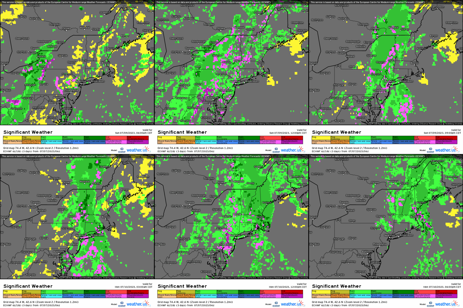
In conjunction, severe weather on Sunday looks likely, especially south of the Maxon-Dixon line where favorable instability and shear look to create clusters that could produce hail and damaging gusts while thunderstorms look to occur as well further north into the Northeast.
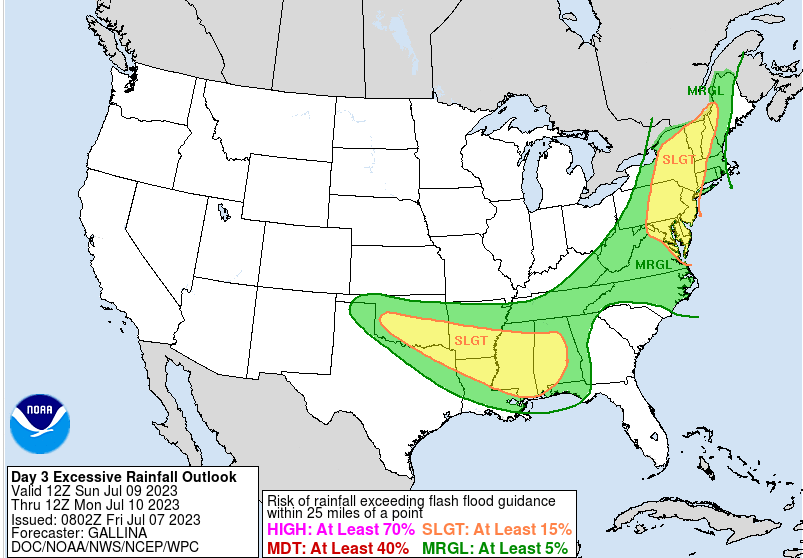
Lastly, to add “insult to injury”, the Weather Prediction Center has places areas in the Mid-Atlantic and Northeast in a “SLIGHT” excessive rainfall risk given the extremely potent atmosphere for heavy rainfall where flooding as aforementioned, will occur.
A rainy day looks likely on Sunday into Monday with slow moving areas of low pressure along a near stationary boundary along with thunderstorms for these regions that have experienced quite an active summer season thus far.


