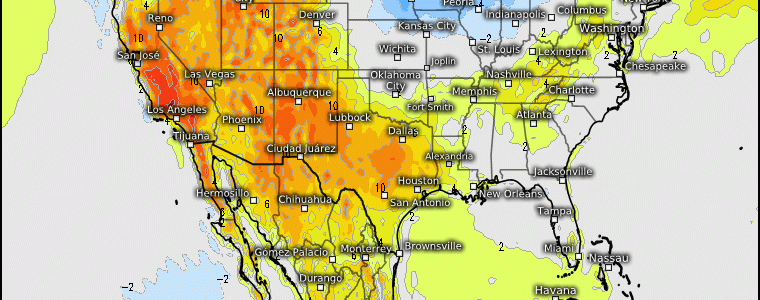
A Pattern Of Persistence
Lets analyze the three main ensemble groups: the EPS, GEPS, and GEFS. These animations extend out to the end of the month. Notice anything different amongst all three? The correct answer would be not really, no. We have a robust consensus on the evolution of the height pattern as we progress into the month of August where the mean sub-tropical ridge remains nearly stationary across the desert SW as the bulk of the upper level heights are mainly across the West, and below average heights expand the Ohio Valley, Mid-Atlantic, and Northeast regions.
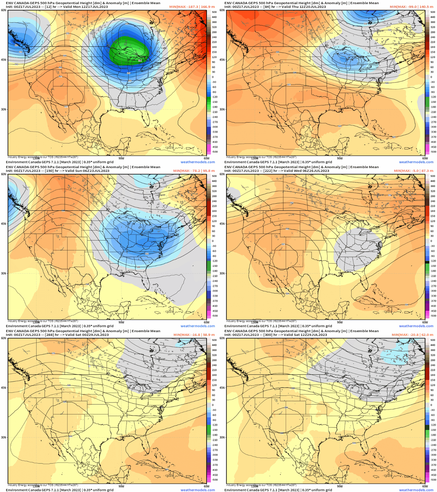
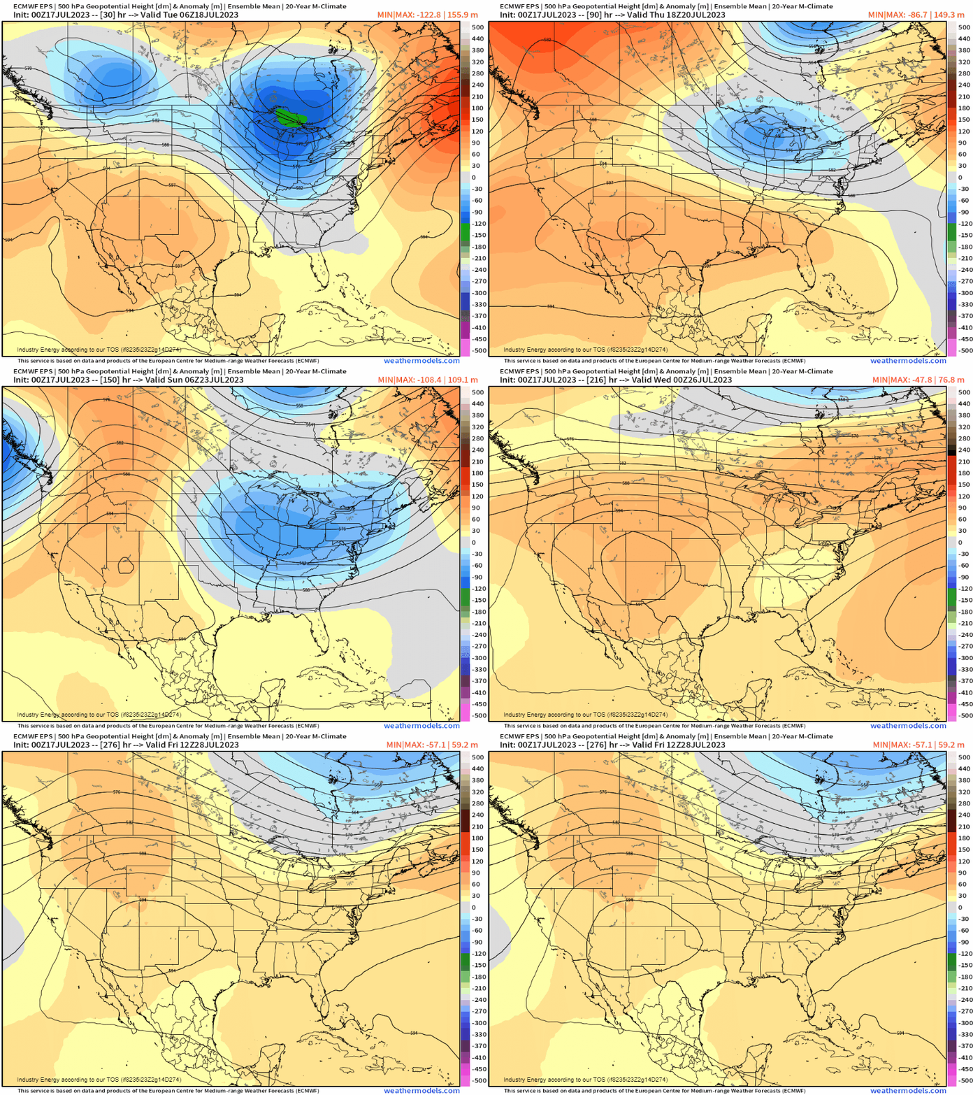
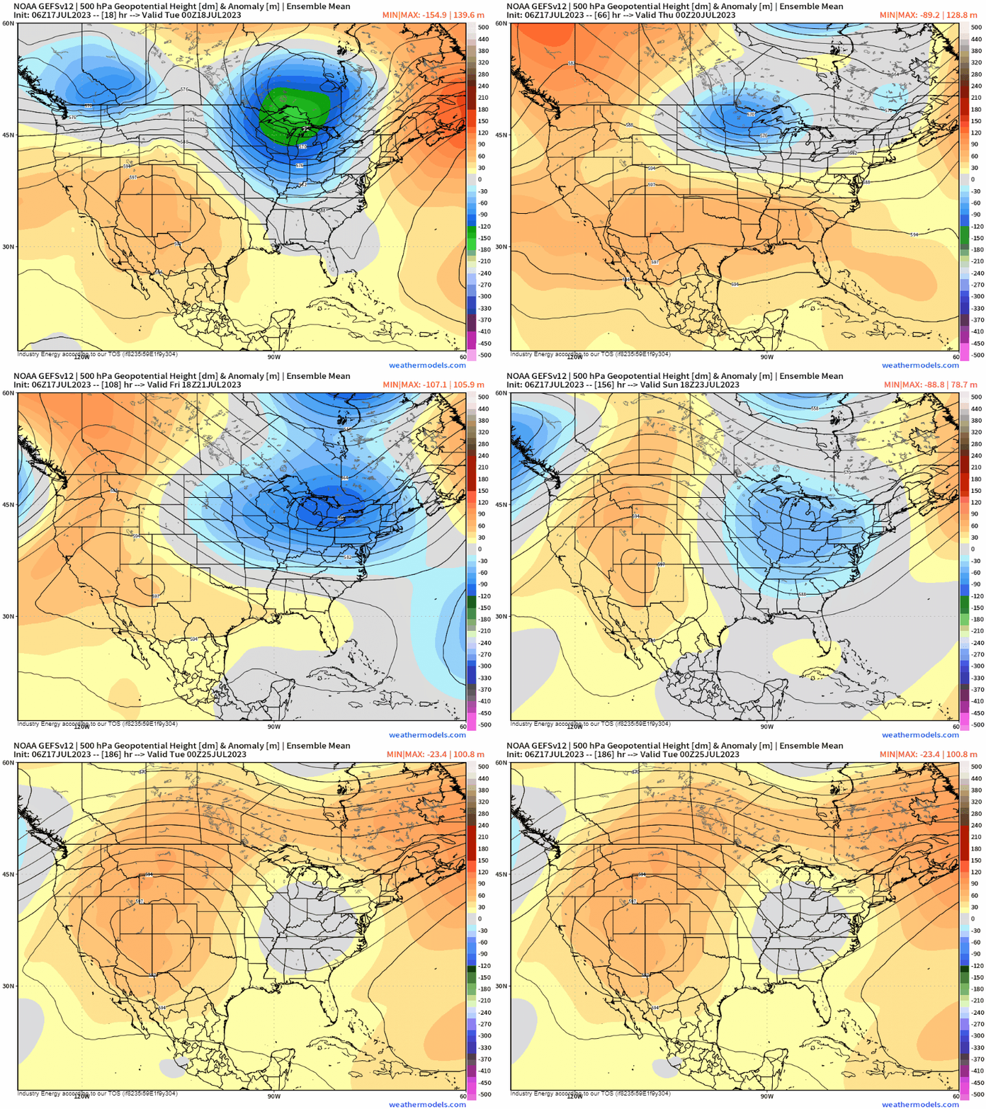
How this translates to the surface is how’d you imagine it; above average temperatures prevail from the Northwest to the deep South while average to below average temperatures continue to remain across the upper Midwest, toward the Southeast, and into the Northeast.
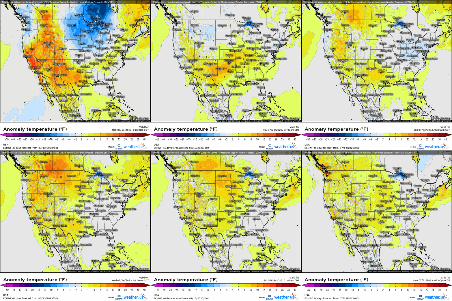
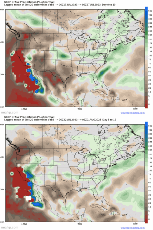
With a pattern as such, not only will we continue to see relentless heat and a long duration heatwave continue to plague the desert SW with continued dangerous heat expanding into the deep South, this means that there’ll be no shortage of activity in the Ohio Valley and Northeast. With a broad cyclonic flow remaining quasi-stationary over the Great Lakes, this will just allow disturbances and shortwaves to rotate through as cold fronts at the surface lead the way. Then, we see continued southerly flow advect moisture up the East Coast, bringing continues periods of rain and storms. This will bring about continuous flooding setups and concerns given that it’s now completely saturated for so many areas across the Northeast. Notice the CFSv2 weeklies showing that general above average swath across the Midwest and into the Northeast signaling the activeness, while toward the West it’s unsurprisingly dry and continues to stay that way for the foreseeable future.
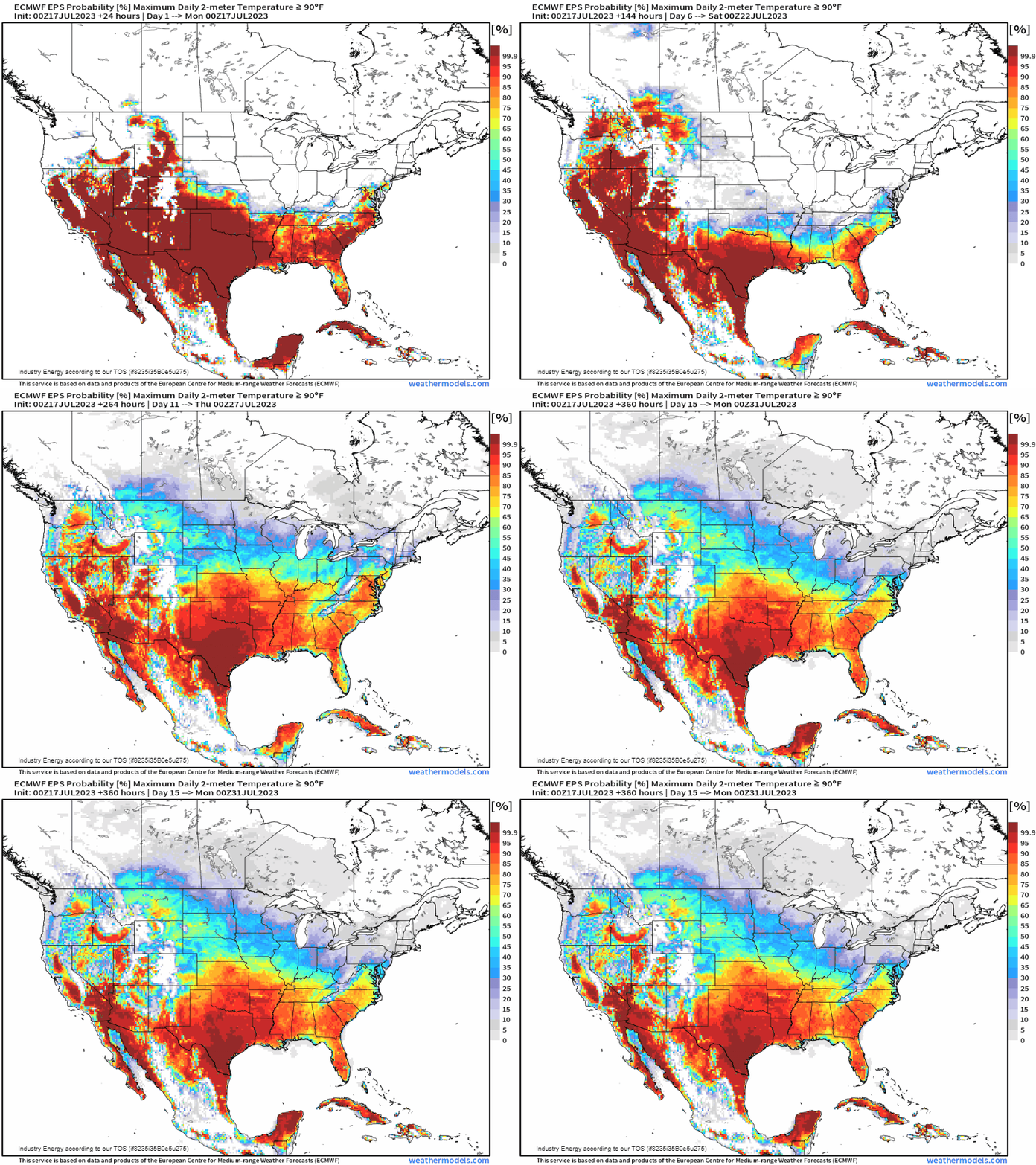
In terms of the heat, as a reference we can see the magnitude of its persistence by analyzing the probability of reaching at least 90*F or greater. What this doesn’t factor in is moisture, meaning the heat indices will be even higher, but this shows where the core of the heat will continue to remain as it oscillates across the deep South and Southwest.
There are some signals that this pattern will change and “reshuffle” itself by August, and can change from other external atmospheric forcings as well (i.e. typhoon re-curvature can shake up the entire downstream pattern, which is one plausible scenario); but in the meantime, we’re going to continue with the same weather headlines as we round out the month of July. At least the tropics are quiet for now.


