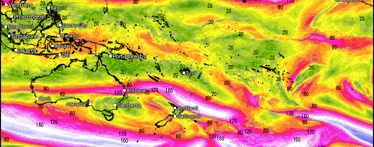
A Pattern Change In Sight … Coast to Coast?
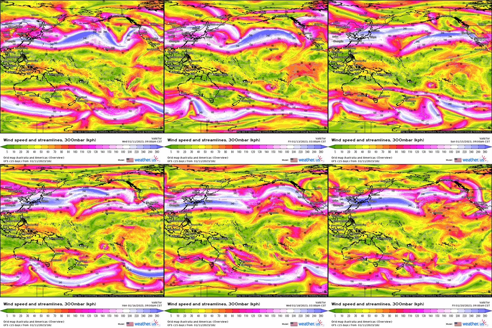
Look at this from a global perspective. Notice how the jet stream basically stretches from Japan all the way to the West Coast. It’s this extended Pacific jet that has resulted in remarkable rainfall, severe weather, and feet of snow over the last week and continuing into next week, and the atmospheric rivers that resulted!
However, notice by the middle half to the end of next week, we see all-of-a-sudden a drastic easing in the jet streaks and the zonal aspect of it. It goes from zonal to meridional (i.e. north-south), as the entire jet now retracts back toward the central Pacific.
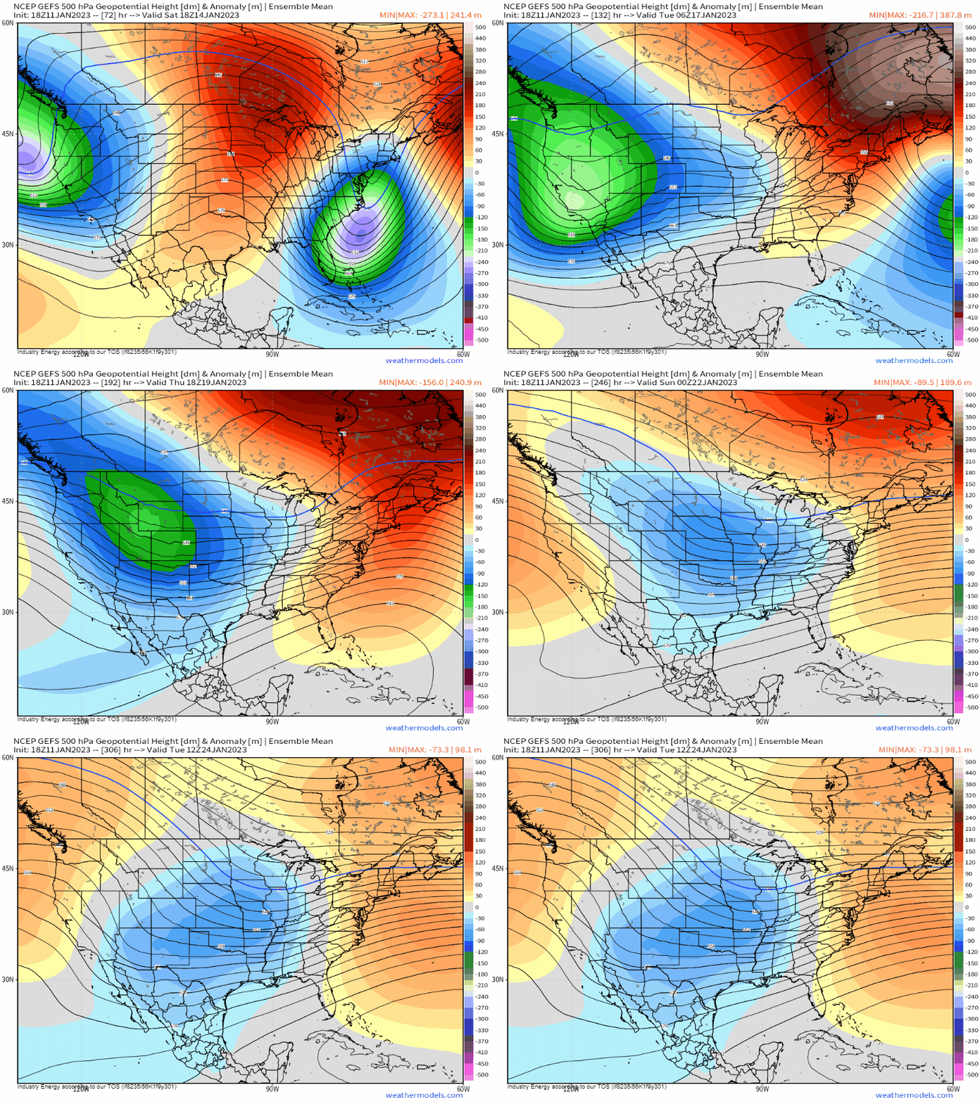
Lets see how this translates first in the mid levels. We begin at the start of the loop (this weekend) and roll it into next week with a bunch of blues and deep purples – indicative of storminess, which then becomes replaced by oranges. It’s during that retraction of the Pacific jet that allows ridging to form first in the northeastern Pacific before shifting along the coast.
At the surface, we see initially and into next week several more rounds of storms delivering continuous amounts of rainfall and snow. However, toward the end of the loop (by Wed-Fri of next week), watch how the activity lessens quite drastically! We finally are nearing the end with what has been an astonishing stretch of active western weather, but it couldn’t of have come at a better time to help, to a degree, alleviate a long-standing drought!

Now look at the current synoptic z500mb pattern: We have western troughing, which is of course plaguing the West with relentless storms, while ridging and bad news for ski resorts east of the Midwest along with well below normal snowfall up and down the I-95 corridor.
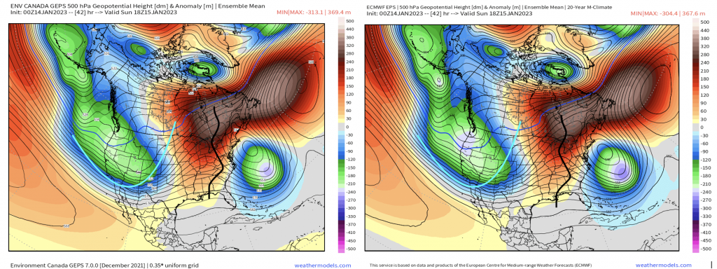
However, lets just fast forward to the last week of the month. Is there a change? Yes. As shown above, once we see that jet retract, this allows a pattern to form as follows below:
- Ridging builds into the NE Pacific and along the West Coast (-PNA to more neutral/positive PNA)
- Dislodges the “TPV” (Tropospheric Polar Vortex) into the Hudson Bay, south of Greenland
- Establishes a baroclinic zone, or temperature gradient/storm track in between with the ridging off the SE coast.
- At the surface, what this would do is “dump” the cold air into the West/Midwest, then gradually build East.
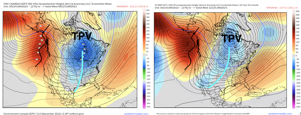
This pattern across the contiguous U.S. toward the end of the month, however, may be somewhat transient as it doesn’t look at the moment to “hit and hold”, so we shall see. There is a risk for that ridging off the West to retract, which would then dig into the Midwest then allocate westward if the Pacific Jet retracts just enough westward across the Pacific domain. We can certainly touch on this as we get closer, but for now at least the main premise is that the West will see a break, as its great news from a hazardous standpoint and the impacts across the towns and cities! It’s also, from a drought perspective, good news currently since it has put a large dent into the drought. It’s quite possible we can see a return to a similar pattern next month.


