A Pattern Change In Sight Across the U.S.?
We’re starting to garner higher confidence that a pattern change, which from what has put places along and east of the Rockies in top 10 warmest start to January, will transpire in the coming week to end of the month.
Lets break it down in intervals and how the mid levels alternate going forward into the end of the month:
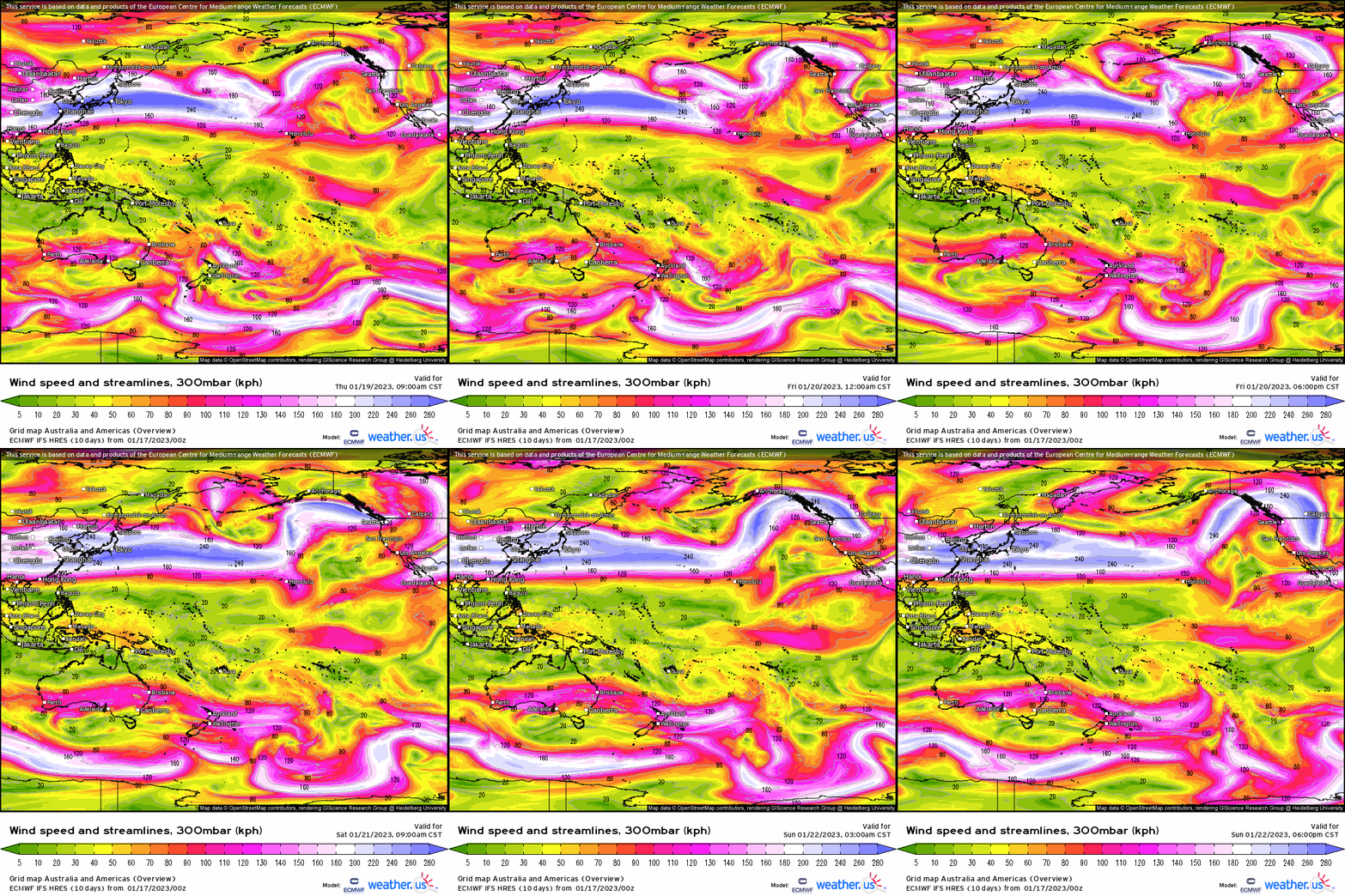
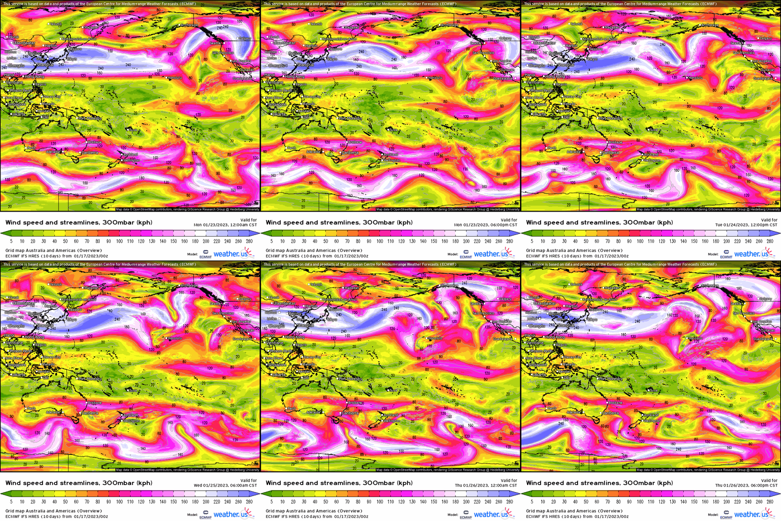
- Initially, we still have a somewhat of an extended Pacific jet that will finally be in the process of pulling back westward and we see this transpire from this past week and into next week.
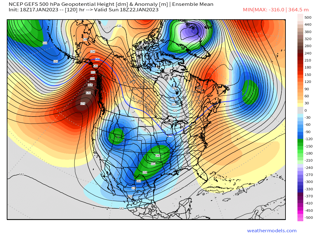
At 500mb, we see residual below average heights dump into the Southwest with pacific air and storminess across the Central U.S. with ridging downstream supporting milder temperatures.
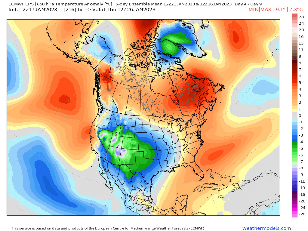
In terms of temperature anomalies, lets look at this using 5-day 850mb temperature anomalies to depict the main areas of where below & above average temperatures will take place. Unsurprisingly, we see what has been the dominant pattern since the new year with below average temperatures in the west and above in the east. This takes us into next week.
2. Now, lets roll into the end of the month going back to the state of the Pacific jet. If you compare above to this below, you’ll notice several differences like the overall mean wind speed reduction (a large loss in momentum), and a much more meridional look. With enough of a pullback, you’ll see outlined a large-scale ridge build across the northeast Pacific into Alaska.
3. Now, lets observe the changes across N.A. using the mid-level height pattern the last week of the month into February:
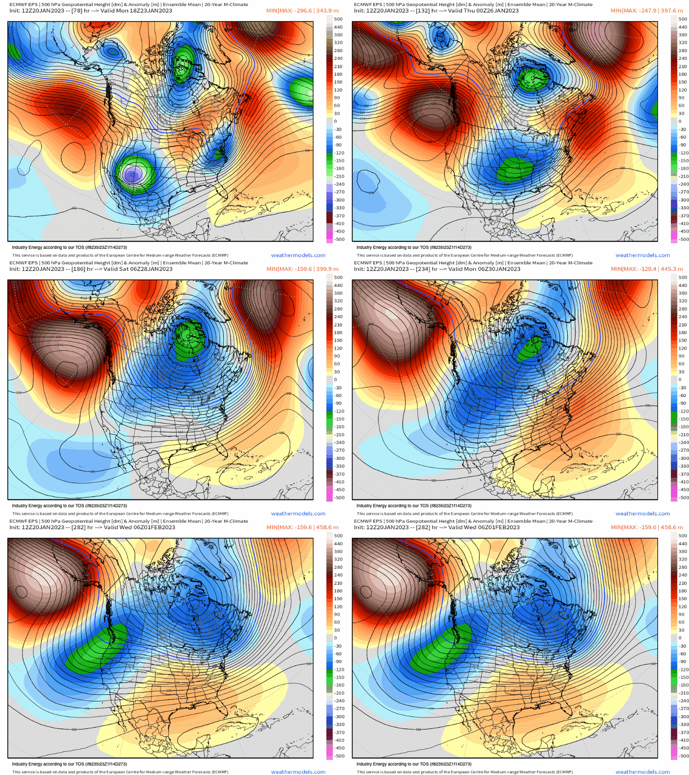
- Ridging billows into Alaska and into the Bering Sea. Downstream, this allows below average heights to eject into the Midwest establishing a trough. This also cuts off the mild Pacific air as it now forces colder air back into N.A.
- In conjunction, which has appeared to be a recently developing signal, is some quasi-stationary (temporary) north Atlantic ridging (i.e. NAO becoming more neutral/negative). This also not only establishes high pressure across SE Canada, but it dislodges with what appears to be a lobe of the tropospheric polar vortex.
- As a result of the ridging out across the northern Pacific pulling back gradually, this does allow the aforementioned Midwest trough to also shift somewhat westward with evidence of ridging off the Southeast coast; however, with some evidence of north Atlantic blocking showing up and with what looks to be a trough east of Labrador & Newfoundland, this establishes confluence (i.e. high pressure) across SE Canada. This type of pattern verbatim results in an active storm track in between both the trough to the west, and ridging to the east.
However, lets go back to 850mb 5-day intervals. Don’t let the 500mb pattern fool you into thinking more continued warm up the East coast (18,000 ft is surely a lot different than what is at the surface). We see how now below average temperatures and widespread cold air dumps back into the U.S., first into the Plains and Central regions before it gradually builds eastward. This will help to significantly reduce the antecedent above average temperatures east of the MS river.
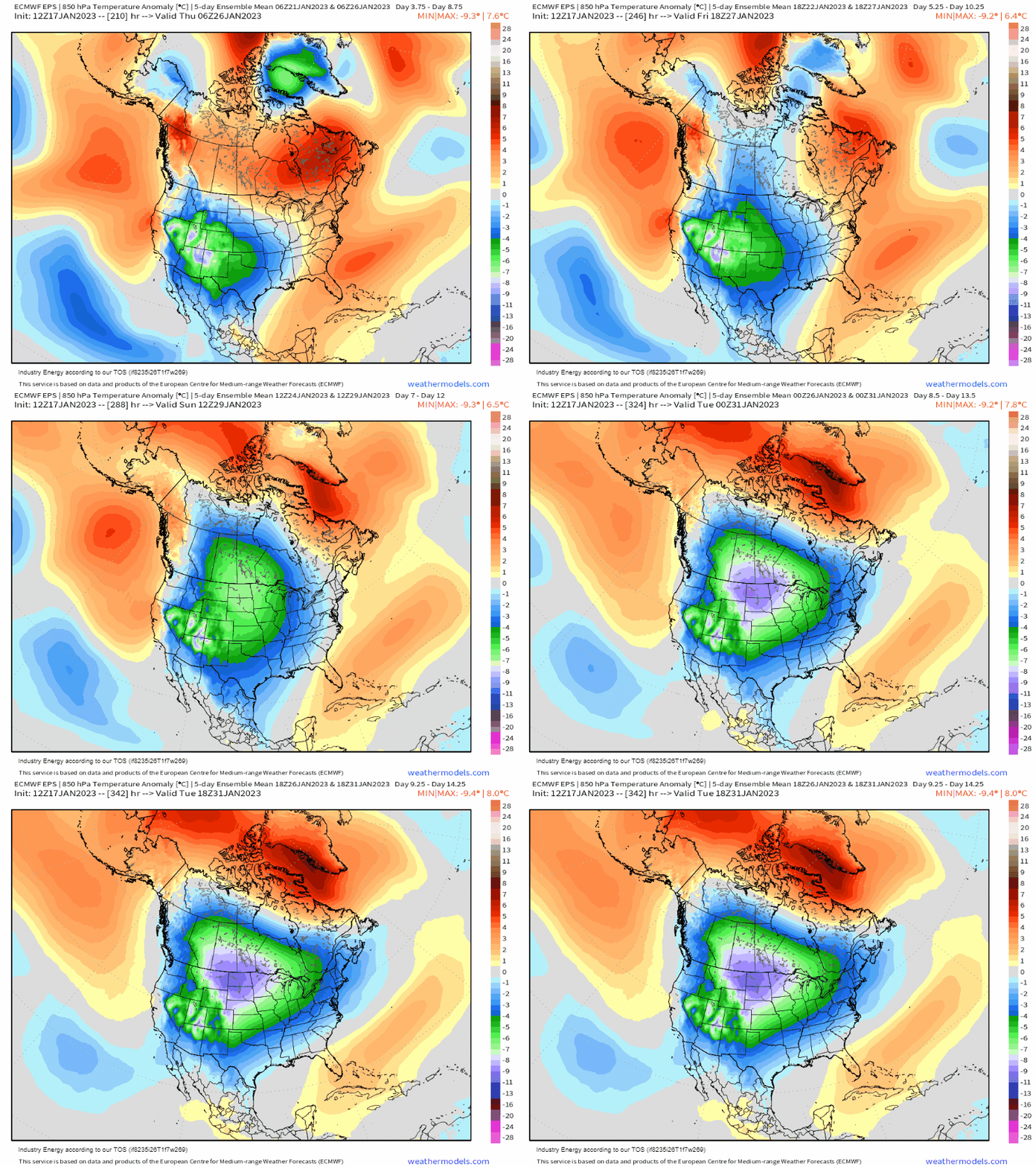
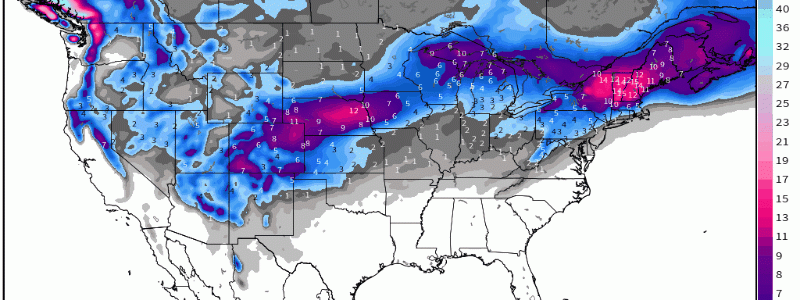
So as you can see, there’s building confidence with support that this pattern change will occur to a degree, and at least will put N.A. back into play for cold air after enduring weeks of above average temperatures. What about snow? Lets just extend the snowfall forecast via the EPS to get a sense of what’s ahead, as with cold air back into the pattern will come opportunities for snow especially in places that is enduring below to well below average snowfall especially ski country in the Northeast!


