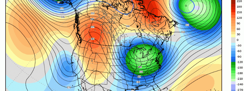
A Pattern Change Heading Toward Mid-May; Drier as Opposed to Wet?
It’s been an active end to the month since that anomalous ridge across the eastern 2/3rds manifested toward the middle of April, and we still will see an active pattern commence as we flip the calendar to May.
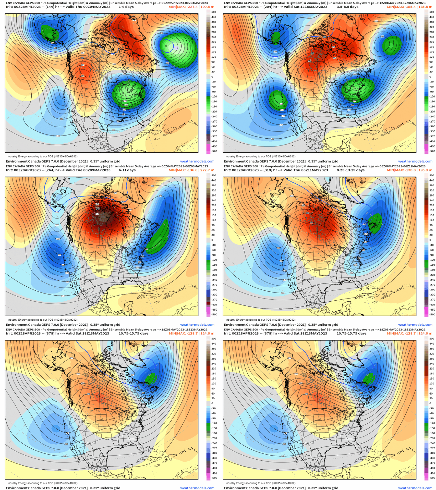
Below, we have a 5-day interval height anomaly where an average of heights are gleaned that form across various regions. What finally begin to see is a breakdown of the Greenland blocking that has allowed for the polar jet to descend into the U.S., and cooler air to filter in. We see an adjustment to the general 500mb pattern as that ridging now shifts westward into central Canada and across the middle portion of the CONUS toward week 2 of May. Below average heights shift eastward into the Atlantic with troughiness hanging off the West Coast.
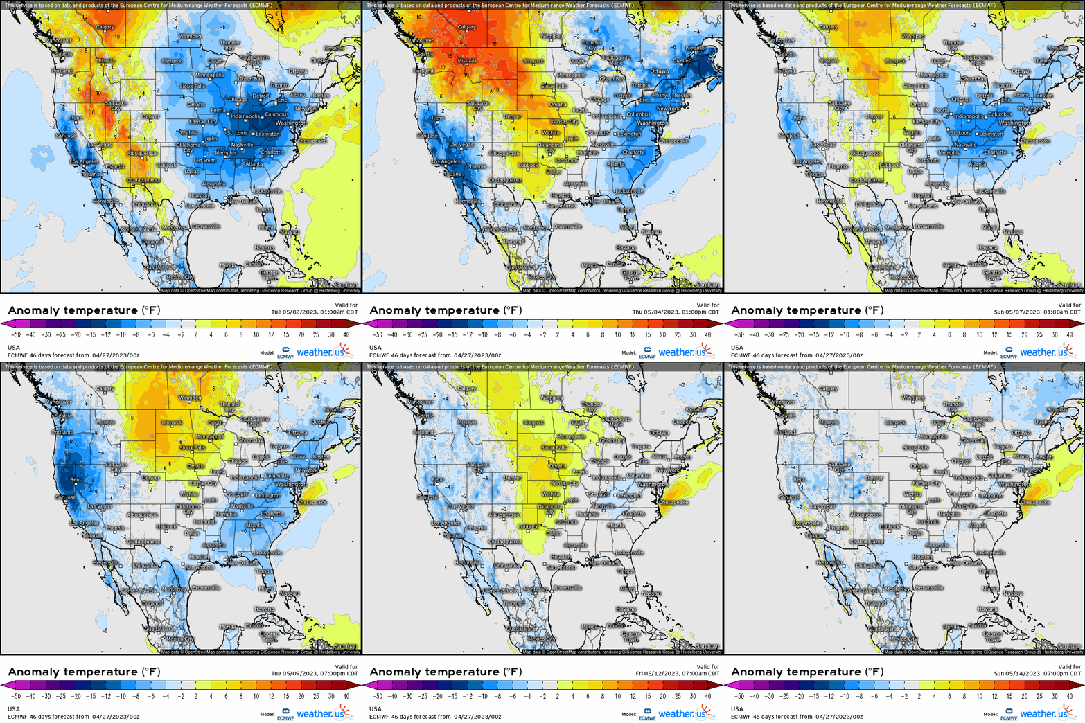
How this plays out in terms of temperature anomalies are a moderation of the below average temperatures across the Great Lakes, Ohio Valley, and Northeast. We see the focus of average to above average temperatures shift across the Intermountain West and northern Plains before slowly bleeding eastward as we near mid May.
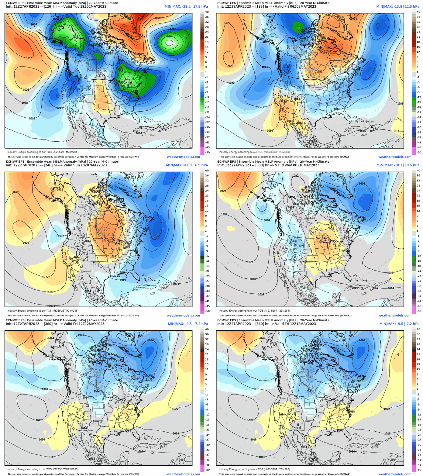
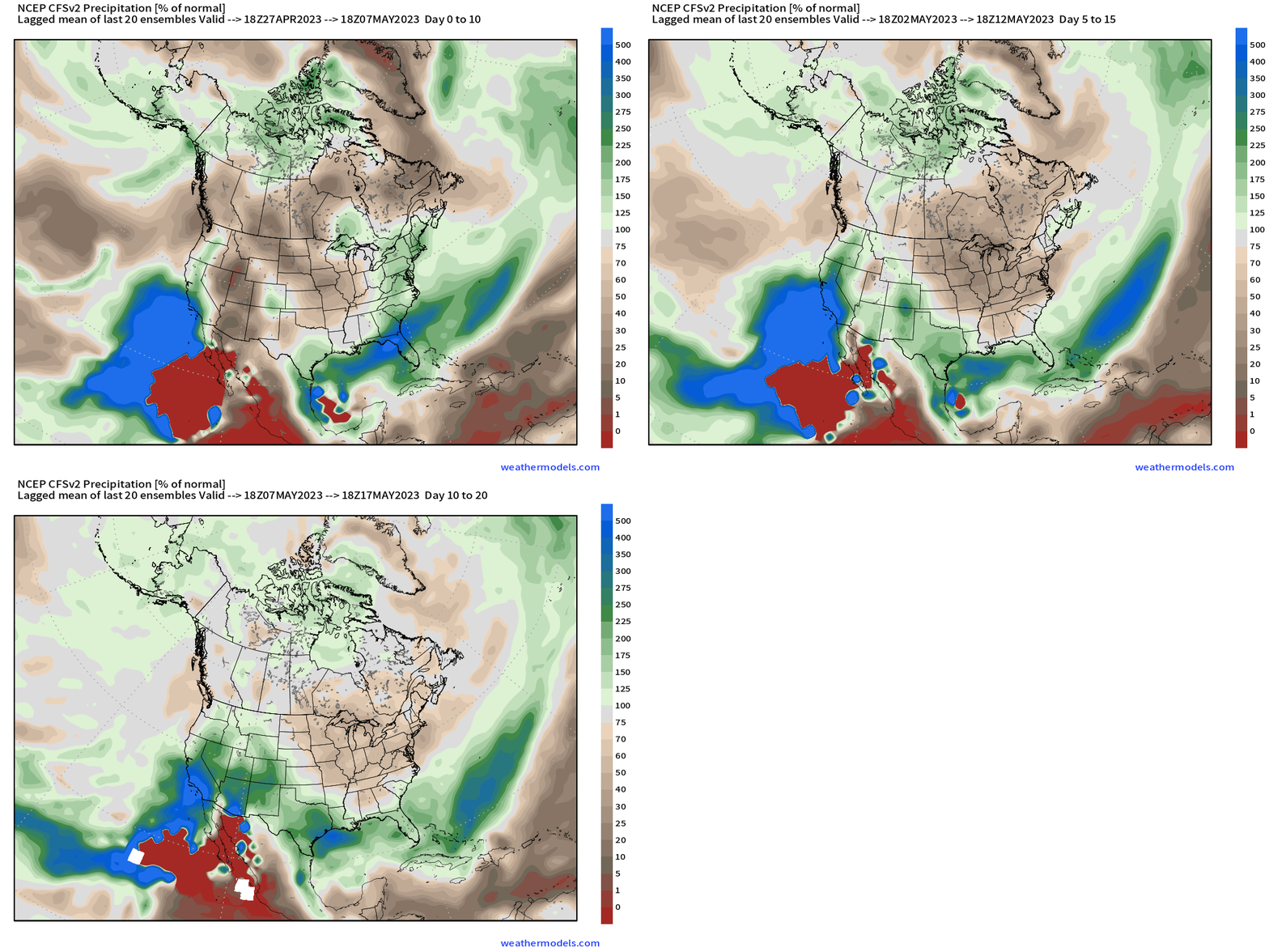
This pattern progression allows for a relatively notable dry pattern to settle in across the Plains and across the East as that upper air pattern forms expansive high pressure that works its way down into the U.S.
We see this nicely reflected in the CFS weekly precipitation departure from average in 10-day intervals. Once we see that slow moving upper-level trough across the Lakes / Northeast shift out (notice across the east it’s relatively wet), which is then replaced by a drier pattern heading into mid May. The latter is crucial since we’re in the midst of growing and planting season in the Corn Belt, so a window is looking likely. In the Southwest and deep South, a trough shifts off California with what appears poised as an active southern branch of the jet stream that brings in waves of moisture and overall active pattern in these regions.
Once again, this is supported by the progression of the MJO signal that’ll be propagating across the Maritime Continent and into the Pacific as we head into May, and toward week 2 especially. For the most part, May as the time being looks to be a transient month without much in the way of stagnant patterns and no notable heat on the horizon just yet.


