A Pattern Change Featuring Heat Next Week?
Our attention regarding the core of the summer heat will be directed to the Deep South and into the Southeastern states beginning next week. Our true most notable heatwave of the season as well appears highly probable, especially when considering the tight consensus amongst all major ensemble groups including the EPS, GEFS, and GEPS.
Over the next few days, we’ll see a pattern adjustment to the lower 48. Our stagnant upper low across the Northeast finally ejects eastward and breaks down, ending the stale and harmful ejections of the Canadian wildfire smoke for the aforementioned Northeastern states. Next, the upper level ridge across the northern Plains and southwest Canadian provinces breaks down as well as it retrogrades westward, forming a rex block (high over low) over the northeastern Pacific. This establishes a cut-off trough just southwest of California. Overall, this weekend into early next week forms into a quasi-zonal pattern with the mean wind flow moving generally west to east.
Then, we begin to see a potent, expansive ridge across Mexico that billows and shifts northward slowly. What’s more, to see already a ridge being prognosticated as 2+ standard deviations above the 20-year average verbatim tells us we’re going to be dealing with excessive heat, heat warning criteria, and health concerns across this region.
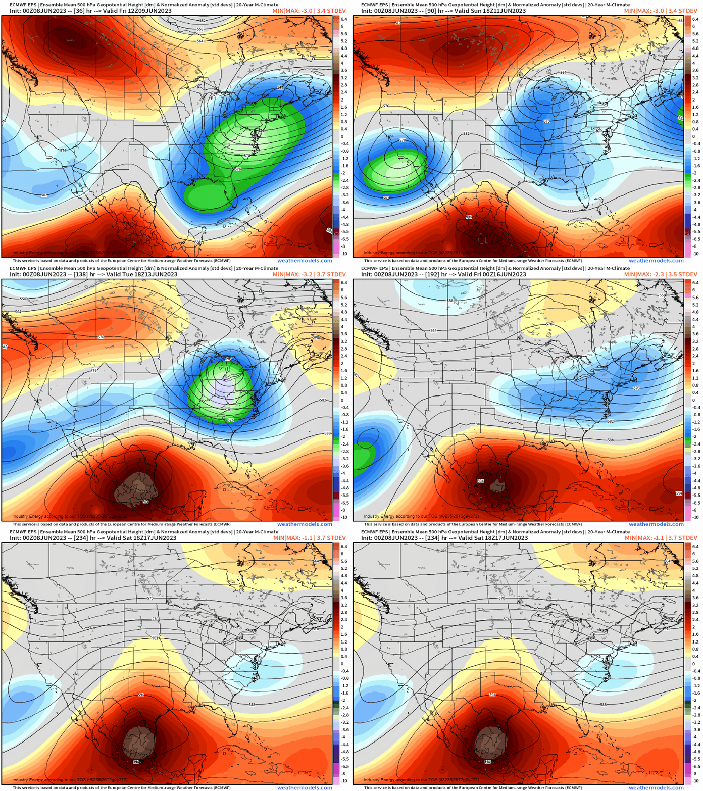
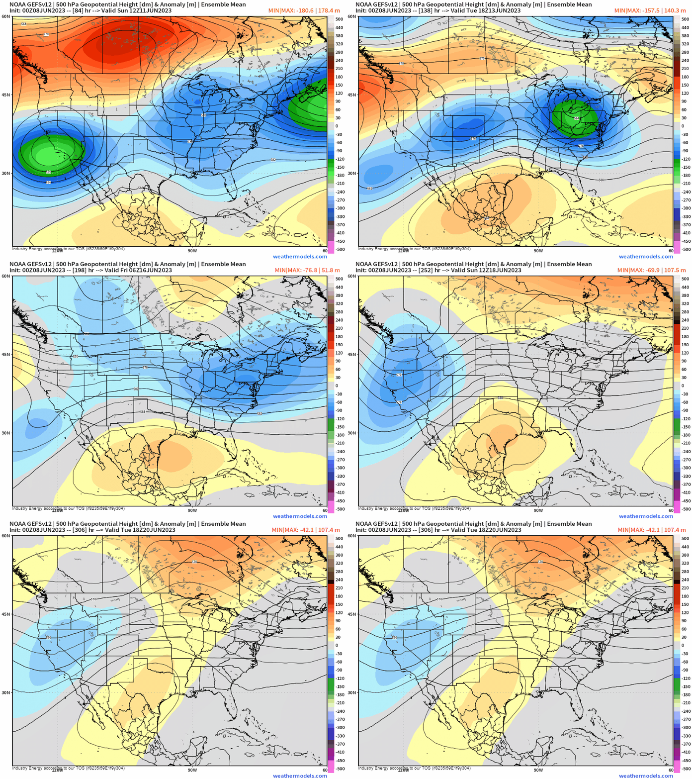
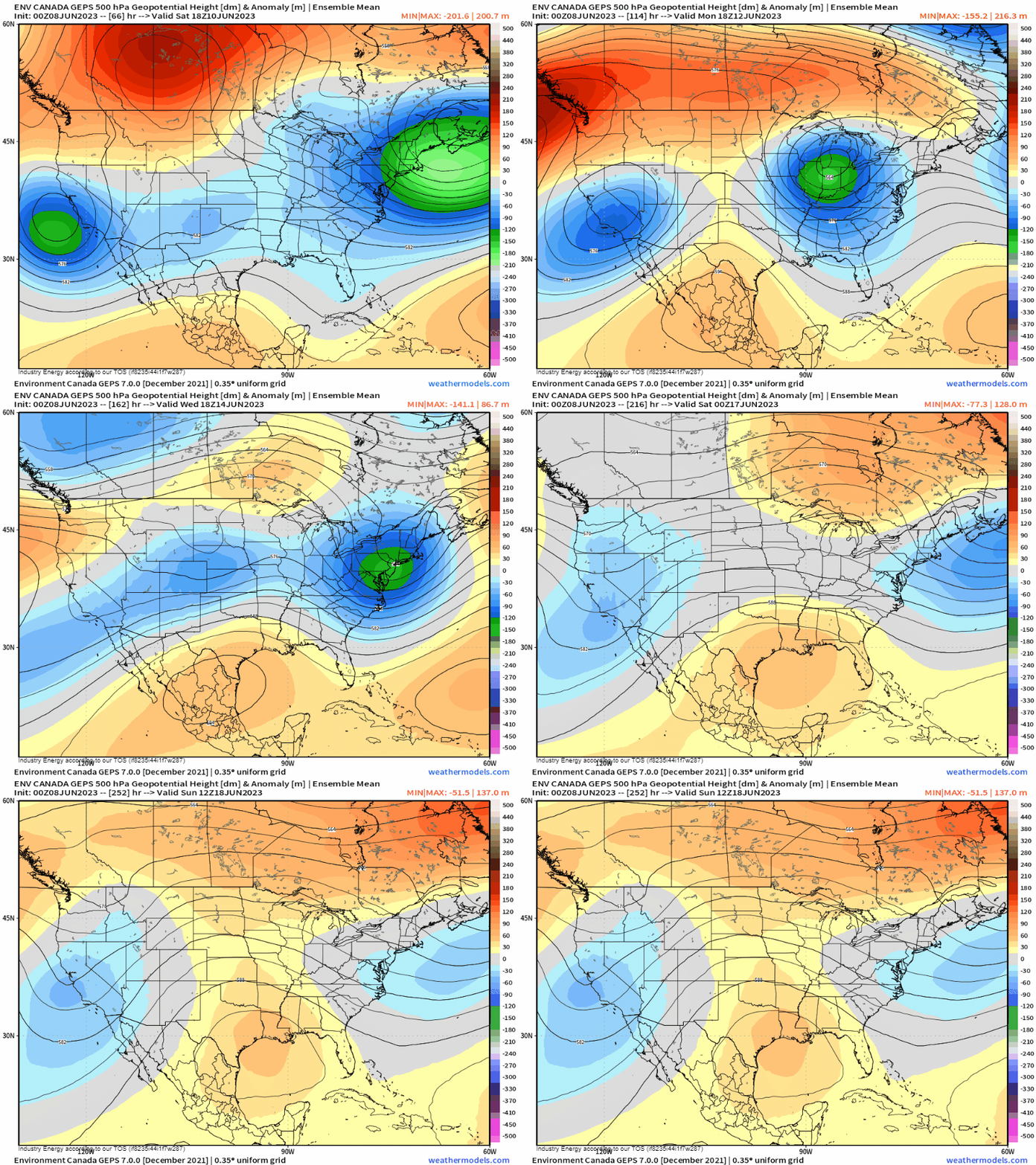
As the EPS shows this, the GEPS and GEFS also reveal a 588+ dm ridge. Typically, we tend to classify heat ridges if the mean heights reach and exceed 588 decameters. In this case, we clearly see that in all the ensembles. As that trough forms off California, it allows for the ridge to essentially “pump up” in response, and augment the anticyclone.
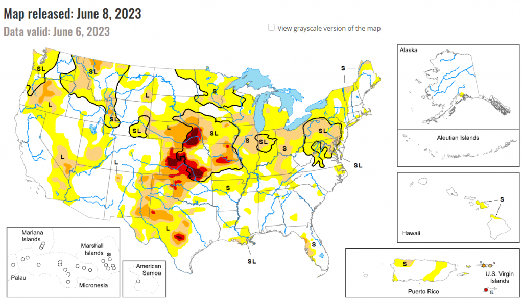
Furthermore, something seasonal forecasters tend to look at when coming out with summer outlooks are where there may be relative longer-term droughts and very dry soils. Why? Simply put, this creates a positive feedback system. Dry soils aren’t helpful for plants and any type of vegetation. Therefore, this allows for enhanced evaporation, therefore, more solar radiation is absorbed by the surface and not by the vegetation allowing for a much easier “path” for high pressure formation and increased subsidence (sinking air). Where is our most notable area of dry conditions? Right over the Plains and Deep South thanks to the daily drought monitor data found here. This isn’t necessarily coincidental that the heat ridge is aligning where the drought conditions are.
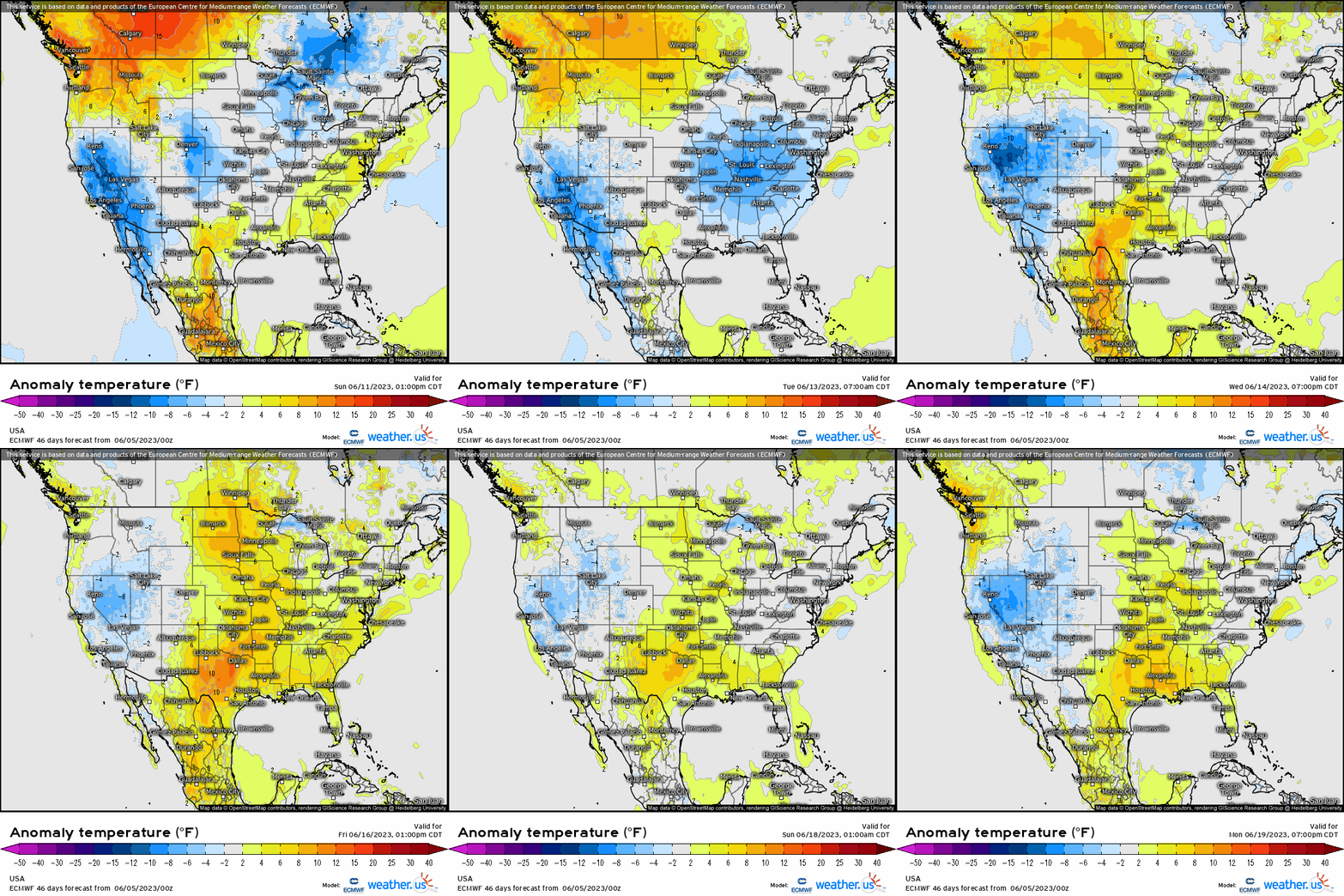
Next week, watch how the daily temperature anomaly intensifies each day as temperatures will exceed 5 – 15+ degrees above average, and remember that this is a smoothed mean of the EPS so technically it doesn’t capture the complete magnitude.
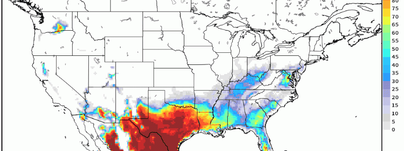
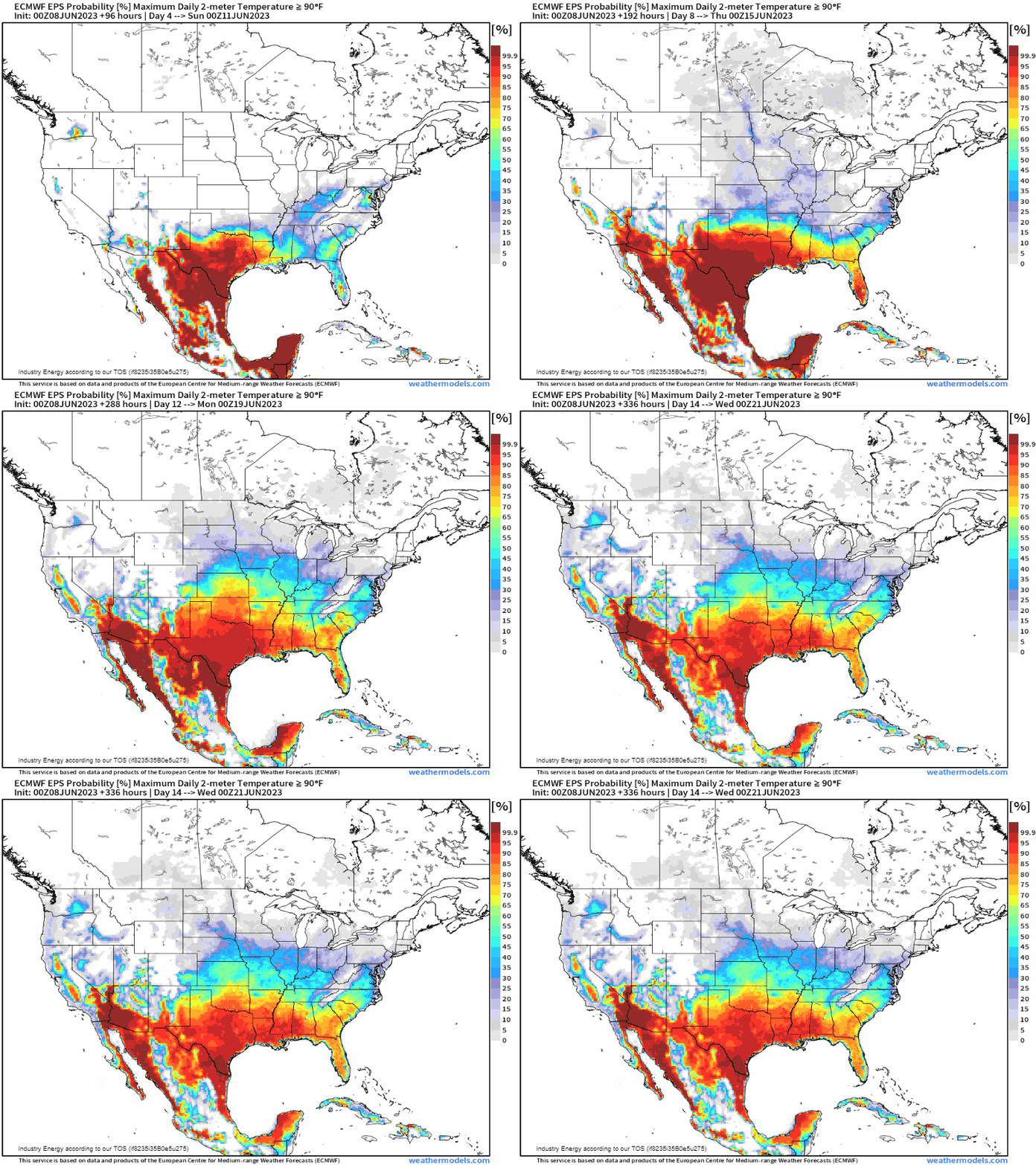
Another way to visualize this is by seeing where the highest probability of temperatures 90*F or greater will occur. Here, the EPS shows 90’s targeting Texas and into the Gulf states at 95-99% confidence level. That is quite remarkably high at this range. So we’re going to see our true first heatwave occur across the Deep South beginning next week. Also, despite temperatures exceeding 90’s, don’t forget that heat indices when combining the inability to evaporate sweat off the body thanks to the higher dewpoints (moisture), will likely get into the 100’s.
At this juncture, if living in this general region i’d be taking precautionary measures to ensure you keep yourself at minimal risk. Make sure A/C units are in place and are operational, and it can’t hurt to be proactive in anyway possible like knowing where maybe local cooling centers are. We’ll be monitoring and covering this into next week, so stay tuned.


