A One-Two Punch of Severe Weather Expected For the Florida Panhandle Today
It’s a double blog day as we have a lot going on weather-wise. Jacob has put out a blog on the winter weather threat for the northeast and I’m writing today on the severe threat in Florida.
The SPC has upgraded the risk from marginal to slight across the central part of the Florida panhandle. This will include places like Tampa, Orlando, and Gainesville while a marginal risk remains in effect for the rest of the panhandle with the exception of far south Florida. This will be a two pronged threat.
Afternoon:
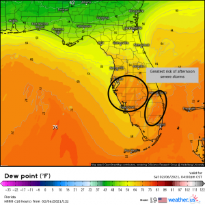
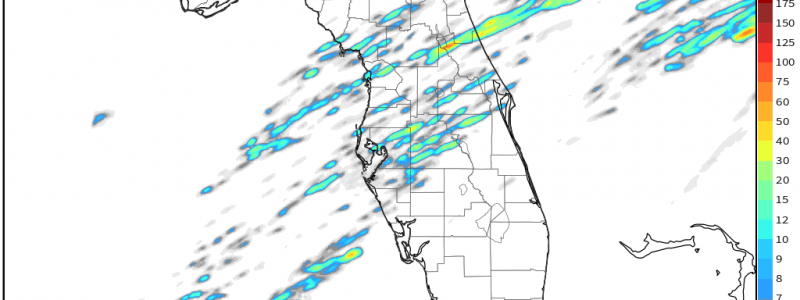
A warm front will lift north across the panhandle throughout the day raising dew points into the upper 60s, possibly low 70s. Destabilization will occur in the areas of greatest moisture: namely, central and southeast Florida (circled above). With surface temperatures in the 80’s, CAPE will be sufficient to support isolated thunderstorm formation. The existence of adequate shear will make environment ripe for the possibility of a few supercells as well.
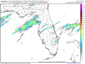
Should these supercells form, tornadoes are absolutely a possibility. The HRRR indicates the possibility of a few strong swaths of helicity, or upward rotation, which is essential for the formation of supercells and, eventually, tornadoes. Though this afternoon threat is the lesser of the two threats Florida will face today, take it seriously. Even marginal threats produce damaging tornadoes, as we’ve seen already this year.
Overnight:
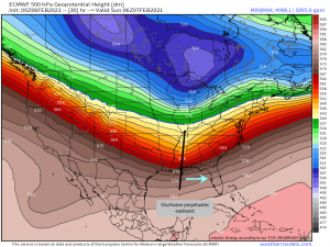
As the warm front lifts over Florida throughout the day, a shortwave trough will swing out of TX/LA where it is currently located and make its way toward the panhandle. This will usher in today’s, or really, tomorrow morning’s, greater threat.
Dew points are expected to rise near 70 across the lower 2/3 of the peninsula by the time the front associated with the shortwave arrives. With the moisture firmly in place and the forcing due to arrive by way of the approaching front, the stage is set for severe weather. The convection is expected to be a bit more organized than the afternoon threat. There will likely be a convective line along/in front of the frontal boundary with possible clusters of thunderstorms/supercells forming ahead of the line. The highest severe threat exists in the formation of these clusters which can produce high winds or a tornado, though these hazards can also be found in the convective line in the form of a “kink in the line” if conditions are ripe.
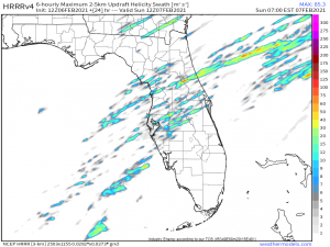
Again, the HRRR suggests relatively strong signals for updraft rotation across the defined slight risk area and even into the marginal risk area.
The message I’m trying to get across here is: Take this threat seriously. As I mentioned before, we have already seen damaging tornadoes produced by marginal set ups this year. All it takes is the correct conditions in a small area for that threat to be realized. Remain weather aware throughout the afternoon and MAKE SURE you’re receiving warnings overnight. Most fatalities from severe weather occur in overnight set ups as people are asleep and not as weather aware as they would be during daylight hours. A weather radio is the best way to receive watches and warnings as it does not rely on any sort of cellular or internet connection. Every home should have one. Secondarily, your phone will receive warnings only if any are issued for your area. Another option in addition to the weather radio is to download your local news station’s weather app. They routinely push warning alerts out to their viewing areas as needed.
Stay safe if you reside in these areas. Also, if you know someone here, give them a call and alert them to the threat so they too can be prepared.
