A Northeast Wintry Event In the Making?
We’re likely going to be dealing with an active stretch for the Northeast next week, with a series of events on the horizon. However, there’s one notable event that we’re going to be tracking for early next week between Monday night and Wednesday!
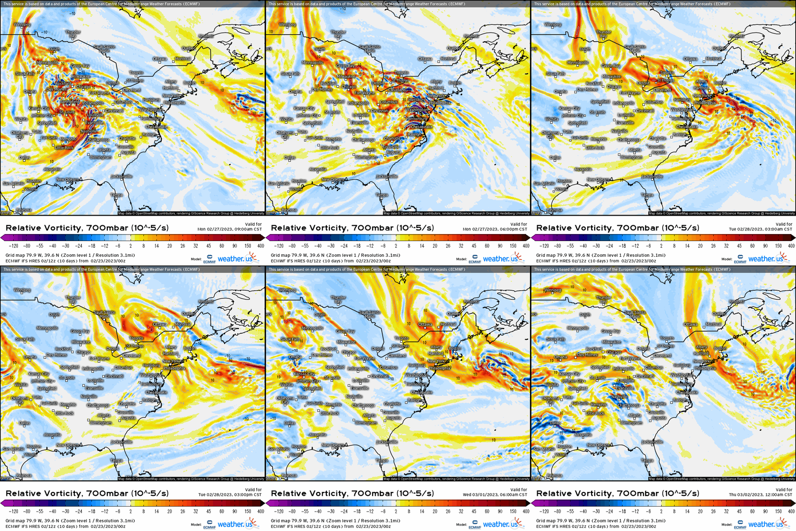
Jumping right into the synoptic discussion, we see an initial closed strong mid-level trough eject out of the Southwestern U.S. As you follow it along, it traverses the Great Plains initially providing the catalyst for the severe weather outbreak tomorrow before it shifts into the Great Lakes region by Monday. What we end up seeing, is that this mid-level trough elongates itself within the trough, and what we end up seeing is differential vorticity advection downstream the trough that allocates toward the New England coast.

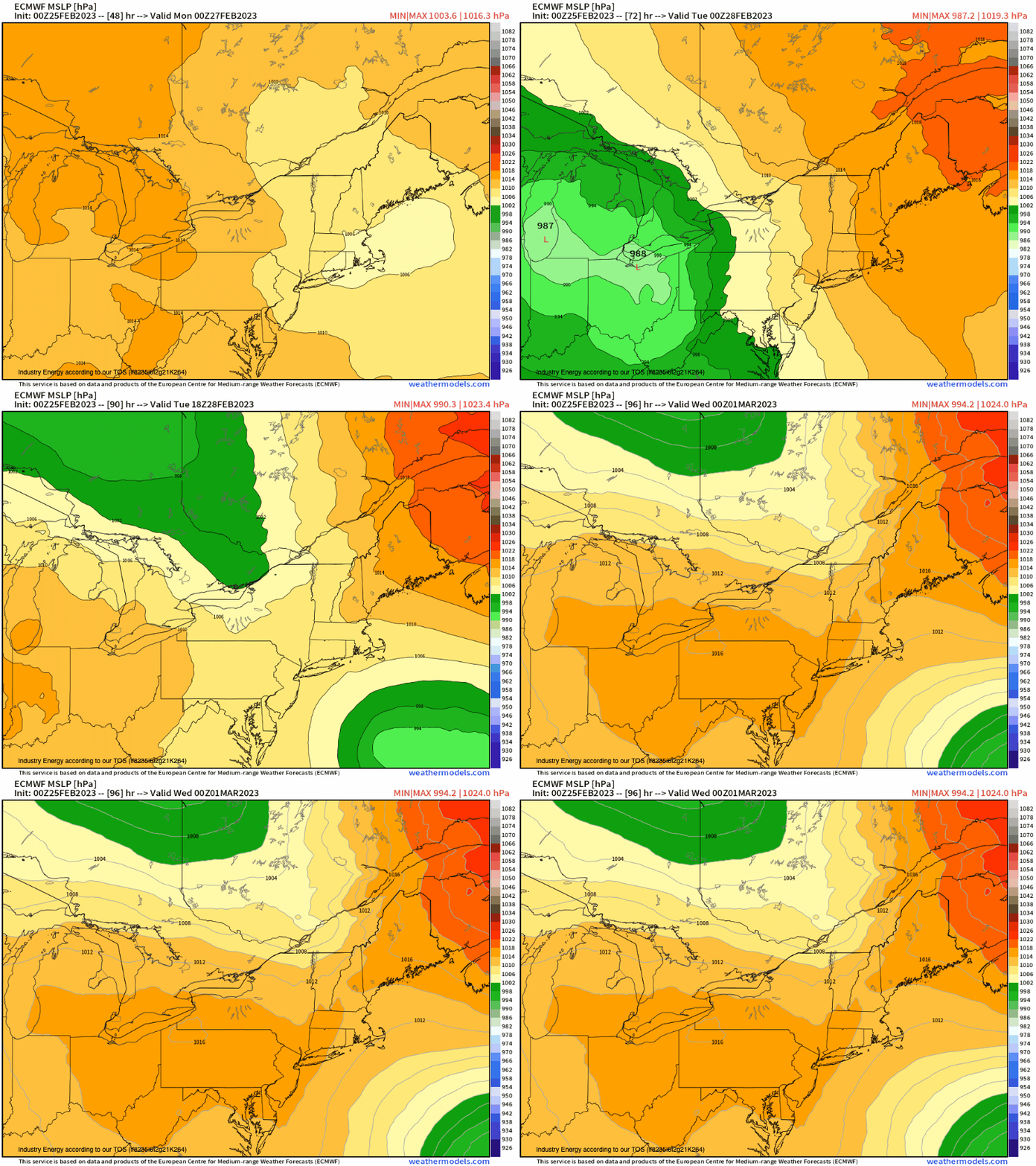
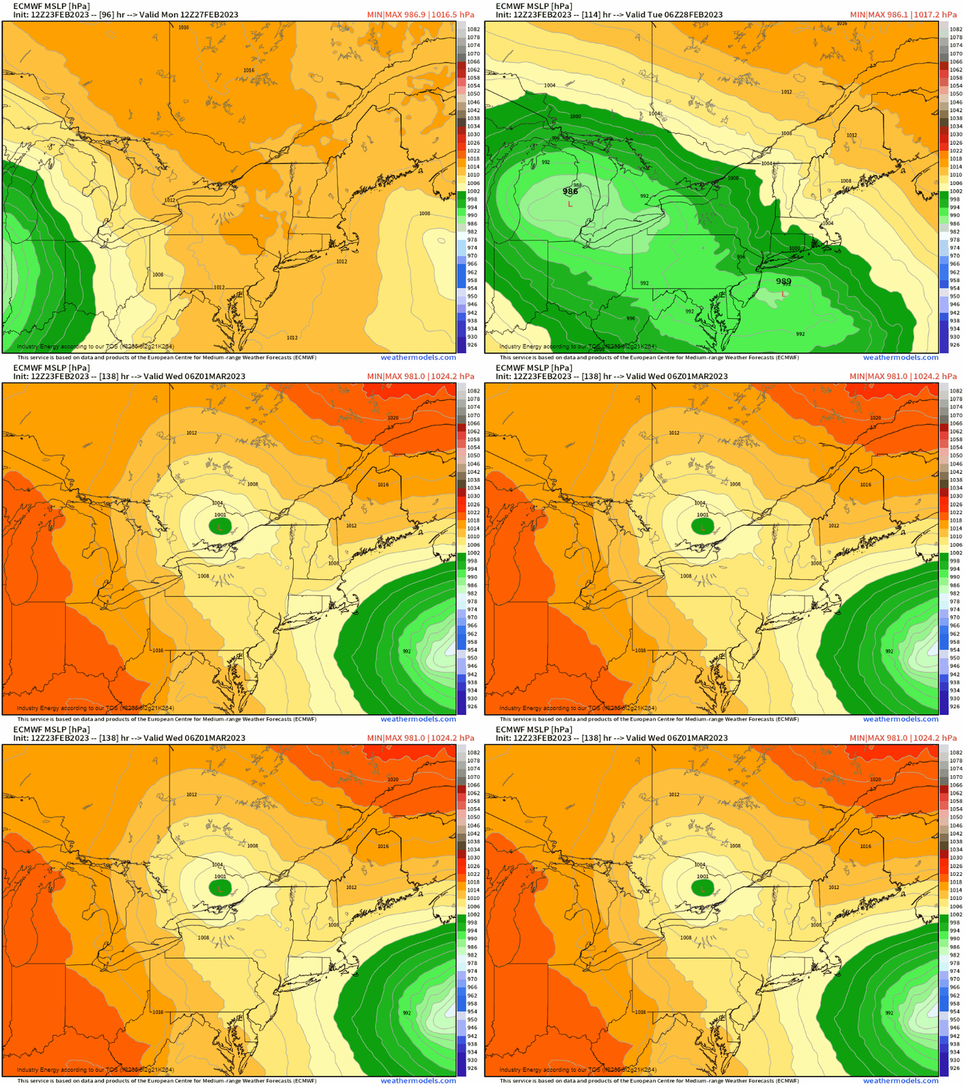
At the surface, this is what it translates to. An initial primary low runs into Michigan and Lake Erie region; however, since there’s higher pressure that simultaneously treks across Ontario and into Quebec, in conjunction with the mid-level trough “opening” up as it shifts across the Ohio Valley, this forces a secondary low to form. A warm front will lift up into the Mid-Atlantic before entering into the Northeast region, and this is where we see a secondary low pressure form upon (tidbit: low pressures tend to “follow” warm fronts so you can actually track the general low’s trajectory!).

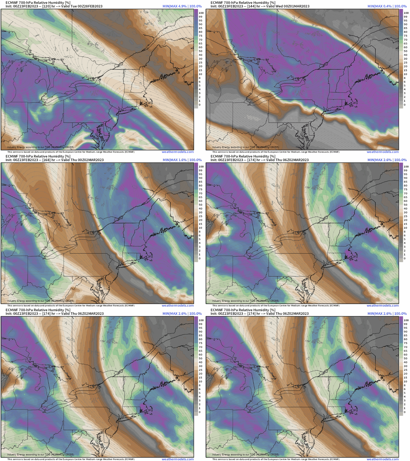
Next, we check our synoptic-scale moisture, typically we do look at 700mb to see if we have sufficient saturation in conjunction with large-scale ascent. Here, if we know we have over 70% saturation (surface to 500-700mb) and vertical motion (omega), we’ll have precipitation!
So the next question is, do we have enough cold air in place as this winter in general, we have just lacked ideal timing. The answer is yes! Below verbatim the ECMWF, look closely at the bright oranges across Quebec and into New England – indicative of higher than average pressure, but a cold air source. More importantly, watch closely at the isobars (grey), and how they make an inverted “V” kinking downward toward the Mid-Atlantic states. This is a cold air damming situation, as cold air advects from the high pressure down into New England and across the Northeast toward the Mid-Atlantic (advection = transportation of air parcels). Not only that, but what enhances this process is during the transfer, we get northeasterly’s, which augments this process!
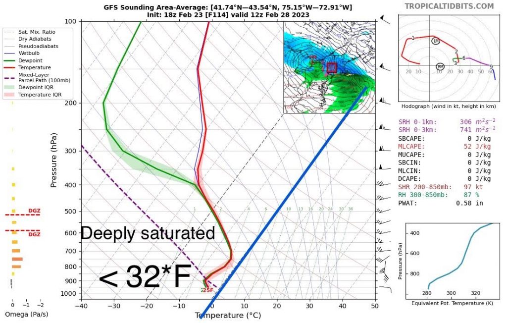
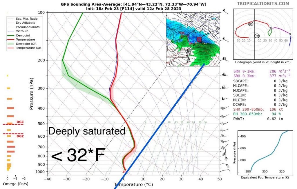
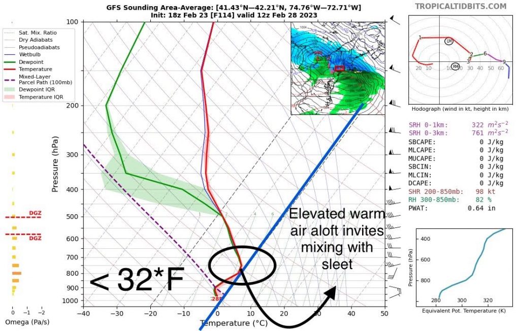
Below I took area averaged soundings from tropical tidbits across the interior Northeast, New England coast, and down into the lower Hudson Valley. What we have in the vertical is a very favorable snow sounding. We have 1.) deep saturation up to 400-450mb, 2.) strong lift and 3.) sufficiently cold air aloft. Now as you go down south toward the Mid-Atlantic states, notice that we begin to deal with warm tongues aloft as we see thermodynamics become more hostile to snow, and more toward mixing and eventually rain further on south. The dark blue line represents the freezing isotherm, as anything to the left is supportive of frozen precipitation, and to the right you get into the warmer air.
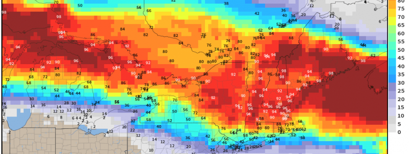
So the question begs now, what could we be looking at accumulation wise? As we know we can see shifts in totals even in the short-term, a probabilistic approach is best from this standpoint! For instance, we see that for at least 3 inches, a widespread greater than 60% chance exists across much of NY and into SNE, getting awfully close to PA, NJ, and LI. The latter regions could benefit from a front-end “thump” and/or as the low pressure exits the area and cold air can filter in on the backside. What about 6” or more? With this type of setup verbatim, this is where places like the Adirondacks, Green Mountains, and the Berkshires benefit from this process; therefore, have the best shot at seeing over 6”+.
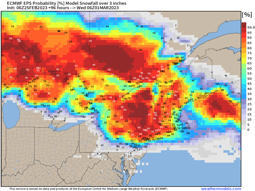
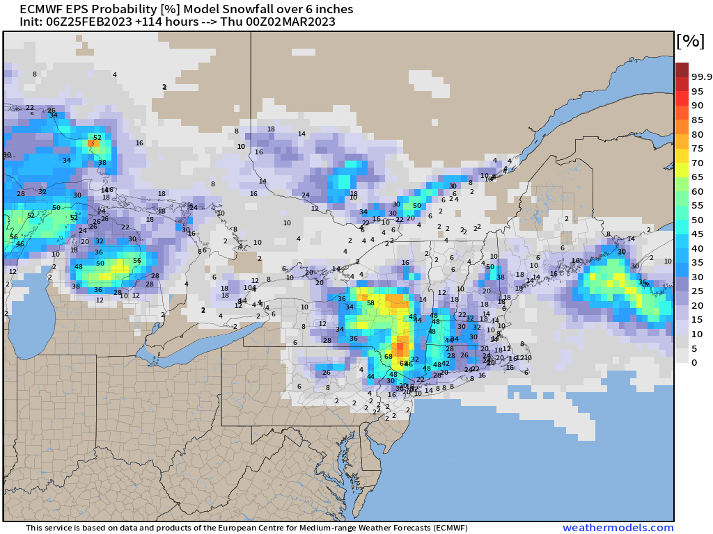
So what we do know is that there’s an increasingly high chance at a plowable event aimed for the Northeast next week where snow looks to begin late Monday night, continuing through Tuesday and into early Wednesday. As we play it out below, we see an initial frozen start for places like northeastern PA, northern NJ, and areas along/south of I-84. The further north and east you go, the colder and snowier it gets so places in SNE that have seen anomalous below average snowfall thus far, in the very least this serves to help render somewhat of “help” to the snowfall deficit. Regarding the latter, we still are looking at an active pattern for March by the way!

Timeframe:
- NE PA / NNJ/ HUDSON VALLEY: Monday 6 – 9PM clears by midday Tuesday.
- NY / CT border, western MA, southern VT 10 PM – midnight clears by mid-late afternoon Tuesday.
- Along and east of I-95 11 PM – 2AM clearing by late Tuesday night into Wed.
Since this is a quick progressive trough that zips through, it’s relatively quick but will put down accumulating snow quickly given the timing of the antecedent air mass and transfer process that can “lock in” cold air advection.
Stay tuned for updates!


