A Northeast Winter Storm On Tap
Another winter storm has its “eyes” set on the Northeast today and tomorrow. A low pressure system will continue to climb up the East Coast and “hug” it along a frontal boundary, therefore causing a wintry mix scene for several places including all snow further Northwest and rain southeast, with a sloppy mix in between.
The setup:
This is a classic “CAD” setup (cold air damming), where high pressure across southern Canada funnels cold air down through the Northeast as a low pressure slides up the coast and warm air advection along with strong moisture advection, “clashes” into the colder air. However, notice the retreating high pressure as it shifts off to the east, and the low pressure treks up the coast, but taking an inland track.
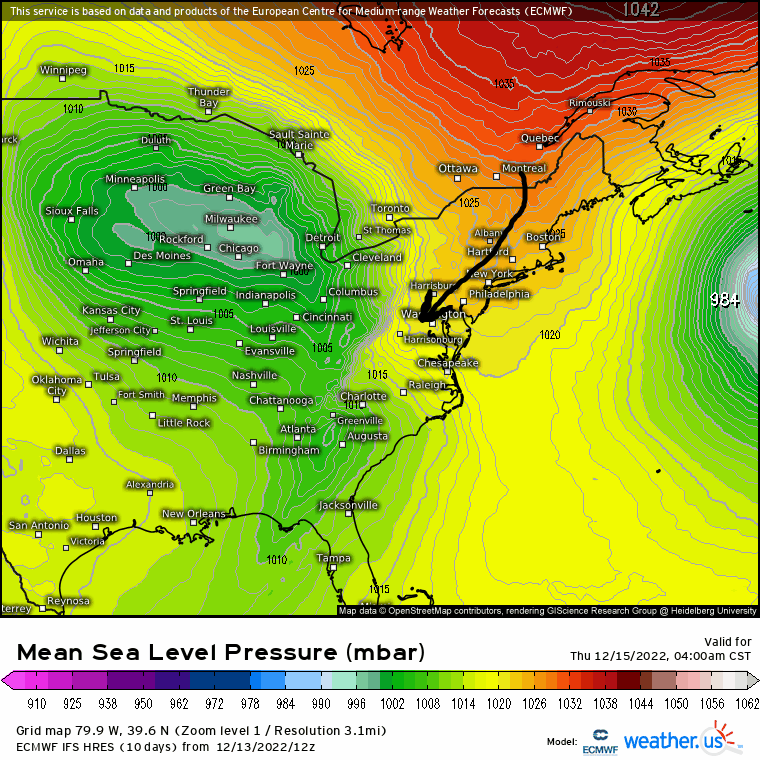
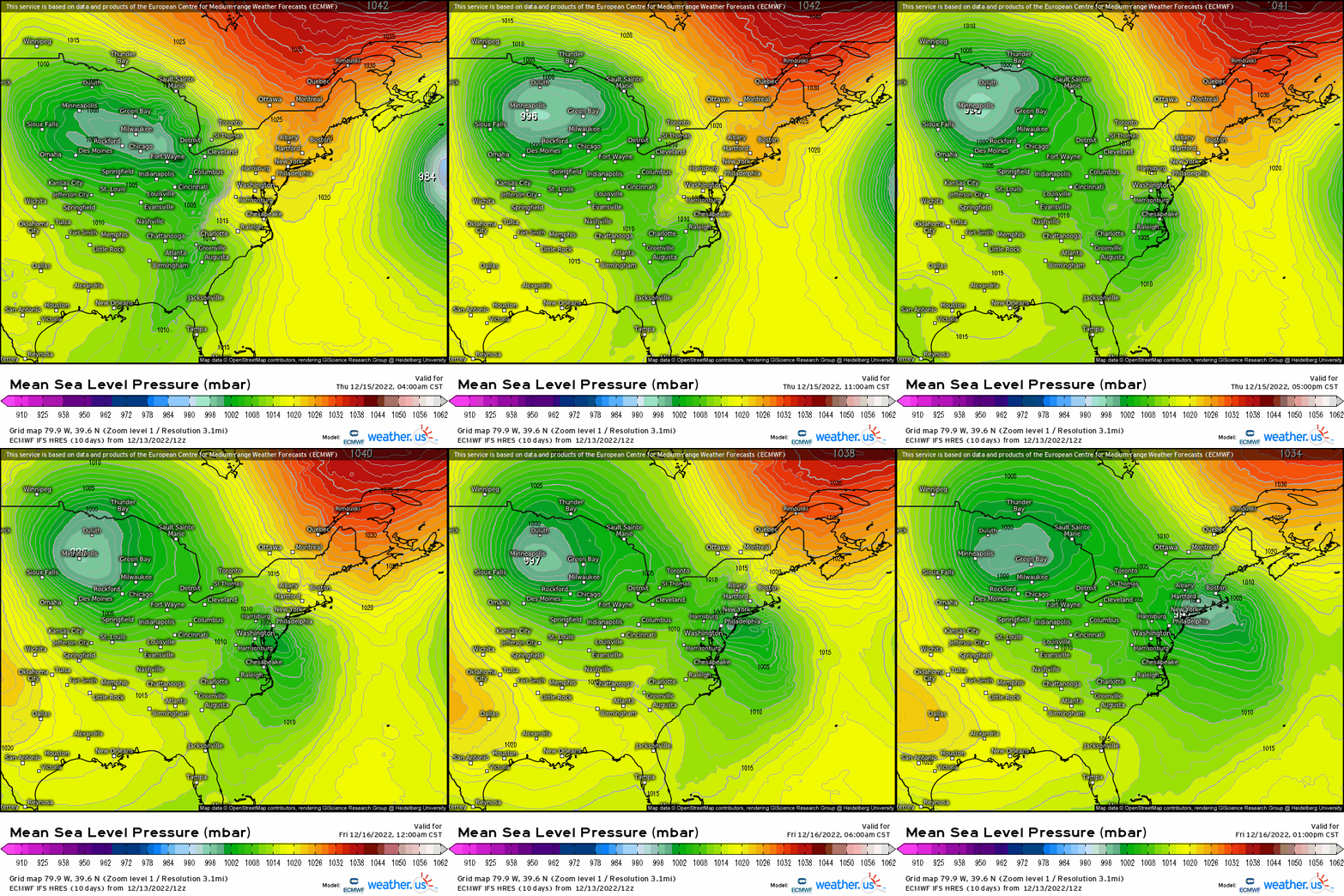
We can see how the track plays out generally as a solid consensus amongst both deterministic and short range models concur. Precipitation will be starting out as a wintry mix along and northwest of I-95 with a snowier solution further to the north and west that include places such as NE PA, Lehigh Valley, lower Hudson Valley, NWNJ, and into the western southern New England on north. Closer to the metro areas, while some sleet could mix in at the onset, temperatures trend up rather quickly as the low pressure and warm air advection surge up the coast causing a flip to heavy rain by tonight.
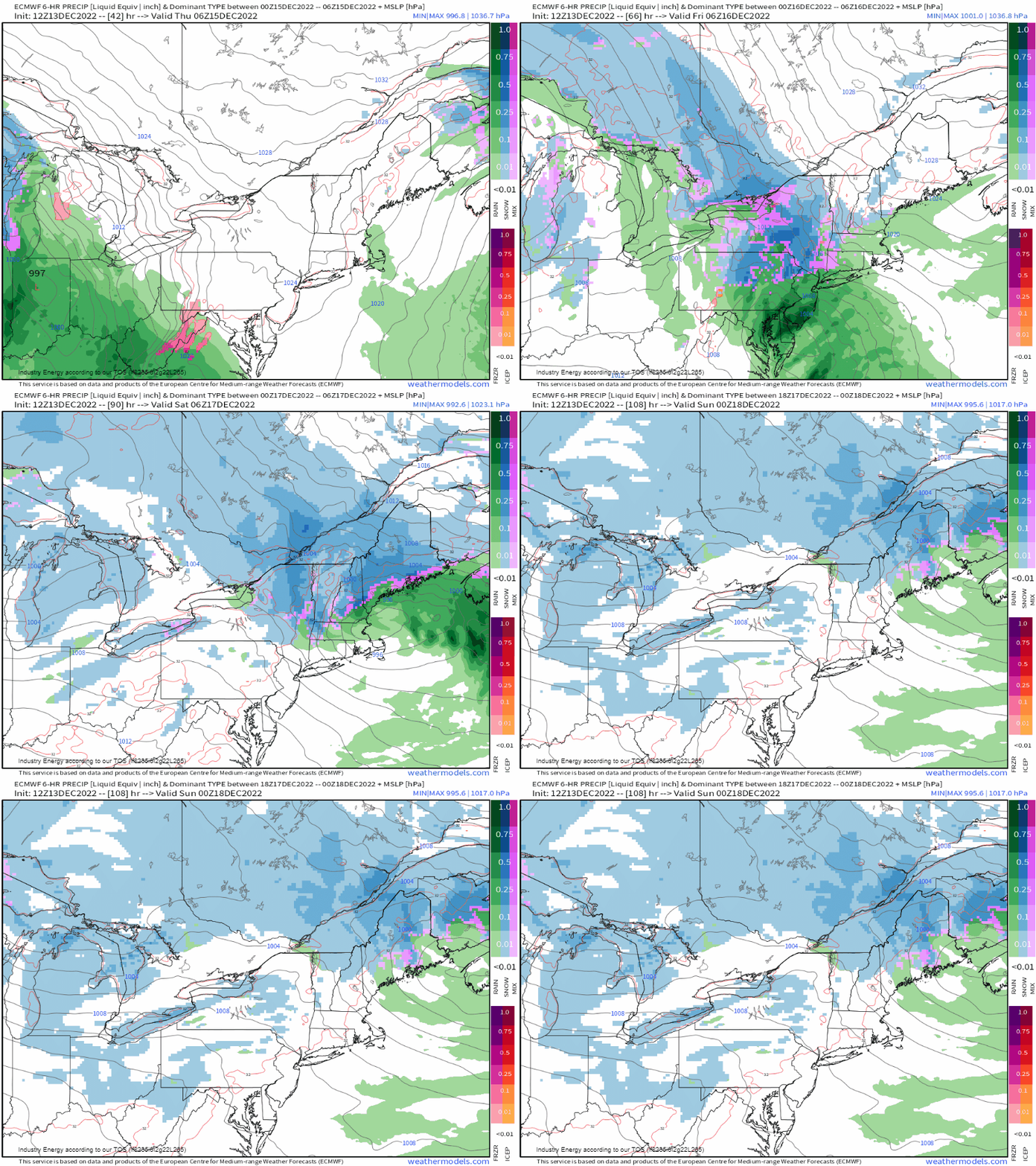
Surface temperatures remain marginal and above freezing from Baltimore into Philadelphia up to NYC and into Boston. Note the temperatures that are cold enough are further north and west, and especially in areas above 700′ in elevation. This type of track will cause an onset of a wintry mix of snow, sleet, and rain where temperatures are just hovering around 32 degrees and once the precipitation shield moves in as it’ll “thump” initially.
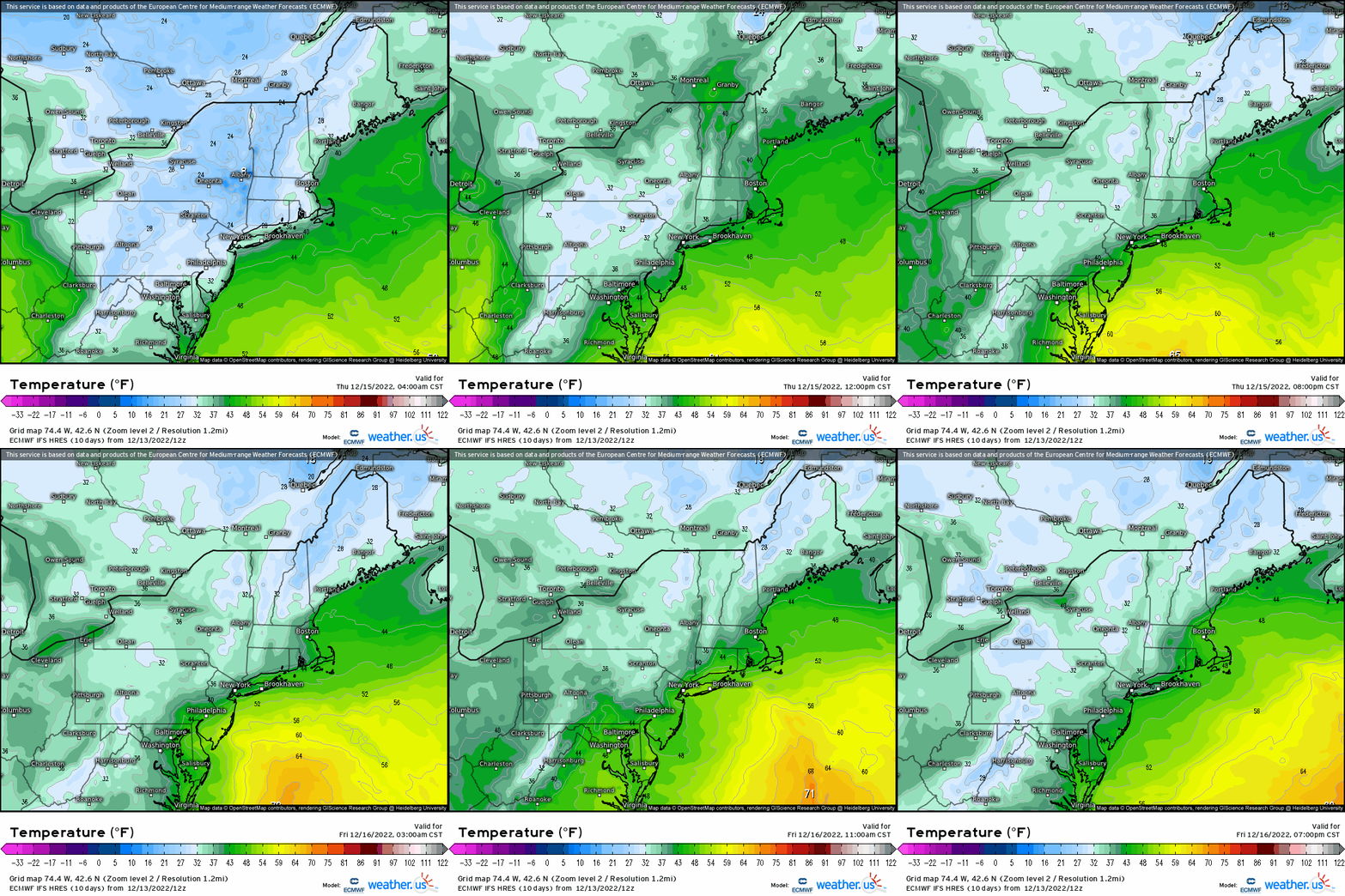
As for freezing rain, the good news is that the way this low pressure tracks reduces the widespread potency of freezing rain as it’ll remain confined toward the Blue Ridge mountains and along the spine of the Appalachian mountains across western VA, western MD, and into south/central PA.
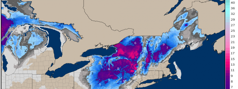
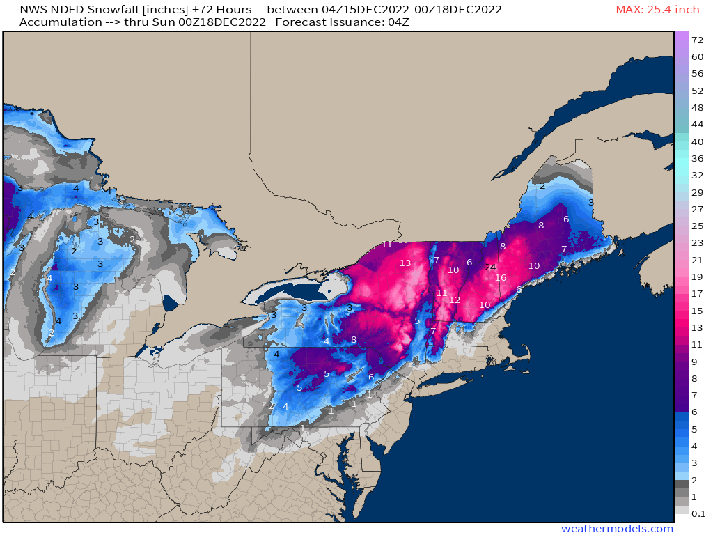
In terms of total snow totals through the end of this event, this is what we’re looking at across the northeast with a few inches across far NWNJ and into NE PA. Across northern PA and into NY, this is where we’ll see that “thumping” of heavy snow with some mixing toward this evening. It stays all snow predominately north of I-84 across southern NY and into western MA, up into NH, VT, and ME. The highest totals are expected to be across interior NY and across the interior Northeast.
It’ll turn chillier behind the departing low, and especially as we get into next week as a very strong cold arctic air mass looks to take control leading up to Christmas! We also will be monitoring an active pattern next week with a few chances as more winter weather!


