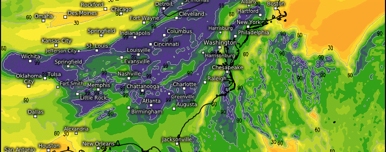
A Northeast Washout Tuesday-Wednesday
The setup across the Northeast today and tomorrow supports a widespread rainfall, as we dive into the synoptic details starting aloft amidst a quasi-zonal flow across the eastern 2/3rds of the U.S.
Upper levels
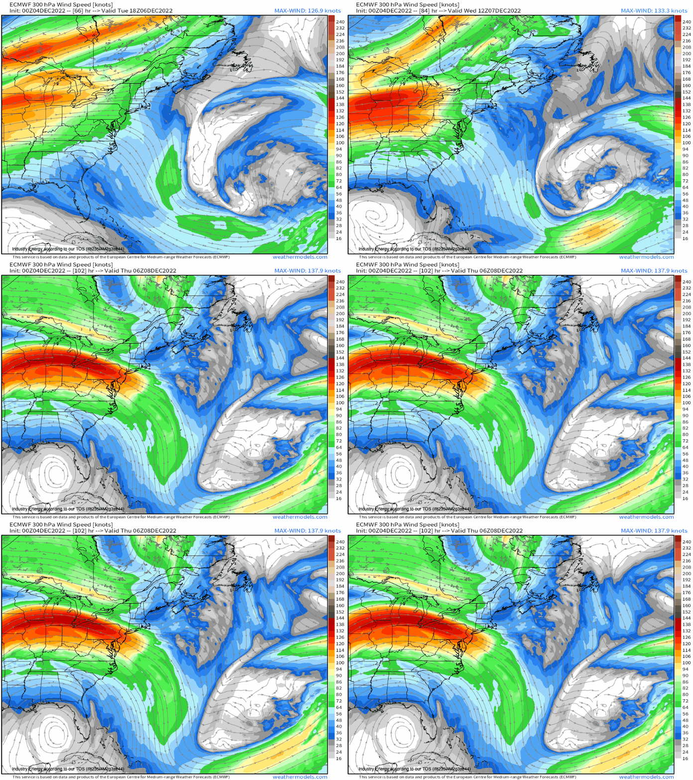
An approaching jet streak shifts into the Ohio Valley & Northeast by tomorrow, supporting upper level divergence, enhancing lift at the surface. The ageostrophic component (i.e. imbalance in forces of winds which means a compensation in mass is what necessitates air to rush in and converge at the surface, thus forced to rise), is what’ll enhance precipitation from aloft (why we always look at the upper levels!).
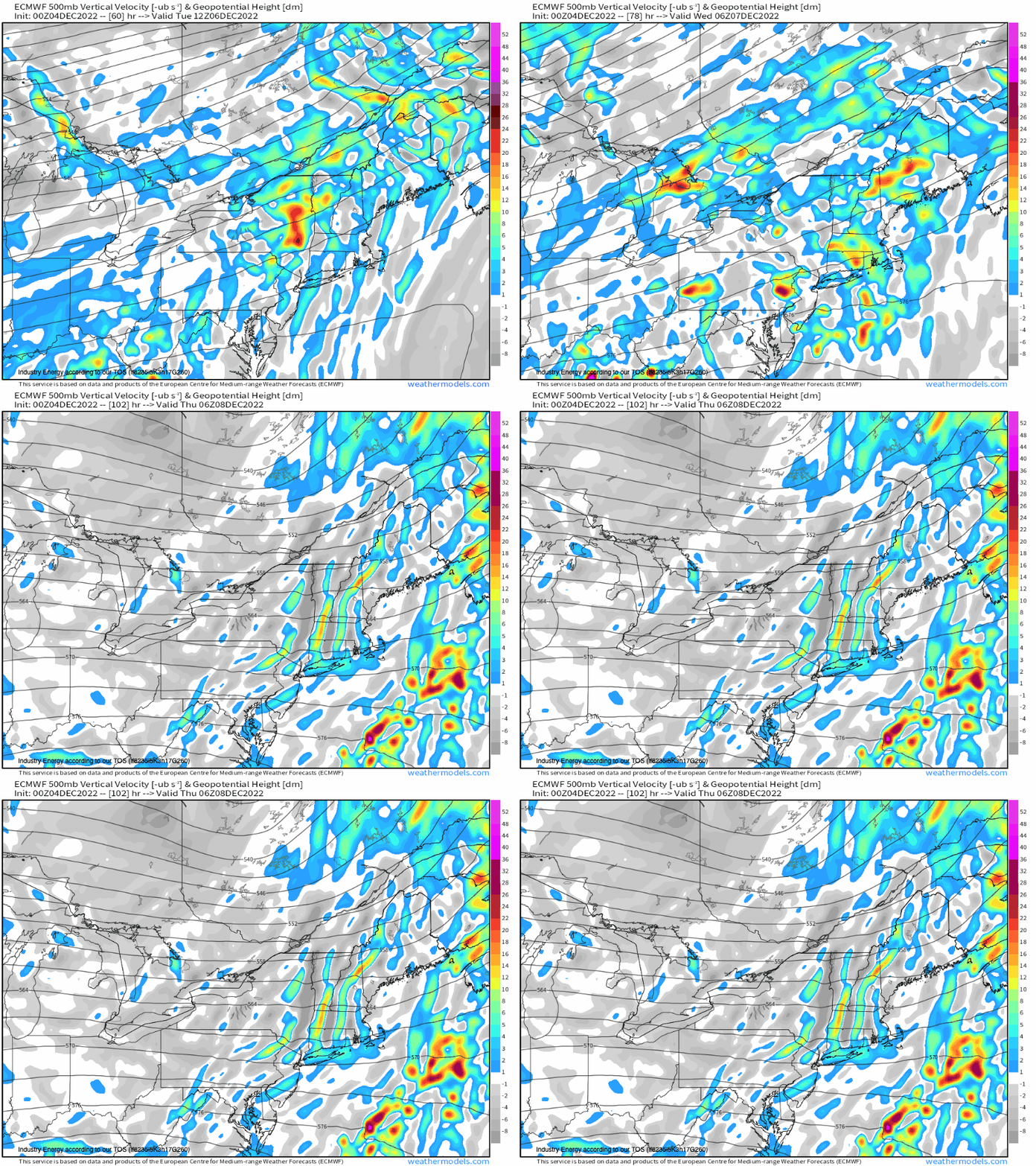
Now I’ll get to the surface details toward the end, but it’s important to preface that the setup will be a stationary boundary that originates as a warm front from the southwest. This then becomes a stationary boundary west of the Appalachian mountains. The reason to preface that is then now working our way down to 500mb, we see several shortwave embedded within the mean flow. When we have already divergence aloft In tandem with net PVA (positive vorticity advection) with already a setup that provides forcing for ascent (which is our surface boundary), this further accentuates the precipitation!
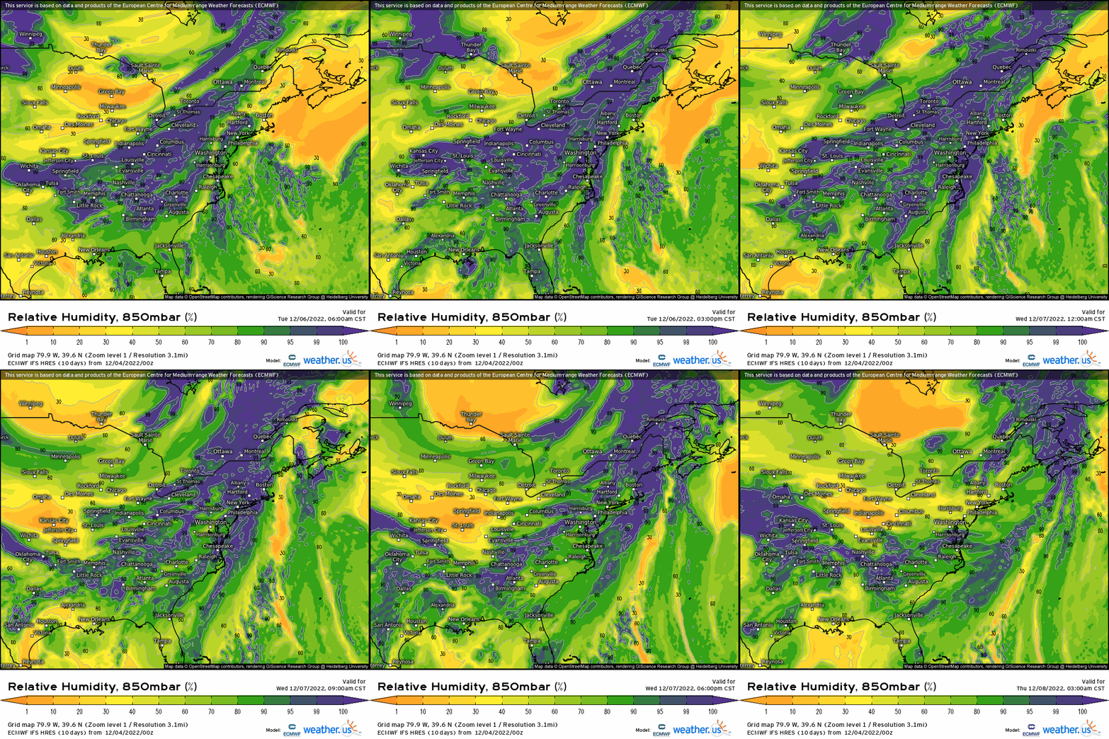
What makes this entire setup even more intriguing from a synoptic standpoint, is the 850mb low level jet’s role in this. Through showing RH, we can see high moisture advection with actually a subtropical connection from the Eastern Pacific, advecting anomalous moisture ahead of the frontal boundary.
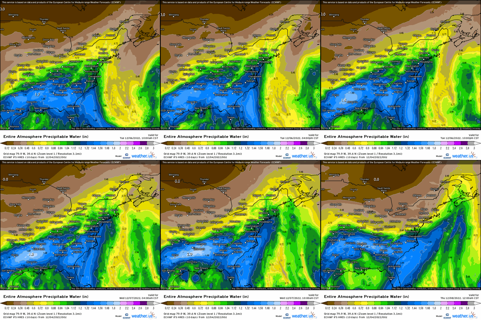
Above, we see anomalous PWAT’s associated with the LLJ, an notice the connection (far lower-left corner of the animation, southwest of Texas) from EPAC. We even have some moisture advecting from the Gulf of Mexico.
Adding this all together, supports a general 1-2” along and east of the I-95 corridor, although don’t be surprised to see some localized 2-3”+ with this type of setup supporting heavy rainfall, and at least a setup that supports a widespread healthy rainfall through late Wednesday before the boundary finally pushes through by Thursday!
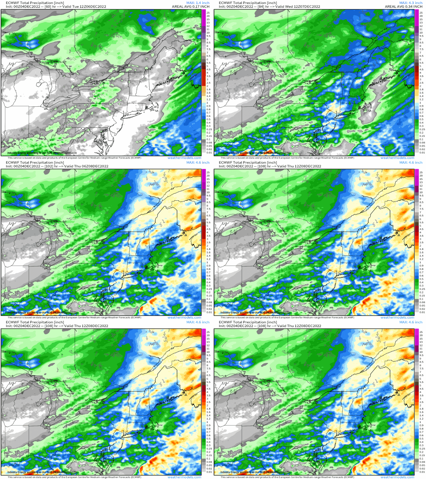
A wet weather week is in store without a doubt, especially east of the Mississippi River valley!


