A Northeast / Mid-Atlantic Severe Weather Day On Tap
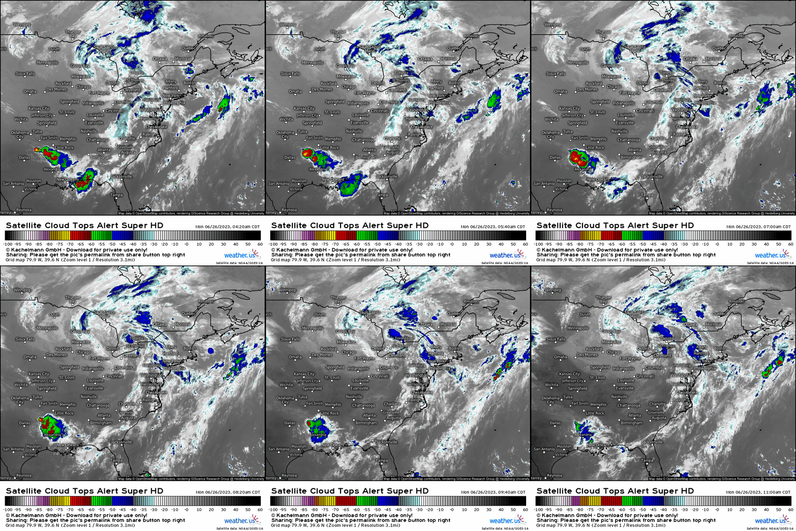
With severe weather a given for a region in general for that specific day, it’s always useful and prudent to start by just observing what exactly is in place in the atmosphere that is manifesting storms, or be the catalyst. Today, we have a potent upper low across the Great Lakes, and the blues here verbatim reveal cloud tops “cooling” as storms grow higher in the atmosphere. The main forcing for ascent that’ll help foster storms, with other favorable atmospheric ingredients, will be this large-scale feature aloft and also at the surface below.
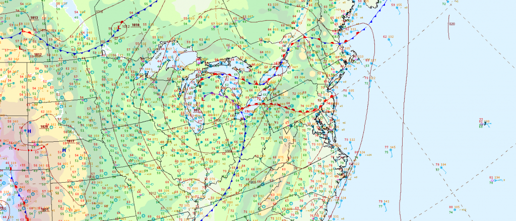
In conjunction with current observations, lets see what the surface analysis reveals via The Weather Prediction Center (WPC). A warm front is draped across the Mid-Atlantic from OH to NJ. This is currently firing off some isolated to scattered storms. Now the main “event” will be the cold front that you see below that extends from OH to TN. Once the warm front pushes northward today, all areas will be within the warm sector. Once we get clearing in between as we enter the peak heating “window”, destabilization occurs as CAPE strengthens (thanks to the Sun), moisture increases, shear increases, and then the main forcing “trigger” (cold front) makes it all happen.
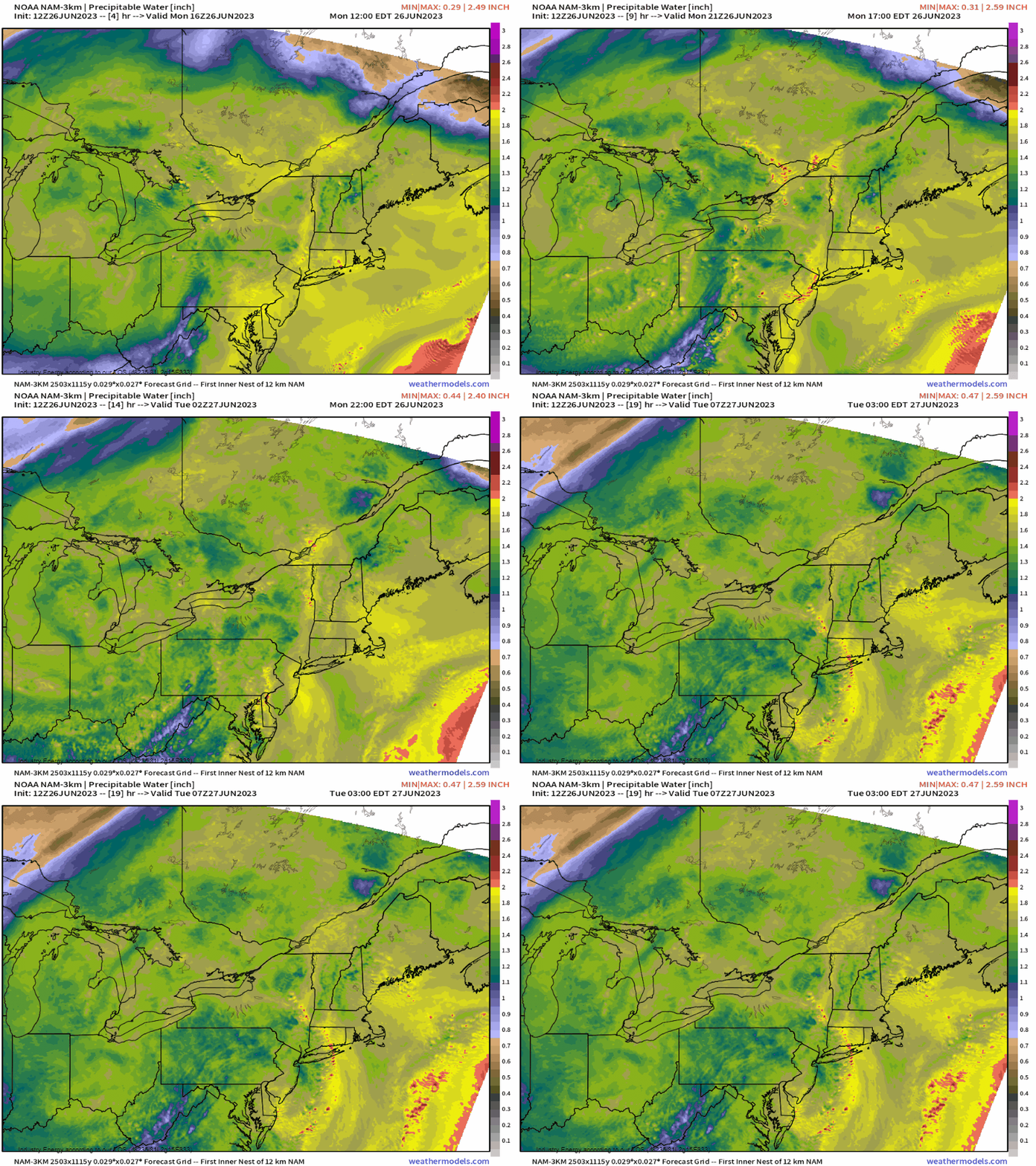
- Precipitable Water. Here, if you live in the Mid-Atlantic and Northeast regions, you’ve felt the tropical air mass characteristics with dewpoints that have been in the 60’s and even low 70’s. There will be no short of moisture today, with PWAT values exceeding over an inch in many spots, so we’ll have plenty of “fuel” in place for parcels to become easily buoyant.
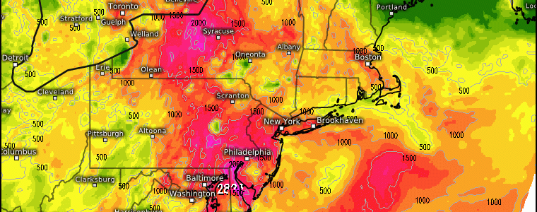
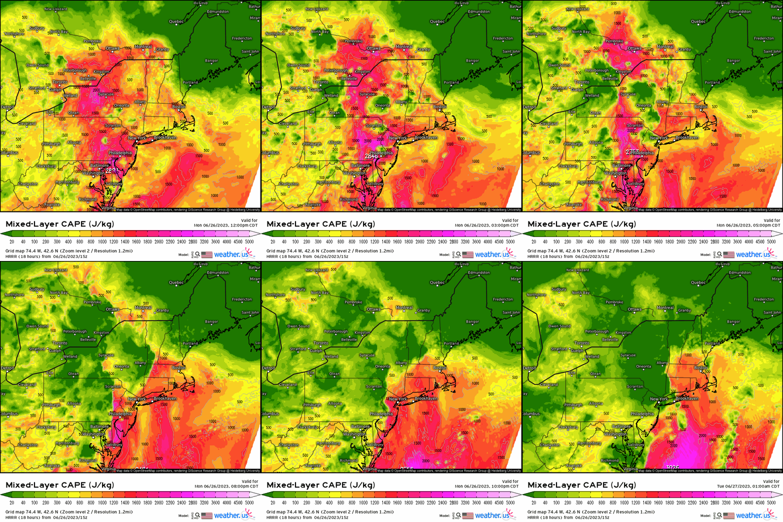
2. CAPE. Here however, we have “Mixed-Layer CAPE”, which essentially utilizes the lowest 100mb of the atmosphere since it’s shown that the quicker acceleration of parcels leads from the surface to the lower portions of the updraft has implications for how potent a storm can be. Once we see diurnal heating kick in, our values of CAPE increase drastically. A large swath of over 1500 J/Kg are shown ,even getting to above 2000 J/Kg, which reveals a very unstable and potent atmosphere.
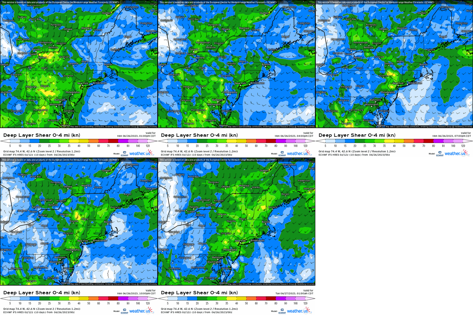
3. We have the instability, so lets see about the shear. Here, we see that the better corridor of shear is located toward the southern Apps around W.VA, VA, and southern PA. Elsewhere, it’s sufficient with over ~15-20 knots, which really anything over 20 knots can be more-than-enough to support severe updrafts and that is the case today.
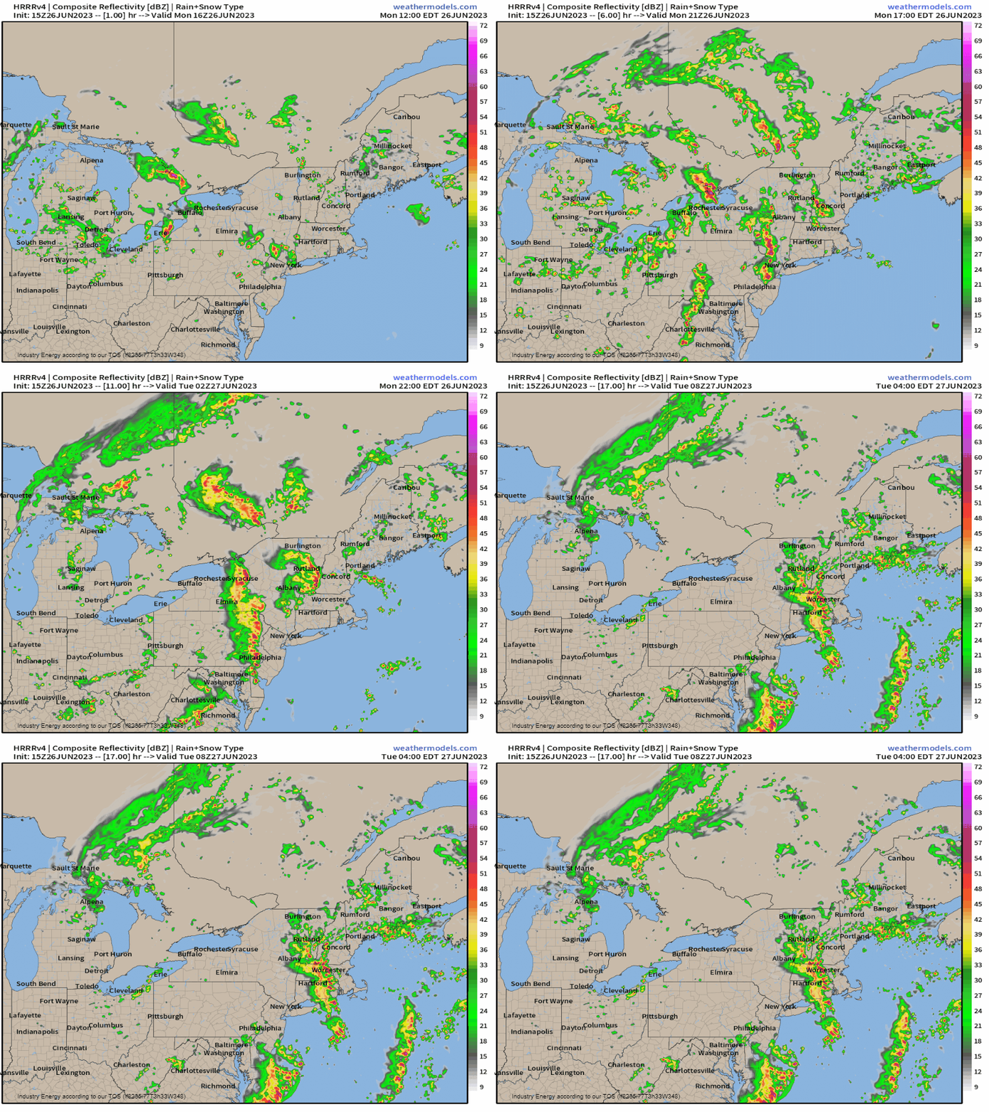
We have the trigger, the instability, and shear. Once we put it together, we have a atmosphere capable of producing severe storms today that’ll come in the form of discrete cells, that’ll grow upscale into clusters (multicell), and then finish off with bow echoes and squall lines. Here we see the latest short-term convective allowing model (HRRR) reveal how this looks to play out. Current storms now shift northward, then as the cold front swings east we see storms fire off the higher terrain of C. PA into VA (orographic lifting as well), which then congeal and shift eastward through the evening and into tonight from VA and Carolinas, up to the Northeast.
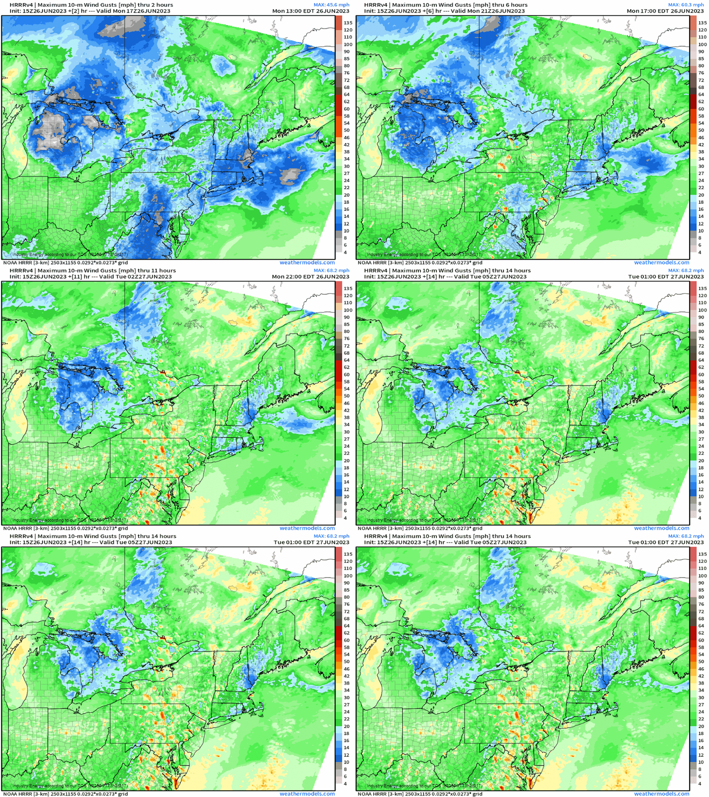
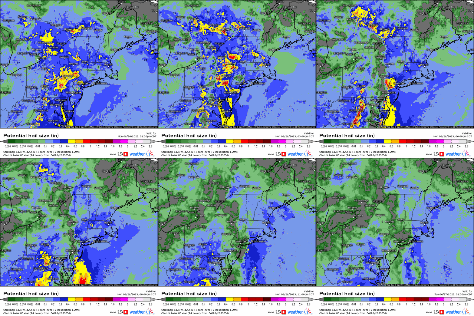
Hazards from these storms will primarily include severe gusts over 50mph, and hail up to an 1” – 1.5” as we see from both the HRRR forecasted max gust potential and the helpful SWISS 4×4 model found here, where you can see what hail size we could be looking at for an area or region. The severe gusts, while can occur with discrete cells, will come from the squall lines / bow echoes especially. Heavy rainfall will also arise with multicell storms, where urbanized flash flooding can occur given the high PWAT’s and saturated areas from previous rainfall across this region. Tornadoes certainly can occur with either supercells and/or bow echoes with sufficient low-level shear and boundary collisions that can enhance shear at the surface. If anything, the area most favorable for the latter would likely be in southeastern PA, Delmarva, and S.NJ
With severe thunderstorm watches already posted across NY, PA, and NJ, those residing in these locations and across the Mid-Atlantic and Northeast be situationally prepared, aware, and have a backup plan just to play it safe!


