A Most Disastrous Tornado, Ten Years Ago
Today marks a somber anniversary in weather history, ten years to the day from arguably the single most devastating thunderstorm in the era of modern meteorology (1950-present). On May 22nd, 2011, a supercell amidst an incredibly volatile parameter space spawned a mile wide EF5 tornado that tore directly through the city of Joplin, Missouri, destroying numerous city blocks completely and killing 158 people.
It was a tragedy incompatible with how many saw modern forecasting. No tornado had killed more than 100 people since 1953, a remarkable achievement heralded by incredible advancements in doppler radar, the science of warnings, and communication abilities. Remarkable outbreaks on 4/11/1965, 4/3/1974, and 4/27/2011 had proven that tornadoes could still prove extremely deadly and devastating, and all had death tolls exceeding 250. But each also featured more than 15 violent tornadoes, and no single one in any of the three outbreaks had killed nearly as many as the 5/22/2011 tornado would. In the era of WEAs, tornado emergency polygons, high-resolution doppler radar (and even some degree of dual-pol deployment), and shelter drills, decades after Fujita and years after Corfidi, one could be excused for thinking that individual tornadoes simply could not be truly calamitous anymore. Joplin proved that wrong.
The tornado environment of 5/22/2011 was about as synoptically evident as possible for late May. A massive longwave dominated North America east of the Mississippi, and a compact closed low within the trough’s periphery was slowly pivoting north towards Sioux Falls.
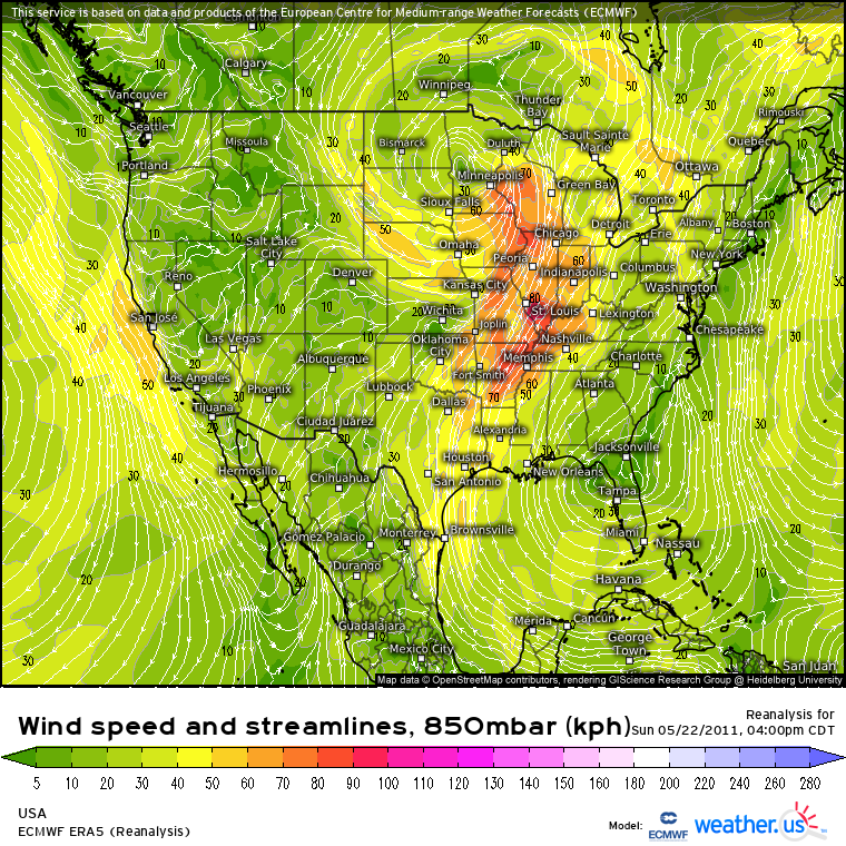
The result was a belt of speedy 500mb flow from northern Mexico to Michigan, typically from 40-50 knots. Diffluence associated with this flow led to a good deal of mass removal, especially to the immediate east of the north-central closed low. Thousands of feet below, at a pressure level of 850mb, heights steadily deepened into a notable depression centered near Minneapolis. Arcing towards this low was a snaking swath of southerly wind, a thousand miles long, stretching from the central Gulf to Duluth. As a massive amount of air migrated north along this jet, it brought two things to a huge swath of land that extended from Texas to Wisconsin: an airmass and energy. The former as Gulf air was siphoned north, flooding the central US with high-end atmospheric moisture content, and the latter as the brisk low level flow threatened to kick an updraft into a spinning tube, known as a mesocyclone.
The high dewpoints that characterized the Gulf air were overspread by a stout EML from the southwest, creating an airmass with an extreme amount of potential updraft bouyancy. Any parcel lifted to condensation amidst this airmass would be able to rise explosively as it long proved warmer, and less dense, than its environment. And with strong bulk shear amidst the aforementioned midlevel jet, and impressive low-level helicity across a wide area due to the strong low level flow, these self-sustaining updrafts could well organize into long-lasting supercells. A lot of this can be seen in weather.us ‘s ERA5 severe weather composite chart:
Of course, lift is necessary for updrafts to develop. This lift came as a cold front arced south/southwest from the Minnesota surface low, merging with a dryline over SW Kansas that extended south through Oklahoma and Texas. Along this front, cold and/or dry air forced warm, moist air ahead to rise until the parcel could self-propagate vertically.
The impressive parameter space along a lifting boundary was unusually widespread, and led to the SPC initiating a broad moderate risk for tornadoes from Wisconsin to Oklahoma. Two zones seemed to bear watching: maximized kinematic support int the vicinity of the low, from Wisconsin through Iowa and into Illinois, and maximized turning of flow near a mesolow at the dryline/cold front intersection near the OK/KS/MO border.
By 3pm CDT, supercells had erupted along the cold front. The northern half of the risk area saw these storms quickly intensify, dropping numerous strong tornadoes, including a 70-mile-long tracking EF3 in Wisconsin and a deadly EF1 in Minnesota.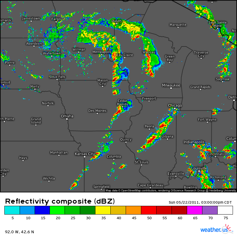
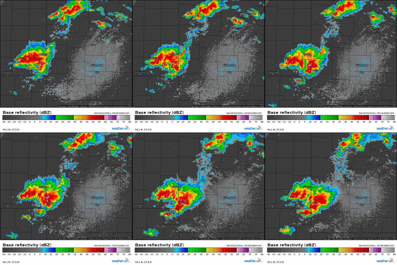
To the south, one of these cells had developed in the zone of prime curvature with height near our KS/OK/MO mesolow.
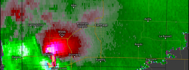
This cell quickly progressed east towards Joplin, in SW Missouri, along with the triple point. It ingested several smaller convective cells, and soon a huge thunderstorms had swallowed the city amidst an expansive hail core. It was then that another convective cell merged with the supercell from the south- suddenly, inflow expanded significantly, and a massive hook echo with an extremely compact, strong velocity couplet was swinging into Joplin.
The tornado spun up at an extremely rapid rate, and hit the city head on. A tornado warning provided 20 minutes (!!) of lead time in an incredible meteorological success, but a tornado emergency was never issued, likely due to the speed at which the mesocyclone intensified. It’s possible that the ‘run of the mill’ tornado warning in a city used to being scraped by low-end storms could have led to people not heeding warnings to the fullest extent possible.
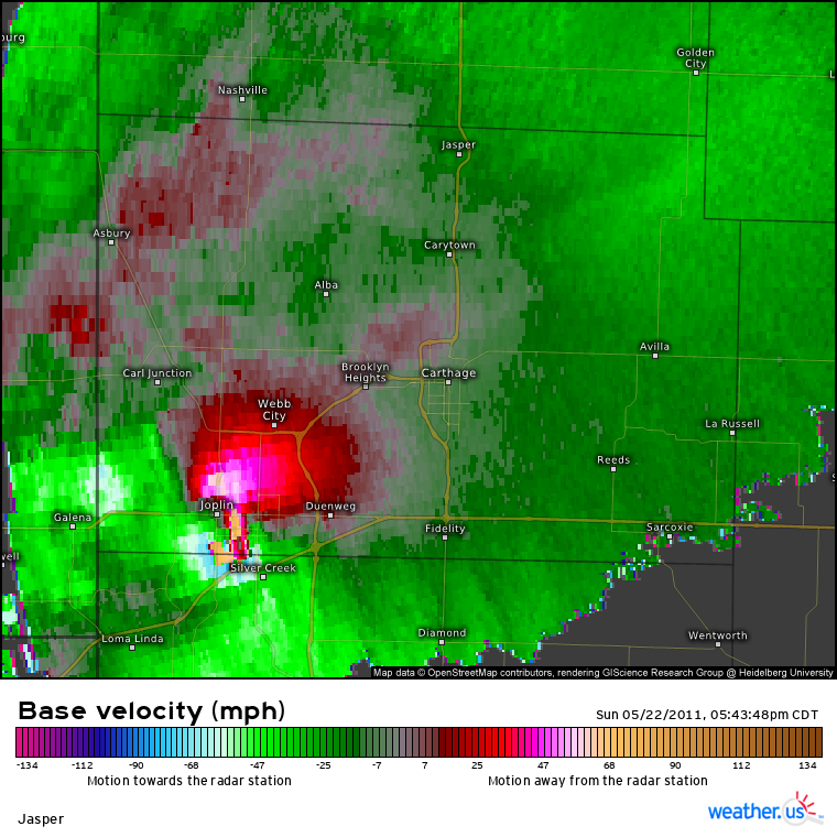
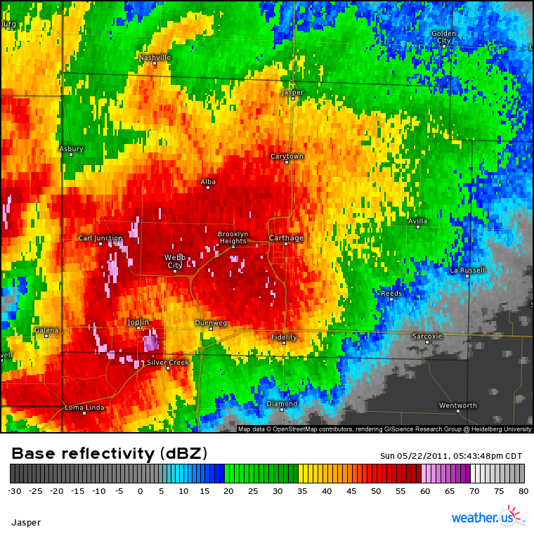
A zoom on the radar shows how the intense couplet, one of the strongest ever seen on radar, coincided with a huge debris ball as a massive tornado roared through Joplin.
The tornado flattened dozens of city blocks, destroyed part of a huge, well constructed hospital, and caused massive devastation to the entire southern half of a large city. It killed 158, caused more than 1000 injuries, and caused >3 billion dollars in adjusted damage.
Hopefully, something like Joplin never happens again. The odds of a tornado hitting a highly populated city are inherently small, especially one as intense as the 5/22/2011 storm. There hasn’t even been an EF5 tornado in more than 8 years! The meteorological community, already well prepared for such an event that morning in 2011, is more ready than ever before due to what was learned from the disaster.
On 5/22/2019, the 8 year anniversary of the Joplin tornado, a high-end EF3 roared through Jefferson City, a city with a similar population to Joplin in central MO. It formed after dark and tracked directly through a trailer park and a residential suburb before smashing through the city’s downtown. It had all the marks of a tragedy, and could have well killed dozens. But with an astonishing 30 minutes of lead time, and the willingness of residents to ensure the safety of their neighbors, only one person was killed. The tragic lessons of Joplin made such miracles of science and humanity possible.

