A March Nor’easter
To borrow a quote from The Lord of the Rings series, “The board is set. The pieces are moving.”
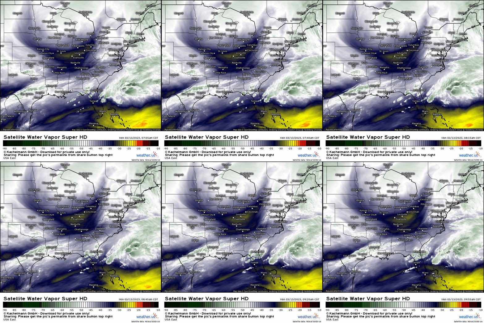
As Armando discussed in Saturday’s blog, the pieces are coming together to produce what will be a highly impactful Nor’easter. It seems strange that the Northeast’s most widespread, impactful snowstorm of the 2022-2023 winter season should come in mid-March after 2 months of solidly above average temperatures, but here we are.
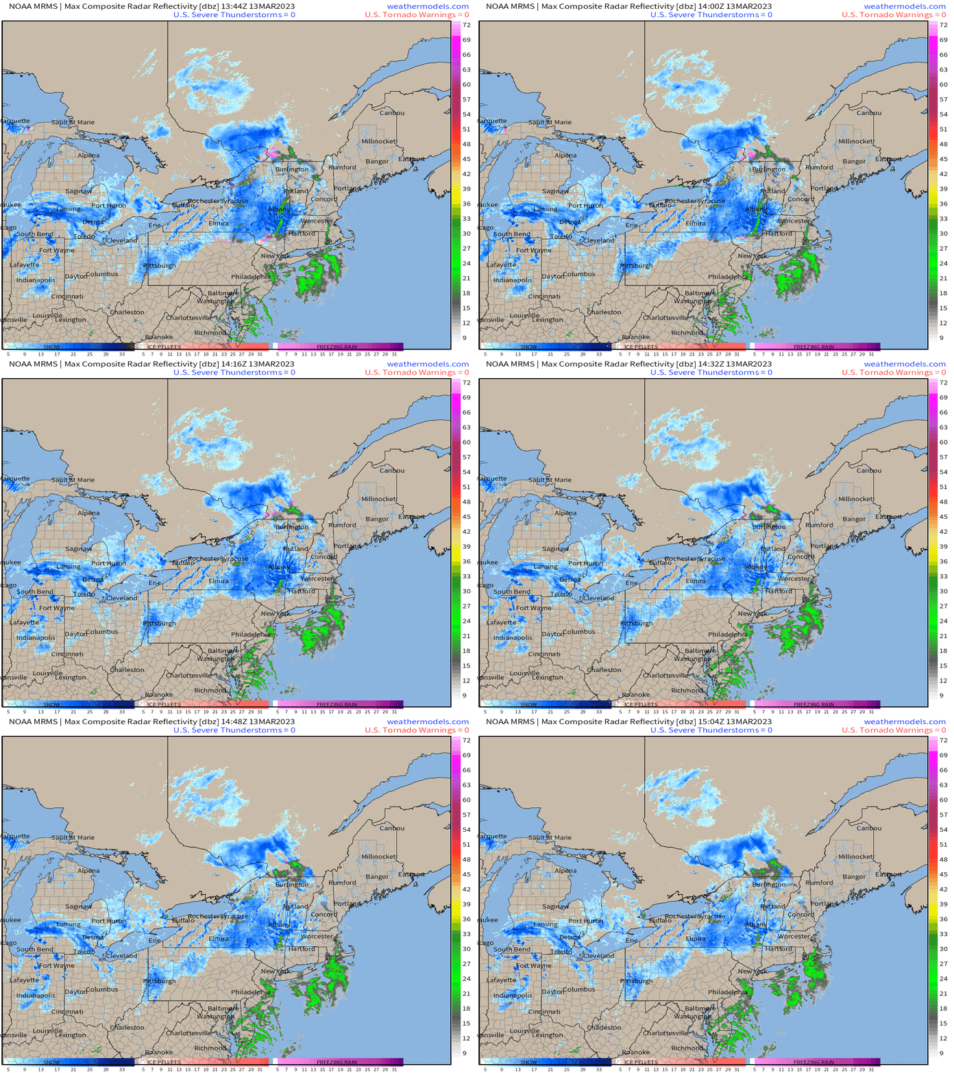
Current radar shows a bit of “pre-show” activity happening now as our aforementioned pieces move into place. Activity will really start to ramp up into the evening and overnight hours.
As residents of this region may already know, precip type is highly dependent on the position of the low. A coast-hugging low can produce and interior snowstorm while more coastal locations receive plain rain while a low further off the coast can, if properly aligned with enough cold air, produce a snowstorm that dumps snow on the I-95 corridor.

Models are in general agreement that this storm will eventually consolidate a low offshore. This low seems to be not quite far enough out to produce an all-snow event for the immediate coast, but close enough to produce a potent snow event for the interior Northeast.
As always, the mountainous regions will be the big winners. Their naturally colder environment and help from orographic lifting allows this not only to be an all-snow event, but enhances total snowfall.
One thing we’ll need to watch with this storm is where banding sets up as the low really gets going.
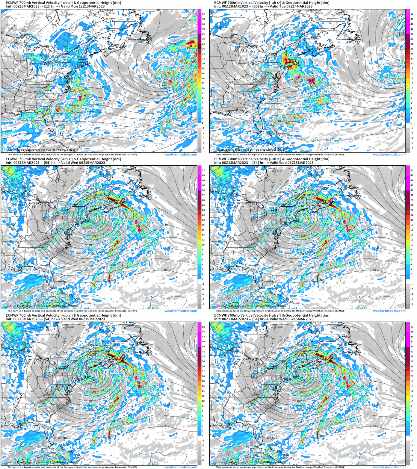
Banding typically occurs north and west of the center of low pressure as frontogenesis occurs. Horizontal convergence between competing air masses produces a somewhat narrow band of enhanced lift. Where this occurs, precipitation rates of 2 to 3 inches per hour (or sometimes more) are possible. These bands can remain stationary for hours, producing crazy snowfall totals underneath.
Modeling suggests that this banding will materialize over places like the Catskills, the Green Mountains, the Berkshires, the White Mountains, and perhaps even parts of the Poconos.
Notice that I mentioned a few mountain ranges. So banding plus orographic lifting means we could see some incredible totals somewhere in this region.
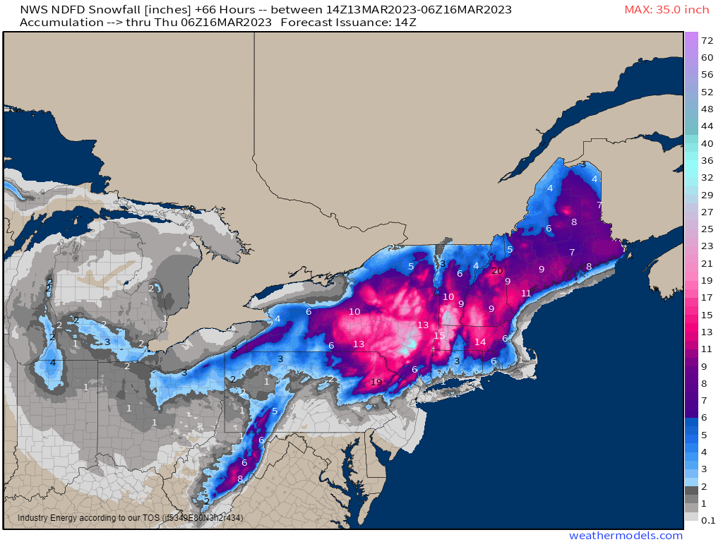
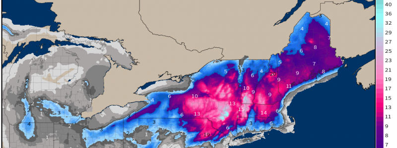
The map from the NWS shows exactly what I’ve outlined above. The “big winners” are the Catskills with a secondary maximum in the Berkshires. If you’ll refer back to the 700 mb Vertical Velocity map, these are exactly where the modeled banding tracks over.
Another thing you’ll notice on the above map is the lack of any meaningful accumulation for most of the I-95 corridor. With no truly cold air in place during the event, temperatures near the coast will remain just a tad too warm for a solid accumulation. There may be a window of opportunity for accumulation tomorrow, but a small wiggle in temperature could change that.
But, just because these coastal locations won’t be buried in snow doesn’t mean they won’t also be seeing impacts.
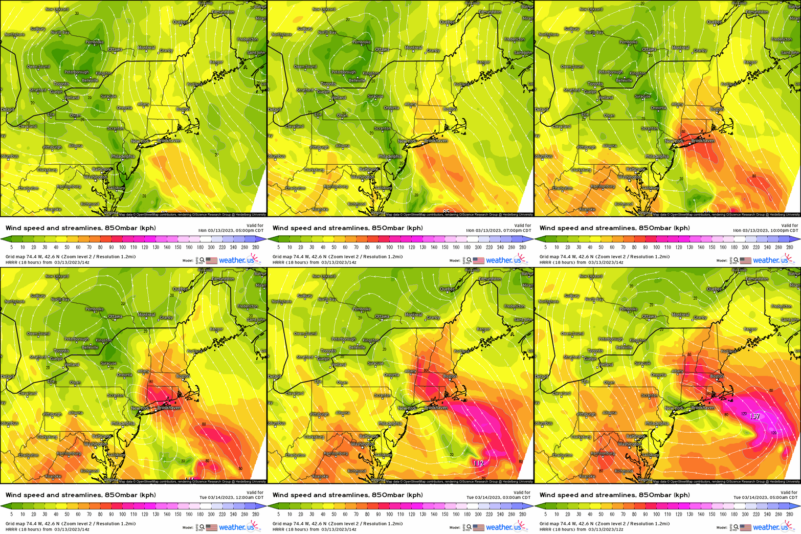
In addition to heavy rain, the low-level jet will ramp up as the low deepens. An onshore push of water will be seen along the coast, potentially resulting in coastal flooding.
We’ll have windy conditions to contend with as well.
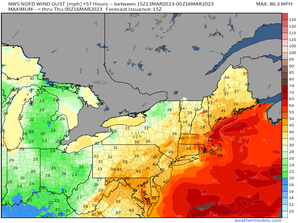
Gusts of 35 to 55 mph area-wide could bring down branches or trees, causing power outages. Keep this in mind, especially closer to the coast, and make sure you have ways to keep warm during any potential power outages.
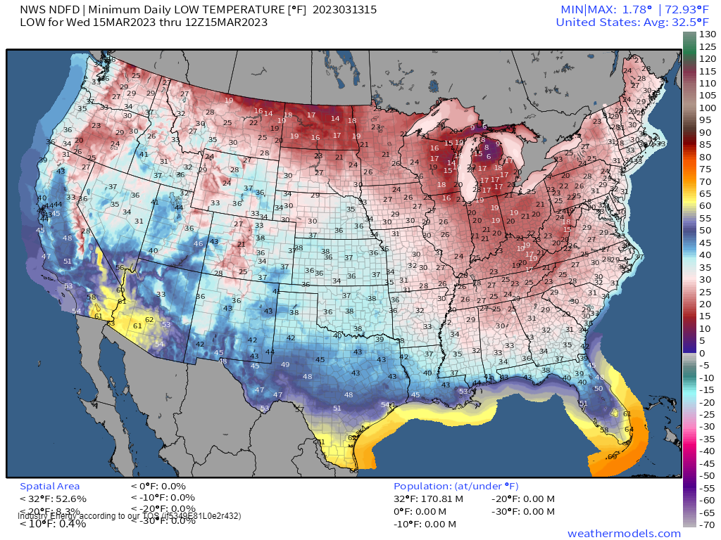
Looking at the larger picture: much colder air will filter into the Eastern US as this nor’easter develops and departs. Widespread lows at or below freezing are on tap for tomorrow morning.
Freeze Warnings have been issued for some of the Southeast. If you have sensitive plants that are already blooming, take steps to protect them tonight if possible.


