A Look Back at the Superstorm of 1993
The 30th anniversary of the Superstorm of 1993 is upon us.
This storm was one of the “greats.” A storm so powerful, multi-faceted, and widely impactful that it will be remembered for a very long time. It was one of those storms that inspires a new generation of meteorologists. And I was one of them.
I was six years old, living in northeast Pennsylvania when the 1993 Superstorm blew through. At 6, I had no clue about the wide ranging effects of the storm. In my little corner of the world, I just wanted to know how a storm managed to give us that much snow – 2 ft to be exact, which was over half of my height at that time – AND produced more than a little thunder and lightning while simultaneously pouring snow. And thus a future meteorologist was born.
So if you haven’t guessed by now, we’re going to use weather.us ‘s ERA5 database to look back at that incredibly impressive storm.
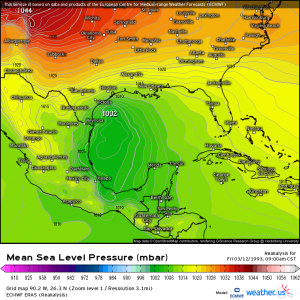
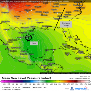
The 1993 Superstorm, heralded as the “Storm of the Century,” began as an unassuming area of low pressure in the Gulf of Mexico on March 12, 1993.
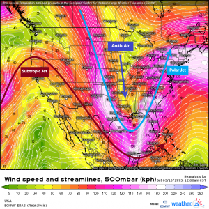
Meanwhile, in the center of the country, a strong arctic high was funneling frigid air into the lower latitudes of the US.
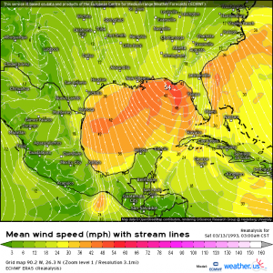
A subtropical jet, which was unusually far south and reaching all the way into the Pacific, supporting the Gulf low would phase with a shortwave in the polar jet and the combined systems then rapidly deepened. By 9 pm on March 12, the system was a 989 mb low lurking off the coast of the Florida panhandle. A screaming low level jet created extremely hazardous conditions offshore with huge waves reported along with hail and “washing machine-like” conditions.
The storm then blew ashore in the early morning hours of March 13. By that time, it had intensified to 979 mb and would continue to plunge even further. Packing sustained winds equivalent to a mid-grade tropical storm and gusts that were hurricane force, it caused storm surge of up to 12 ft along the Florida coast. A squall line became a derecho and produced straight-line winds of up to 100 mph from Florida to Cuba. Fifteen tornadoes touched down across the state, destroying homes and property. And the storm plowed on.
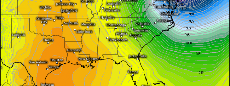
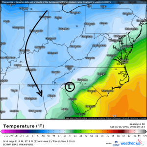
By 9 am on the 13th, the storm had deepened to 967 mb. The center was located over South Carolina.
The rapid intensification the cyclone was undergoing pulled frigid arctic air in behind it. Temperatures plummeted throughout the eastern third of the US. Heavy snow was falling from the Florida panhandle into the northeast with blizzard conditions seen across a large area. Thundersnow was reported from Texas to Pennsylvania.
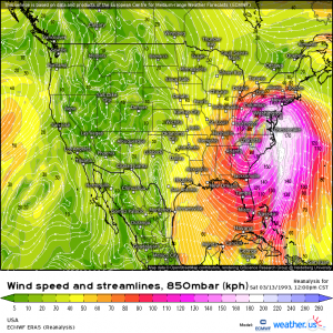
The pressure gradient associated with the deepening storm combined with an extremely strong low level jet produced absolutely brutal winds across the coast of North Carolina. The highest gust recorded was 93 mph at the Frying Pan Shoals Light Tower in North Carolina. These winds caused storm surge and beach erosion for south-facing beaches along the Carolinas. Hundreds of homes were damaged or destroyed.
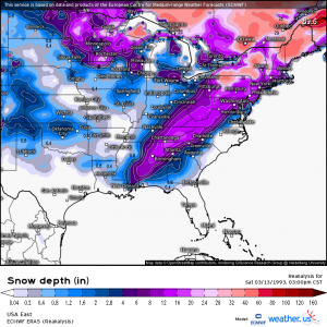
Perhaps the most remembered part of this storm was the snow. Accumulations were reported from the Gulf coast of Mississippi all the way to Maine. Places like Birmingham, Alabama received 17 inches of snow, which is nearly 9 times its annual average of 2 inches.
The big winners though were Mt. LeConte, TN and Mt. Mitchell, NC which received 60 inches and 50 inches respectively. These totals were enhanced by orographic lifting, but are extremely impressive nonetheless. During my time living in Tennessee, I’ve never seen Mt. LeConte with more than 18 inches at the most. I can’t imagine the problems 60 inches of snow caused for the national park.
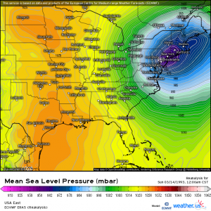
By midnight on March 14, with a center over middle New Jersey, the superstorm reached it’s peak intensity of 960 mb. Those with an interest in tropical meteorology know that’s equivalent to a strong category 2/low category 3 hurricane. It then exited to Canada by late morning on the 14th.
When all was said and done, this storm affected 26 states and 100 million people. It’s effects stretched from Canada to Central America. It was credited with 300 deaths and power outages to 10 million.
I remember the white out conditions. I remember my dad setting up a camera in our attic to capture the whole storm on video, which has probably been lost by now. I remember watching the storm from that same window being absolutely awed by the raw power it displayed. I am even more awed by it now that I look back on it meteorologically and see the absolute marvel it was.
What about you? Do you remember this storm? I’d love to hear your experiences! Drop me a note in the comments if you’d like to share.
All stats sourced from https://www.weather.gov/ilm/Superstorm93


I lived in the northwest suburbs of Chicago at the time, where it was cold with cloudless skies – while the city of Chicago itself was under whiteout blizzard conditions!
I was at the Lyndon State College storm conference in Saratoga Springs, New York. I remember looking outside the window standing next to Jim Cantore watching cars get buried underneath the snow!