A Look at The Tropical Atlantic Activity: Medium-Long Range
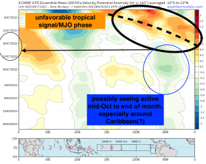
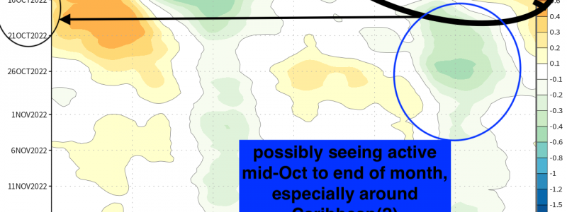
While we’re now passed the peak of the Atlantic Hurricane season with respect to climatology, we’re still of course not done just yet with the threat of hurricanes and tropical storms! However, by this time of year, we begin to shift now more toward the Caribbean and Gulf of Mexico as we journey further into the fall months. Once invest 91L and TD 12 move along with the former likely headed for Central America and the Yucatan peninsula while the latter recurves out into the open Atlantic, it appears we’re going to enter into a relatively quiet period for several reasons with one of them being the state of the MJO/tropical variability signal. Below is the ECMWF EPS 200mb velocity potential hovmoller, which I broke down in great detail in how to read. You can catch that here!
Below shows that the state of intraseasonal tropical variability (i.e. MJO/CCKW’s) will generally be unfavorable regarding its influence to “spark” activity, and make for a more auspicious environment for tropical development. With the MJO entering into the West Pacific, what likely is to occur is a large dosage of shear and some dry air even getting entangled. Verbatim that takes us into mid-month and slightly beyond. However, it’s thereafter toward the end of the month that at first glance, we could see a favorable environment for tropical cyclogenesis in particular for the Western MDR and Caribbean, with climatology already in favor of this area.
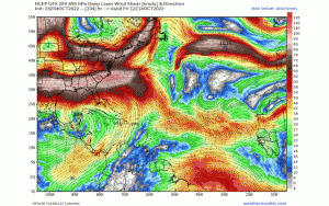
Note the increasing deep vertical wind shear values increasing across the Gulf and out into the open Atlantic, especially toward the MDR denoted by the deeper colors. The Caribbean on the other hand still warrants attention for any possible wave to form, as shear won’t be too hostile. Regardless, shear will help to work against Atlantic hurricane development going into mid-month.
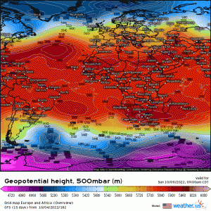
In the mid-levels (500mb), a large subtropical ridge will remain quasi-stationary across the central and eastern Atlantic, imparting shear and some dry air as well off Africa and if any wave were to try to develop, this positioning and orientation does favor tracks out to sea.
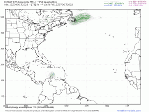
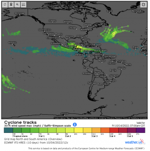
What this looks like on model guidance reflects the agreement regarding the unfavorable Atlantic state heading into the mid month time period. Note the lack of enthusiasm on the ECMWF spaghetti plots heading into week 3.
That is what the state of the tropics look like at the moment, which favors around average to below average tropical activity, especially with an unfavorable MJO phase. We still of course have to monitor any “sneaky” wave that may develop, especially across and near the Caribbean or near “home”. At least this can be viewed as optimistic news, especially after the devastation that Ian brought for many people!
