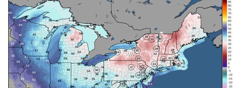
A Late Season Freeze
Northeasterners: I sure hope you haven’t packed away those sweaters just yet. Thanks to the passage of a strong cold front, current temps across the region are roughly 10 to 20 degrees below average.
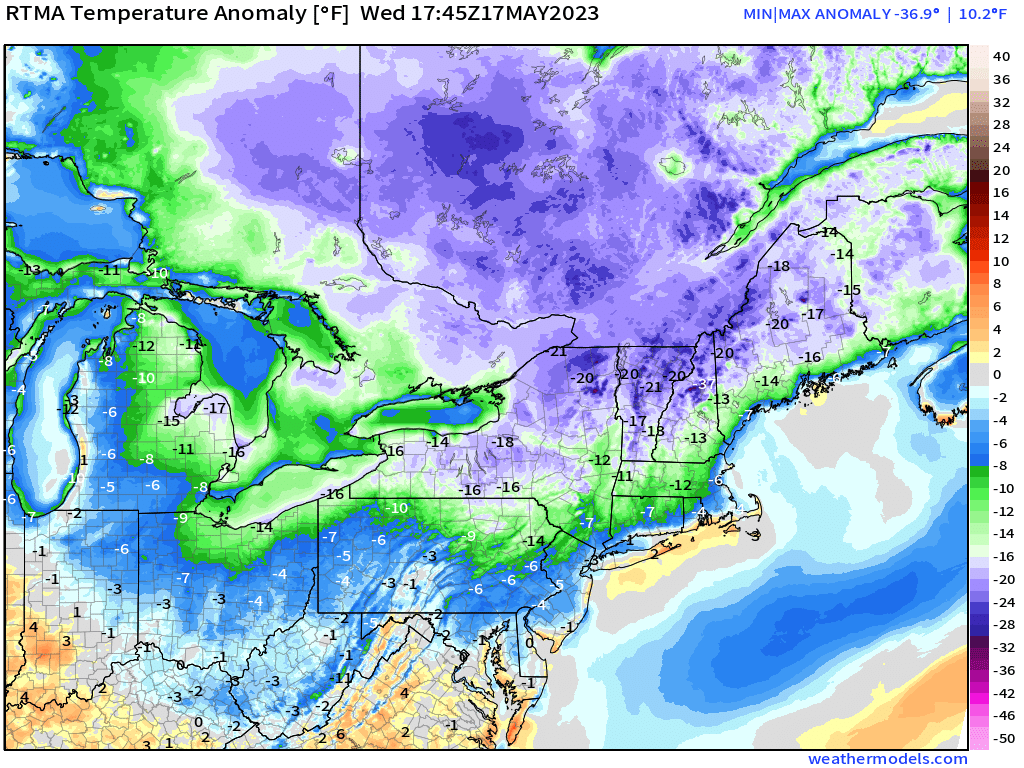
With a range from the mid-50s in Northeastern Pennsylvania to the mid-30s across interior Maine, it is (in my opinion) far too cold for May.
High pressure will build into the region as we go into the evening and overnight hours. Large-scale subsidence will lead to calm conditions and clear skies overnight.
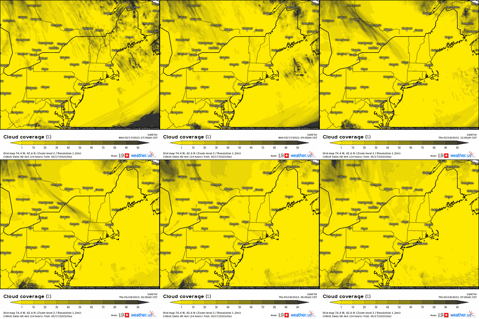
With no cloud cover to trap and re-radiate any meager daytime heating that has occurred today, heat from the surface will be free to escape into the atmosphere which will allow the temperature to drop significantly overnight. You may have heard this referred to as “radiational cooling.”
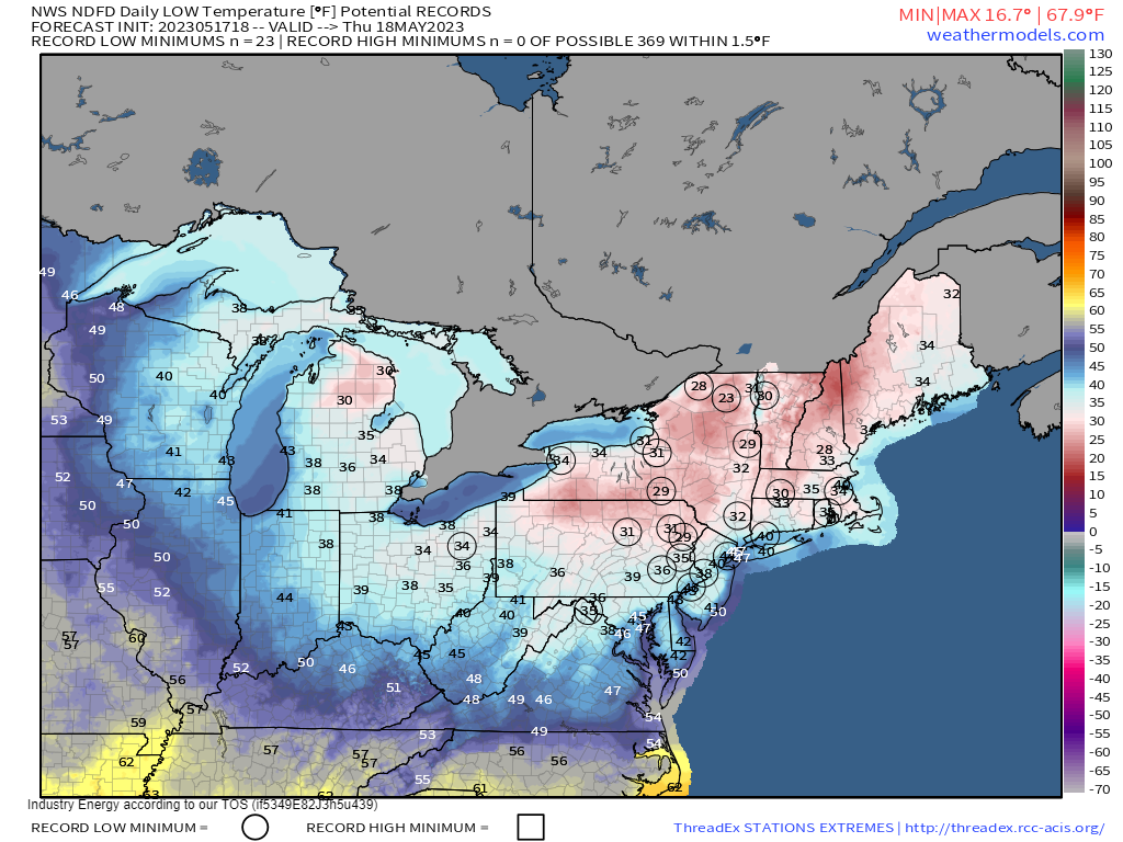
Temperatures will tumble to near or below freezing under the clear skies. Widespread record lows are entirely within the realm of possibility as is a hard freeze for some of the colder locations.
Where temperatures aren’t quite cold enough for long enough to produce a hard freeze, calm to nearly-calm winds at the surface may allow for frost to form.
As we are already in the growing season, take measures to protect any sensitive vegetation you may have. Bring the plants in if possible. If not, cover them with sheets, blankets, a tarp, etc. Covering them with inverted buckets, baskets, or coolers is also an option.
Fortunately, these widespread lows near/below freezing last only one night.
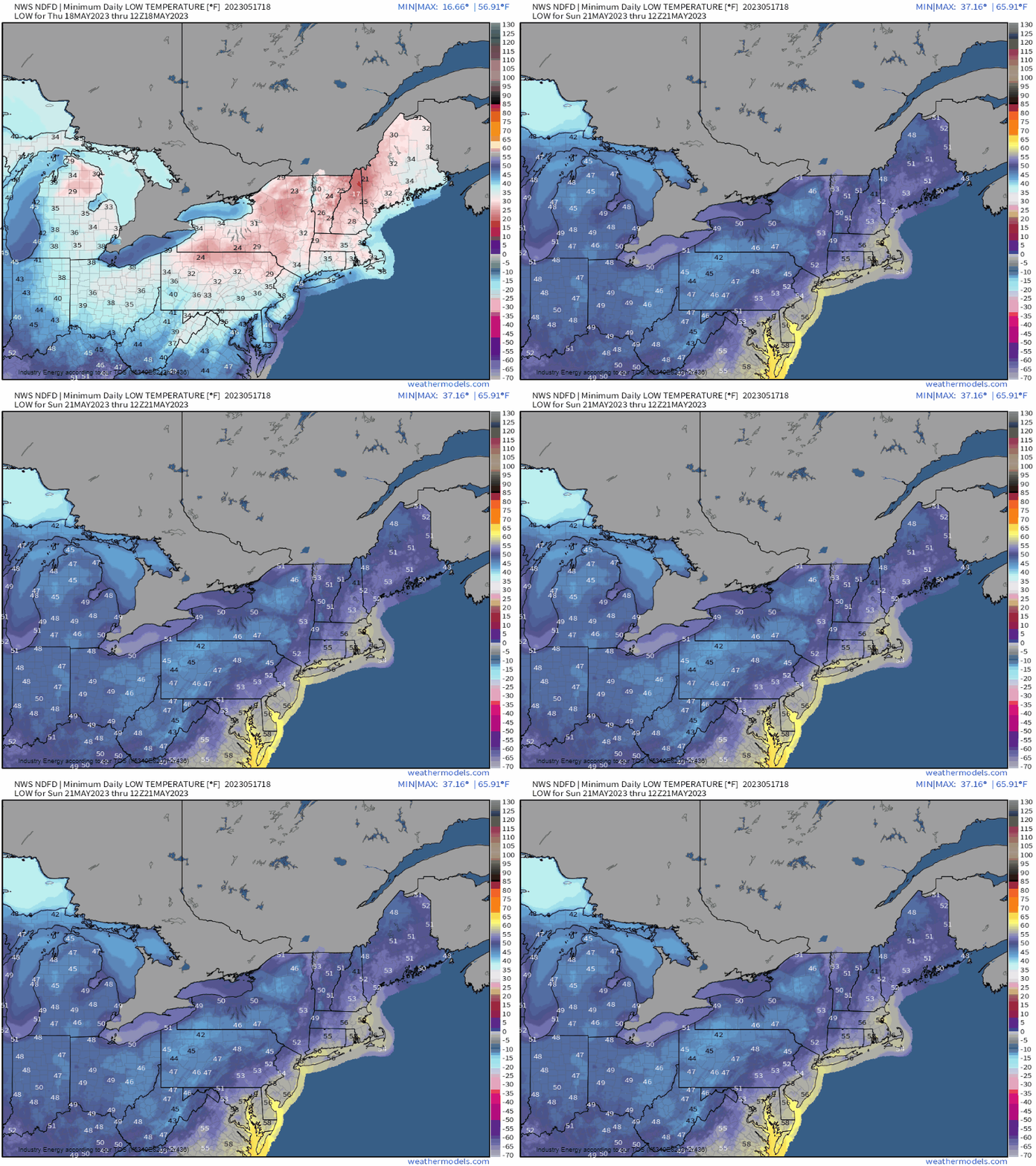
Overnight temps will warm through the remainder of the week.
Don’t let down your guard just yet, though. We’ll have to watch early next week carefully as a weekend cold front may usher in another shot of cold air. Could it be another chance at a widespread frost or freeze? We’ll see how the forecast evolves in the coming days.


