A Late Season Chill
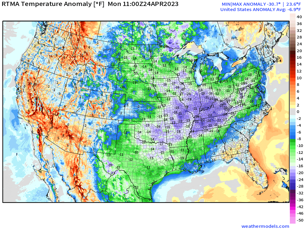
As advertised in blogs by both myself and Armando late last week, much cooler air has made itself at home east of the Rockies this Monday morning.

Morning lows up to 25 degrees below average were observed this morning. Widespread frost and freeze warnings were in effect as temperatures crept near, or even below, freezing.
A late season frost and/or freeze like this can be particularly worrisome to those who are employed in the agriculture sector. A warmer than average winter offered an early start to the growing season, putting more crops than usual at risk during a late season frost.
And the threat hasn’t passed quite yet.

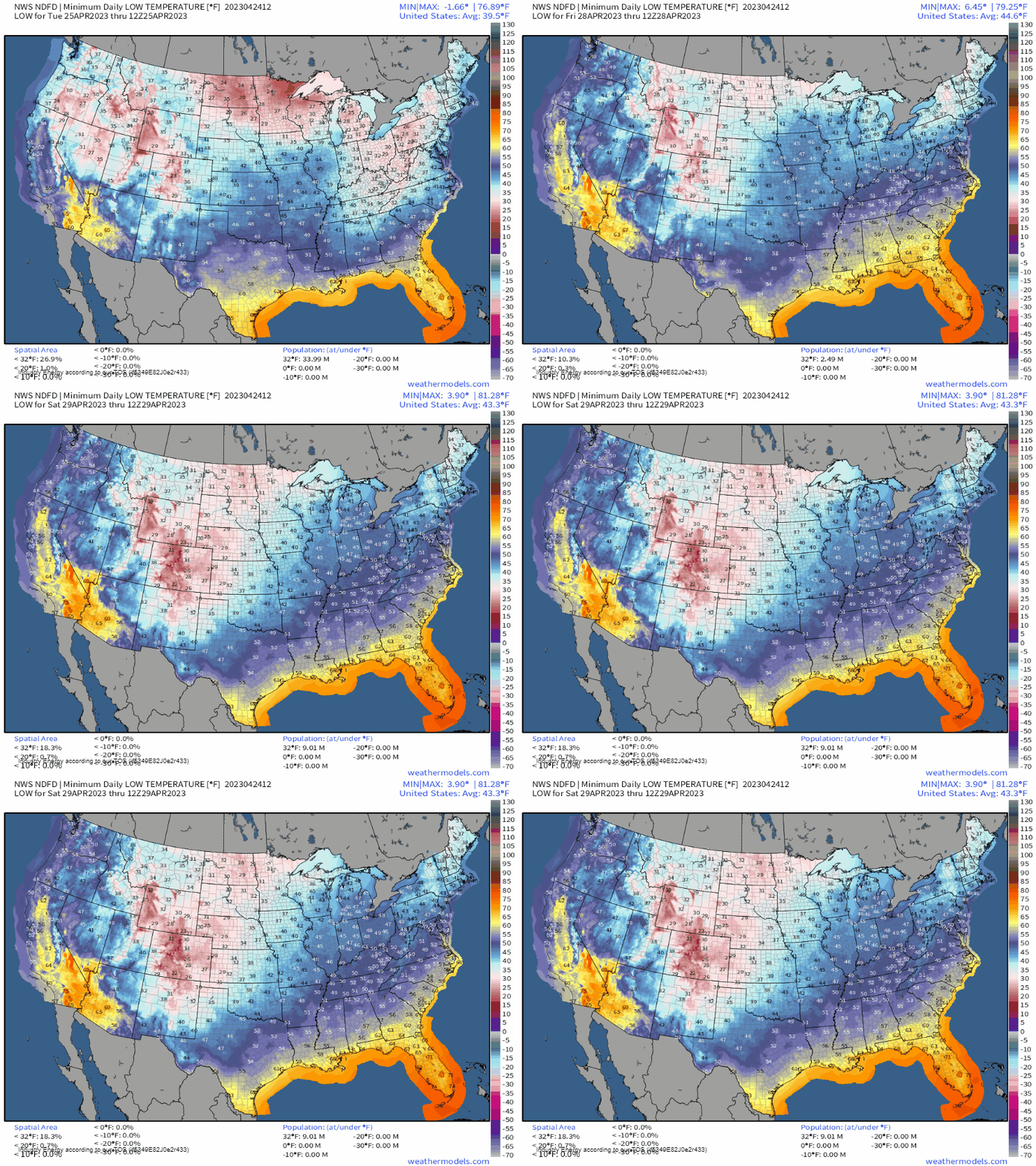
As we remain in a colder-than-average pattern, a few more chances at a frost/freeze will come along for different regions east of the Rockies while high pressure and clear nighttime skies remain in control:
- Tuesday morning lows will dip to near/below freezing in the Ohio and Tennessee River Valleys/Central Appalachians.
- On Wednesday and Thursday mornings, the coverage of near-freezing temps shrinks some, remaining in the Midwest/Great Lakes/Northeast.
- By Friday, increasing cloud cover and an advancing system will keep temps from dipping too close to freezing, with the exception of northern New England.
But we’re safe after that, right? It is almost May, after all.
Not so fast.

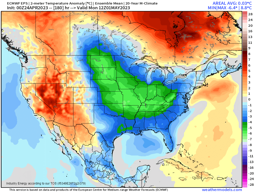
While regions east of the Rockies will remain somewhat below average through the week, models suggest another, more potent cold shot materializing early next week behind a departing front. It is possible that morning lows may once again approach the freezing mark for many.
This is, of course, a week out and can change. However, if you’re employed in agriculture, it’s a forecast worth monitoring.
Take steps again this evening to protect any tender vegetation if your area is under threat for a frost or freeze. And, even though May is a week away, don’t let your guard down just yet. There may be at least one more frost/freeze in the forecast as cooler than average temperatures persist.


