A First Look at Tuesday’s Potential
The first severe thunderstorm outbreak of what looks to be quite the active pattern is in its late stages over the southeastern US at present, with numerous cells and line segments amidst moderate instability and fairly favorable, if ‘straight’, hodographs. The result is fairly widespread large hail and damaging wind gust production in strong convection.
As the outbreak wanes with sunset, a period of relative peace will fall over much of the US, and no substantial severe weather is expected through Monday night at present.
This very well could prove the calm before the storm, though, as a broad longwave slowly ejects into the central US to start the week. A number of shortwaves skirting the periphery of the trough’s forward flank will promote and enhance southerly low level flow in a belt from the Gulf through the central US towards the Canadian border, allowing for a steady moistening of the environment, and keeping the heights gradient at 850mb taught. A little higher in the atmosphere, around 700mb, persistent SW flow will import a stout EML northeastward, into much of the central US.
The result will be an environment increasingly sheared, both in the low and midlevels, and increasingly unstable. As early as Monday, a swath from the central plains through parts of the midwest should see a parameter space supportive of rotating storms; however, capping and a lack of synoptic-scale forcing for ascent/mass removal should limit potential to elevated storms north of the focal warm front posing a hail threat very late Monday or very early Tuesday.
Come Tuesday, the approach of a pivoting impulse at the base of the longwave could bring a great environment for tornadic storms to the south-central US. It really is the kind of midlevel system that gives Tornado Alley its name- with minimal atmospheric support, the pieces largely fall into place. It is then up to mesoscale features to bring the atmosphere the rest of the way to a tornado outbreak.
The pieces of the outbreak will fall into three groups.
We already discussed the stage setting, done as impressive midlevel lapse rates migrate north within the aforementioned EML and as deep moistening commences at the hands of long-fused southerly flow south of shortwaves pivoting along the longwave’s periphery. Any development on Tuesday will also be occurring within a pre-existing height gradient capable of supporting the type of impressive low level flow that can promote mesocyclone growth.
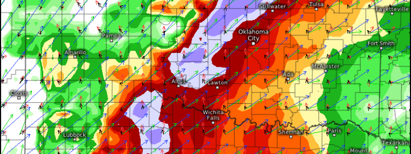
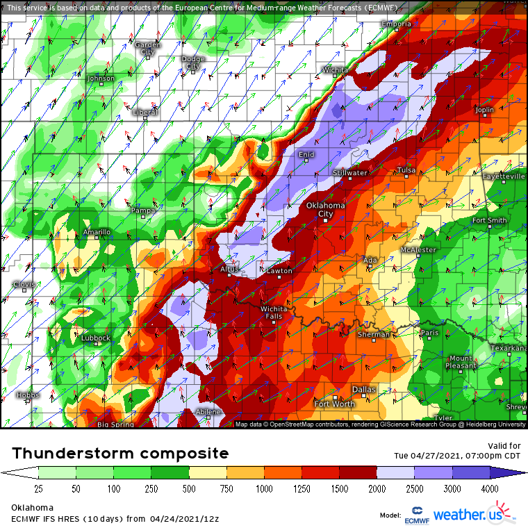
On the day of, the approaching midlevel trough will promote low level cyclone development along a pre-existing frontal gradient on the northern edge of the aforementioned long-developed moisture tongue. This cyclogenesis will enhance the southerly low level jet by increasing the height/pressure gradient in the warm sector, increasing both helicity and moisture transport from the Gulf. Meanwhile, increasingly strong midlevel flow will overspread the south-central Plains as the midlevel heights grow taught ahead of the main impulse at that level. A look at the Euro’s severe storm composite shows how these elements will all come together to support high-end severe parameters in parts of Texas and Oklahoma come Tuesday evening.
This outbreak has been pretty hyped for a while now, both because of the fact that this synoptic scale support has been readily apparent in models, and because of the date it’ll occur on- 10 years to the day from the 4/27/2011 superoutbreak.
I can’t really comment on the latter, but to the former, I will say that some things have been looking less good with time. Mostly, the trough axis looks to be tilted more positively, which will serve to lower the ceiling of the outbreak in two fairly important ways.
Foremost, this has led to a trend away from the type of trough orientation that would support significant intensification of the surface cyclone on Tuesday. While a pronounced surface low is still possible, the loss of the wind profiles and forcing intensity associated with a stronger low are detrimental for confidence in tornado risk.
Secondarily, the positive orientation will lead to both low level flow and frontal orientation that’s more parallel to midlevel flow, which reduces tornado threat by reducing hodograph curvature and by increasing the odds that initial storms will grow upscale relatively fast.
This is, of course, a developing situation, and we encourage you to stay tuned!


