A Dynamic “Duo”; Major Winter Storm & Severe Weather Outbreak Update
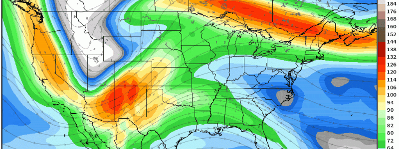
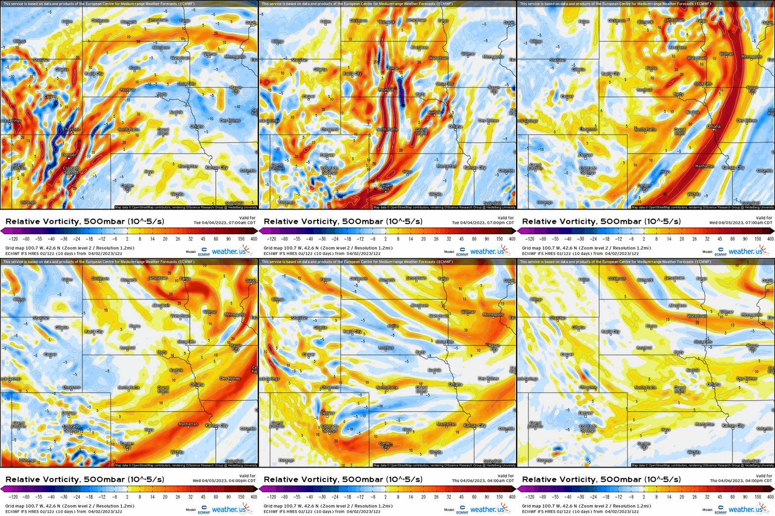
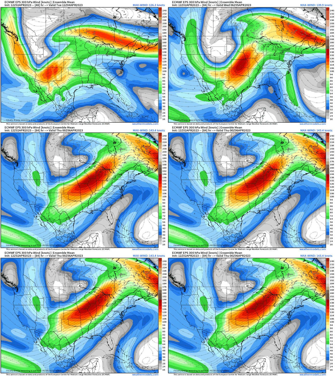
A potent, digging mid-level trough will allow for cyclogenesis to manifest along the Front Range in CO. A surface low pressure will form, and take a track into NE/KS, IA, and passing into WI. Below, we see a vigorous trough with strong forcing for ascent in the form of positive vorticity advection. Below, we see an impressive jet streak carve out the base of the trough, which overspreads its divergent left-exit region across the northern Plains helping to augment an already favorable environment supportive of wintry weather.
At the surface, we see the reflection of the surface low as it treks across from the Intermountain West through the northern Plains and into the Upper Midwest. It’s northwest of the surface low that is where the impressive dynamics take place, as we’ve already seen impacts across CO and WY, with snowfall starting out in western NE and southwestern SC. Here, the low will shift northeastward into MN / WI vicinity heading into tomorrow bringing with it blizzard conditions and hazardous travel implications from WY into the Dakotas, and northwestern MN.
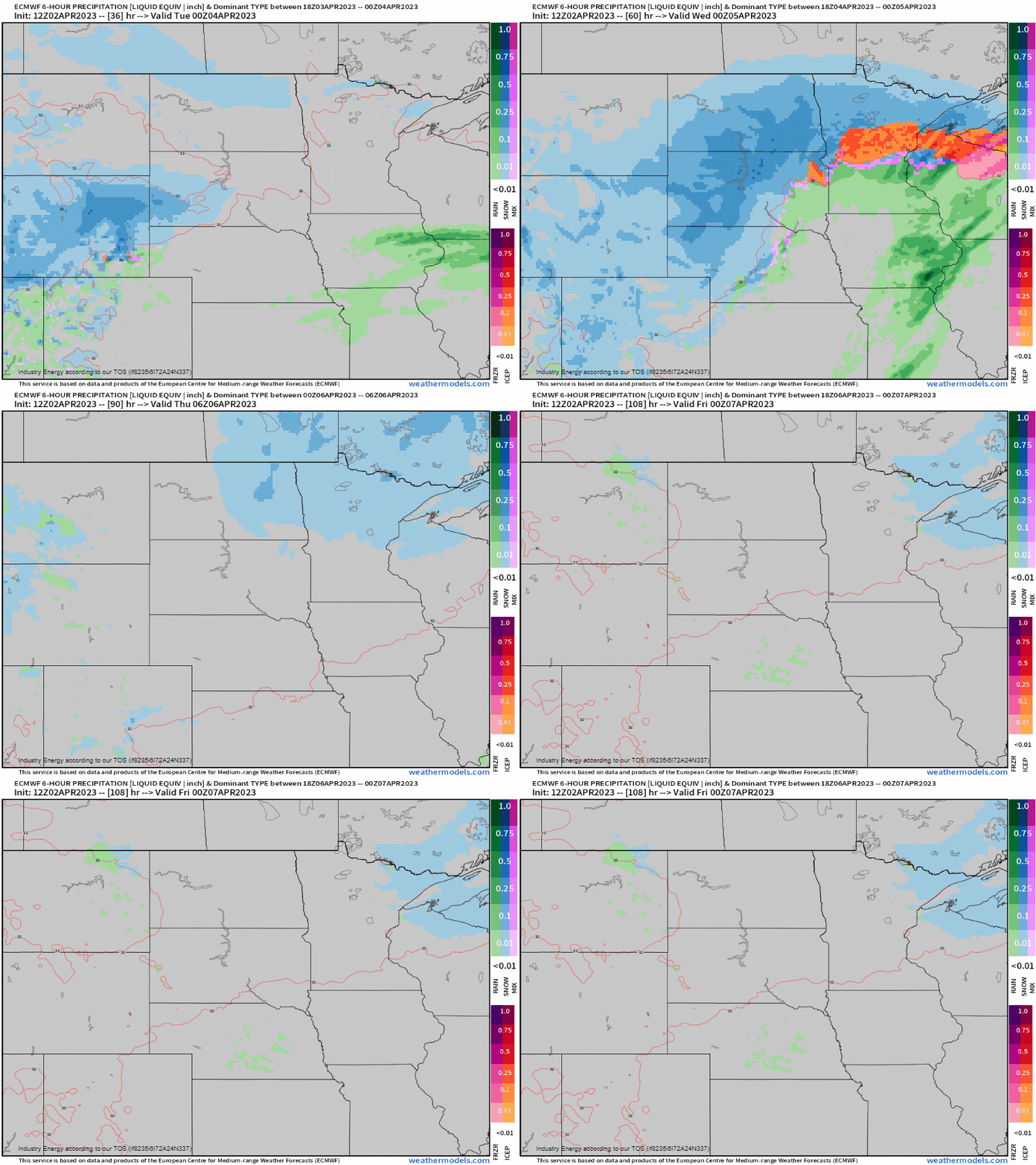
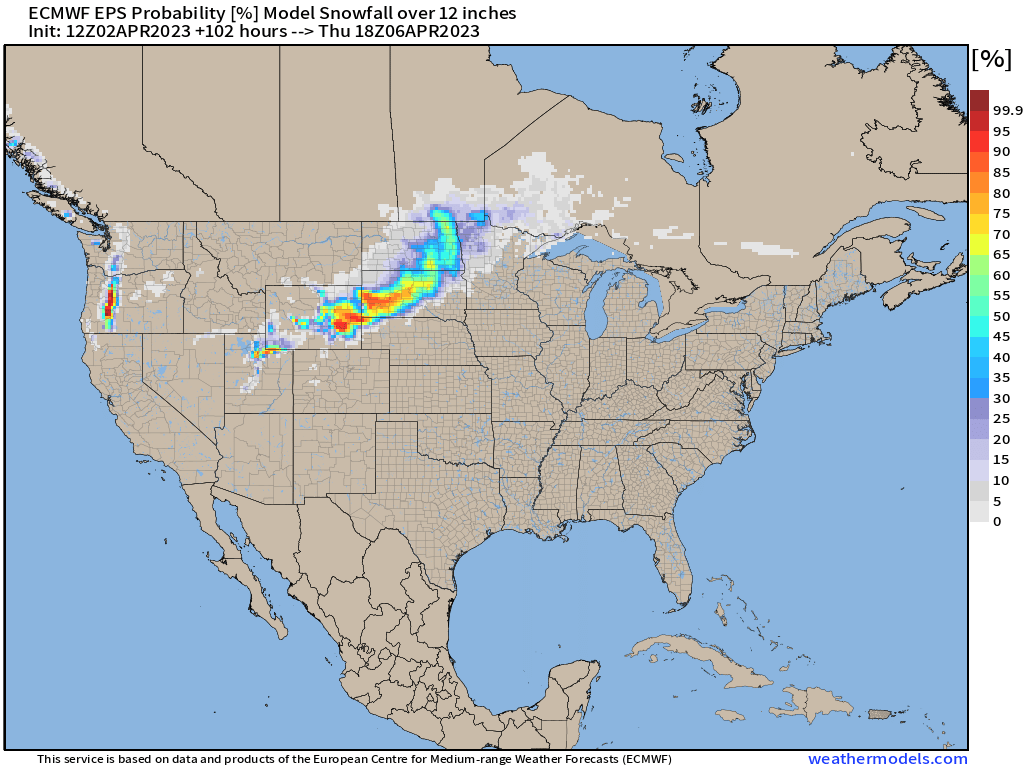
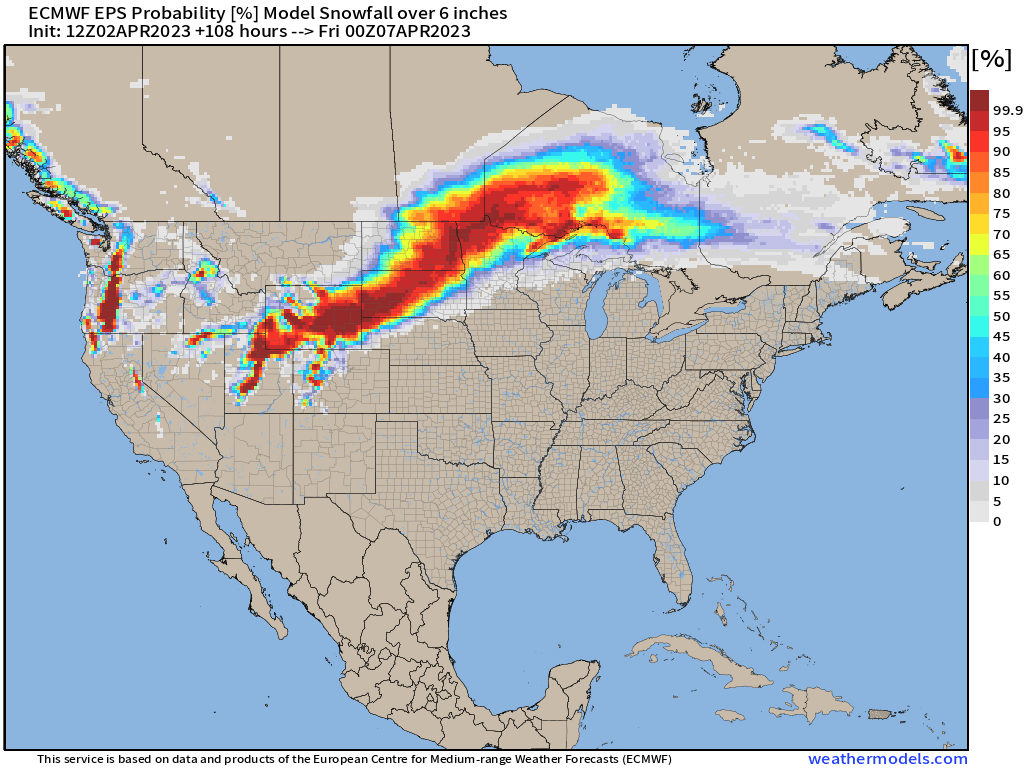
In terms of snowfall, are we turn to ensemble probabilities of both over 6″ and 12”, respectfully. We see a general “jackpot” zone will setup across eastern WY to southwestern SD where the highest chances of seeing over a foot is over 75%. A large, notable swath of at least 6” however, will occur across these aforementioned states from this impressive Spring winter storm, that’ll challenge April records!
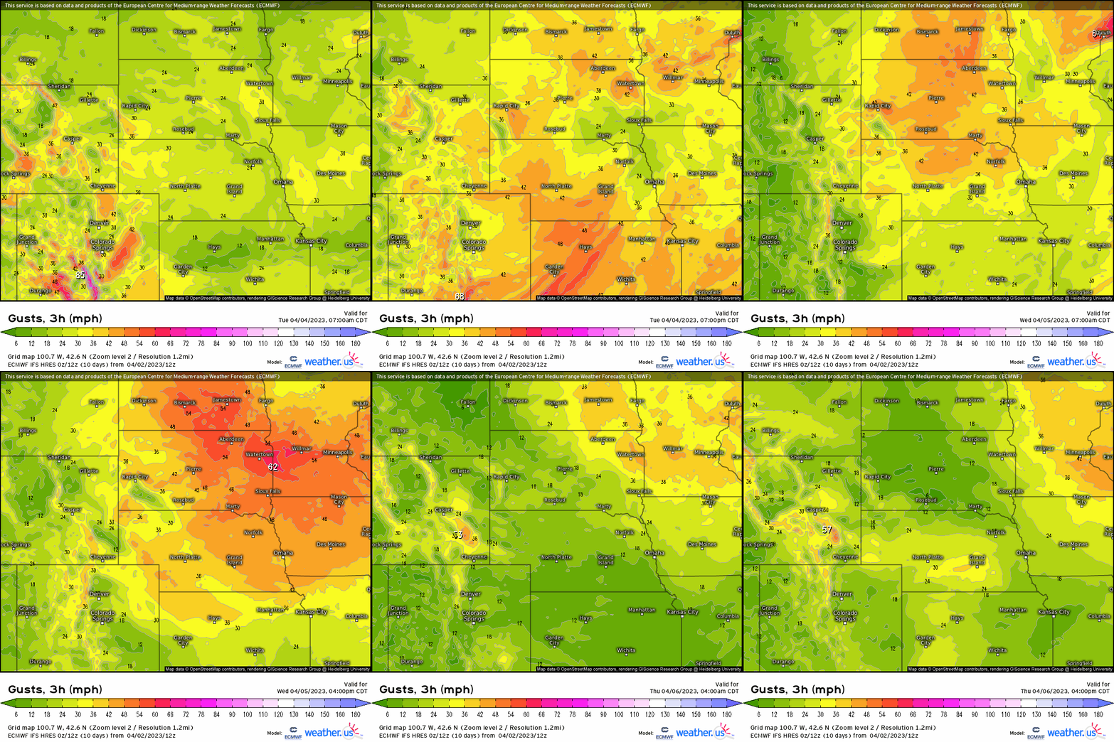
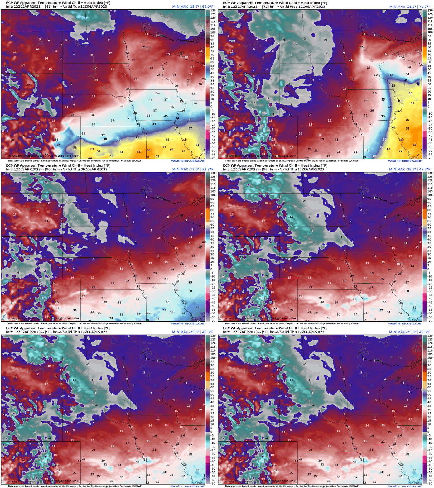
Speaking of blizzard conditions, surely whiteout conditions will transpire with gusts likely to exceed 40 mph+ today and tomorrow, causing intense blowing snow! What’s more, it’ll get downright cold with wind chills dropping anywhere from several degrees below zero, down into the single digits and teens across the northern Plains as this cyclone lifts into the Great Lakes! So this is going to be one impactful Spring season Winter event for places that just can’t seem to evade this recent Winter’s wrath!
SEVERE WEATHER COMPONENT
As Meghan discussed in her blog yesterday, the setup we’re dealing with once again is another “bimodal” threat with two main areas that appear poised to see higher-ceiling potency, though anywhere within the general vicinity of the warm sector ahead of the cold front are at risk for all types of severe hazards! The same surface low that impacts the northern Plains with blizzard conditions, will help foster ripening ingredients for discrete supercells. A plume of instability in the form of CAPE ejects northward under an intensifying low-level jet with robust vertical wind shear overspreads places along the Ozark Plateau, up the MS River, and into the Midwest. We see this here shown by the thunderstorm composite combining CAPE and wind shear (10m – black, 850mb – red, 500mb – green, and 300mb – blue) to show where to pay attention to.
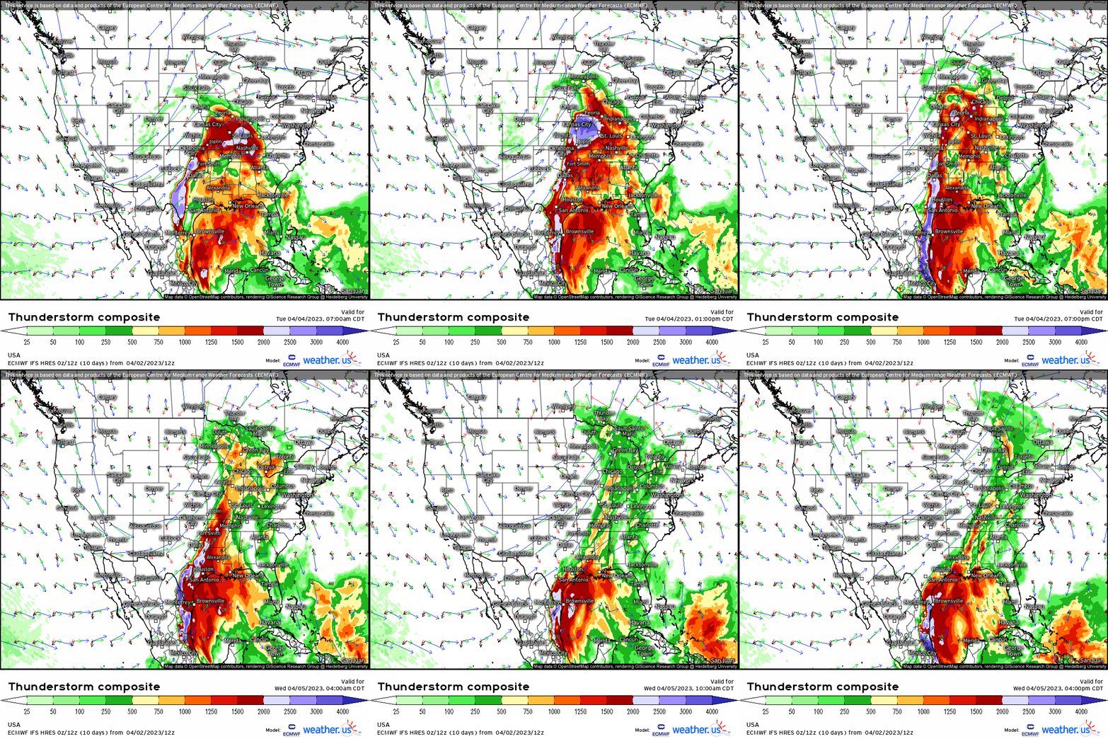
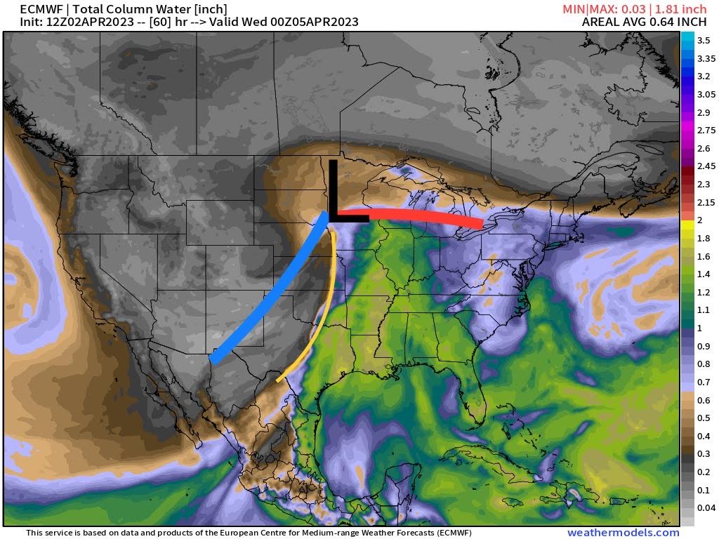
The setup revolves around the triple point, where south of the warm front and near the dryline for SE IA, N MO, and W IL is where first the action occurs later this afternoon and evening for severe storms, supercells, and tornadoes. It isn’t until later tonight where further south there’s more moisture that builds below the capping inversion where the cold front overtakes the dryline, and the result are strong supercells and long-lived tornadoes. It’s also this process that’ll allow a long squall line to form later tonight into tomorrow, and push eastward once again delivering damaging wind gusts (outside of any t-storm cluster or supercell). I do want to stress, however, there’s inherent uncertainties with this setup as the challenge is rather high given the bust potential – however, the setup is culminating today for there to be a potent, notable outbreak.
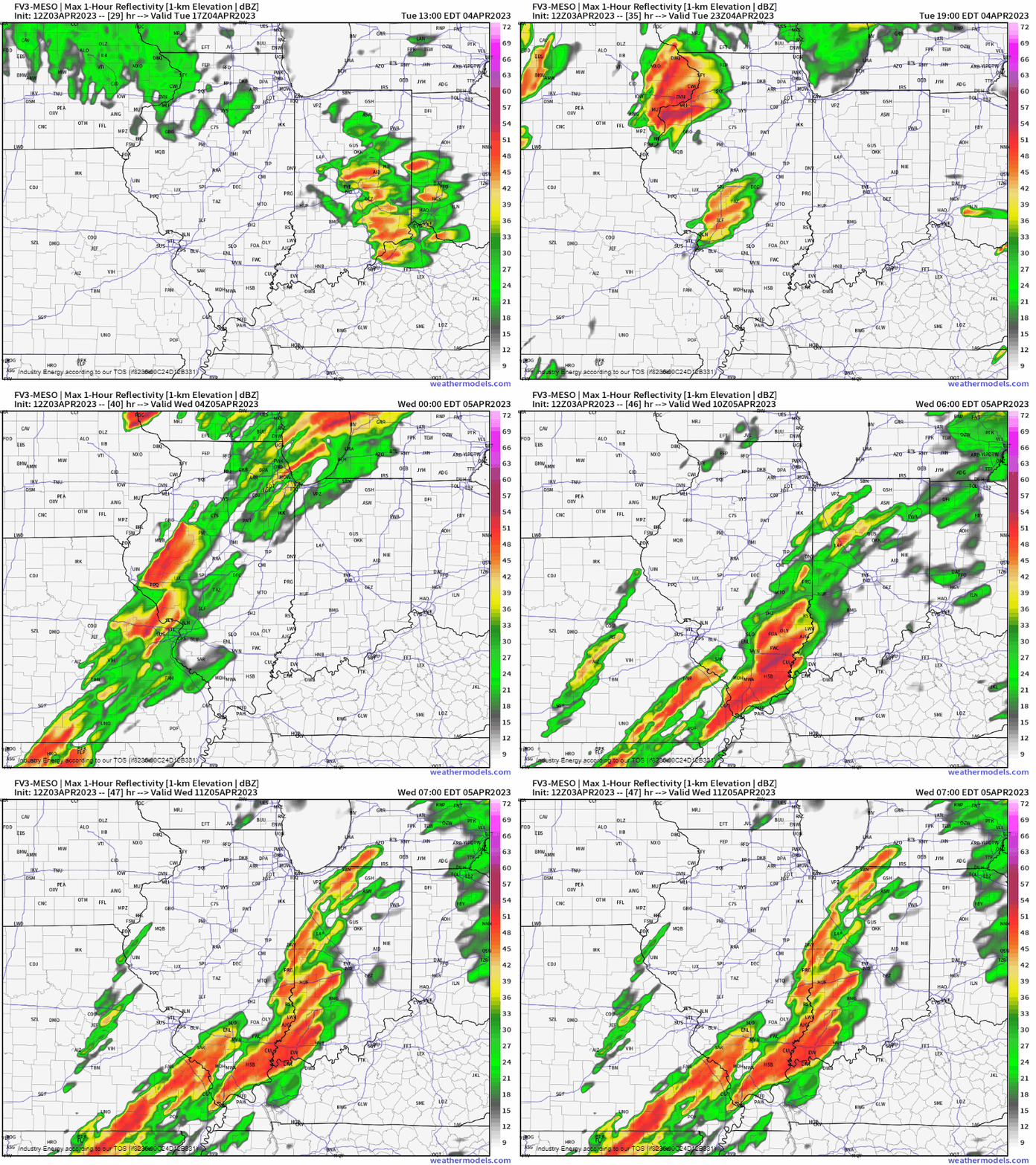
Below, we see how this plays out verbatim beginning this afternoon and into the evening as Meghan in her informative blog from yesterday as there’s going to be two parts to this for IA / IL / MO (later this PM) and then tonight for NE TX / AR / E OK.
Near the triple point for Upper Midwest region (IA / N. MO / IL, WI):
- Between 3 – 6 pm CT, south of the warm front is where models are targeting warm-sector discrete convection in the form of merging clusters and supercells. Given the extremely favorable environment with strong low-level shear and high CAPE, strong tornadoes are strongly supported.
- This threat that emanates back across northern MO (signal to begin there), is favored to track into IA and western IL before shifting toward the WI / IL border later this evening.
- Damaging wind gusts in excess of 50 – 60+ mph, large hail, and again tornadoes are all favored for this general region!
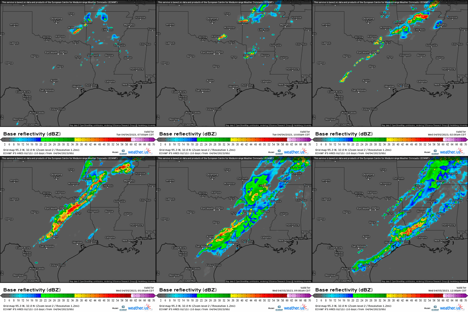
Southern Plains – TX, OK, AR Region:
- Further toward this area, the environment will remain capped; however, while an inversion exists aloft in the low-levels, it’s during the day today that with the help of vorticity (cooling) and the low-level jet (supplying moisture) is what steepens lapse rates. It’s then the eastward movement of the cold front acts as the impetus to allow strong and severe storms.
- Storms are set to occur after 11 pm tonight, with nocturnal supercells likely as a result once the cold front shifts eastward into eastern OK / central TX as it overtakes the dryline.
- Large hail, damaging gusts 60+ mph, and long-lived tornadoes are all hazards that’ll render possibly significant damage.
- This can not be stressed enough – the risk for nocturnal tornadoes is abnormally high for this general region with the risk lowering once east of the TN River! Please, prepare accordingly if you live in this region, and trust your local broadcasters and trusted NWS meteorologists that service your coverage area!
In a nutshell, rather then repeat everything since it was summed up extremely well from Meghan, I’m going to repost from her regarding how to go about this situation:
Have multiple ways to receive warnings, including one that will wake you if necessary. Your primary warning source should be a NOAA weather radio (which can be found on Amazon or at places like Walmart, Target, or sometimes even your local grocery store).
Outdoor warning sirens are NOT reliable. They are not meant to be heard indoors and sometimes may not even sound.
Prepare your safe space ahead of time. This should be an interior room on the lowest level of your house. Stock it with helmets and hard sole shoes. Put a battery-powered radio in there as well so you can keep receiving information if the power goes out.
Know your plan to shelter and make sure your family is aware of it as well.
Know what county you reside in, how to find it on a map, and the surrounding counties. Remember, warnings are issued by counties. Knowing the counties near you can give you a heads up on whether or not you need to be thinking about getting to safety.
Mobile/manufactured homes are NOT a safe place to ride out a tornado. If you reside in one, you need to make plans to shelter elsewhere. Do not wait until a warning is issued to leave for a shelter. If a watch is issued, that is the time to start enacting your plan. The Red Cross keeps an updated map of open shelters which you can access here.
Stay weather aware and up-to-date with the forecast throughout the day. Check your local NWS website or tune in to your local broadcast meteorologists on the news for specifics regarding your area and extended coverage.
Warn your friends, warn your family. If you know someone in the risk areas, WARN THEM. Increase awareness so no one can say they were caught off guard. Stress the seriousness of the situation and the need to prepare.


