A Difficult Winter Forecast
Even though we’re just about 2 to 3 days out from the onset of the event, the forecast concerning this weekend’s winter storm is still a bit… murky. I won’t lie to y’all, this is a tough one. There are many aspects of the forecast that depend on relatively mesoscale components that won’t really become clear until the high-res shorter range models come into range.
But, we do the best with what we have so far and today I’m going to outline the risk areas, discuss potential impacts, and talk about how any changes could affect the forecast.
I first wrote about the set-up for this storm on Tuesday.
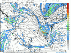
To recap, an upper level trough will swing down out of the Pacific Northwest and dig deep into the Southeast before traveling up the East Coast.
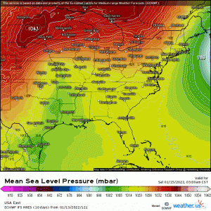
On the heels of a departing “bomb cyclone” in the Atlantic, a strong high will set up in the Northeast, funneling frigid air southward. This high will provide the thermal support for winter weather.
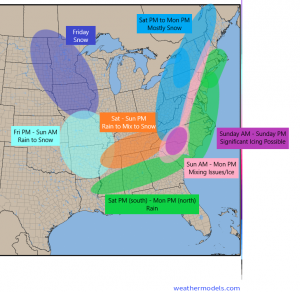
I’ve put together a risk/timing map for you. Keep in mind, it’s a bit rough and not meant to be an all-inclusive, set-in-stone depiction of where and when weather related to this storm will occur. The intention is to give you an overview of what is currently expected.
That said, I won’t be talking about totals today as there is still some uncertainty in the track. How far onshore/close to the coast the low will be in the Northeast is still somewhat up for debate. As we know, that can make a huge difference in who sees what form of precip.
So, let’s look at what we are expecting, without totals.
As the trough dives south across the Plains states, precip will begin in the form of snow. Snow continues to be the main form of precip until it the system encounters warmer air as it approaches the Gulf. At this point, roughly around Missouri late Friday, any precip will begin as rain and then quickly change to snow as cold air rushes in behind it.
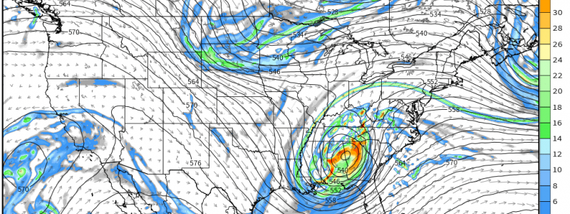
The system will undergo surface cyclogenesis as it descends the Rockies. A relatively weak low forms in western Texas and strengthens as it moves east into the Deep South.
Once there, rain will be found to the south of the low while a mix of rain and snow will traverse the Tennessee Valley along with the low before becoming all snow on the back side. The length of time it takes for the rain to change completely over to snow will depend on how strong/how far north the warm air aloft is. The track of the low is also key here. A nudge north means more rain and less snow for the Tennessee Valley. The opposite is true with a nudge south.
The low continues eastward toward the Carolinas. This is where we encounter a problem.
The strong high over the Northeast I mentioned earlier in this blog will be pumping cold air south into this region. A set up like this often leads to a meteorological condition known as Cold Air Damming (CAD). It looks like this:
The easterly flow coming off the high pushes the cold air up against the Appalachians. Cold air doesn’t rise, so instead it lingers there trapped in the Piedmont until stronger westerly winds come and mix it out.
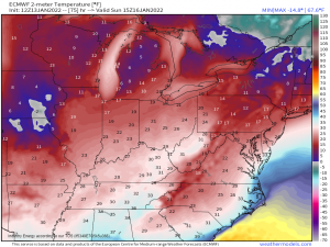
Cold air at the surface by itself is no big deal. But cold air at the surface combined with warm air being advected above it is the perfect recipe for an icy mess. Which is exactly what the Carolinas – and even Northern Georgia and Southern Virginia to an extent – will be facing.
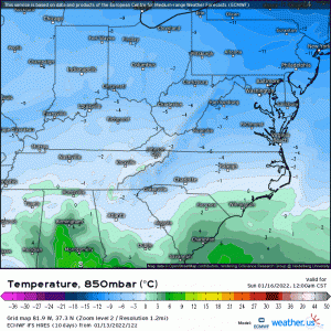
The animation above is the 850 mb temperature – the temperature at roughly 5000 ft above the ground. You can clearly see the band of warmer, above freezing air being advected northward around the center of the low. All this is happening while the temperature at ground level is below freezing for most.
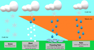
Whether the precip type will be sleet or freezing rain will be controlled by the depth of both the surface cold layer and the warm layer aloft.
Here’s a little refresher I created last winter if anyone needs it.
The duration of the icy precip will depend on how fast the CAD at the surface can mix out. CAD events tend to be stubborn and slow to erode. It’s entirely possible that this region ends up with a long-duration ice event.
Sleet or Freezing Rain, it ultimately doesn’t matter. Both are icy, make travel difficult, and will undoubtedly cause a travel nightmare.
The area I outlined above on the risks map in dark pink is at greatest risk for significant ice accumulation. If you are in this region, plan on not traveling at all on Sunday. Honestly, any travel in any of the regions outlined is probably not the best idea, considering how much of a mess this has the potential to be, but most especially in the areas at risk for ice. Make a plan now in the event you lose heat or power. Get what you need to stay warm for an extended period of time and stock up on food and water. Power outages are likely with heavy ice accumulations.
After the low moves out of the Carolinas Sunday evening, it will remain onshore and swing through the mid-Atlantic up into the Northeast.
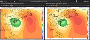
The positioning of the low, though mostly thought to remain inland once it reaches the Northeast, is still somewhat up for debate. Both the EPS and the GEFS have solutions clustered on shore and hugging the coast.
An onshore solution would mean rain for the big cities and the I-95 corridor but heavy snow inland. A coast-hugger would introduce potential mixing and/or snow to the I-95 corridor and not quite as much snow for the far interior Northeast.
The low remaining inland seems to be the most likely solution due to the strong eastward-retreating high preventing any eastern wiggle in the low. However, if that high weakens or retreats faster, a coast-hugging low becomes possible.
But, assuming the inland solution is the correct one, we’re looking at heavy snow in the interior northeast – most likely Western PA/Western NY – and heavy rain, wind, and coastal flooding for the I-95 corridor.
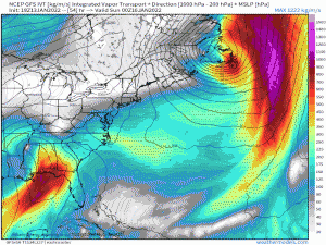
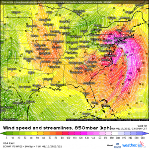
This system will have access to plentiful moisture, pulling it all the way from the tropics as the low deepens on it’s journey north.
In addition, the low level jet is forecast to be rather strong.
These winds will push water onshore, acting as a sort of storm surge. If you reside in the Mid-Atlantic/Northeast and your area is prone to coastal flooding, take note.
I mentioned I wasn’t going to discuss totals – and that remains true. I will put out an updated blog on Saturday fine-tuning our forecast and discussing totals.
This is still very much an evolving forecast so continue to monitor it for your area via your local NWS offices and broadcast Meteorologists.
Check back on Saturday for a final update!
