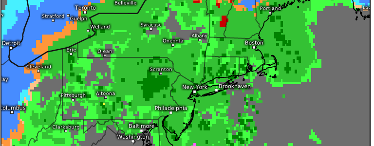
A Deep Trough Later This Week: Low To Impact Ohio River, Mid-Atlantic, & Northeast
Confidence is once again increasing for a relatively impactful system toward the end of the week that’ll contain heavy rain, a wintry mix, and even heavy snowfall across the Ohio River and into the Northeast.
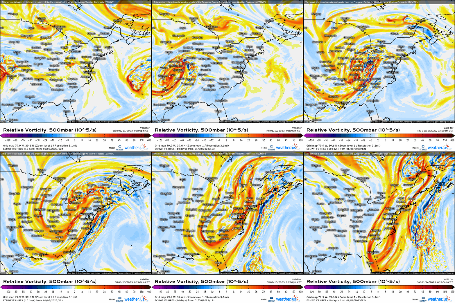
Taking a look at it from a dynamic standpoint, we’ll see an interaction between the northern and southern stream energy into a deep trough, where the mid-level height’s try to cut off, though there’s some variability regarding where (further south, more cold air as opposed to the mid level center occluding further north).
Below using the z500mb vorticity via ECMWF, we can see two distinct pieces where a polar shortwave “phases” into the southern trough, and all the energy ejects out ahead into the Northeast.
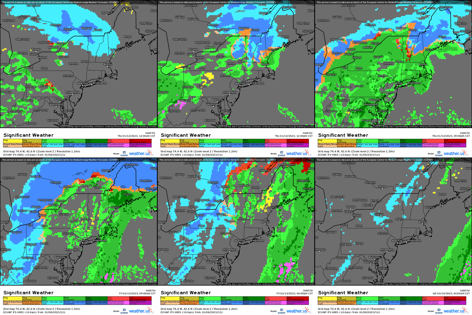
How this is reflected at the surface is as shown below. A low pressure system, as a result, ejects from the Midwest and tracks into the Ohio River valley. From there, we may see a secondary low try to develop depending upon the evolution of the mid-level trough. Overall, we’re looking at a track where the main low treks somewhere into the vicinity of western PA or Ohio before we then see a redevelopment off the Northeast coast. Now there are some discrepancies regarding the overall placement of the mid-level trough and therefore the surface. If the secondary low pressure forms further south like east of the Delmarva, this could bring snowfall and wintry precipitation risks further southward (not widespread however IF this solution were to pan out). We’ll see where this goes come Thursday where the next blog update on this system will come out.

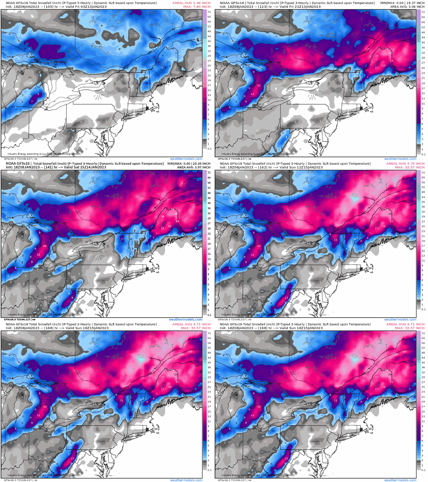
Anyhow, a track as such will bring a variety of weather from heavy rainfall to a wintry mix and snow. As of now, the heaviest axis of snowfall, or staying all snow, will remain confined toward Maine, northern NH, VT, and possibly upstate NY. Now this could change still as previously mentioned, but as of now i’d feel safest with Maine (mainly north and west of I-95) staying mostly all snow. This would look to come in later Thursday with the steadiest of the intensity; however, an area of light snow may form out ahead with weak warm air advection very early late Wednesday into early Thursday out across the interior Northeast. There will likely be some mixing in with sleet as the warm air surges northward with antecedent cold low level air hanging tough, so some ice could develop early Friday AM across NH, VT, and into western ME.
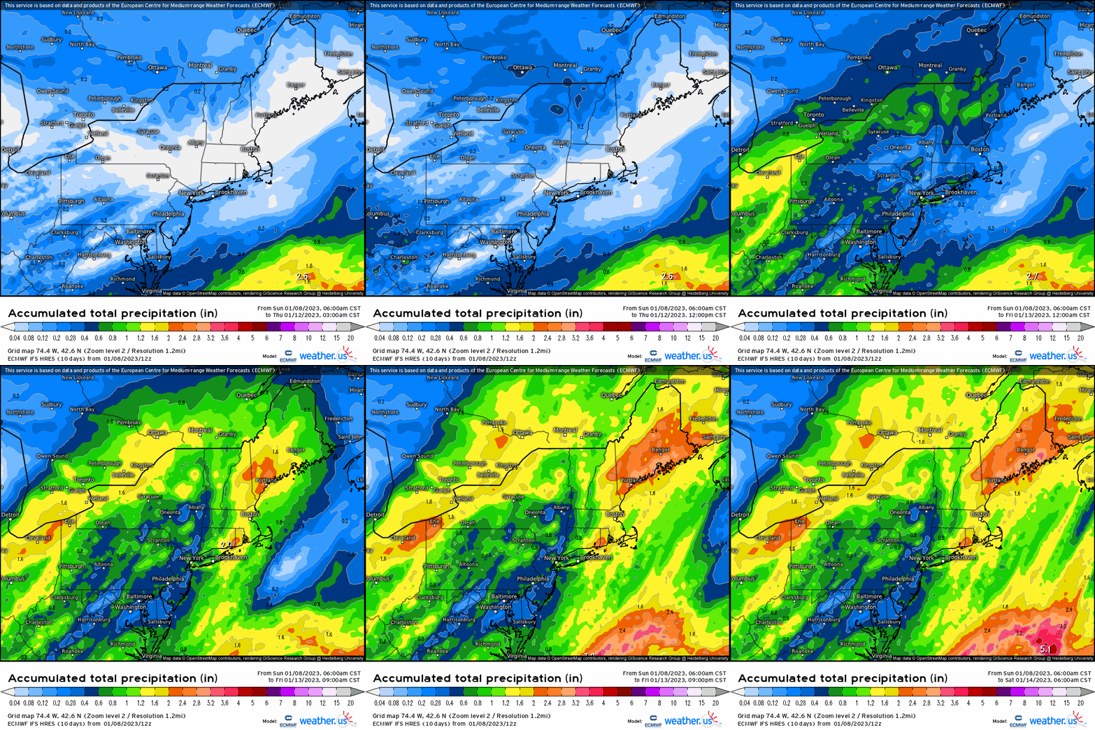
In terms of rainfall, a large majority is looking at a widespread several tenths to over an inch, though the latter will be more of a local concern given pockets of heavier rainfall will be embedded as the low deepens to an extent, and we look to see enhancement as the secondary low develops somewhere off the Northeast coast.
As for snowfall, several inches to possibly a foot and more as you head northward will be realized with an inland track and transfer. Again, this favor far interior, and down closer to the coast there could be some backside wet-to-white changeover, or snow showers on the backside as the low pulls away and cold air drains behind. Unfortunately, this looks to overall be more wet than white for a large majority of the regions of the Mid-Atlantic, Ohio River, and Northeast (southern New England). These areas are seeing below average snowfall up-to-date, and this also doesn’t help a lot for the ski areas given the threat for rain to get as far north as some of the computer models are showing. However, there are still several more weeks left this winter, so chances will certainly be there for coastal snow events.
Despite uncertainty, there remains once again a high confidence forecast for a relatively strong system.


