A Complicated, Widespread Severe Threat
Yesterday’s severe event was active, but overall, it was confined to a relatively small region. Today’s severe threat is completely different as it encompasses much of the Central US.
This doesn’t mean the threat will be the same for the entire length of the defined risk area, though. Some of this threat is conditional, and some has the potential to be much more potent than the other parts.
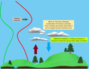
Before we begin, I’m going to share my Capping Inversion infographic again. The cap will play a large role in at least part of today’s event. If you don’t know what a cap is, now is a good time to learn.
Now, let’s see if we can make sense of all the nuances of today’s potential event.
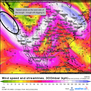
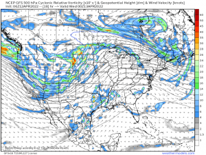
We begin with a shortwave trough. Notice the winds on the western side. They are faster than those on the east. This indicates that the trough will continue to dig in. This results in a slightly positive to neutrally tilted trough.
At the surface, the low associated with this system will continue to deepen.
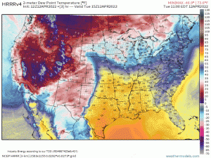
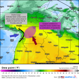
As it does so, a rather long dryline will sharpen and migrate eastward. This dryline will provide a boundary that is expected to initiate convection later this afternoon. At least for some, but more on that in a minute.
An important note on the dryline: as everyone who has ever chased storms off the dryline knows, the bulge is where you want to target.
The Dryline Bulge:
- Indicates stronger winds from the WSW as the line advances ahead of the rest of the dryline.
- Forces surface winds ahead of the dryline to back from the SE, increasing directional shear.
- Provides lift to help break a cap/get convection started.
So, if this particular bulge materializes as the HRRR suggests, it would really serve to bring together and focus the ingredients available to give the area ahead of it a higher chance of storms. Not surprisingly, this is where the SPC has outlined a Moderate risk for today, indicating a higher confidence in storms materializing and becoming severe here. The extra lift courtesy of the proximity to the surface low (triple point) also really helps out here.
Due to all the ingredients mentioned above, this area is where the highest probability of all hazards – damaging winds, tornadoes (some strong?), and large hail – exists today. Be ready.
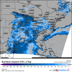
As mentioned, the atmosphere is expected to remain capped. Therefore, convective initiation really depends heavily on who has enough lift and instability to overcome the aforementioned cap?
We already discussed the ingredients expected to come together to help parts of Iowa overcome the cap, but what about the rest of the line?
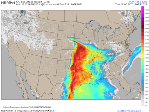
While daytime heating will add abundant instability with CAPE exceeding 3500 J/kg in some places, there is very little mechanical lift available. Outside of the triple point and away from the surface low, the only lifting mechanism further south is the dryline itself. The dryline/instability combination may not be enough to break the cap in places like Oklahoma and Kansas.
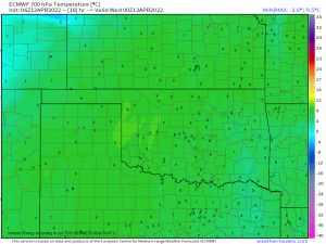
It’s not a foolproof method, but the strength of the cap can be estimated by the 700 mb temp.
In early/mid April, a 700 mb temp of 8 to 9 degrees C generally indicates a strong cap that will not be easily overcome by instability alone.
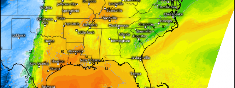
This map (via the ECMWF) shows 700 mb temps in Kansas and Oklahoma around the 7 to 8 degrees C mark. There is a strong possibility that these states, despite the strong instability, will end up with a “blue sky bust” and no actual storms. However, storms remain possible if a little extra lift can be added via a shortwave or a dryline bulge.
So, it’s not that there is no threat here today, it’s just that the threat is highly conditional. Without extra lift, there’s a good chance storms will fail to materialize. Still, prepare for the worst, hope for the best. If those storms do fire, they could be intense. Be ready regardless.
Further south, from Texas into Louisiana and Arkansas, a southern jet stream shortwave impulse is expected to provide the lift that will be lacking in Kansas and Oklahoma.
Conditions are expected to be conducive to supercells initially with upscale growth into clusters. Large hail and damaging winds will be the main threats with these storms, but shear profiles also support a somewhat lower-end tornado threat, especially where more moisture is available further east of the dryline.
So, in summary, we have a VERY complex severe weather set up today. If you reside in the Central US, you need to be paying attention to your local weather. Be ready to act regardless of which “risk level” is defined for your area.
Since the risk area is so broad and it’s hard to be specific in this blog, if you’re concerned about your particular location, refer to your local NWS or broadcast meteorologists for the finer details of what’s expected for your area.
Wednesday will deliver yet another severe threat which we’ll discuss tomorrow morning. Stay tuned!


Thank you. Excellent blog. I am learning alot.