A Complete Mess: Winter Storm Brings Variety of Precip to the Northeast
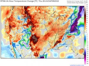
After a brief brush with Spring, a large portion of the Northeast is now roughly 20 to 40 degrees colder than they were at this time yesterday.
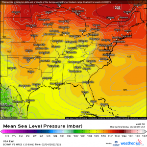
The culprit: a strong arctic high sitting over eastern Canada and pumping cold air southward.
The result: temperatures today have barely risen above freezing in areas closer to the coast while others inland still sit solidly in the 20’s.
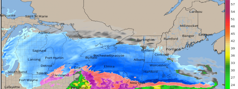
If you take a look at the map above, you’ll notice a broad area of low pressure sitting in the vicinity of the Tennessee and Ohio Valleys. That’s right – a system is on the way. And with cold air already in place, you would figure this would be a lock for an all-snow event, right? Not so fast.
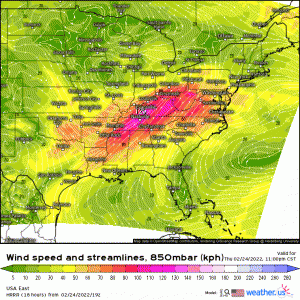
A strong low level jet accompanying our developing system will advect in not only the moisture for this storm, but warmth as well. With sub-freezing air solidly in place at the surface and above-freezing air overrunning it aloft, parts of the northeast along and south of the center of low pressure will be ripe for mixing issues.
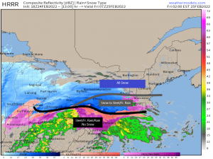
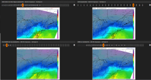
Let me preface this map with: This isn’t a set-in-stone estimate. A good deal of how large the transition zone becomes depends on exactly how far north the warm nose makes it. Different models suggest different things. We’ll look at that in a minute.
There will be 3 distinct zones (or possibly 4 if you want to separate out the “Plain Rain” as well) for this forecast.
- Those on the southern fringes will be too warm aloft for snow and marginal at the surface. This leads to:
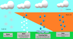
- Rain – where surface temps > 32 degrees
- Freezing Rain – where a very shallow layer of air < 32 degrees exists with a deeper warm layer > 32 degrees aloft
- Sleet – where a deeper layer of air < 32 degrees exists with a more shallow warm nose > 32 degrees aloft
Quick P-Type reminder, if needed:
2. The middle zone will be cold enough to start as snow and then, depending on the northern extent of the warm nose, will transition to sleet or possibly freezing rain. Any initial snowfall will be tempered by icy precip later.
- More southern locations with shallower cold air will see freezing rain.
- Northern locations with a deeper surface cold layer will see sleet
3. The northernmost zone will remain cold enough in all layers to receive snow for the entire duration. Heaviest totals will be found here.
As to the issue of how far north the warm nose gets:
Each model has an overall agreement but also very subtle differences in the forecast for the 850 mb temp that can end up making a huge difference in the P-type certain regions end up with. It’s impossible to break this down in a single blog for such a large area so, if you’re in the changeover zone, I suggest you consult your local NWS’s forecast for a more specific idea. Otherwise, just know that in the middle zone I defined, there will be a changeover. How far north that changeover makes it depends entirely on how strong that warm nose is.
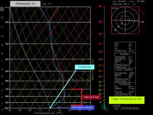
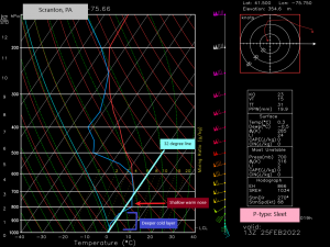
Let’s take a look at a few forecasted soundings from each zone to get an idea of what the atmosphere may look like in key locations tomorrow. I’ve chosen 3 locations in Pennsylvania to compare as it seems this will be the “main” state with mixing issues.
Philadelphia:
Philly is in the southeastern fringes of Pennsylvania. It’s also somewhat closer to the coast and therefore sometimes subject to coastal influences. Solidly cold air at the surface will be harder to find here. A very shallow layer of at or below freezing air may be present with a much larger layer of above freezing air aloft. This would translate to freezing rain IF there is enough sub-freezing air at the surface or plain rain if surface temperatures stay above freezing.
The urban heat island effect is known to keep surfaces temperatures in the cities slightly warmer than the outskirts. It’s entirely possible that plain rain could fall in the city while freezing rain occurs in the outskirts simultaneously. Marginal temperature profiles can be tricky.
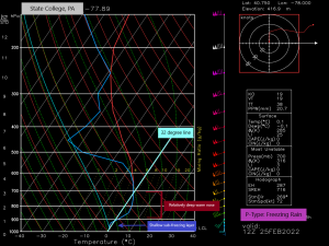
State College:
State College is at almost the exact center of Pennsylvania. This puts the town further away from the high providing the cold air. However, it’s more poleward and inland than Philadelphia. Consequently, we can expect the sub-freezing layer at the surface to be shallow, but still relatively well-established.
Additionally, the center of the low is forecast to track across central/western PA. Proximity to the center leads to a decently deep layer of warm air aloft, as indicated by the sounding. This is a fairly classing freezing rain set up which could produce treacherous conditions.
Scranton:
Scranton, though technically in a valley within the Pocono Mountains, is further north and east than State College and much further north than Philadelphia. This puts the town closer to the source of cold air (the high) and therefore we would expect a deeper sub-freezing layer at the surface. As depicted in the sounding, a deeper cold layer allows for a more shallow warm nose and lends to sleet rather than freezing rain. Any frozen precip is impactful, though, and leads to problems on the roads. Don’t assume that driving conditions will be any better simply because it’s sleet falling and not freezing rain.
I hope my little tour of Pennsylvania by way of soundings helped make the point that location will make a big difference in this storm.
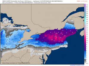
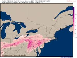
Let’s briefly touch on expected totals:
These projected totals pretty well outline what we’ve been discussing. Heaviest snow totals are kept to northern New England where there is no changeover and totals decrease as you move south where mixing will temper any initial snowfall.
Higher “ice” totals (be they freezing rain or sleet) will be found further south where cold air is much more shallow and the warm nose is able to poke in.
Whatever your p-type for tomorrow, make plans to stay home if possible. This winter storm is poised to be a mess from start to finish.
