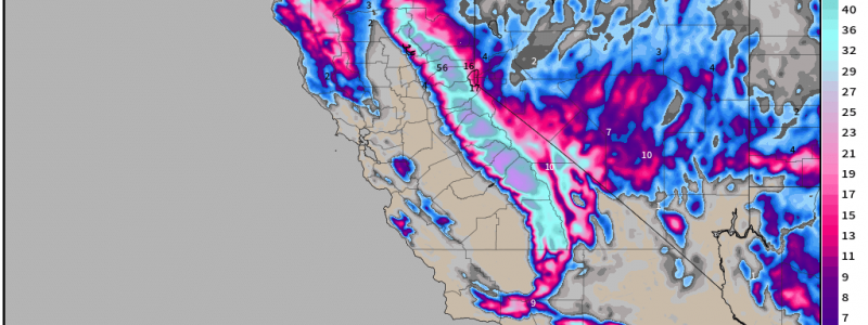
A California Blizzard
In yesterday’s blog, Armando wrote about the sprawling effects of the latest winter storm set to impact the Northwest through the Northeast over the course of the week.
Today we’ll turn our attention to another winter storm in a more southern location: California.
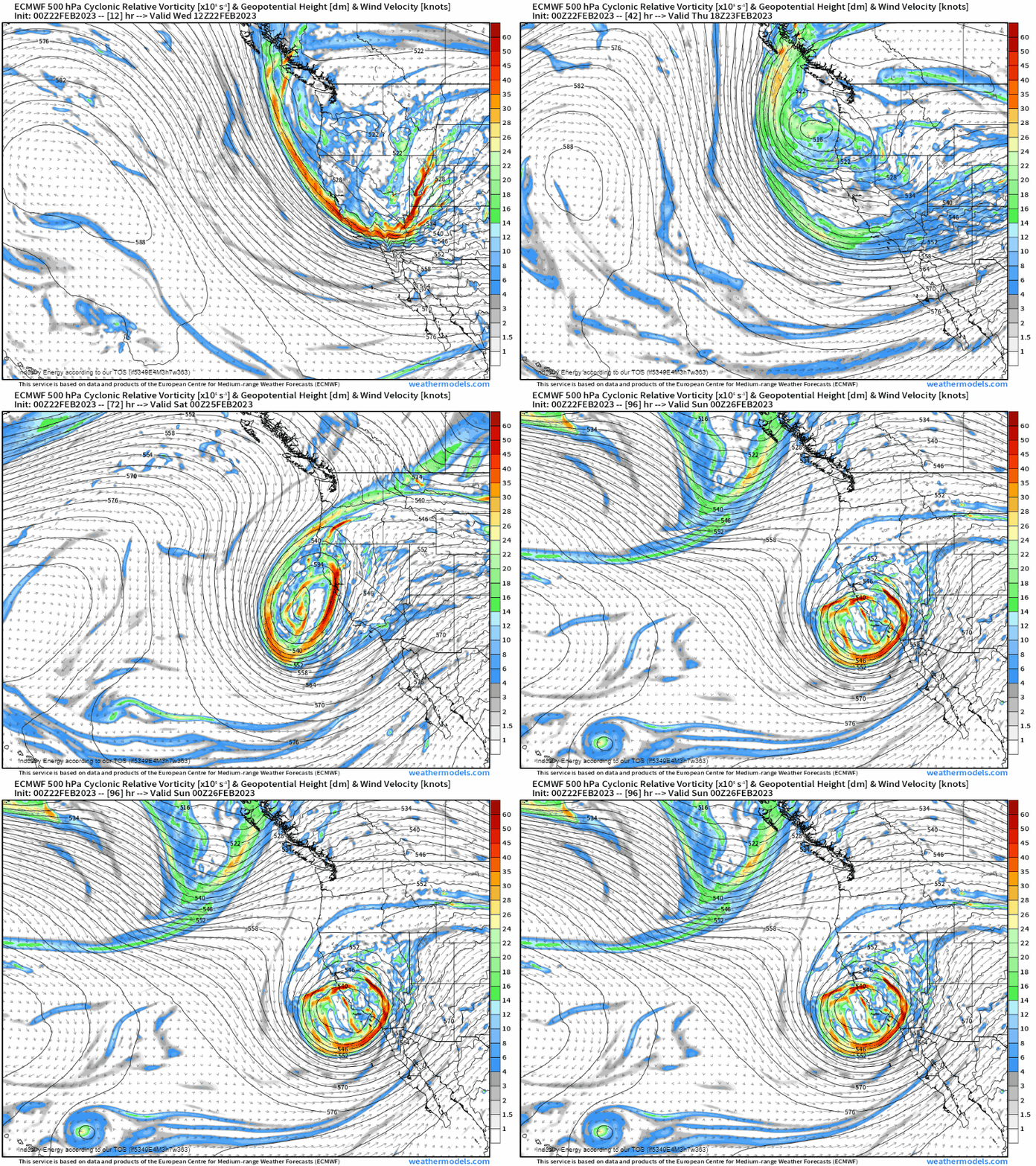
An upper-level low will begin to shift southward out of the Pacific Northwest later today/early tomorrow.
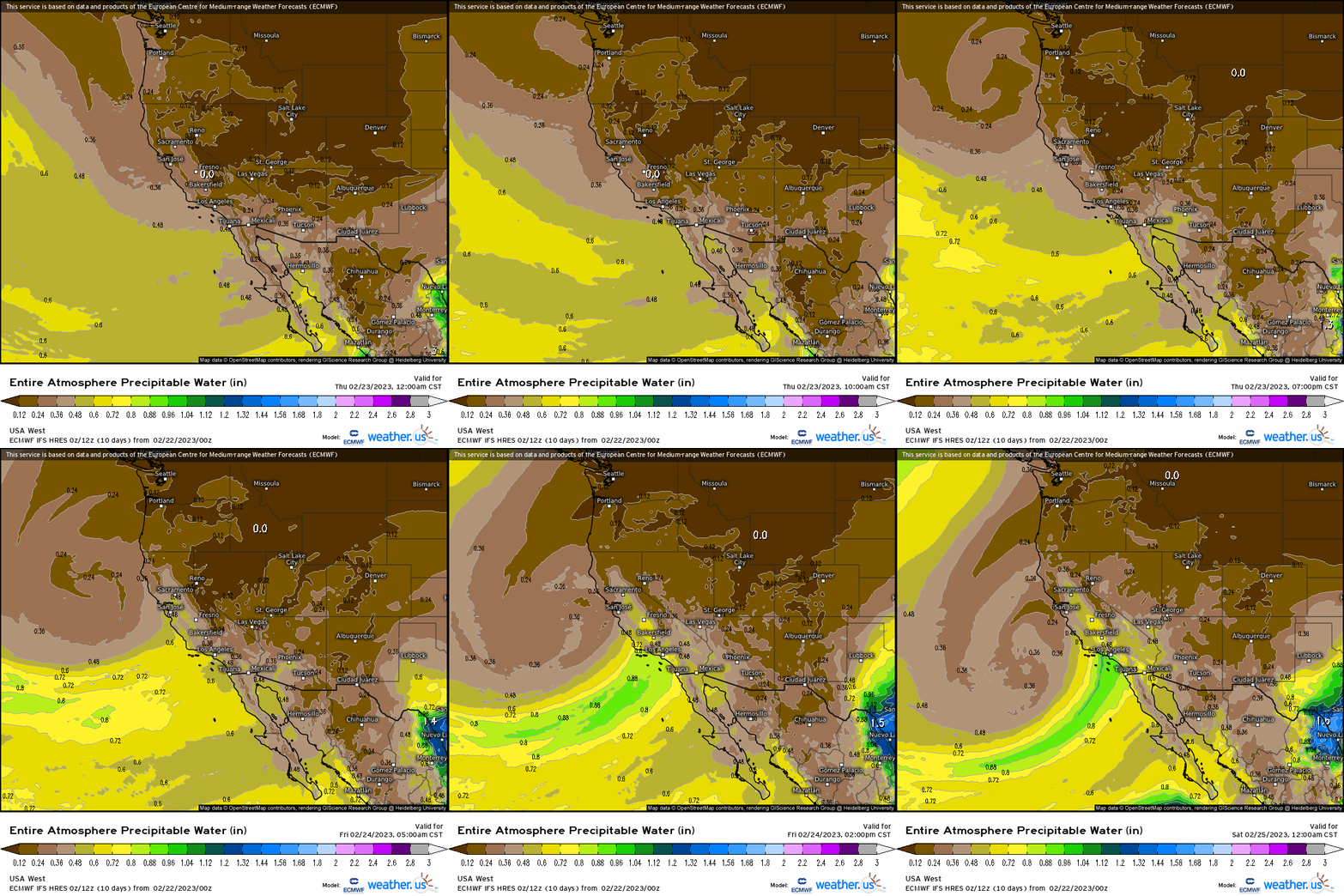
As the low shifts southward, the flow around the low will direct moisture toward Southern California, resulting in rain and snow.
“So what?” you may be thinking. Rain and snow in California isn’t really anything special, given the amount of both already received this season, right? However, the “big deal” here isn’t the event itself but rather how much rain/snow is expected AND exactly how low into the valley that snow line will fall.
This will be a fairly long-duration southwest flow event which, for the Sierra Nevada and Santa Ana mountains of central/southern California, can produce some pretty large snowfall totals.

Up to 79 inches could fall in the highest peaks over the course of just a few days. For those not so great with math, that’s nearly 7 FEET of snow.
And, to add to the heavy snow which will already make travel through these mountain passes impossible, the wind will be intense.
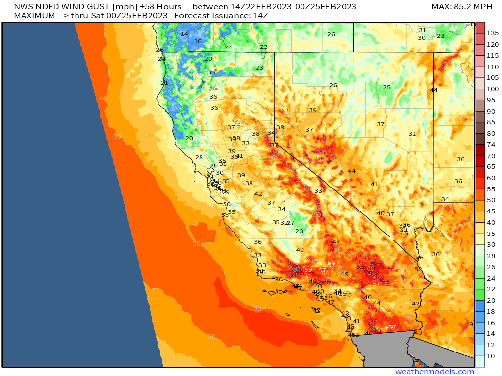
Gusts in the higher elevations could exceed 75 mph.
Heavy, blowing snow, subsequent reduced visibility, and intense gusts has lead to the issuance of a Blizzard Warning for the mountains of Ventura County and Los Angeles County – a very rare thing.
Just as rare is the lowest elevation at which snow will be possible.
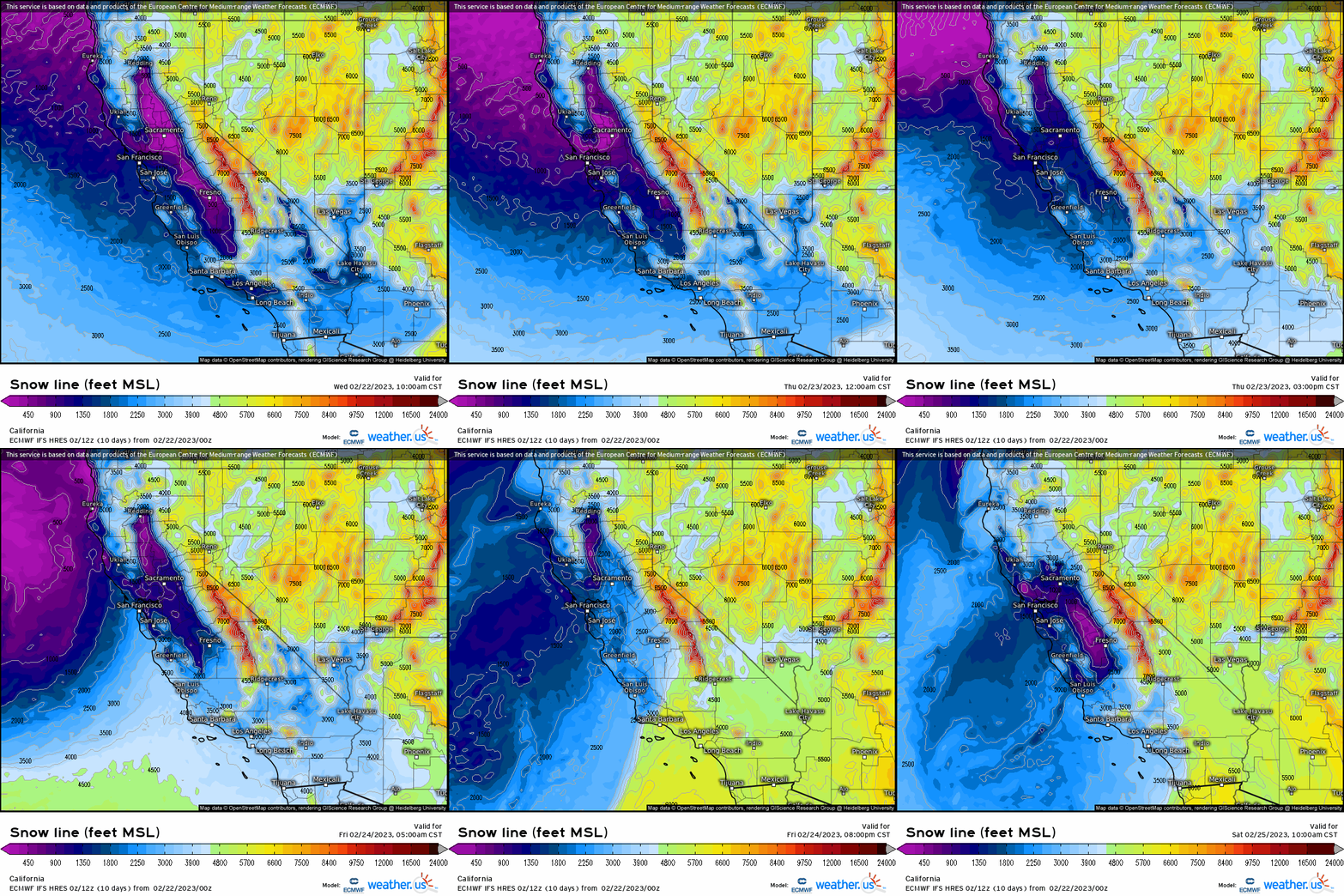
With colder-than-average air already in place and expected to remain so through the weekend at least, the snow line will drop astonishingly low at times. In both the central and southern valleys, the snow could accumulate at elevations as low as 1000 ft. As residents of this region already know, this is rather unusual!
Where temperatures remain above freezing, heavy rain will fall. A general 1 to 3 inches is expected along the coasts and valleys of Central/Southern California.
What You Need to Know:
- A potent upper-level low will bring messy weather to Central/Southern California into the weekend.
- Rainfall totals along the coast and in the valleys are expected to be 1 to 3 inches. Flash flooding/mudslides/debris flows are possible.
- Heavy snow is expected for the mountains and down to as low as 1000 ft as temperatures remain well below normal. Up to 7 feet of snow is possible in the highest elevations while lower elevations could pick up up to a foot in places (mainly the Sierra Nevada foothills).
- Strong winds are expected, with gusts up to 75 mph in higher elevations. Power outages are possible.
- A blizzard warning is in effect for the mountains of Los Angeles County and Ventura County. Travel will be difficult to impossible.


