A Blizzard Inbound For the Northern Plains
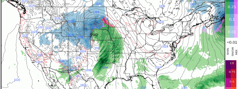
As a large system emerges out of Colorado, it’ll strengthen and shift into places such as NE, SD, and IA over the next few days. With this storm track, it’ll usher in warm air advection and relatively high PWAT’s as it pulls it northward via the warm sector. In conjunction, on backside as the low pressure steadily strengthens, cold air advection on the backside will also strengthen causing heavy snow to north and west of the track, rain to the south and east, and a wintry mix in between.
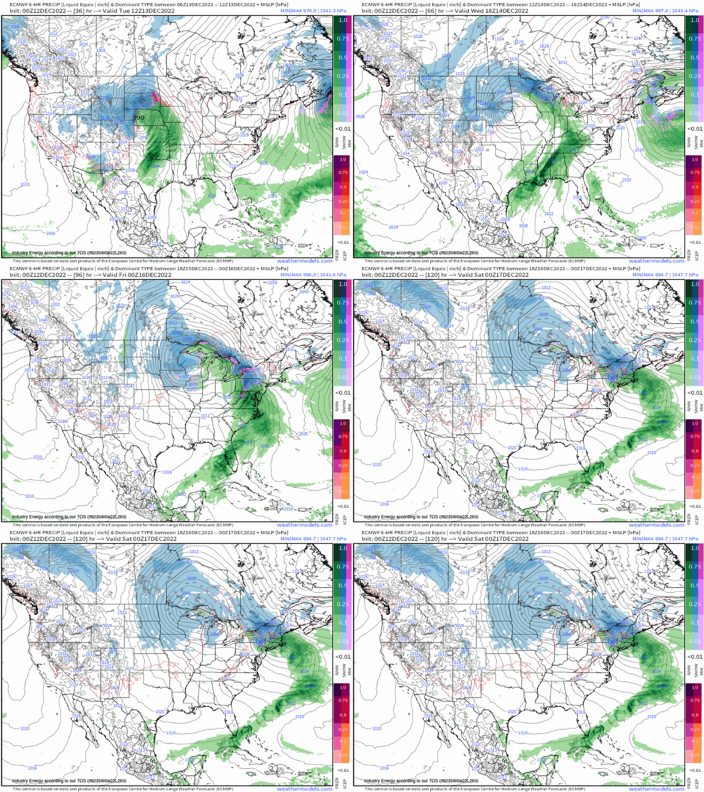
What makes this such a potent and robust storm, is the mid-level progression of the trough. An anomalous trough cuts off from the flow, which is apparent in the closed contours. The reason why it does, is because of the large blocking high to the north across southeast Canada, and another blocking ridge to the northwest across Alaska and British Colombia. This forces the track track to cut up the Midwest, delievering a dynamic setup.
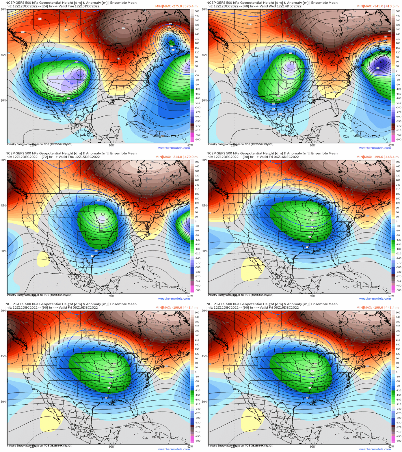
Here are the modeled output surface temperatures via ECMWF HIRES. There are two main points to note here:
- You can visually see the warm sector through the surge of higher temperatures. You can also outline where the main low pressure center tracks with the temperature contrast. This “pulls” warm air and moisture, causing strengthening of the low pressure and rendering heavy precipitation.
- These differences in temperature toward the surface and a few thousand feet in the boundary layer will cause mixing issues up across southeast SD, northeast NE, central-southern MN, southeast ND, and into WI. We can see up to an tenth or so of ice through tomorrow as the worst of it unfolds tonight and into tomorrow.
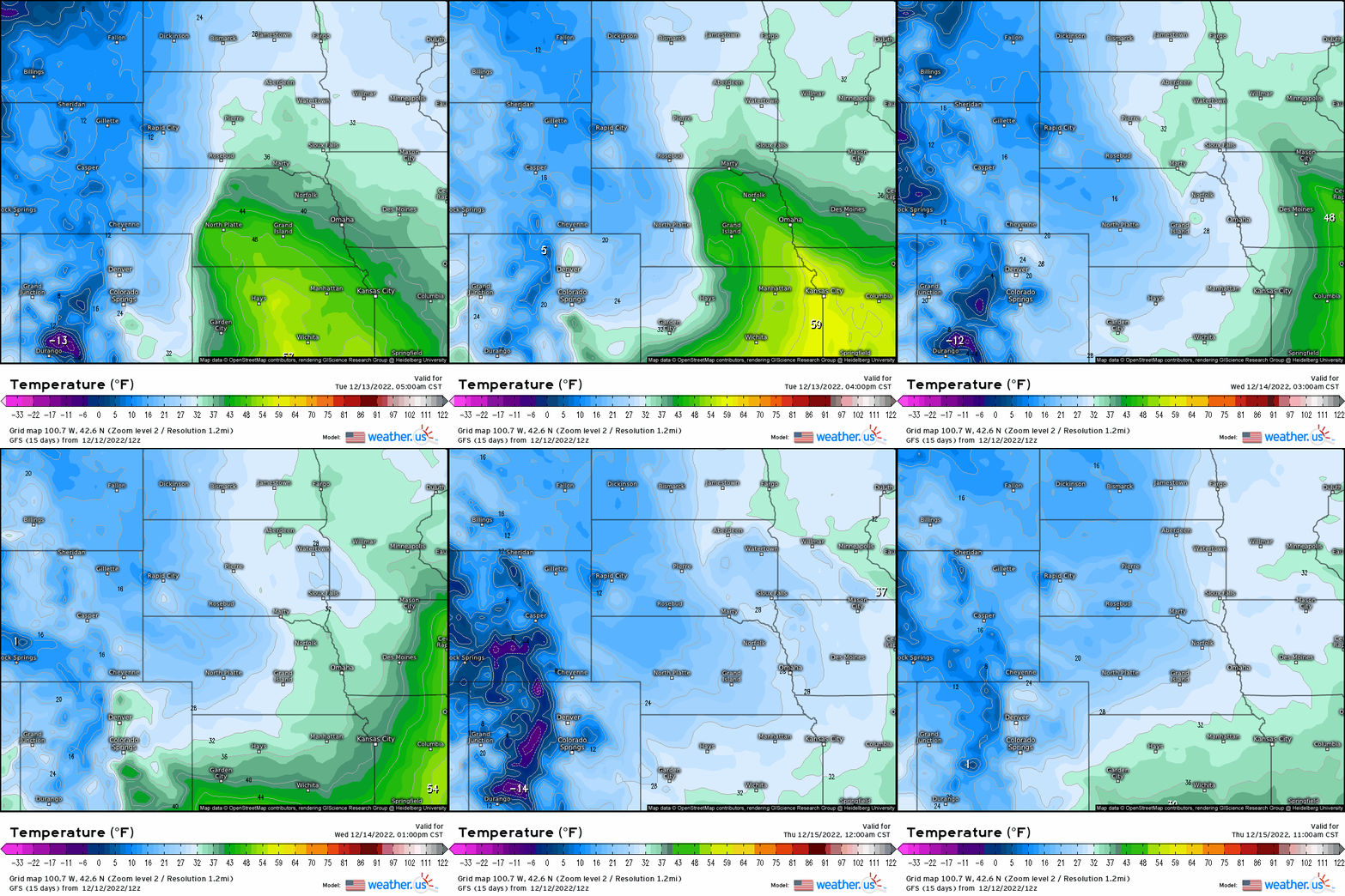
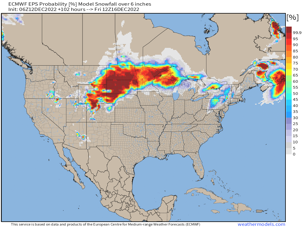
Here is the EPS probability of where we may see over 6” of snow through Friday, and notice a large swath of greater than 50% from northwest NE into northern WI.
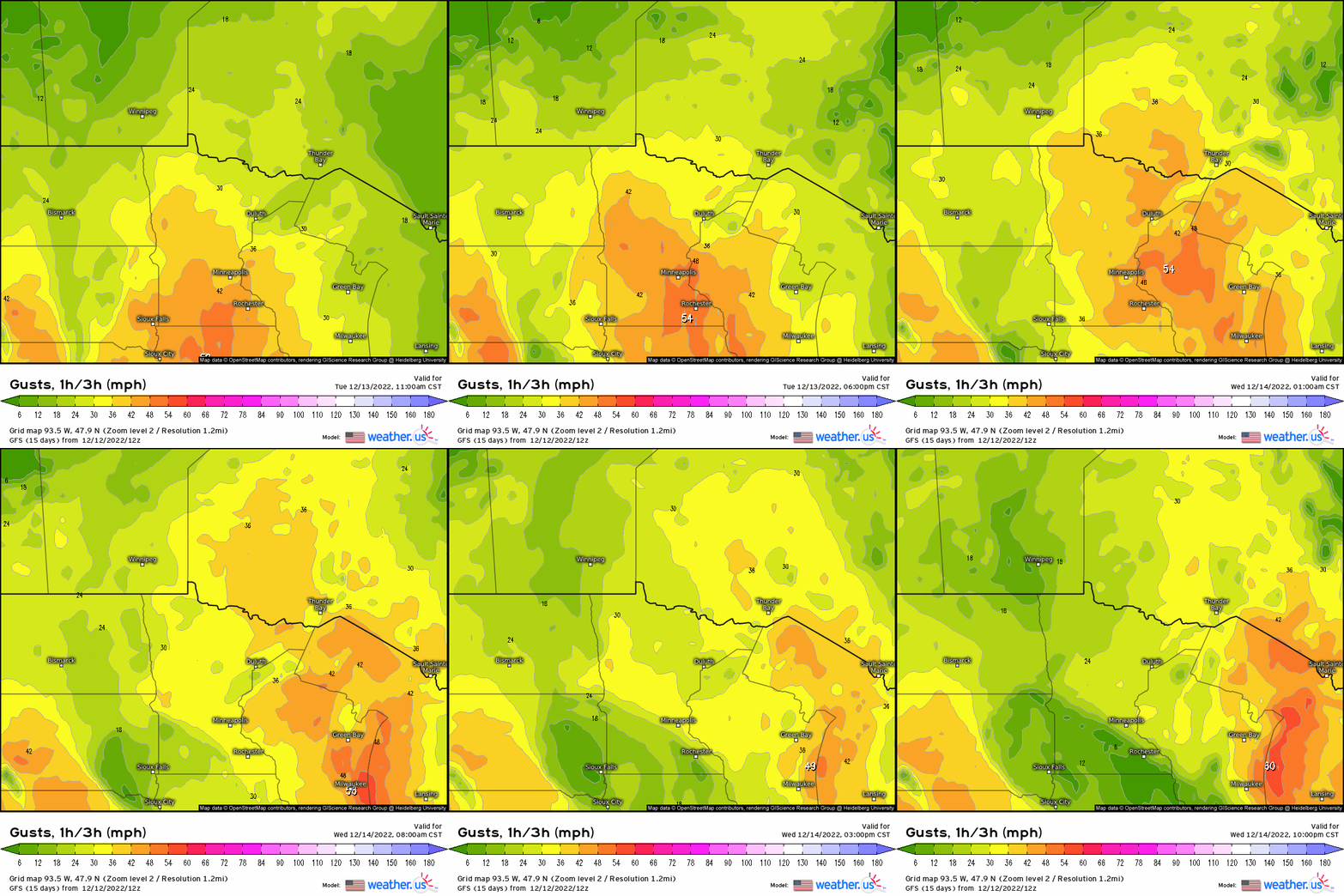
To make matters worst, this actually is set to be by official definition – a blizzard. Through tomorrow, wind gusts will exceed 35-40 mph across the Dakotas and into MN. Where we have frequent gusts over 35 mph and blowing or drifting snow for at least 3 hours, then according to the NWS, this is a blizzard. Expect snow to be blowing and drifting quite significantly, reducing visibility down to less than a mile!
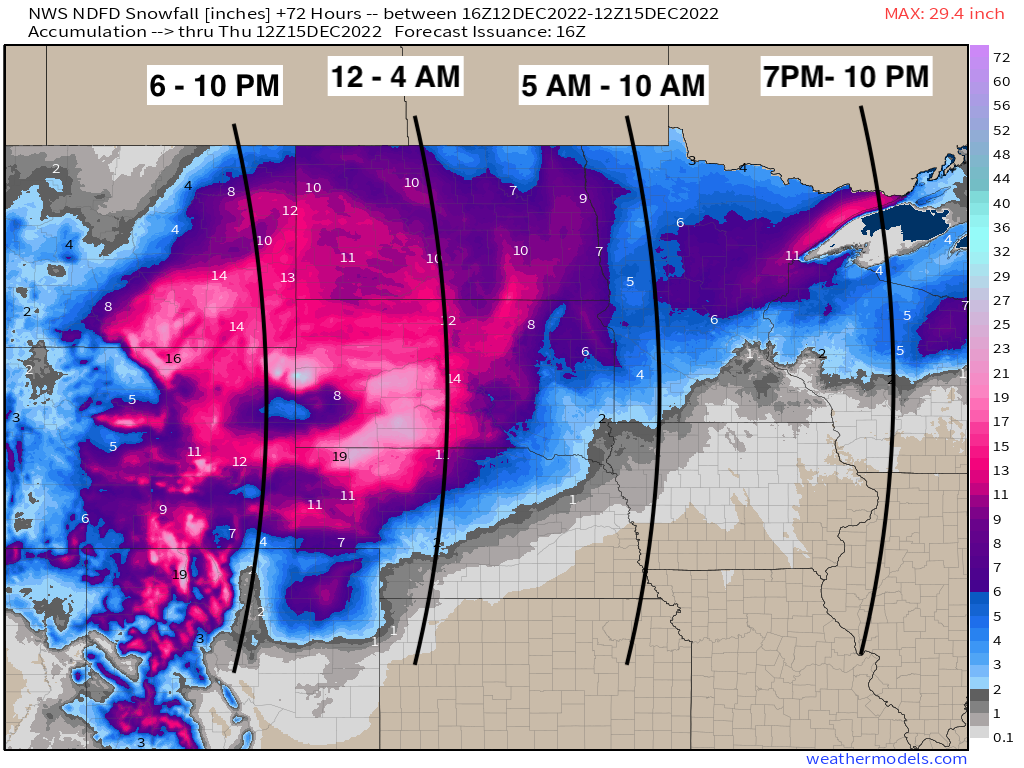
When all said and done, this is a general idea via NWS of how much snow is expected through the end of the week, with many places seeing almost a foot! I also added in general start times of when the initial push of the synoptic precipitation shield begins from southwest to northeast.
This system then translates eastward, which will set the stage for impacts across the Northeast, Ohio Valley, and Mid-Atlantic by the end of the week. We’re going to be rather active over the next few weeks, so buckle up!


