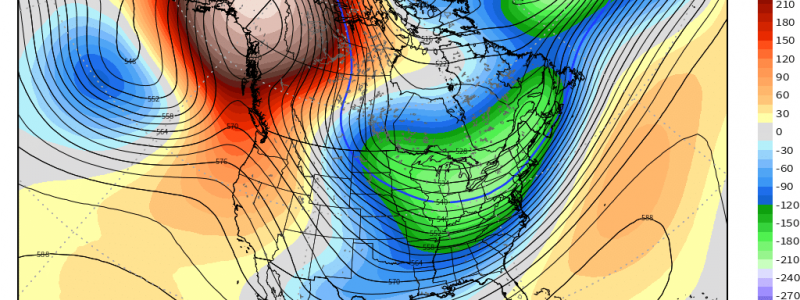
A Big Chill
The north-central part of the US spent a lot of this past summer at above-average temperatures thanks to prolonged ridging. Now, as we creep toward winter, one of our teleconnections will work to keep this region well below average for an extended period of time.
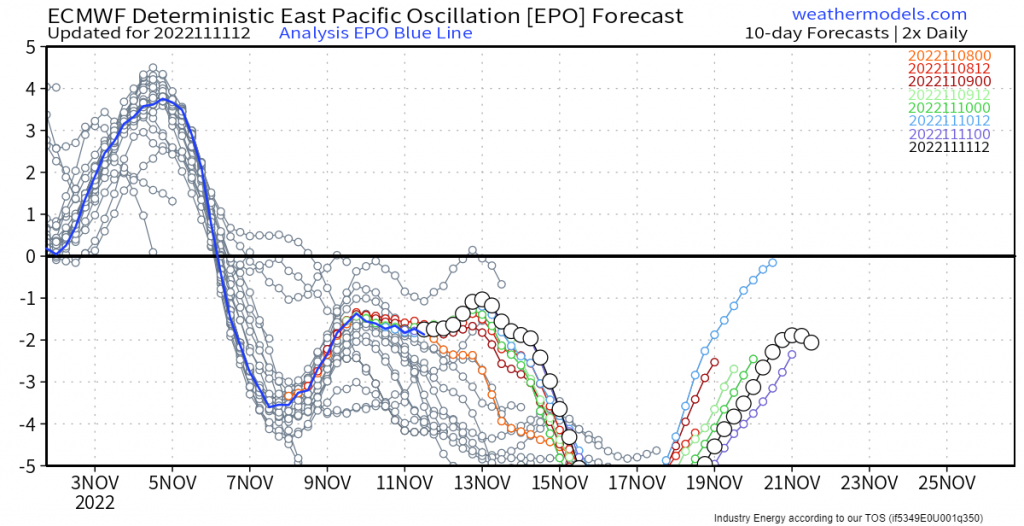
This time, we’re talking about the Eastern Pacific Oscillation (EPO). While it is currently in a slightly negative phase, it seems poised to become extremely negative over the coming week.
So, what does that mean?
Well, when the EPO is negative, it generally means there is a ridge of high pressure parked over Alaska. While they see warmer than average weather thanks to the ridge, the more amplified that ridge becomes, the greater the chance for cross-polar flow to develop. If this occurs, it allows cold, polar air to spill into south-central Canada and eventually the north-central/central US.
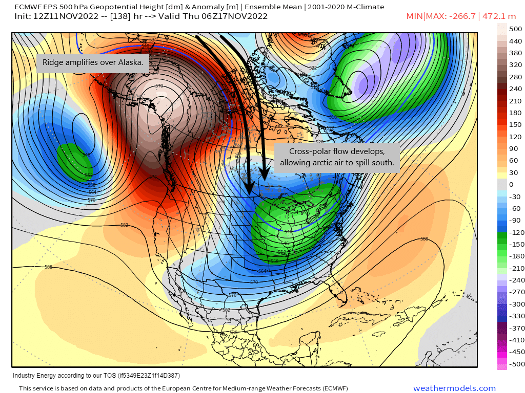
It looks a little bit like this. These are the modeled 500 mb height anomalies for next week. They clearly show an anomalous ridge in place over Alaska, allowing for that cross-polar flow to develop.
Let’s look at it another way.
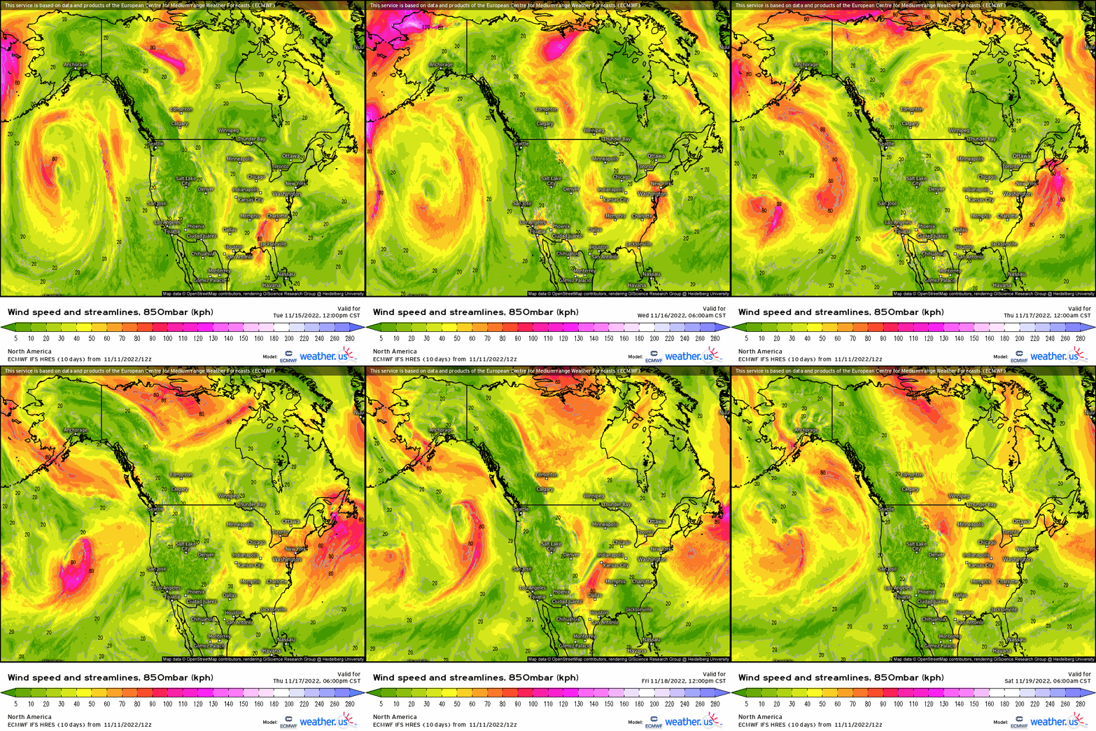
Here, we’re looking at the 850 mb level – the level we use to identify warm and cold air advection. We can very clearly identify air streaming southward from the poles, especially toward the end of the loop.
Anyway, all of that is a very long-winded way of explaining that it’s about to get cold (and why).
Remember that the EPO is slightly negative now, and allowing a shot of cold air to spill in behind the front currently working its way eastward.
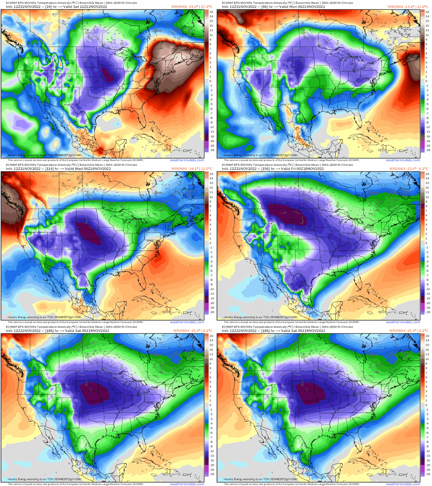
But as the EPO goes very negative next week, a much more potent shot of cold air settles in.
And, as multiple shortwaves in a broader troughing regime spin through, there will be several chances for snow in the Northern Plains and Upper Midwest. Additionally, cold air advecting over the still-warm Great Lakes should fire up the Lake-Effect Snow Machine as early as this weekend.
While this is fantastic for winter-lovers in parts of the lower 48, Alaska – the land of snow and ice, especially at this time of year – will experience an extended period of above average temperatures.
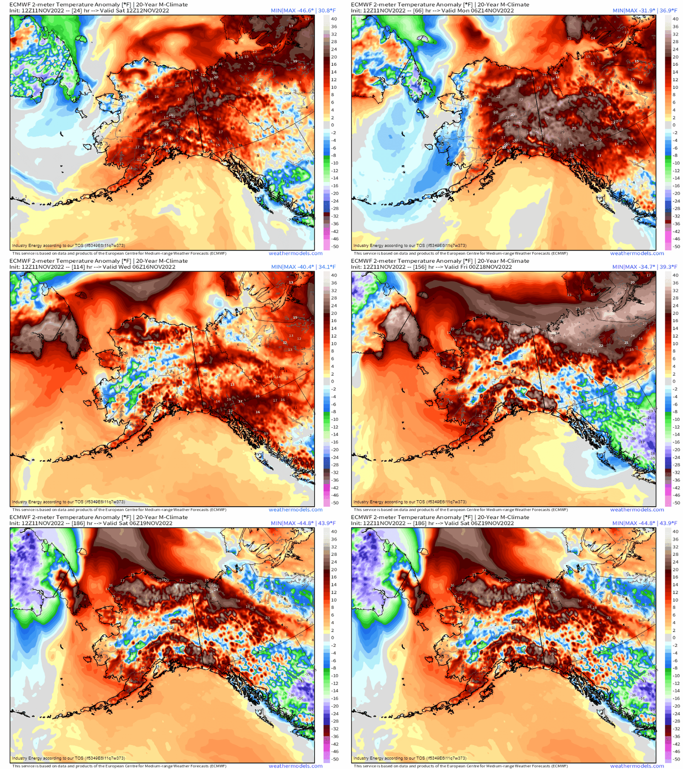
While I wouldn’t exactly classify the expected temperatures as “warm,” places that are typically in the single digits at this time of year could creep above freezing. That’s close to 30 degrees above normal and is certainly significant, if it occurs as forecast.
Currently, however, the first cold shot is already settling in.
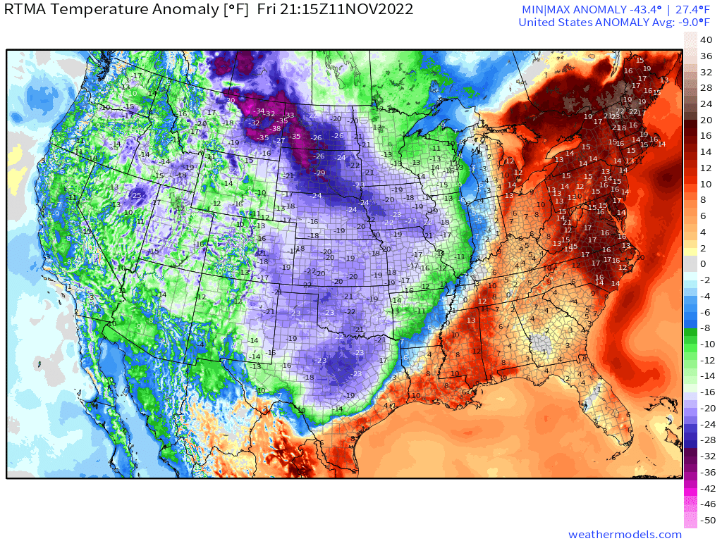
As we move into the overnight hours and brisk northwesterly winds continue to blow over the Plains states, we’ll need to account for the wind chill as we go about our activities in the morning.
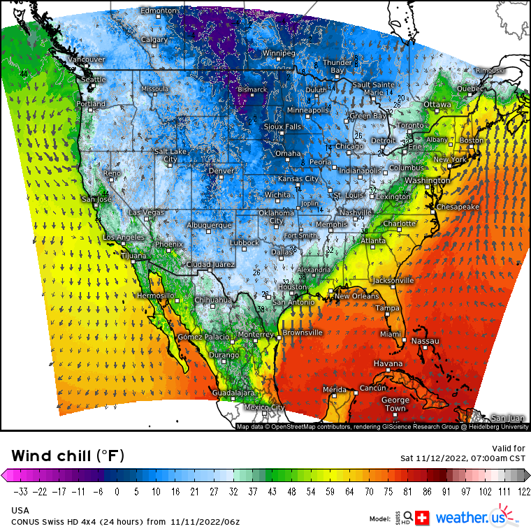
With morning lows solidly below freezing and sometimes-gusty northwesterly winds in place, wind chills could dip to dangerous levels – most especially in the Northern Plains. If you must be out and about in the coming days, be sure to monitor the wind chill and properly protect your skin. Frostbite can occur more quickly than most people think.
Enjoy the cold! If you’re into that sort of thing, anyway.


