Tropical Mischief In The Gulf?
This morning, we shift our focus away from the relentless heat and back to the tropics.
It seems we have the potential for a legit threat to the Eastern Gulf in the next week or so.
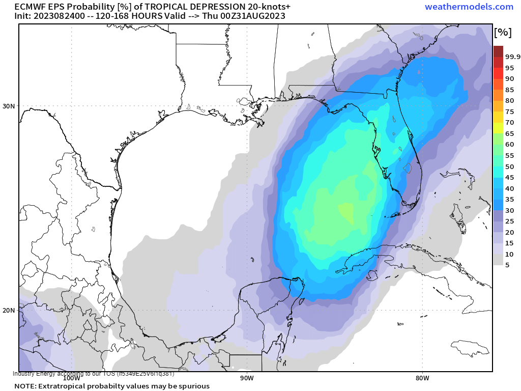
Before anyone panics, please note that I did say “potential,” as in there is still a good deal of uncertainty. Let’s take a look at what we know so far.
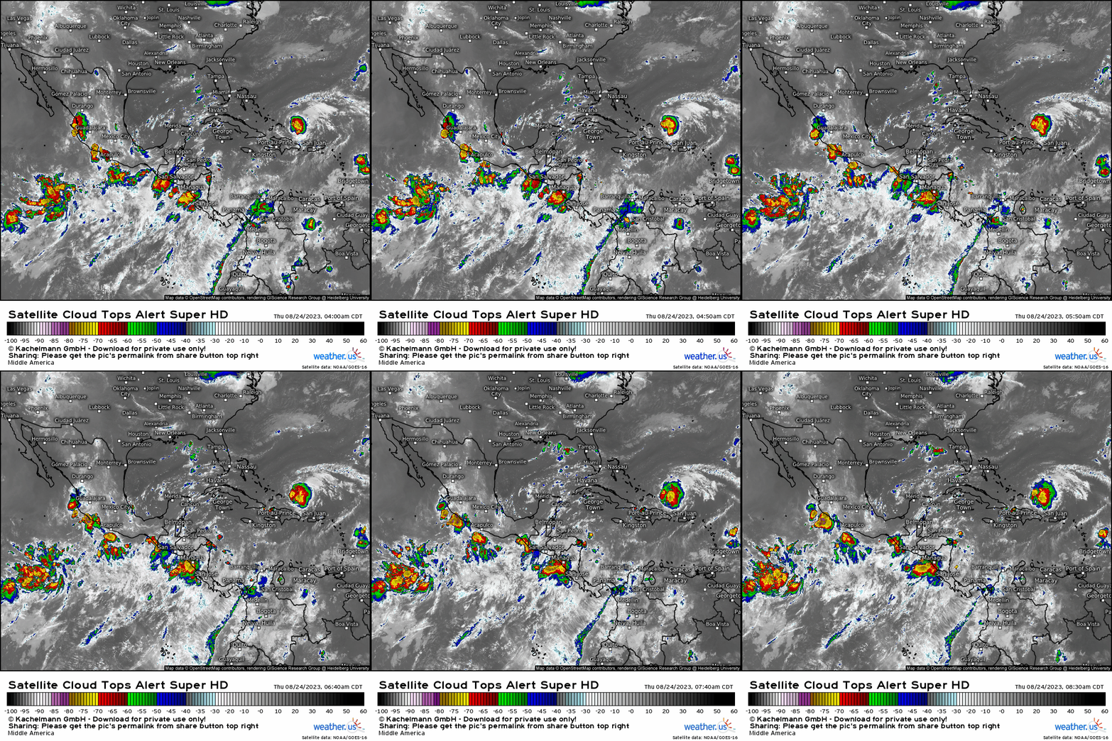
The area of interest we’re discussing is a broad area of low pressure currently on the Pacific side of Central America, just offshore of Nicaragua.
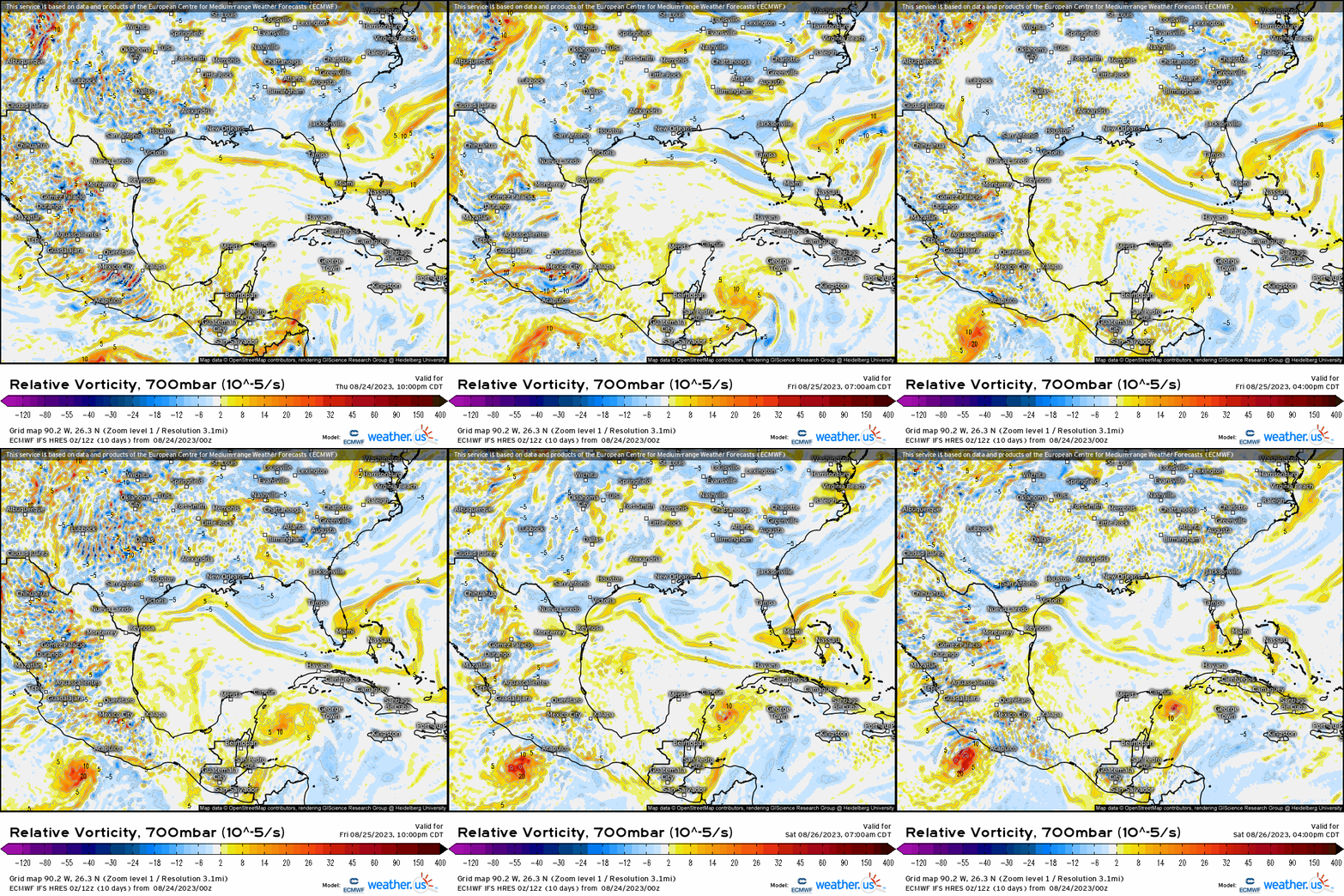
In the coming days, this disturbance is expected to move NNE across Central America and into the Western Caribbean.
This is where the word “potential” comes into play. The models do not currently agree on how it will develop (or perhaps not develop) from here.
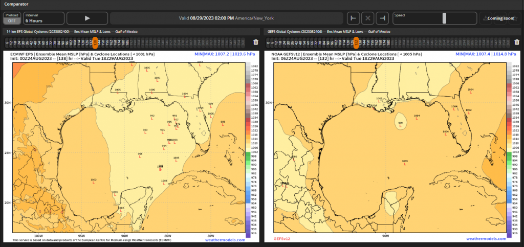
At this time, the EPS is a bit more enthusiastic about the development of this disturbance than the GEFS. Significantly more members show development, though placement and timing seems to still be up for debate.
But, we know how these things work. Models will continue to shuffle around with placement and timing until an actual center forms. So now the only question we need to be concerned with at the moment is “does it develop?”
Let’s take a look at the background state.
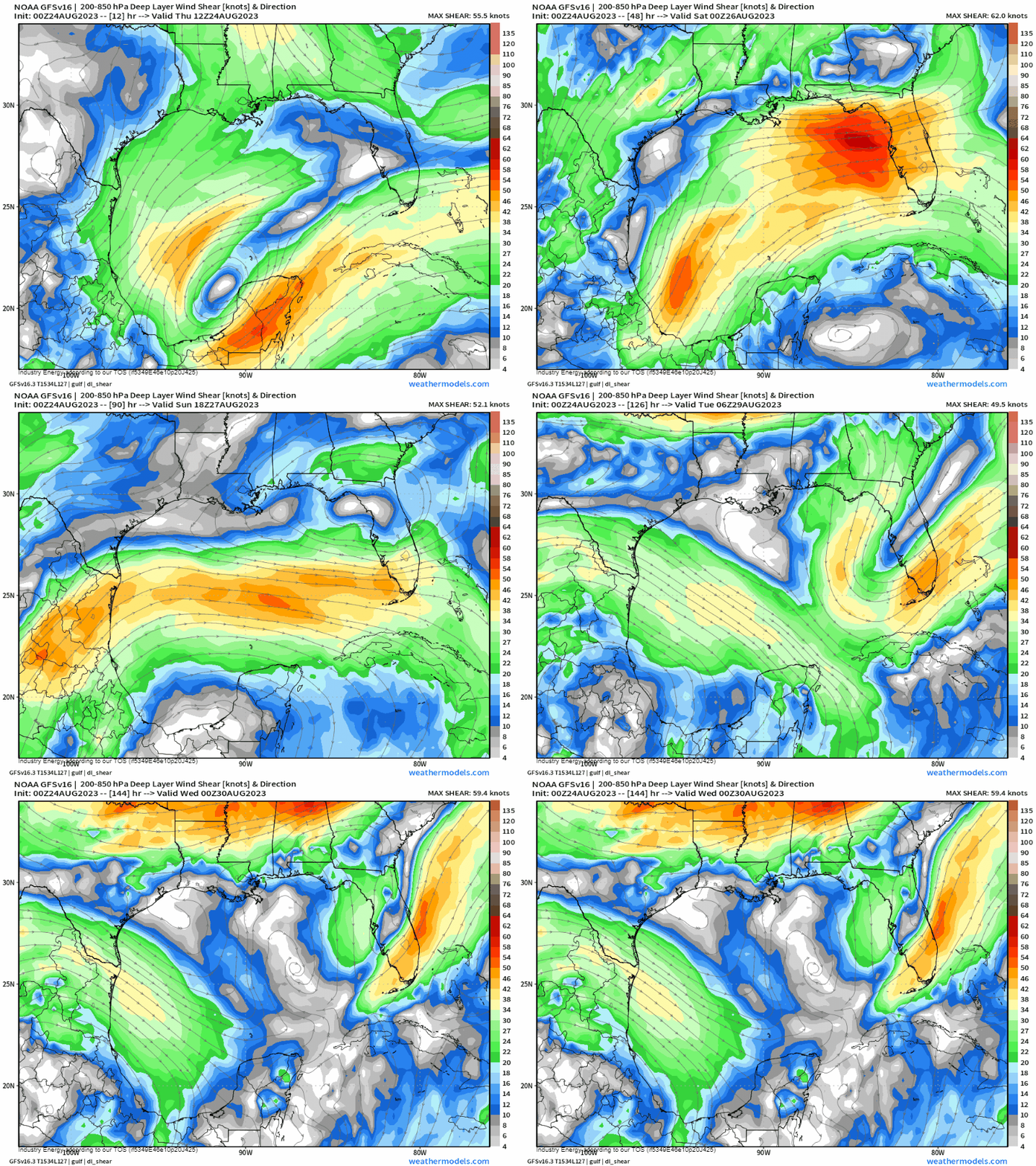
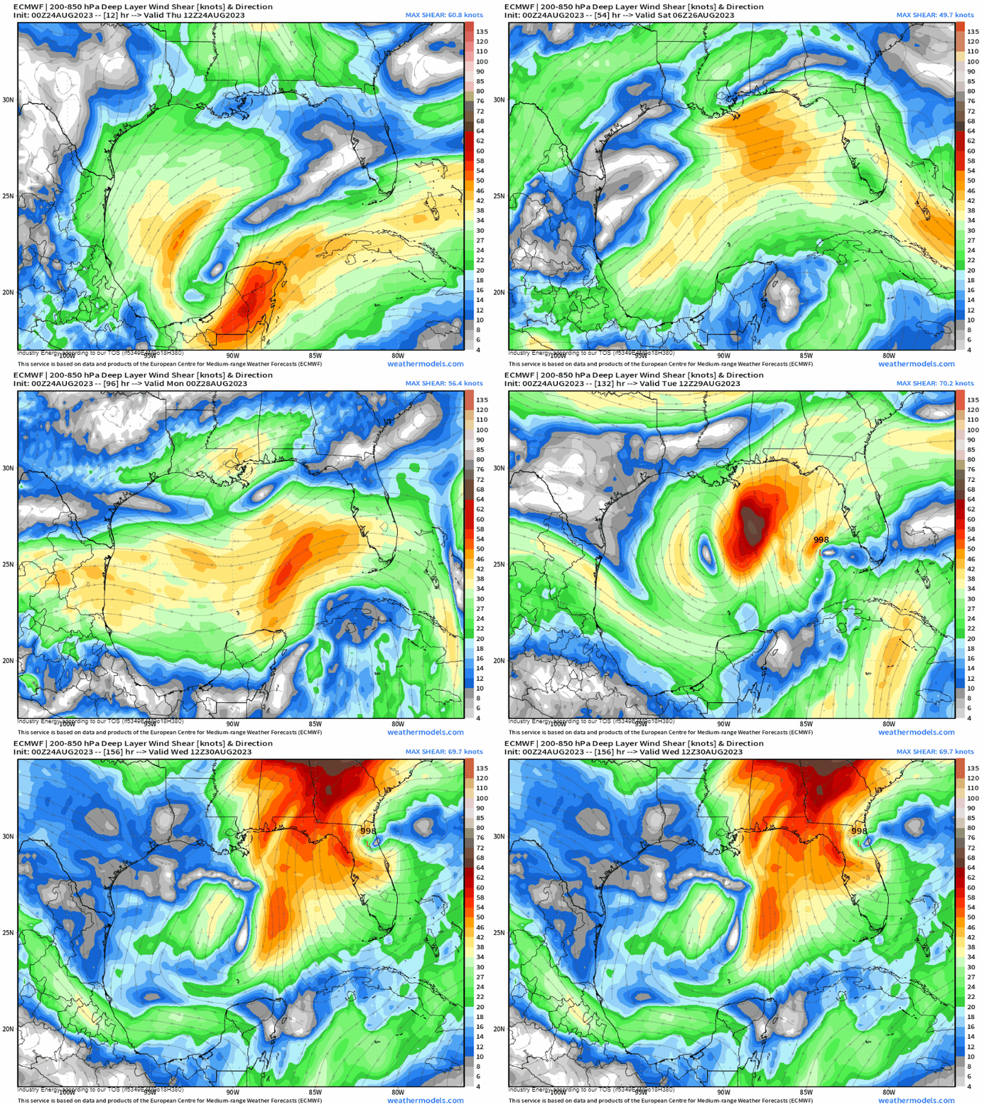
Either way you look at it, shear will be an issue – at least initially. The GFS (first gif) keeps moderate shear in place while the ECMWF (second gif) shows shear relaxing just enough to allow for some development before the next cold front swoops in early next week. This is likely why the ECMWF/EPS is on board with development and the GEFS/GFS is not.
Additionally, we’ll need to consider whether the background state will be too dry. With multiple fronts on the move in the next 7 days, at least some continental dry air will likely move into the Gulf. This could put a lid on any development as well.
The bottom line right now is that there is absolutely some potential for development here. Additionally, should it develop, it will likely move toward the Eastern Gulf.
As for specifics, it’s too early. We’ll need to monitor how this disturbance evolves over the next couple of days once it enters the Caribbean. Also, we’ll need to monitor the evolution of the background state of the Gulf. Is shear or dry air trending less? More? More questions than answers right now.
What can you do now while we wait for more clarity?
- Review your hurricane plan if you reside along the Eastern Gulf.
- Be ready to use it if necessary.
- Keep checking the forecast.
- Make sure you’re working with the most recent information. Possible tracks/odds of development will change frequently as we approach the weekend.
- Don’t panic. Uncertainties abound and nothing is set in stone yet.
- Be prepared, not scared.
I’ll keep you updated as the forecast evolves!


