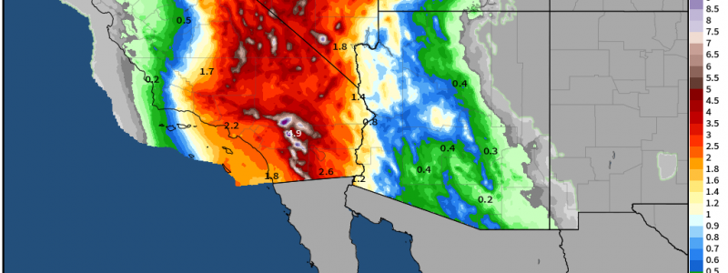
What To Expect When You’re Expecting Hilary
Hurricane Hilary hasn’t yet made landfall, but it is already making history.
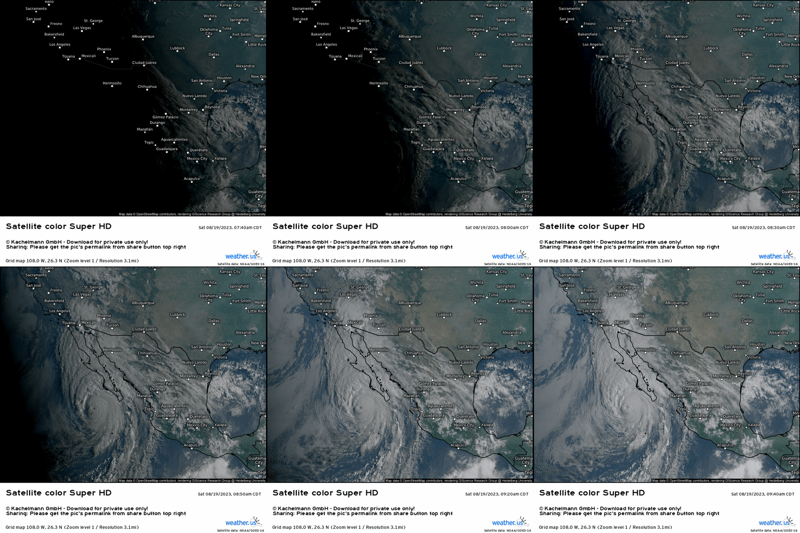
For the first time, all of Southern California is under a Tropical Storm Warning. Though a tropical storm was recorded as landfalling here in 1939, the NHC as it is now did not exist yet and therefore were not issuing warnings.
Much has changed since 1939. Cities have risen, terrain has been altered. In this modern Southern California world where annual rainfall can sometimes be only in the single digits, this is truly an unprecedented event.
Unlike East Coast cities who routinely enough see tropical systems landfalling and at least have a general idea of what the impacts will be, this is new territory for Southern California. The most disconcerting thought right now is that we don’t know how, exactly, this will impact the region. We’ll have to find out as we go – and that can be downright dangerous.
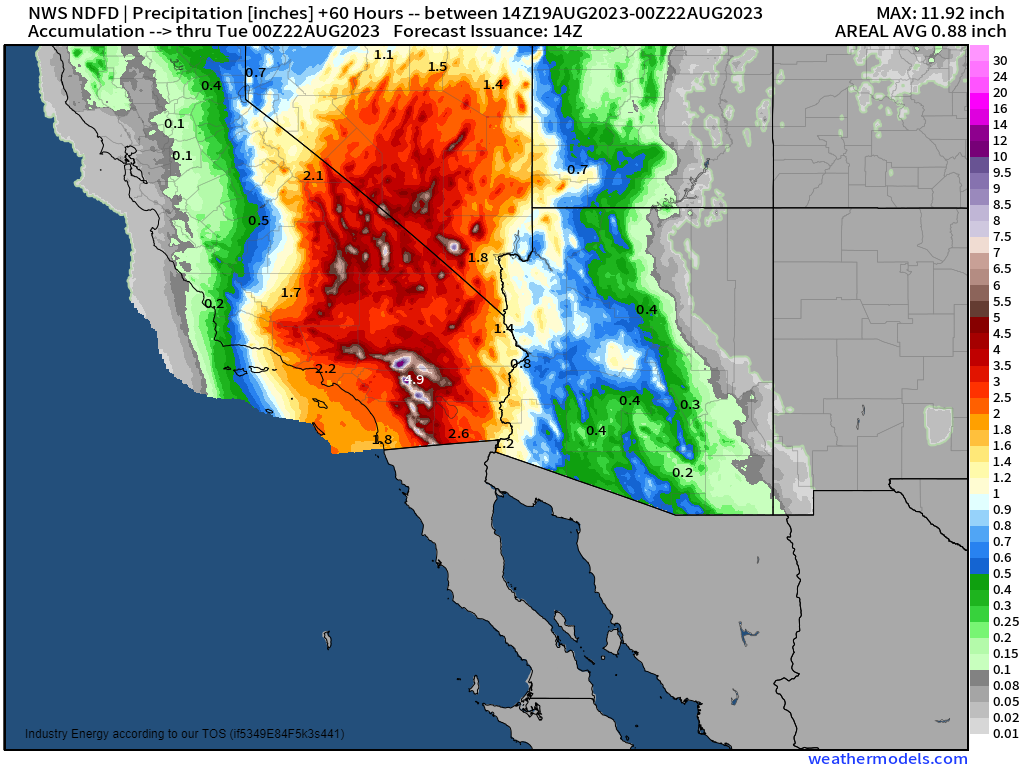
Hilary is forecast to weaken to a tropical storm by the time it landfalls in/near Southern California. Does this mean it won’t be a big deal? No. Absolutely not.
Hurricane categories are based solely on wind speed. But the problem with Hilary, as with most tropical systems, will be the water. When deep tropical moisture arrives in a region that maybe sees 15 inches of rain (or even much less) on average per year, there is going to be big problems.
Terrain is going to play a large role here in a few ways:
- Elevation changes provide extra lift, allowing more moisture to be squeezed out of the system.
- All the extra rainfall squeezed out by the elevations has to drain somewhere. This will lead to a pile-up of water in the lower elevations.
- Leeward and Windward sides of the mountains and their normal precipitation impacts will cease to have any meaning. The counter-clockwise flow around the center of the storm could very easily reverse the natural pattern, allowing for more rainfall in the lee than on the windward.
- Cities could be particularly vulnerable as many lay at the base of the higher elevations. Increased run-off and poor drainage due to all the concrete typically seen in cities could lead to a very serious situation.
- Burn scars in this region may increase the amount of run-off and/or debris flows. Burned soil with no vegetation won’t soak up the water like healthy soils might.
One further consideration here is the changing microclimates throughout this region. From coastal to mountainous to desert, each will react to total inundation differently.
My point here is that those in this region need to be ready for anything in terms of flooding. Places that haven’t flooded before may flood during this storm. Waters may rise extremely fast, giving residents very little time to get to safety.
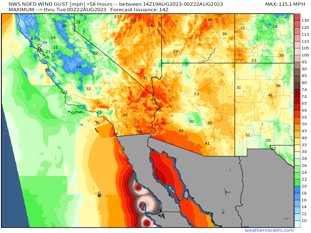
Though the winds are far from the main headline of this storm, we do need to touch on them.
Trees, power poles, etc. topple much easier in a saturated soil. With tropical storm-force gusts in the forecast, this could lead to widespread power outages. Prepare now to get through any outages – buy batteries, charge devices, make sure you have a way to get info that does not require being plugged into a wall.
Another thing to consider as far as winds go is the circulation around the tropical cyclone. This could lead to an on-shore push of water and storm surge for some, though it depends on the exact track.
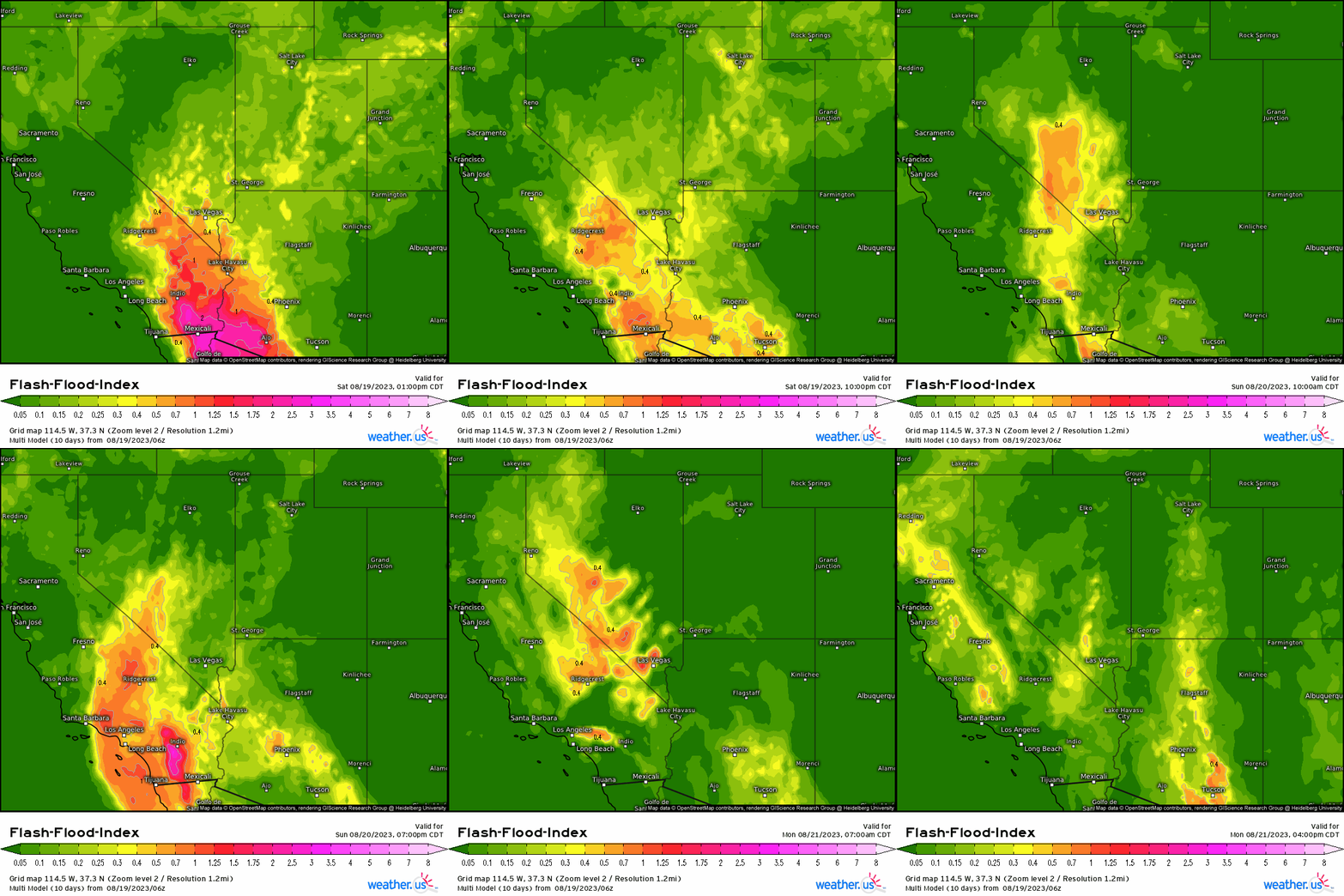
Let’s wrap this up by discussing timing.
Some rainfall is already on-going over the Southwest. These showers will continue to increase in coverage and intensity into the evening and overnight hours. The heaviest rains will arrive early Sunday and last throughout the day. No one should be planning to travel tonight or tomorrow. The potential flooding situation is simply too dire.
It is absolutely imperative that everyone in this region remain alert and up-to-date on the latest information. This situation will likely evolve quickly and could become life-threatening for some. Stay tuned to your local NWS office and your local broadcast meteorologists for hourly (or less) updates.
Stay safe, Southwesterners!


