Your 2023 Fourth-Cast
Another summer holiday is once again upon us. The 4th of July is famous for its outdoor-centered celebrations. Among these are pool parties, barbecues, boating on the lake/ocean, and, of course, fireworks displays.
It’s not hard to imagine, then, that a little bit of bad weather can effectively ruin quite a lot of plans. Will the weather cooperate for your festivities this year? Let’s take a look!
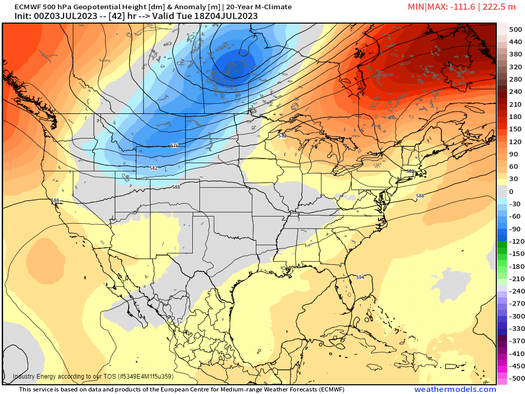
A quick look at the 500 mb Anomaly Heights can give us an idea of the overall pattern:
All three coasts (East, West, Gulf) are under the influence of ridging. This suggests warmer temperatures and perhaps air mass thunderstorms, especially in the eastern portion of the US where moisture from the Gulf of Mexico can set the stage.
In the north-central portion of the country, we see troughing coming down off of the Rockies. If you’re familiar with weather patterns, this may lead you to surmise that a system will be forming. And, if conditions are right, severe weather could be in play.
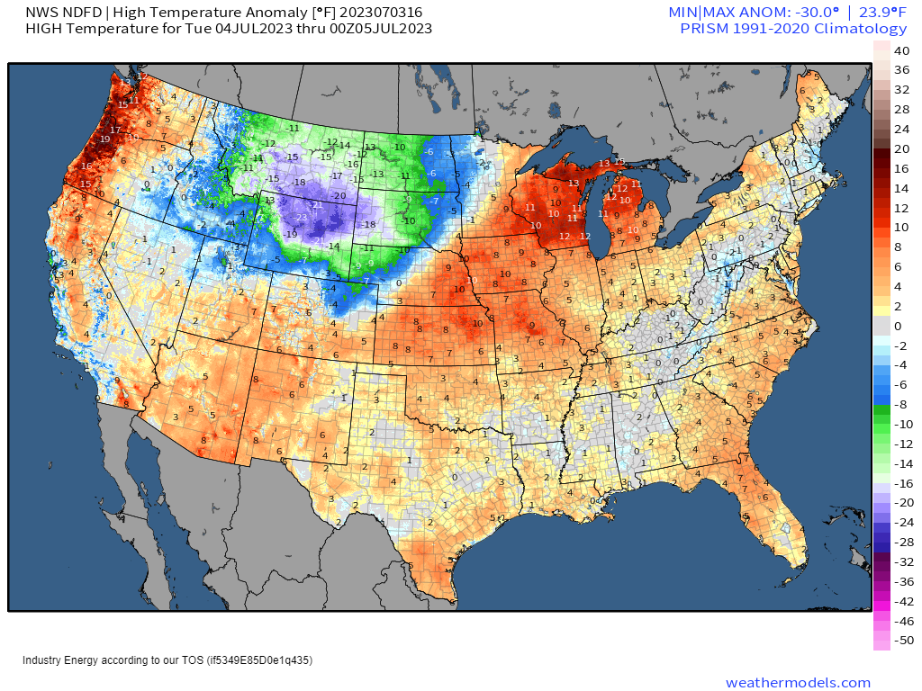
Looking at the forecasted temperature anomalies for tomorrow, we can see that our assumptions based on the 500 mb Anomaly map was generally correct.
Above average temperatures can be seen on all three coasts, with the strongest anomalies over the Pacific Northwest and Great Lakes regions where ridging was a bit stronger. From the Deep South to the Ohio Valley, we see pockets of average to slightly below average temperatures which would indicate the influence of cloud cover/air mass thunderstorms that have cooled the atmosphere.
Conversely, we see significantly below average temperatures in the North-Central US, where we supposed that a system would be forming.
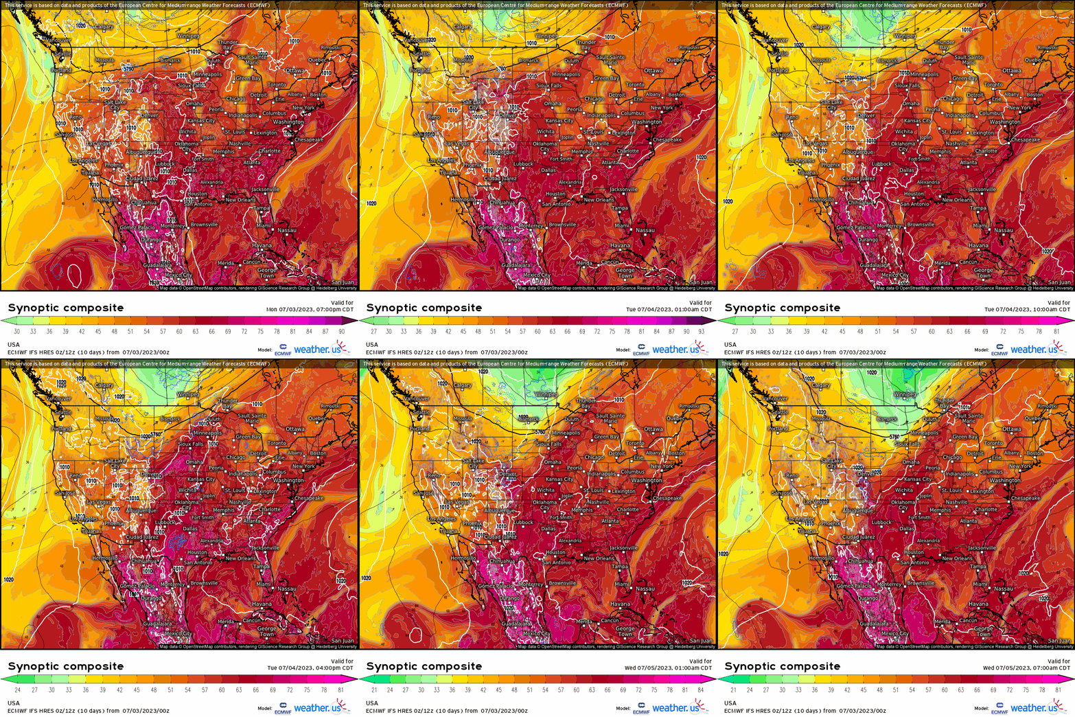
Through use of the Synoptic Composite, we can clearly see that trough dig down over the aforementioned region while warm, moist air is pulled up ahead of it. So, yes, we will have the ingredients for scattered severe thunderstorms from roughly the Upper Great Lakes region through the Great Plains.
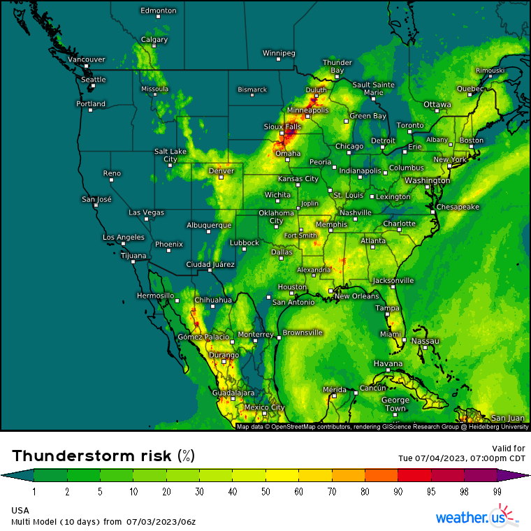
While this will be mainly a wind and hail risk, a few tornadoes will be possible – especially in the Central High Plains.
Additionally, as air mass thunderstorms blossom over the East Coast and Southeast, a few could become severe. The main threat posed here would be damaging winds.
Whether or not you’re expecting severe weather tomorrow, let’s not ignore the lightning risk.
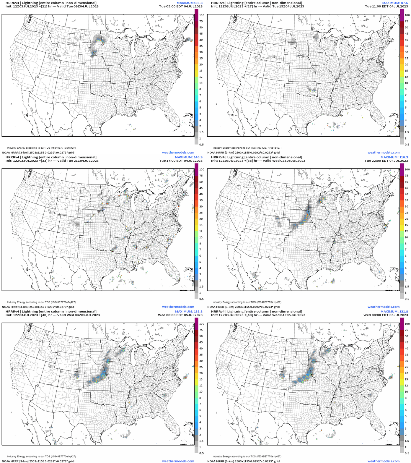
Storms do not need to be severe to produce dangerous lightning.
I’m sure you’re tired of hearing this from me, but it’s important:
If you’re close enough to hear thunder, you are close enough to be struck by lightning. Even if it doesn’t look stormy over your particular location, if you hear thunder, get inside immediately. Cloud-to-ground lightning strikes from the anvil of a storm can, on average, travel up to 12 miles from the storm itself.
This bit of info is especially important on a day like tomorrow where many will be outdoors celebrating.
One more thing to discuss before I wrap it up:
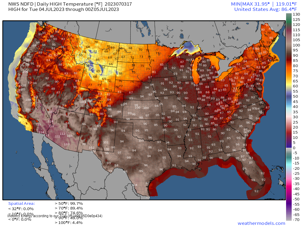
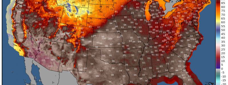
Don’t ignore the heat. Temperatures will be dangerously hot in the Southwest and creeping into the Northwest. Additionally, while temperatures aren’t as hot as they have been recently in the South/Southeast, humidity will make it feel much hotter.
Use caution in how much time you spend outside. Stay hydrated, out of the sun, and as cool as possible. Remember to check on family and friends to see if they are remaining cool as well.
Have a happy and safe 4th! Armando and I will be off spending time with our families tomorrow, but will return to regular blogging and tweeting on Wednesday morning!


