A Significant Summer Severe Threat For The South
While summertime severe threats are nothing unusual, if you’re a frequent checker of the SPC Convective Outlooks, you may have noticed something strange about today’s severe weather outlook.
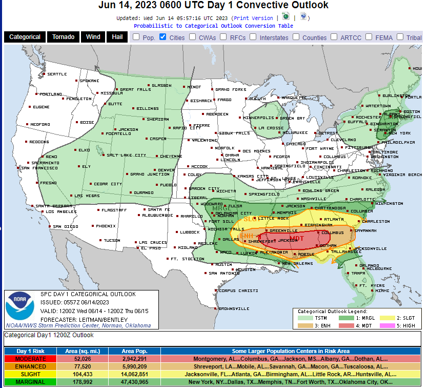
The defined risk areas are centered over the South/Southeastern US. This is rare for a summer day.
Why is it rare? Typically in the summer months, the jet stream has lifted far to the north. It is unusual, then, for this portion of the country to see a system powerful enough to incite organized severe weather. Yes, random summer pop-ups that sometimes become severe are commonplace, but organized severe weather is not.
As Armando mentioned in his blog yesterday, a stationary boundary is draped across this region.
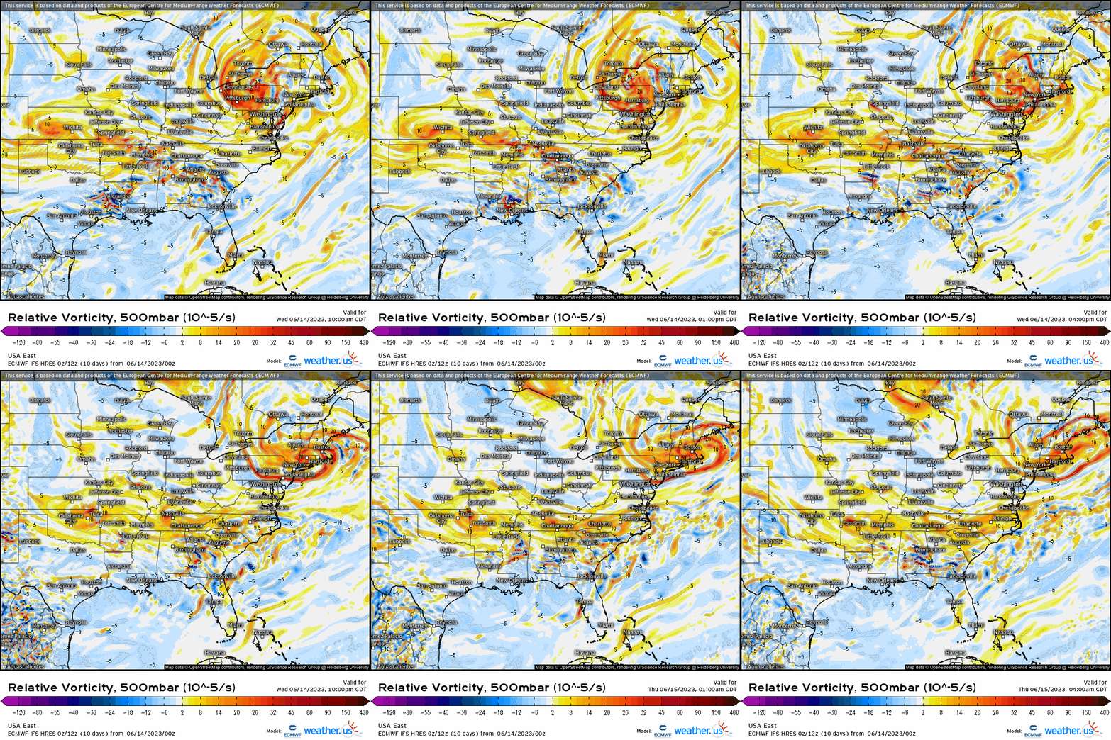
As the day progresses, a series of impulses will travel along this this boundary. These will each be capable of inciting a few different rounds of severe weather. As you can then imagine, today’s threat and timing is complex.
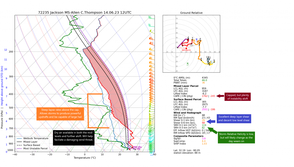
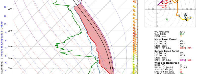
If we take a look at the 12Z observed sounding from Jackson, MS, we can see what factors are currently in place and what still needs a bit of work before a significant severe threat evolves.
- The lower levels are currently capped. We’ll need daytime heating/moisture influx to help erode this cap and allow for storms to become surface based.
- Plenty of instability and steep lapse rates exist above the cap. Storms have enough energy to occur this morning, but would be elevated with hail as the primary threat.
- Shear is sufficient for organizing storms. Wind profiles are a bit unidirectional this morning in the lower levels, but will likely change enough as the day wears on to support a tornado threat.
- Plenty of dry air is available aloft. Additionally, winds in this layer are 50+ kts. These two factors will lead to a significant damaging wind threat later today.
To sum up the expected threats: All hazards are possible today, especially in the afternoon and evening hours.
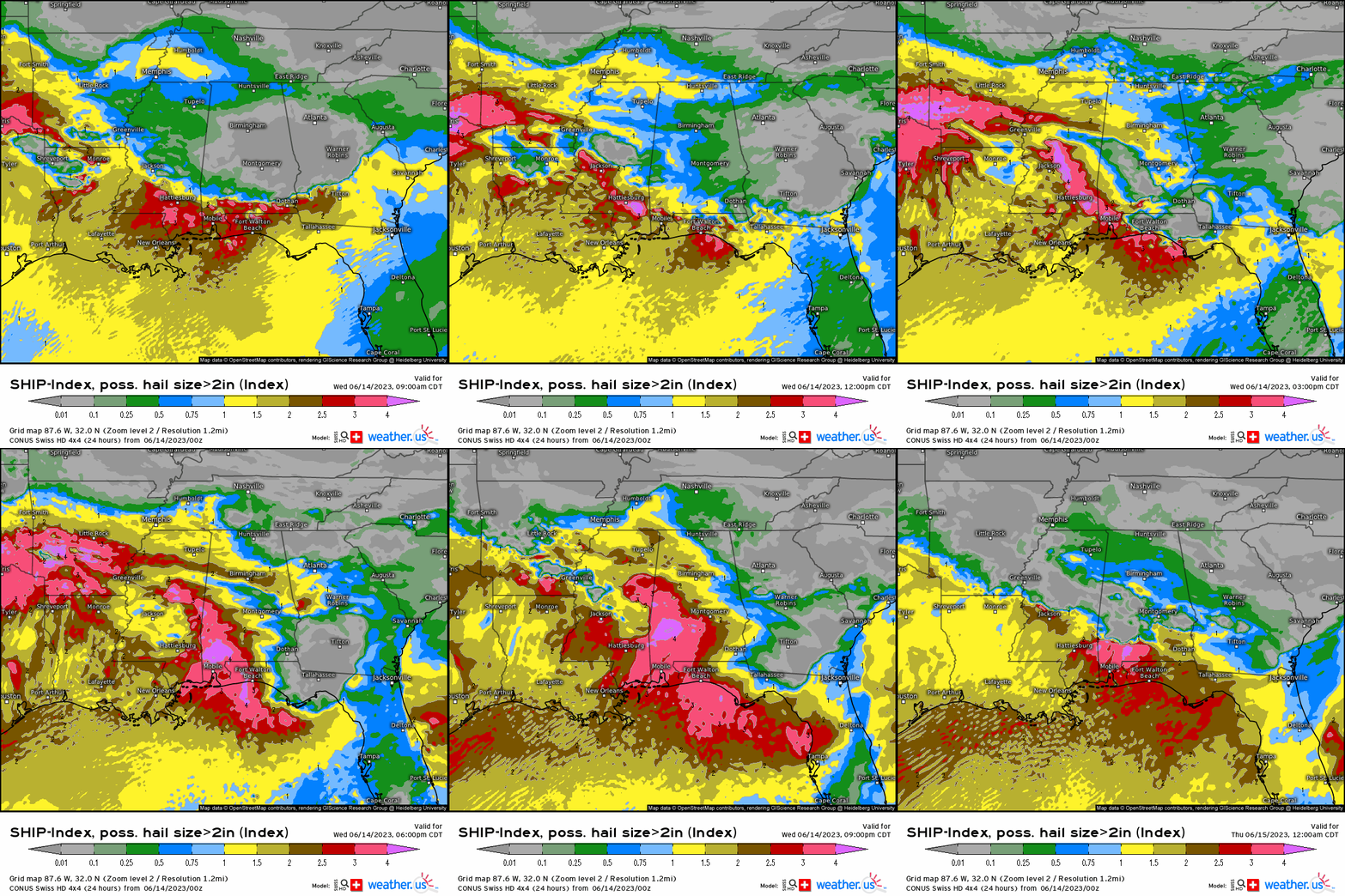
Large hail is possible, especially further west over Eastern Texas and into the lower Mississippi River Valley region.
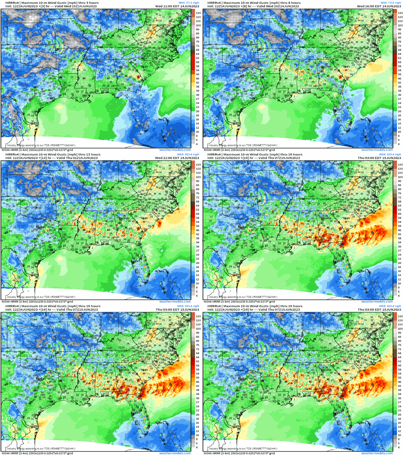
A significant damaging wind threat is expected to evolve. Storms will be capable of winds in excess of 80 mph at times, especially over the Deep South.
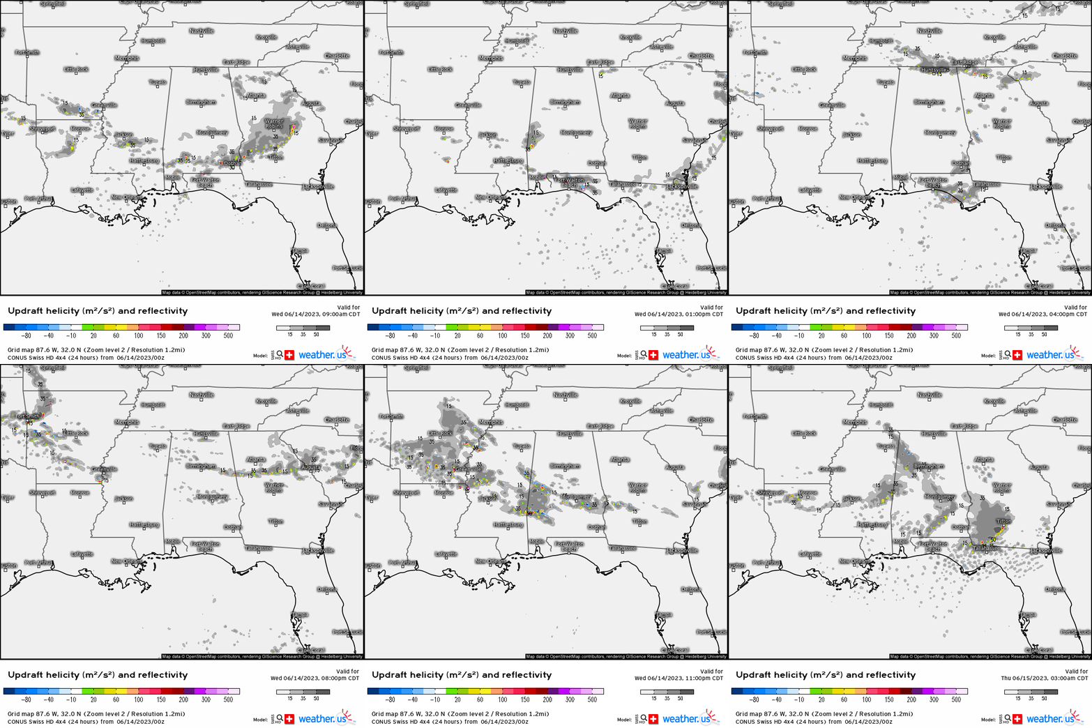
Tornadoes are also possible. A few may be strong, especially over southern Alabama into Southwestern Georgia.
As mentioned earlier in the blog, timing is a bit of a mess today due to the multiple rounds expected.
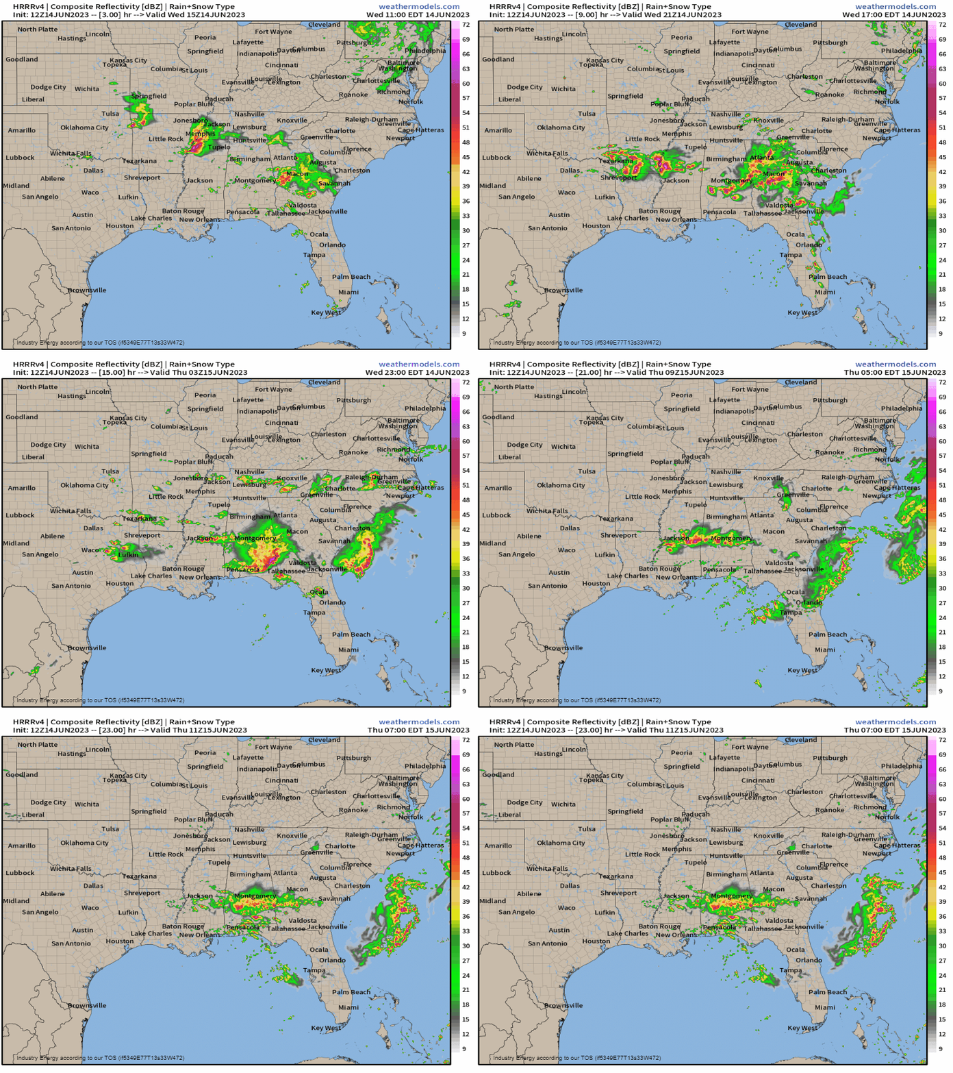
Storms are expected to start firing and quickly become severe over the next couple of hours. However, if you get storms this morning, do not let your guard down. Multiple rounds will be moving through from late morning well into the overnight hours.
Take Action:
- Stay weather aware today. Multiple rounds of storms are expected – this isn’t a one and done event.
- Charge up your devices and make sure you have multiple ways to receive warnings. Your primary source should be a NOAA weather radio with a battery back-up. Wireless Emergency Alerts should be enabled on your phone. Local news station weather apps push out warnings and your local meteorologists will be live on TV if the situation warrants.
- Make sure your safe space is ready to go and your household is familiar with your plan to shelter.
- If you plan to be out and about today, know where you can shelter along your route if the need arises.
- I highly suggest that, considering the damaging wind threat, you shelter for a severe thunderstorm warning as you would for a tornado warning. If winds 80+ mph materialize, they will be capable of significant damage.
- Warn your friends, warn your family. If you know anyone in this region, make sure they’re aware of today’s threat. Spread awareness so no one is caught off-guard.
Stay tuned to your local NWS office and local broadcast meteorologists throughout the day. They’ll keep you up to date on the evolving situation. Be safe!


