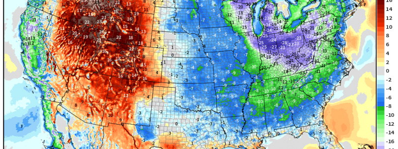
Western Warm-Up Leads to Rapid Snow Melt
While it remains persistently below average east of the Rockies, the western states have been experiencing quite a bit of that springtime warmth.
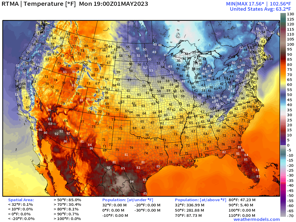
Widespread 70s and even 80s are found all over the Intermountain West region this afternoon.
While the warmth is no doubt welcome after a cold, snowy/rainy winter, this sudden and prolonged warm-up doesn’t come without consequences.
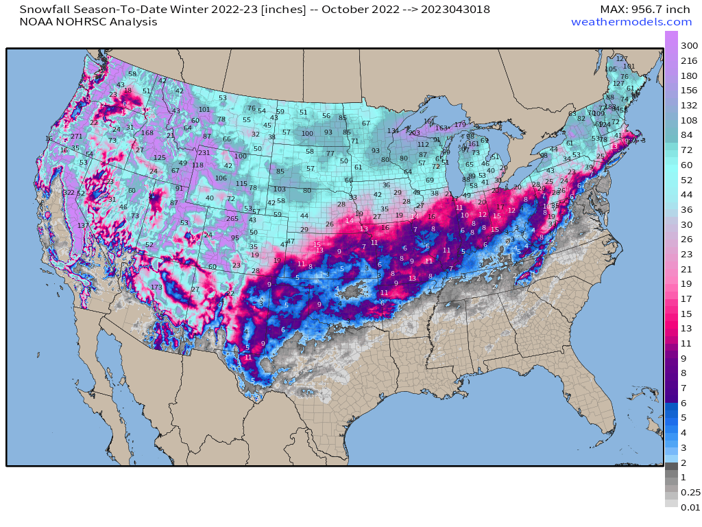
The aforementioned snowy winter has left over 300 inches of snow on some of the highest peaks of the Rockies, Cascades, and Sierra Nevadas. The sudden warm-up the west has been experiencing has allowed for rapid melting to occur. Consequently, river flooding has been a big worry lately.
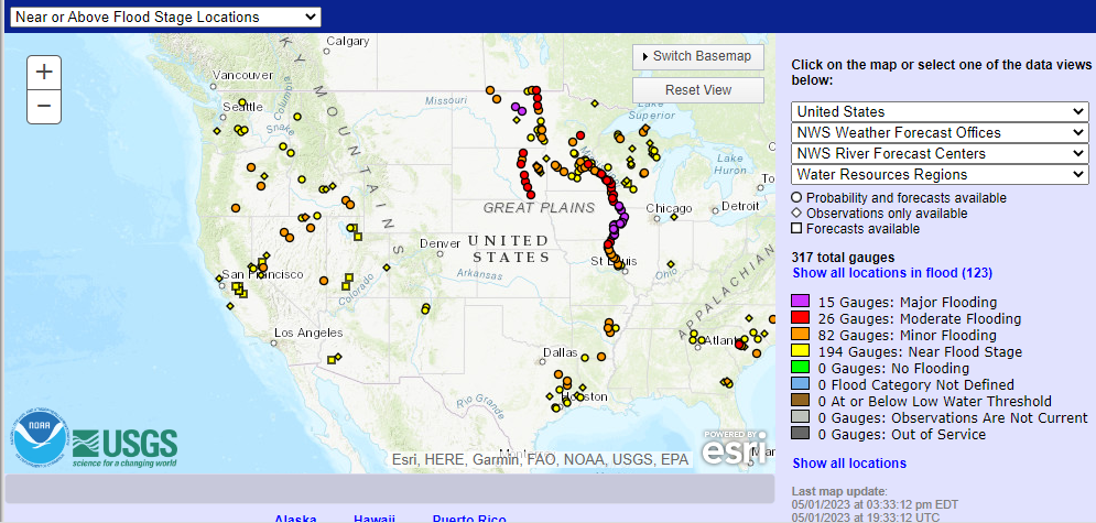
There are already more than a few rivers in this region near flood stage or in minor flooding. As above average temperatures persist into late week, more melt will occur, possibly pushing more stations into minor or moderate flooding.
And, to further complicate the western water situation, a series of systems will begin to bring rain and mountain snow to the western states as early as tomorrow.
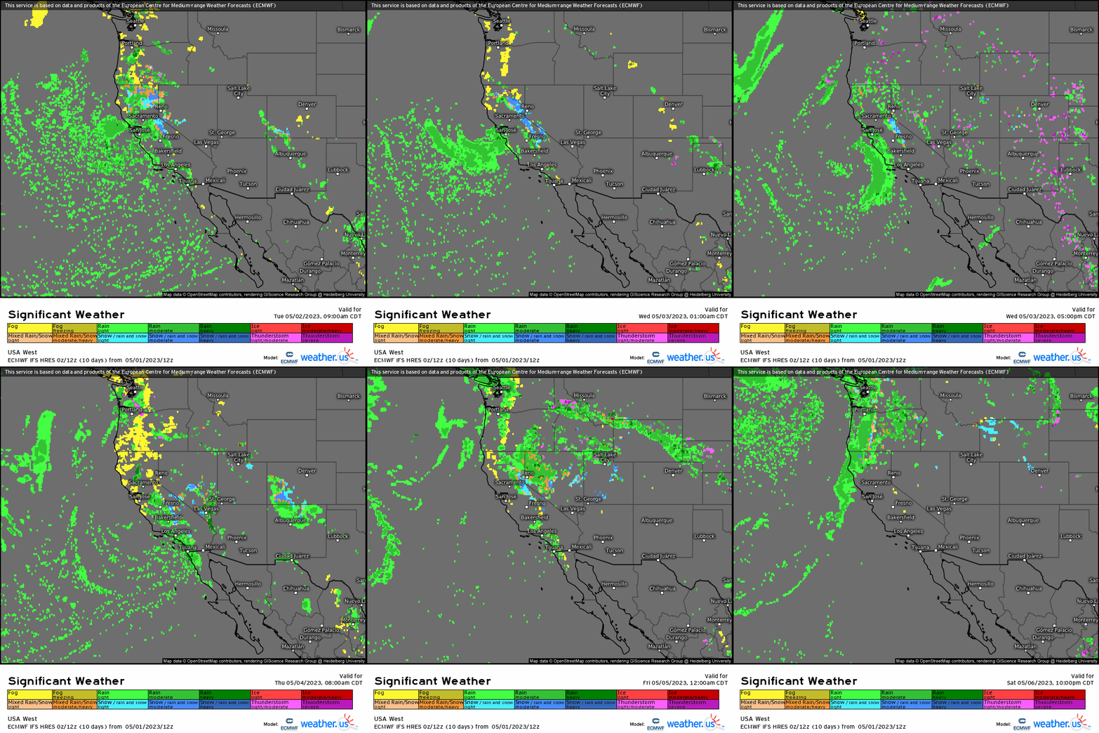
Though the first system will be more of an issue for the Pacific Northwest and California, the second system arriving late week will bring more widespread to the entire West.
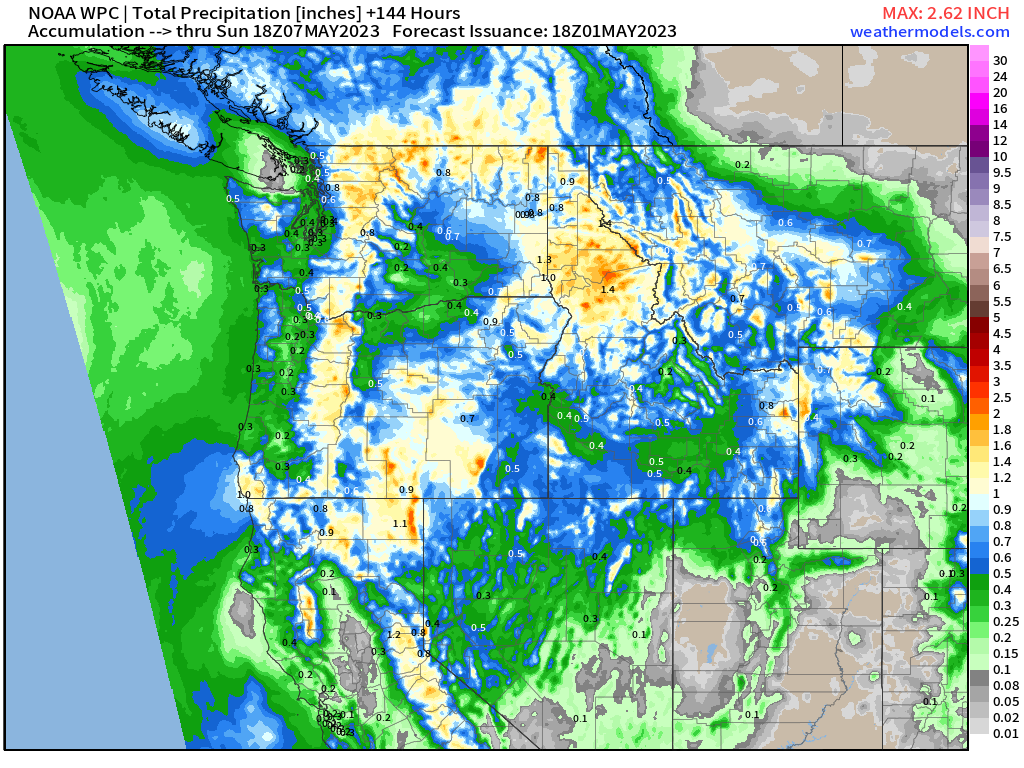
In the end, a widespread half an inch to an inch of precipitation is possible for this region in the next 6 days.
While that doesn’t seem like much in the grand scheme of things, more water coming down on already-swollen rivers doesn’t exactly help flooding subside.
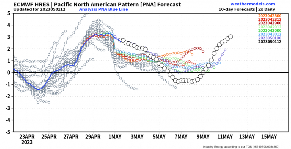
Beyond the next 7 days, additional systems may pass through with more precipitation for the region as the PNA is forecast to become neutral/slightly negative (this would lend to western troughing, eastern ridging). But if it reverts to the positive phase once again closer to mid-month, another warm-up could be in the forecast.
How warm? Too early to tell. It’s worth monitoring as we move through the first half of the month.


