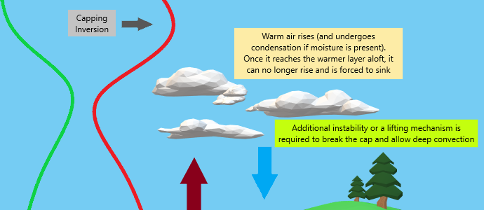
Capped
As we approach that time of year where severe threats subtly shift toward a more frequent appearance in the Plains states than the South/Southeast, it’s important to understand the role of the capping inversion and how it can serve to enhance severe weather or cause a “blue sky” bust.
Perhaps you’re well acquainted with this term. If not, I’ve prepared a homemade explainer graphic to illustrate the concept.
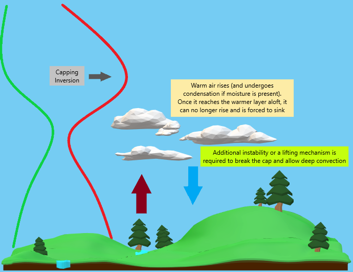
A capping inversion occurs when a layer of warmer air is present aloft. This happens often in the Plains states when warm, dry air from the Desert Southwest is advected into the region.
As the atmosphere heats up, air warmed at the surface begins rising. If enough moisture is present, it will produced clouds when it reaches the point at which the air is saturated. When a capping inversion is present, this level is often found right underneath the cap.
The rising, now saturated air eventually hits the capping inversion, a layer that is warmer, sometimes significantly, than the air below it. Air cannot rise into another layer of air warmer than it, so it is forced to sink. In a situation like this, you’ll often see rows of fair-weather cumulus clouds aloft with clear channels between them.
This process continues until enough instability builds up underneath, the air below is heated past the temperature of the cap, or a lifting mechanism (like a cold front or dryline) comes along to force the air through the cap.
Once the cap is eroded away or broken through, if all other atmospheric conditions are correct, deep convection can now occur.
In situations where there isn’t enough instability added, day time heating, or there is no forcing mechanism, the cap remains in place and no deep convection occurs – hence the term “blue sky bust.”
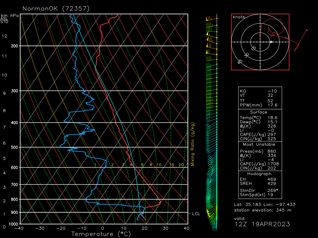
We are seeing this issue today in the Southern Plains region where a very strong cap was in place this morning, as seen on the observed 12Z sounding out of Norman, OK.
Further north in the Central Plains into the Missouri River Valley, the cap, though also rather strong, is not expected to an overwhelming issue.
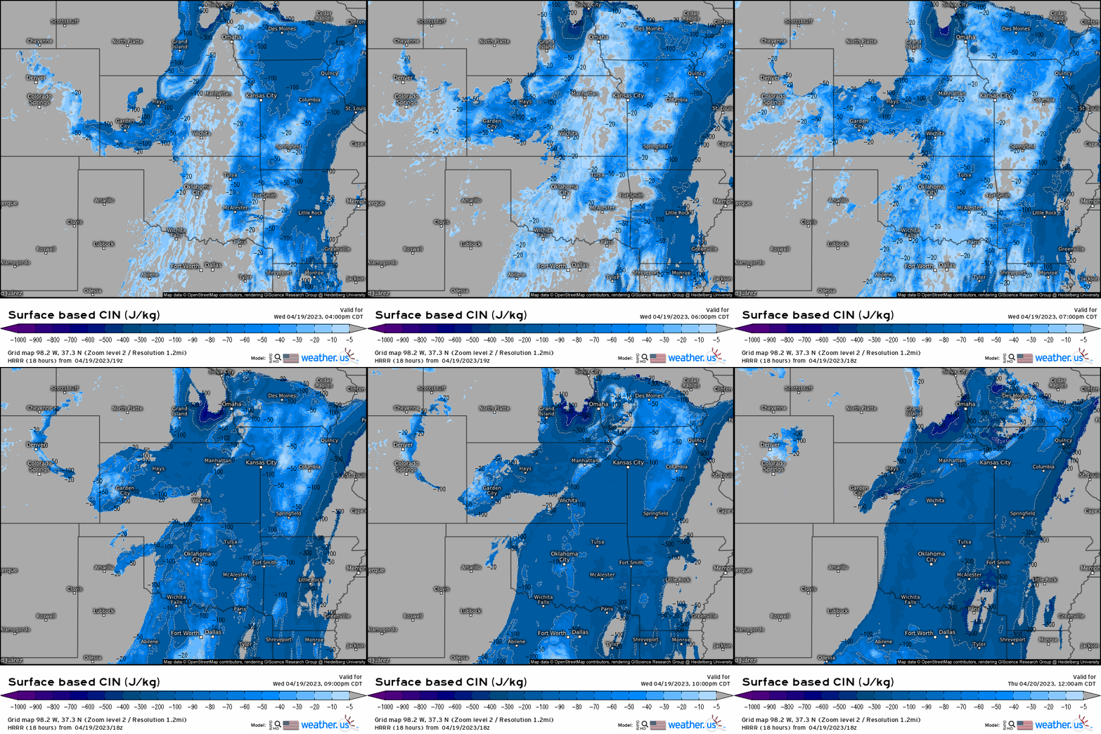
The latest model data from the HRRR shows a somewhat weaker cap in place over the Southern Plains this afternoon while it has nearly eroded across portions of the Central Plains.
The Central Plains region is located closer to the low and better forcing from both the warm front and the incoming cold front. The Southern Plains region is further way from good forcing and is relying on the dryline as its source of additional lift.
The question here is will that dryline provide enough of a boost to break through the cap before it builds back in stronger as evening falls and the boundary layer becomes more stable?
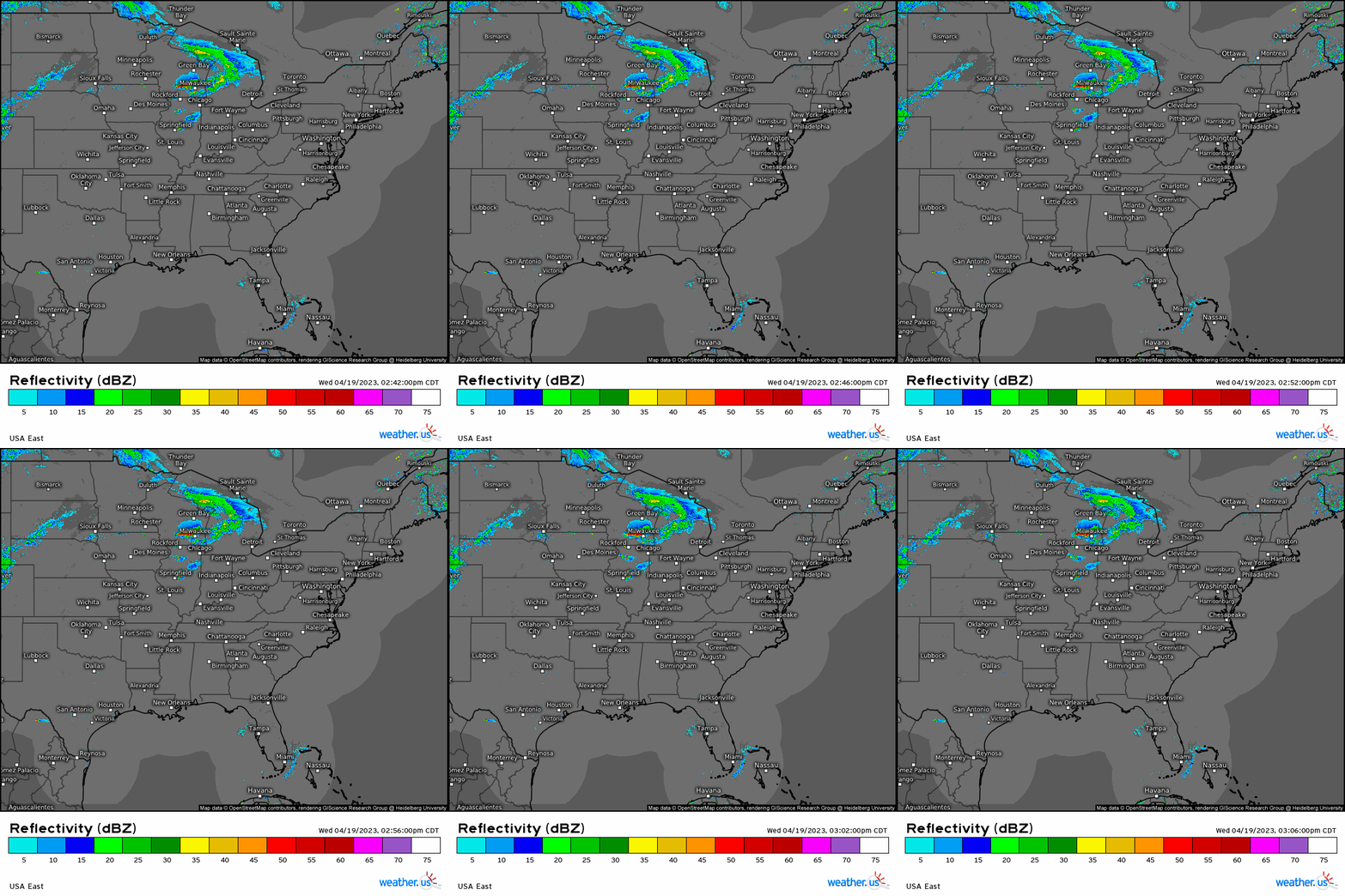
As of right now, not much is happening in the Southern Plains. However, if you’ll check out the Central Plains in Nebraska/Kansas, you can see faint returns that seem to be indicating the cold front on the move. We will likely see some action developing east of here shortly.
While the cap may leave us with a blue sky bust further south, if storms ARE able to form, they could be powerful.
Large hail and a few tornadoes are possible for both areas of concern, but the Central Plains/Mid-Missouri Valley have a significant risk of damaging winds in addition to the other two hazards.
Take Action:
- Severe weather is expected today across the Central Plains/Mid-Missouri Valley and possible in parts of the Southern Plains (mainly Western Oklahoma and North-Central Texas).
- Have your weather radios on and ready to go along with at least one other reliable way of receiving warnings.
- Though tornadoes are not the primary risk, they are possible. Be ready to shelter if necessary.
- Consider sheltering for a severe thunderstorm warning as well, especially in the northern portion of the risk area as significant winds are possible.
- Large hail is expected. Park your car under shelter if possible.
- Raise awareness. If you know anyone in the risk areas, make sure they’re aware of the potential for severe weather this evening.


