Return To An Active Pattern
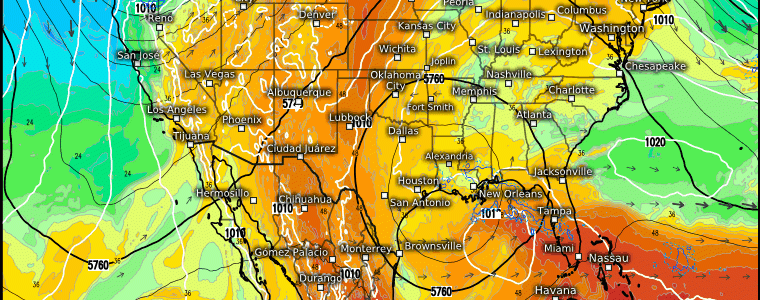
Warm, tranquil conditions continue for many today as a strong ridge remains in control over much of the US.

Temperatures as much as 30 degrees above average exist over the more northern reaches of the country today. The exceptions to this delightful spring weather are the Gulf Coast and the Pacific Northwest, as we’ve discussed in multiple blogs this week.
All good things must come to an end, though. By Friday, a large-scale system will be rolling across the country, bringing back unsettled weather and the potential for severe storms.
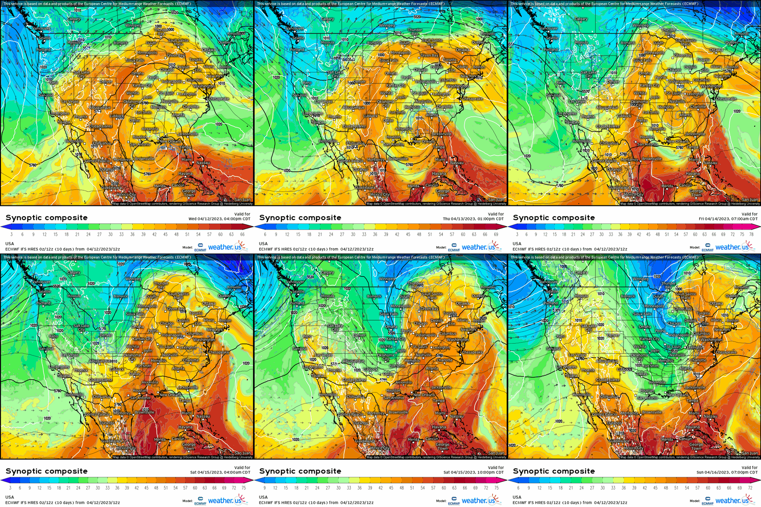
As a trough rolls eastward, a surface low is expected to materialize in the lee of the Rockies. Ahead of this low, abundant moisture will be moving into place over the southern/central Plains region.
Though details aren’t too clear just yet, a classic dryline set-up seems likely.
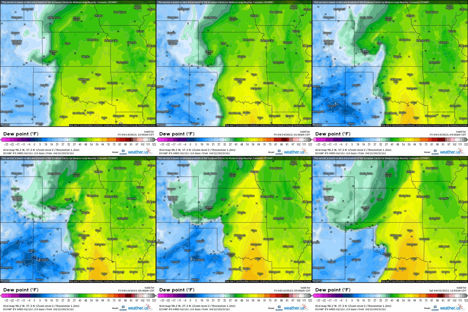
As the low develops and strengthens, moisture streams northward ahead of the front. Behind that, the dryline (boundary between drier air and more moist air) will sharpen and move eastward. This will provide a lifting mechanism for storms to fire from.
Despite abundant low level moisture, this additional lift will be needed as a strong capping inversion is forecasted to be in place.
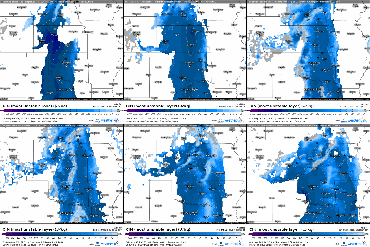
The extra lift should provide enough of a boost to allow a few storms to break through the aforementioned cap and quickly take advantage of the atmosphere before it stabilizes again during the nighttime hours.
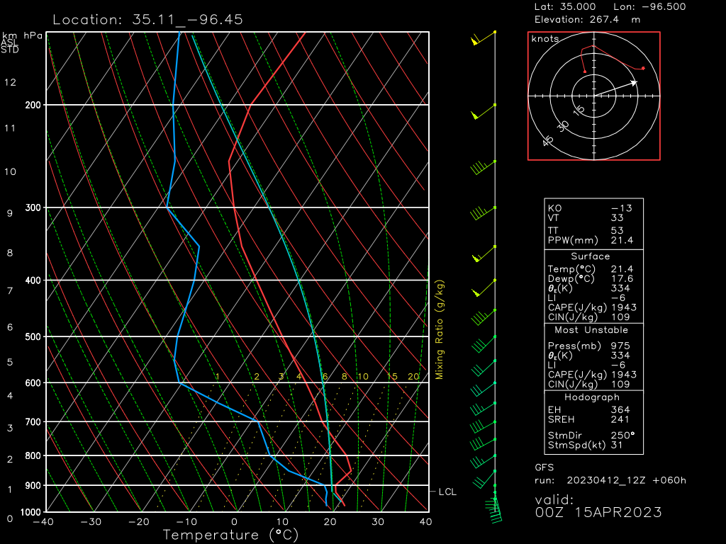
Pulling a sounding from the area with the greatest risk along the OK/TX border, we can get a sense of what may be possible in terms of expected hazards.
- As mentioned, a strong cap is present. Extra moisture/heating/lift will be required to break through.
- Speed shear isn’t that great, but low-level directional shear is. If storms are able to break the cap and organize, tornadoes are possible.
- Above the cap, plenty of CAPE is modeled, as are fairly steep lapse rates. This should help storms strengthen quickly and also introduces a very large hail threat.
- Dry air is available to entrain into updrafts in the mid-levels. However, wind speeds in this layer aren’t terribly impressive. Any wind threat may be on the lower side unless stronger mid-level wind speeds materialize in later forecasts.
For now, Friday’s severe weather threat seems to carry a main hazard of very large hail with the potential for some damaging winds and a few tornadoes. It’ll come into better focus in the next day or so.
This threat will persist into the Mid/Lower Mississippi River Valley region on Saturday, but details are still in the works. We’ll discuss this one in a couple days.
Take Action:
- A return to an active pattern happens as the weekend begins. Severe storms are possible in the Plains on Friday, the Mississippi River Valley on Saturday, and potentially the Ohio Valley/Mid-Atlantic on Sunday.
- Monitor the forecast for your specific area so you know when to be prepared.
- Make sure your ways to receive warnings are working and ready to go should you need them.
- Warn your friends, warn your family. If you know someone in the risk area, alert them to the possibility of severe weather so they can be as prepared as possible ahead of time.


