So Much Water
As you may already know, California has had a phenomenal wet season this time around. A switch seemed to flip just after Christmas and a parade of storms/atmospheric rivers have inundated the state weekly (if not multiple times per week) since.
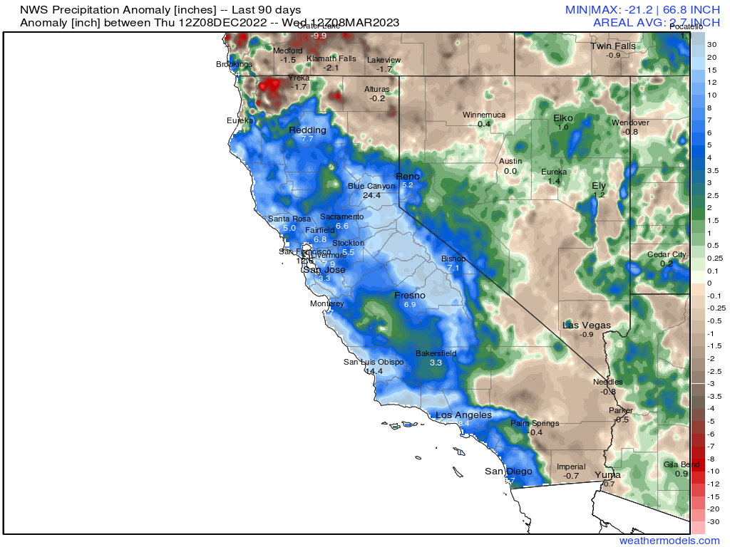
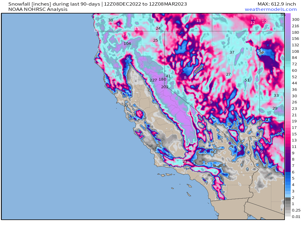
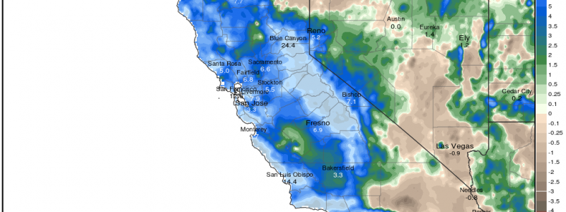
Much of California has received several inches over their average measured precipitation in the last 90 days. The current total snowfall in the mountains across the state is around 200% of normal. All this water has made a huge dent in long-standing drought conditions.
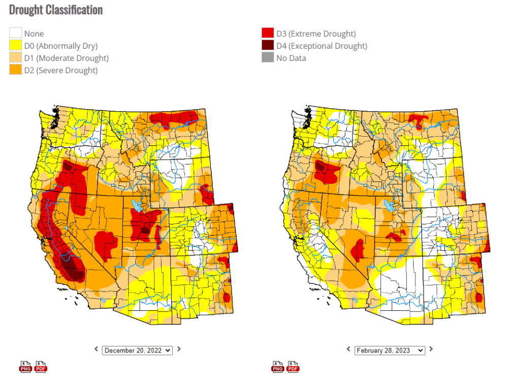
In fact, both the Extreme and Exceptional levels of drought that were prevalent in the state before Christmas are now completely absent.
Much of the state is still technically in drought. “How can that be?” you may ask. Well, we need to realize that before this season, previous drought conditions were the result of multiple years of well below average precipitation. In fact, the lingering presence of drought conditions around the state is a testament to just how dry conditions were before this season. If a wildly above average year can’t fix it, we know circumstances were truly dire.
And there’s more to come. The fire hose, so to speak, has not been shut off just yet.
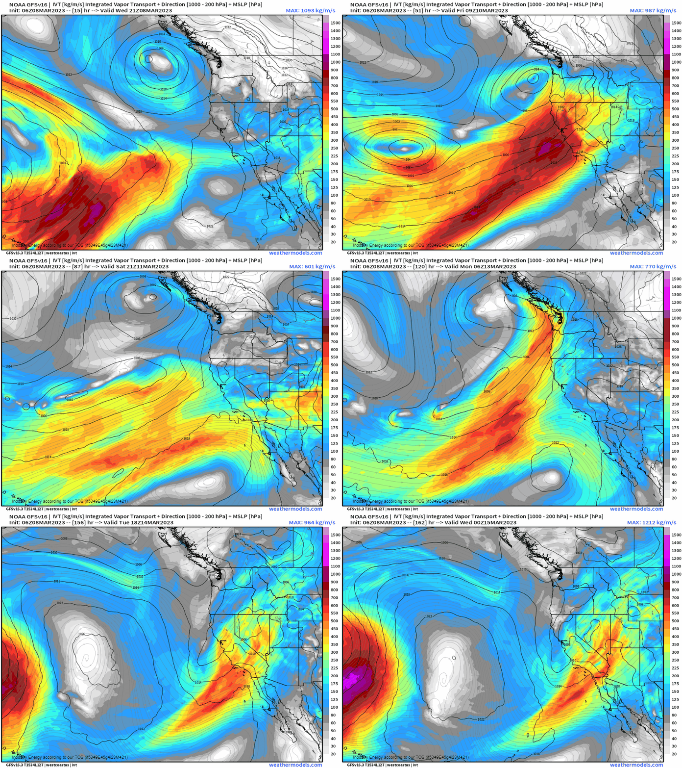
A potent atmospheric river is expected to begin impacting California by tomorrow. Another seems likely by the end of the weekend/beginning of the work week.
Heavy rain and mountain snow will once again be on tap for the state.
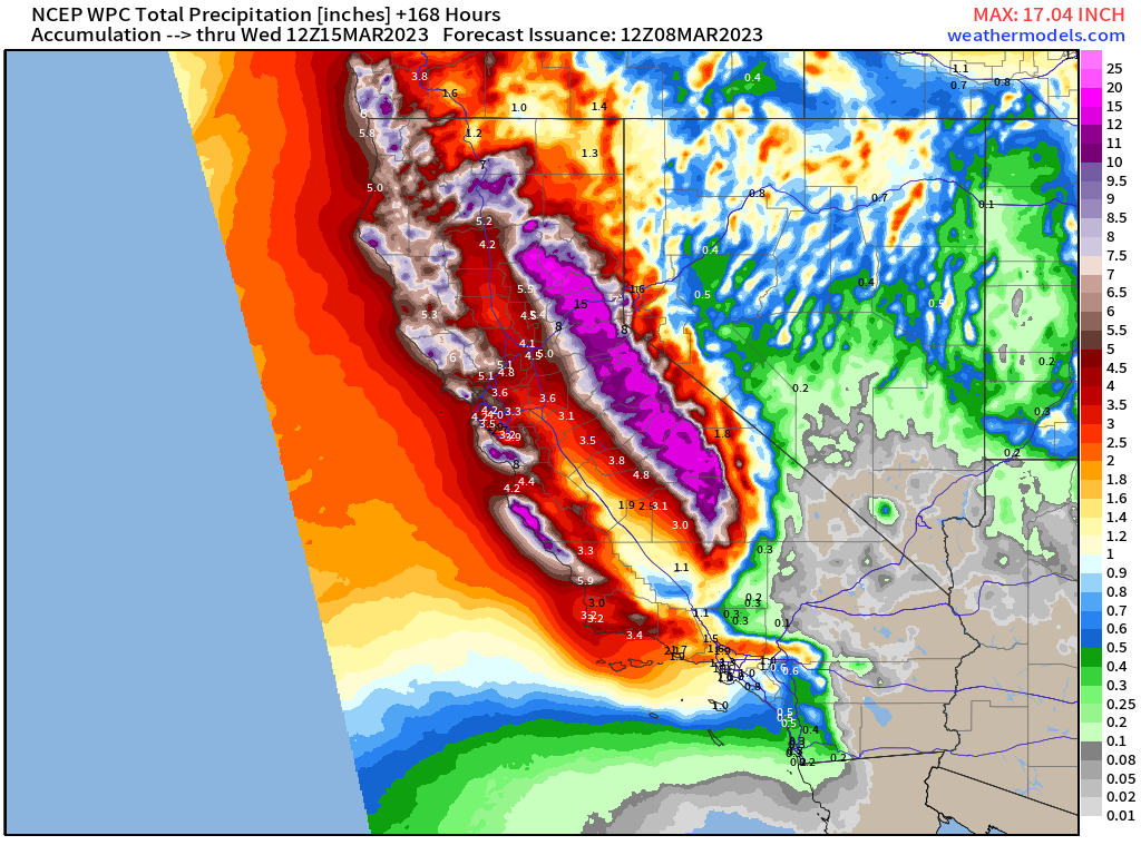
Between these next two events, widespread totals of 3 to 5 inches over 7 days seem possible for the coastal regions. Slightly less – on the order of generally 1 to 3 inches – is on tap for the central/southern valleys. For the higher elevations, snowfall will once again be measured in multiple feet.
As one might imagine, all this precipitation has really kept the ground saturated:
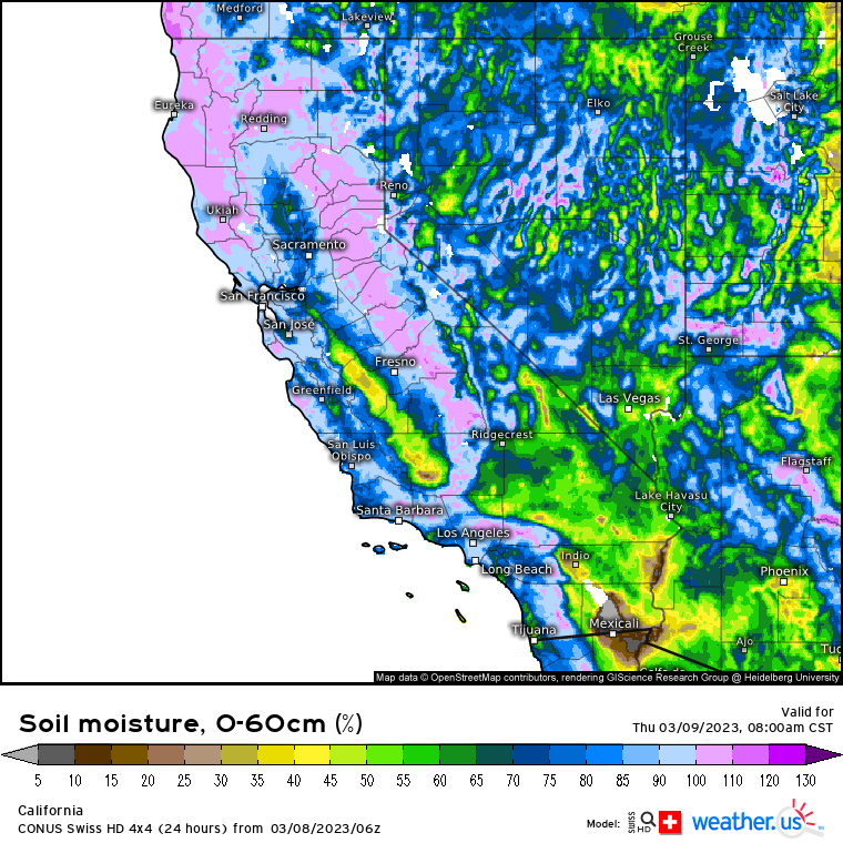
Or perhaps even oversaturated – especially in the coastal regions that tend to receive the most rain.
So, with two heavy rain events in sight over the next 7 days and soil that is already nearly- to over-saturated, it follows that flash flooding may become a serious issue once again.
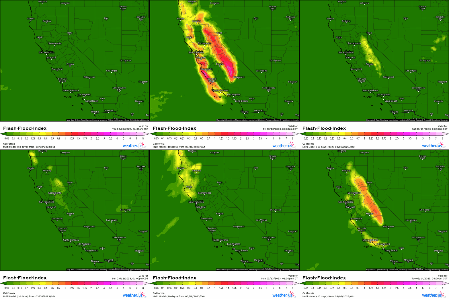
Flash flooding could impact urban areas, allow fast-rising water in creeks and streams, wash out roads, and enable debris flows or mudslides.
Use extreme caution in the upcoming days:
- If you reside in a vulnerable area, do what you can to protect your property but also know when you need to evacuate (if necessary).
- Never drive through flood waters. It may be impossible to tell how deep the water actually is or if the road is washed out underneath it.
- Avoid mountain travel where rockslides and mudslides are more likely.
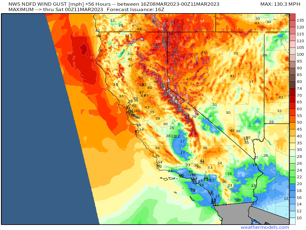
Finally, gusty winds will be a concern on top of antecedent soggy conditions and incoming heavy rain. Trees may fall, causing damage to homes and cars along with power outages. Make sure you’re stocked up on any supplies you may need to get by without power if outages do occur!


