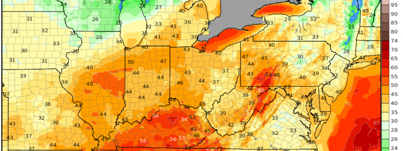
Windy With A Side of Severe Weather
Last night’s severe weather has settled down, so to speak, for the moment. While heavy rain continues and flash flood warnings remain active in the Mid-Mississippi River Valley Region, no severe thunderstorm or tornado warnings are currently active.
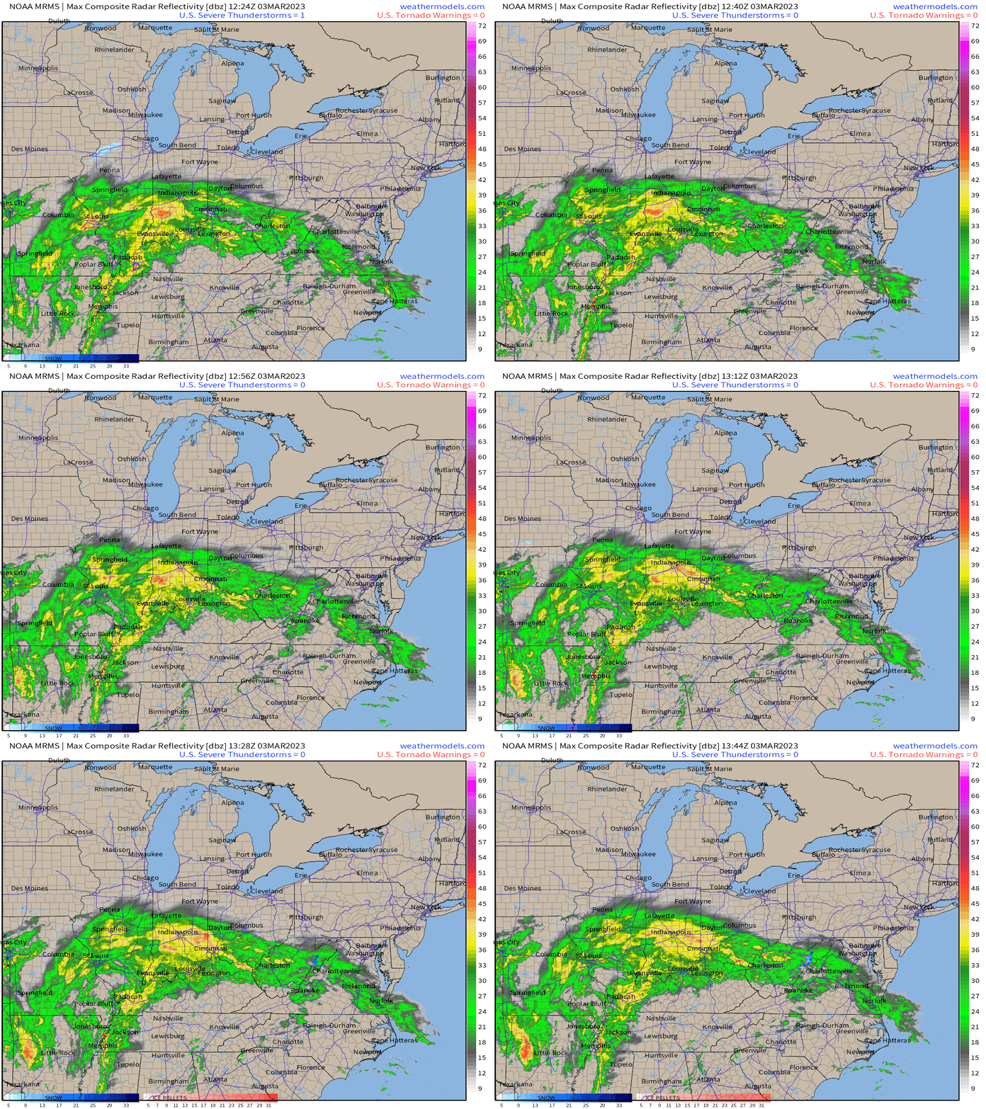
That does not mean the event is over, however. A renewed threat is expected to materialize later this morning and last through the evening hours.
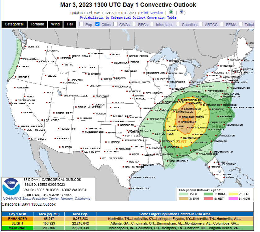
While better moisture will be further south over places like Alabama and Georgia, the better forcing will be closer to the center of low pressure. As the low escapes northeastward, it will track through the Midwest.
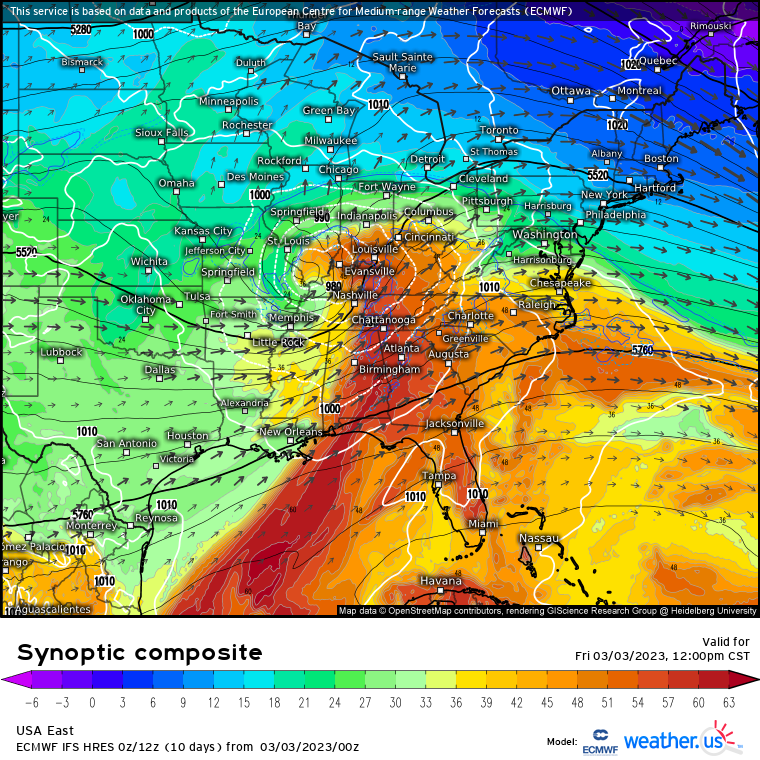
This places the Ohio and Tennessee River Valleys in the “bullseye.” Adequate moisture combined with a location closer to the greatest lift means these regions have the best chance of seeing severe weather today.
What kind of hazards are we looking at, though?
Well, first let’s address one that will exist with or without storms today: wind. That’s the top story today.
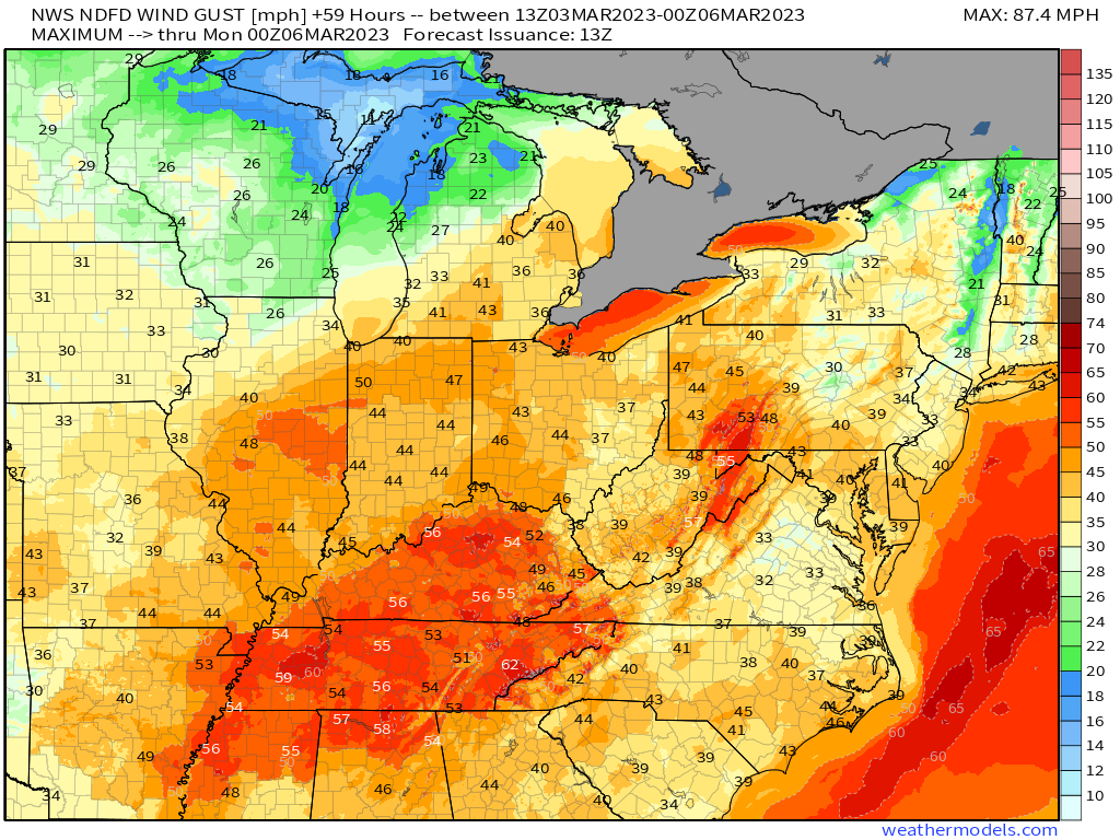
Pressure gradient winds will be roaring today, especially over the aforementioned regions. Sustained winds of 25 to 40 mph with gusts possibly exceeding 60 mph are likely. Much of this region is under a high wind warning – a type of warning that is rather rare for this region, specifically outside of the higher elevations.
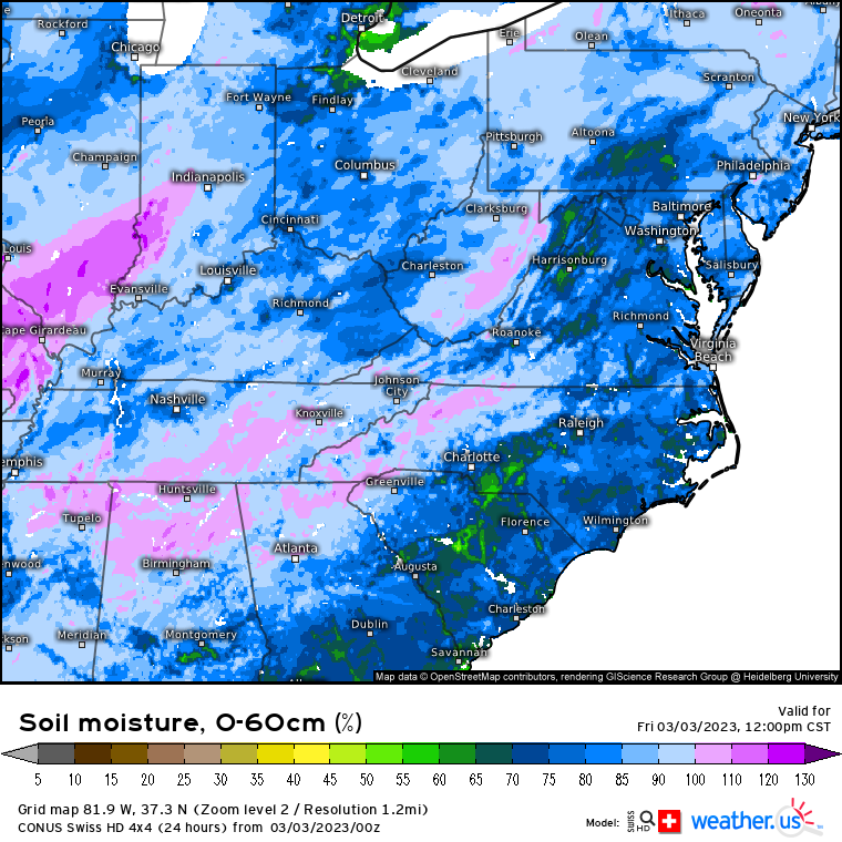
High winds on their own can cause damage, but compounding this problem is the soil moisture content of this region.
Multiple rain events have been seen in this region over the past few weeks with very few dry days in between. As a result, the soil is (over)saturated. Trees fall much easier when their roots have been loosened by soggy conditions. So, based on these two factors alone, power outages and damage to homes/cars/etc are possible even if no severe storms roll through.
Moving on to hazards expected once severe storms do materialize:
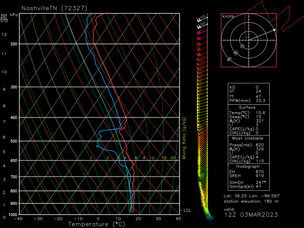
The 12z observed sounding from Nashville:
- Shows an environment that is already highly sheared. Low level directional shear is especially good with winds backing from the southeast. Tornadoes are a possibility.
- Speed shear is also good, with strong winds in the low levels and even stronger winds aloft.
- Dry air exists in the mid-levels and is available to entrain into updrafts, posing a damaging wind threat. Winds in this layer are roughing 75 to 80 kts at the moment, so any wind threat could be fairly intense.
- Lapse rates are not great. There is no solidly cold air aloft. A steady cooling with height helps storms strengthen.
- At 12z, there was very little CAPE available. That may change with moisture transport and breaks in the cloud cover. However, this event will be strongly forced and highly sheared, which could make up for a lack of CAPE.
So for those keeping track: damaging winds and a couple of tornadoes are possible today.
As far as timing goes:
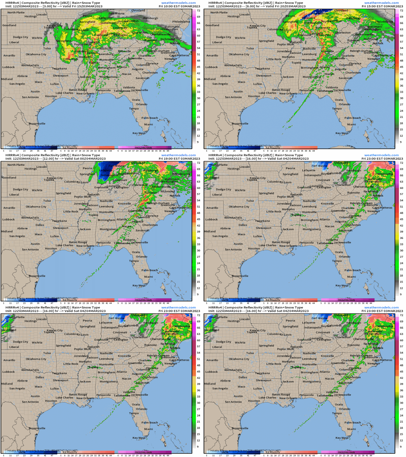
The line, which is currently sort of messy and weak, should begin to reorganize and “sharpen” as it reaches a more favorable environment by late morning/early afternoon. Strong storms will be possible from this point through the evening hours. The line will weaken with eastern extent and loss of instability/entering into less favorable conditions.
Take Action:
- Weather radios should be ready to go as well as at least one other way to receive warnings.
- Know your plan to shelter and be ready to use it if need be.
- It will be extremely windy even if no storms are occurring. Keep your devices charged. Trees may fall, causing power outages. Additionally, avoid being outside in an area with a lot of trees. Branches, limbs, or even whole trees may fall, resulting in injury.
- Some of this threat occurs during the evening rush hour. If you’re traveling home at that time, know where you can shelter along your route if the need arises.


