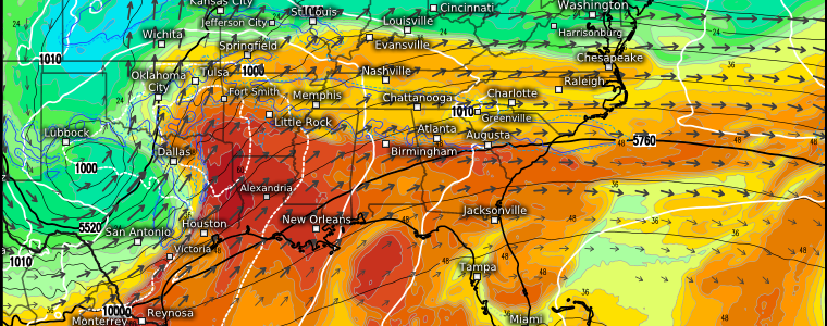
Spring Severe Season Has Arrived
It’s the first day of meteorological Spring and the atmosphere seems to know it. Over the next three days, some of us will face a bonafide spring severe weather event.
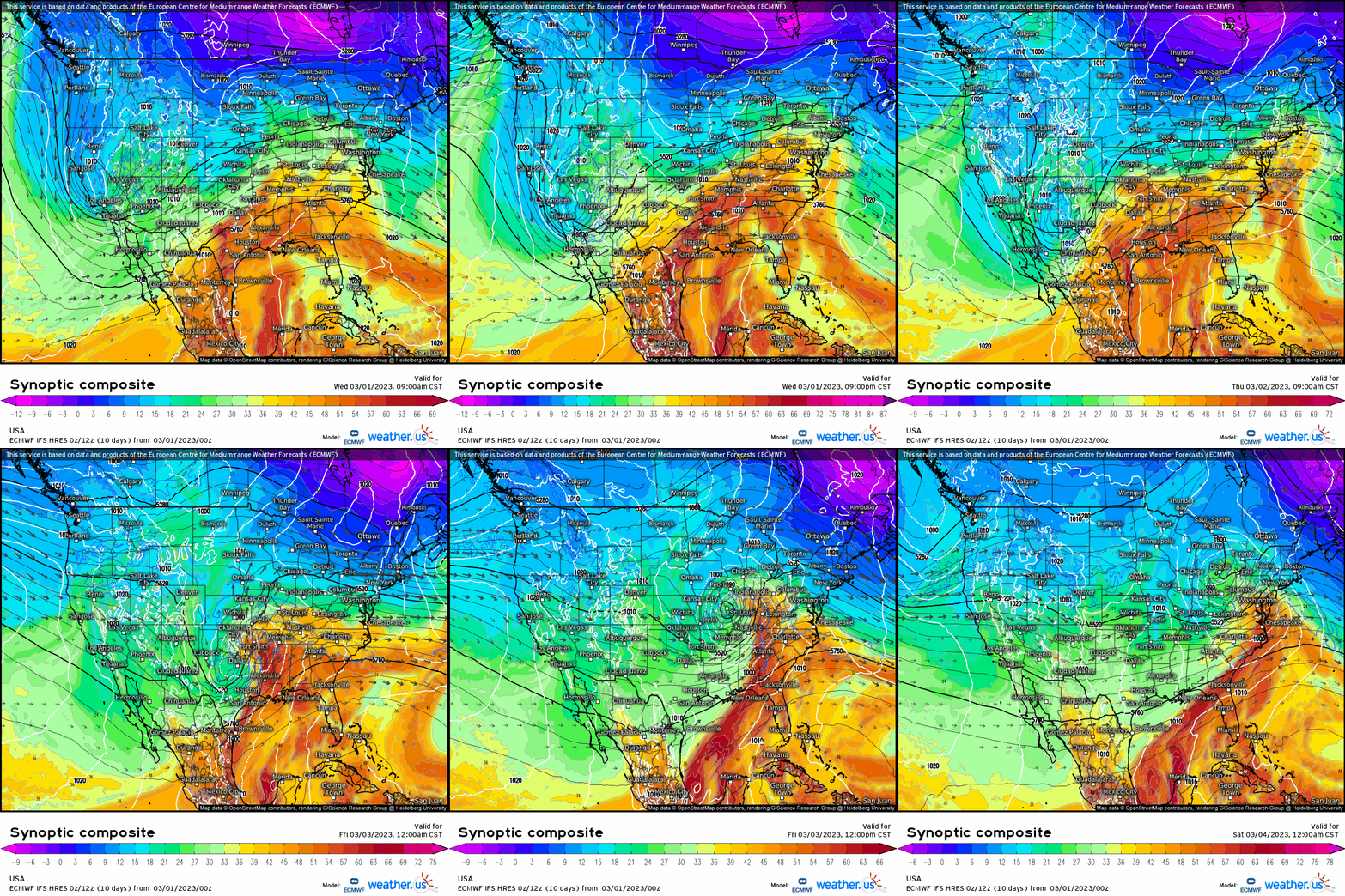
At the synoptic level, a powerful trough is moving steadily eastward from the West Coast. The trough – which is currently positively tilted – will dig southeast into the Desert Southwest where it will take on a neutral tilt. As it begins to lift out to the northeast on Thursday, it becomes a powerful, negatively-tilted trough and the main instigator for a potent round of severe weather.
The scenario we have ahead of us for the next three days is a complex one, so I’ll address each day separately below.
Wednesday
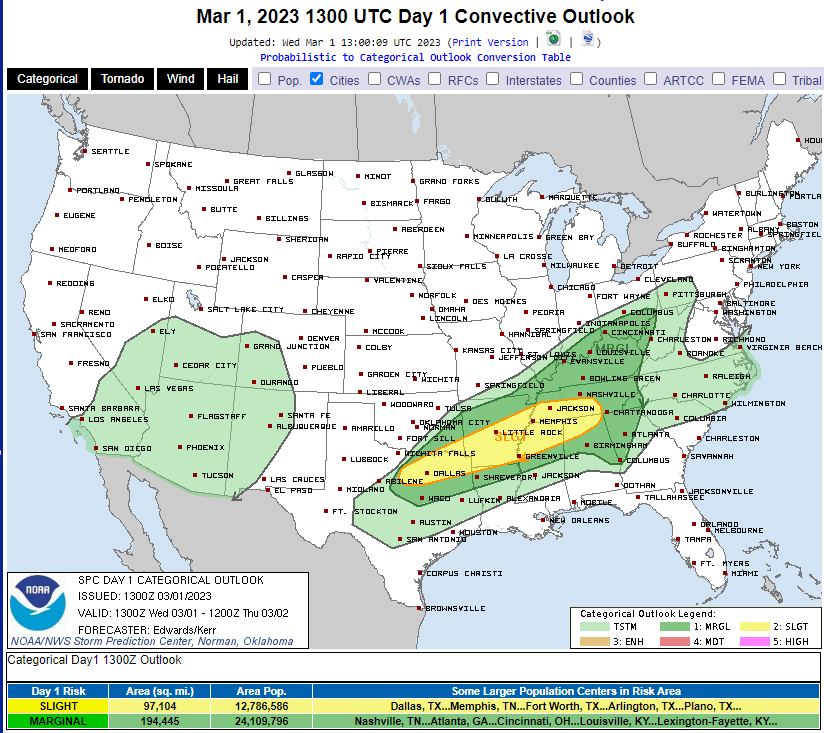
Today’s severe weather threat is not the main event, but rather a sort of “pre-show.” The dynamics in play today have nothing to do with the trough currently over Southern California. Instead, a sluggish cold front draped across the mid-section of the Eastern US will merge with a northward-moving warm front from the Gulf. This is expected to lead to the development of a weak system.

If we look at the 300 mb chart, we see a broad area of diverging flow becoming better defined as we move into this evening. Remember, diverging flow aloft leads to rising air at the surface – an ingredient needed for storms.

Though a few storms are already underway in Texas where warm, moist air is already in place, southerly flow will allow moisture to spread as far northward as the Ohio Valley by this evening allowing for at least some weak destabilization over a broad zone. Best chances for severe weather will be where the better moisture remains – mainly in a line from Eastern Texas through the Tennessee Valley.

Capping will remain an issue today as widespread cloud cover limits daytime heating. Storms will likely be widely scattered with multiple rounds of formation and dissipation from West to East in the target zone today as breaks in the cloud cover allow for a little extra erosion of the cap. Later tonight, they will become more widespread but less severe.
As far as hazards go, large hail and damaging winds will be the main threats. Large hail is more likely in the western reaches of the target area as lapse rates will be much steeper. A few tornadoes are at least a possibility as well, given the shear expected to be in place.
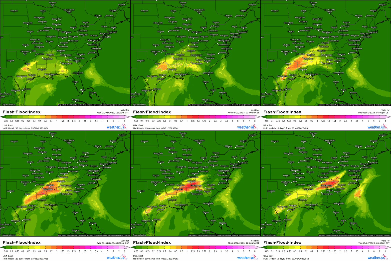
Additionally, as convection meets up with the boundary I mentioned in the beginning of this section and begins to train along it, flash flooding becomes increasingly possible. This region has seen quite a bit of rain recently with few dry days in between. Antecedent soggy conditions and heavy rainfall rates won’t allow for adequate absorption into the soil. Be aware of this threat if your location floods easily.
Thursday
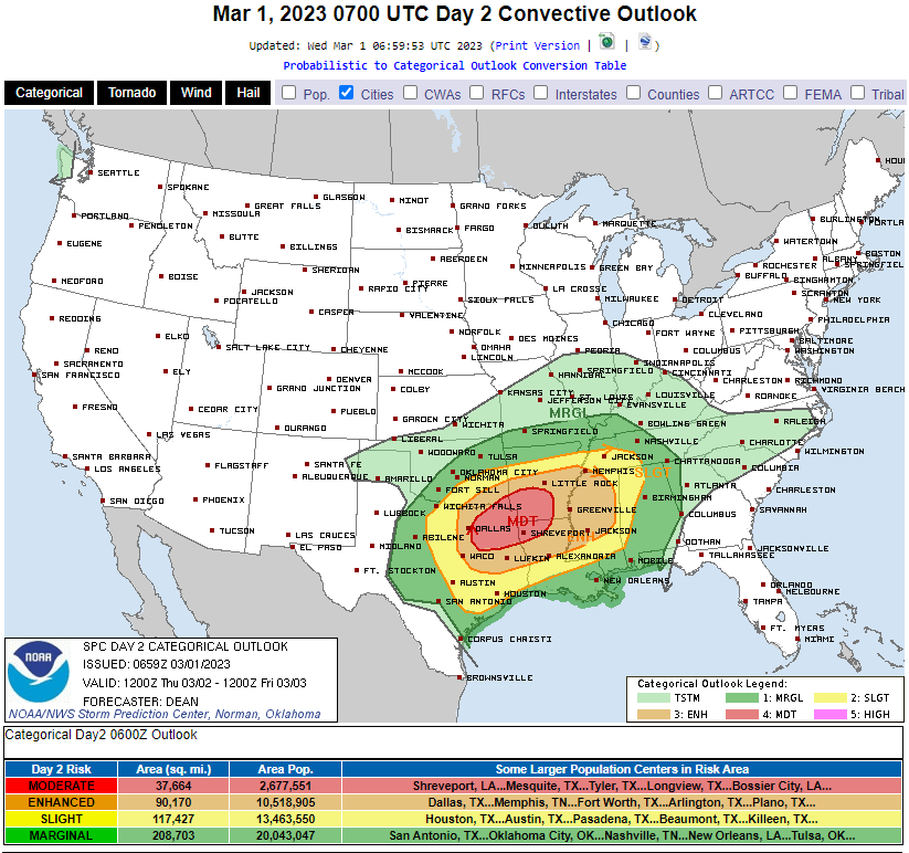
As you can see from the above graphic, Thursday is expected to potentially be the most explosive – in terms of severe weather – day of the next three.
This is when the trough I discussed in the beginning of this blog arrives. It will be bringing strong forcing to an already-primed atmosphere.
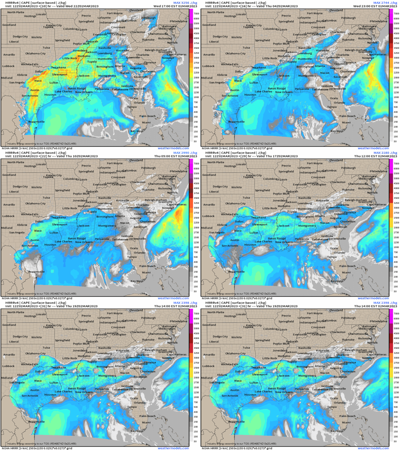
Though storms in this area that occur today will “use up” some of the available energy, the atmosphere will recover quickly ahead of the next round on Thursday. As the surface low associated with the trough forms and deepens, the low-level jet will intensify quickly, flooding this region with moisture.
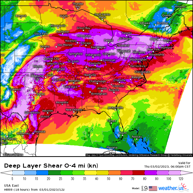
By the afternoon hours, the approaching front will move into an atmosphere that is both sufficient unstable and highly sheared. All hazards are on the table for tomorrow: tornadoes (a few strong), damaging winds, and large hail.
The main convection will be a strongly-forced line expected to materialize by late afternoon/early evening. However, both open warm sector development and development ahead of the front are possibilities, though the former seems uncertain at the moment. If this were to occur, it is in these pre-frontal or open warm sector cells that the highest threat for strong tornadoes will be found.
As the line develops, the more widespread threat will become damaging winds, although embedded supercells in the line can and likely will allow for a few tornadoes, especially given the high shear environment.
Additionally, heavy rain over saturated ground will lead to a fairly significant flash flooding threat, especially in the Mid-South region where moisture lingers from Wednesday’s storms.
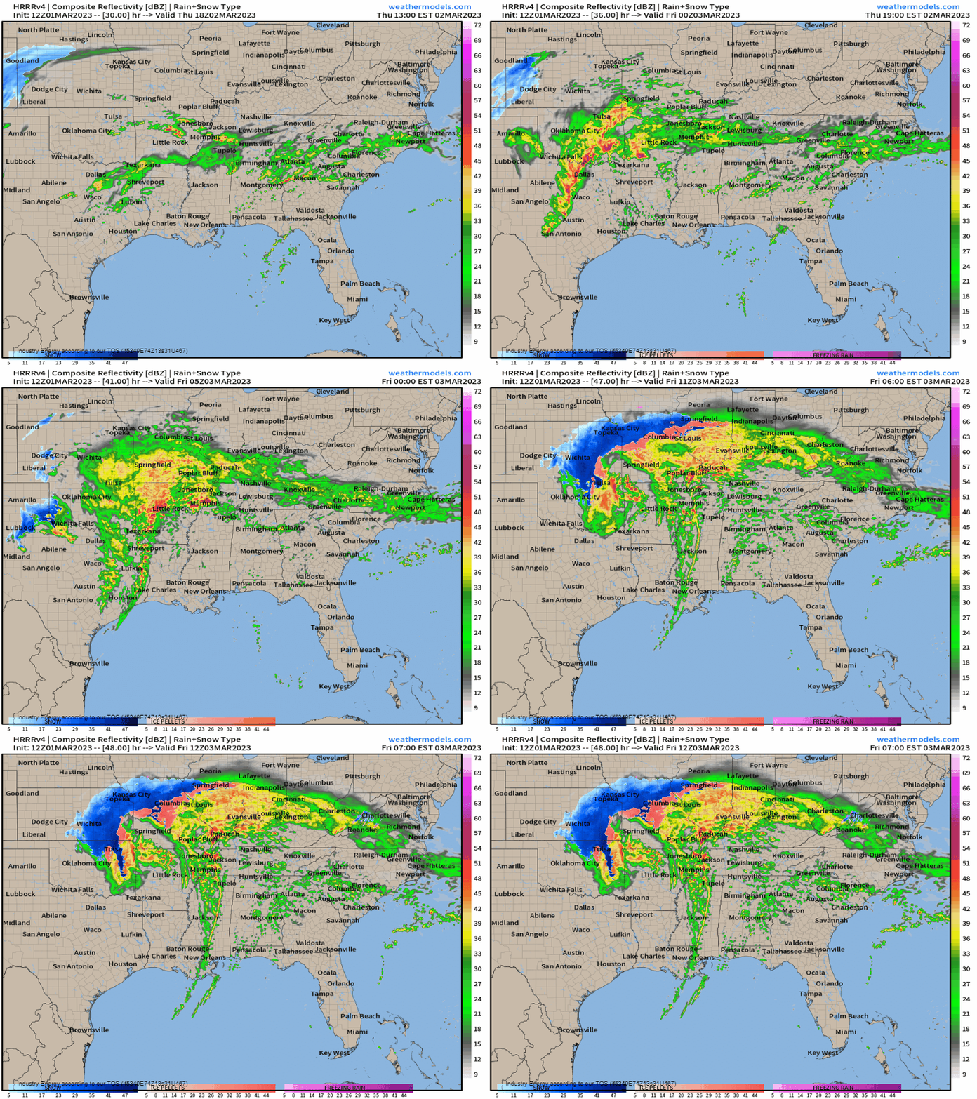
The HRRR shows a scenario similar to the one I’ve described above.
The threat will steadily lessen in the overnight hours as the line pushes into more stable environments. However, this is not where it ends. That brings us to Friday.
Friday
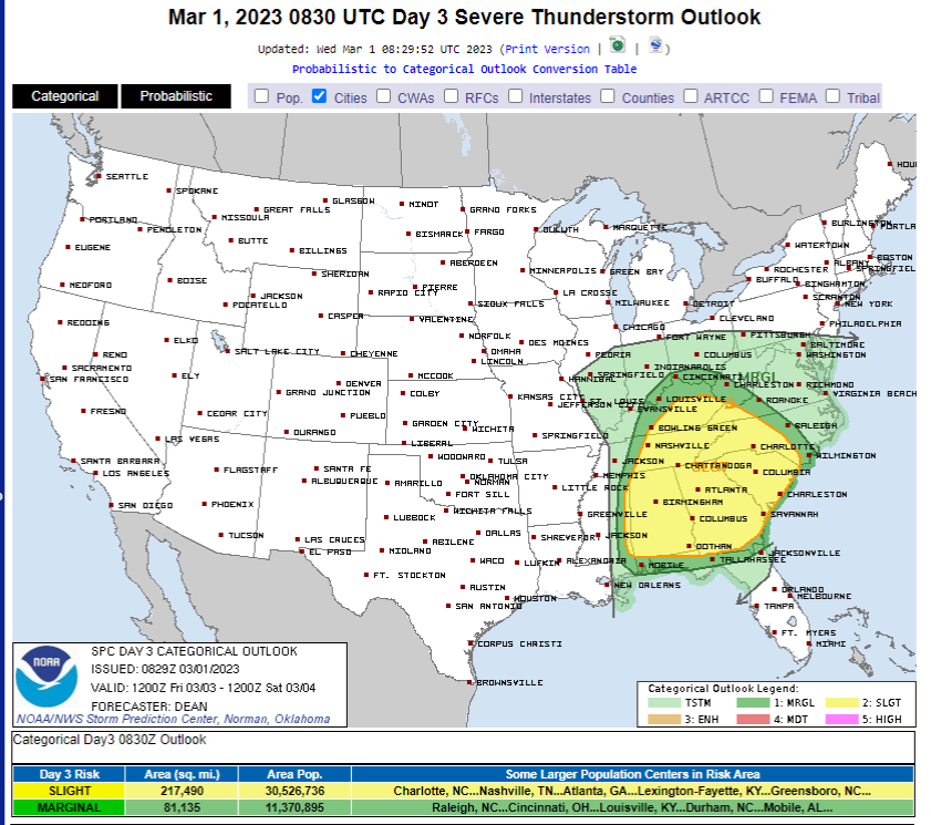
At dawn on Friday, the line of storms from the previous day is expected to be located roughly around the West Tennessee/Mid Mississippi area. That means that areas ahead of it have time for destabilization to occur before the front arrives.

And that’s exactly what the models see occurring. Some amount of destabilization will occur from the Gulf Coast to the Ohio Valley ahead of this line, though the better “fuel” looks to be located in Alabama and part of Georgia at the moment, though they are far from the best forcing, which could limit chances some.
Cloud cover should be fairly widespread Friday morning, so anywhere that is able to see breaks in the aforementioned cloud cover may be able to boost their instability a bit.
Though this round of severe weather isn’t expected to be nearly as potent as Thursday’s, the primary risk for damaging winds and secondary risk of a few line-embedded tornadoes due to the high shear environment will remain. Flash flooding will remain a concern as well due to Wednesday’s expected heavy rainfall and antecedent saturated conditions.
Summary
Three days of widespread severe weather is expected from today through Friday. This is a complex set-up with a lot of moving parts and different impacts for different regions. I’ve done my best to gloss over the important parts in this blog. Since it is such a large region with multiple events, seek out your local NWS webpage or broadcast meteorologist’s forecast for specific impacts and timing for YOUR town. This forecast will likely change some leading up to the event, so be sure to seek out the most recent information a few times a day.
Take Action:
- Much of both of these events will occur in the evening/after dark hours. Have multiple ways to receive warnings including at least one that will wake you if need be.
- Know your plan to shelter. Be ready to use it, even in the middle of the night, if necessary.
- Some of this event will occur during busy commute times. If a warning is issued for your area, know where you can shelter if you are on the road.
- Tornadoes are possible, but don’t disregard the wind threat or the flash flooding threat. Both can be just as, if not more, dangerous than a tornado and typically impact a larger area.
Stay safe and keep up with the most recent forecast for your area!


