Updated Severe Threat 2/26/23
There’s been an increase in confidence in regard to today’s severe risk so, as promised, I’m publishing a quick update looking at the latest information.

Guidance has trended upward over the past few days and now points toward a potentially significant event unfolding later today.
While tornadoes are a possibility, the bigger story here is the damaging wind threat. Let’s take a look.

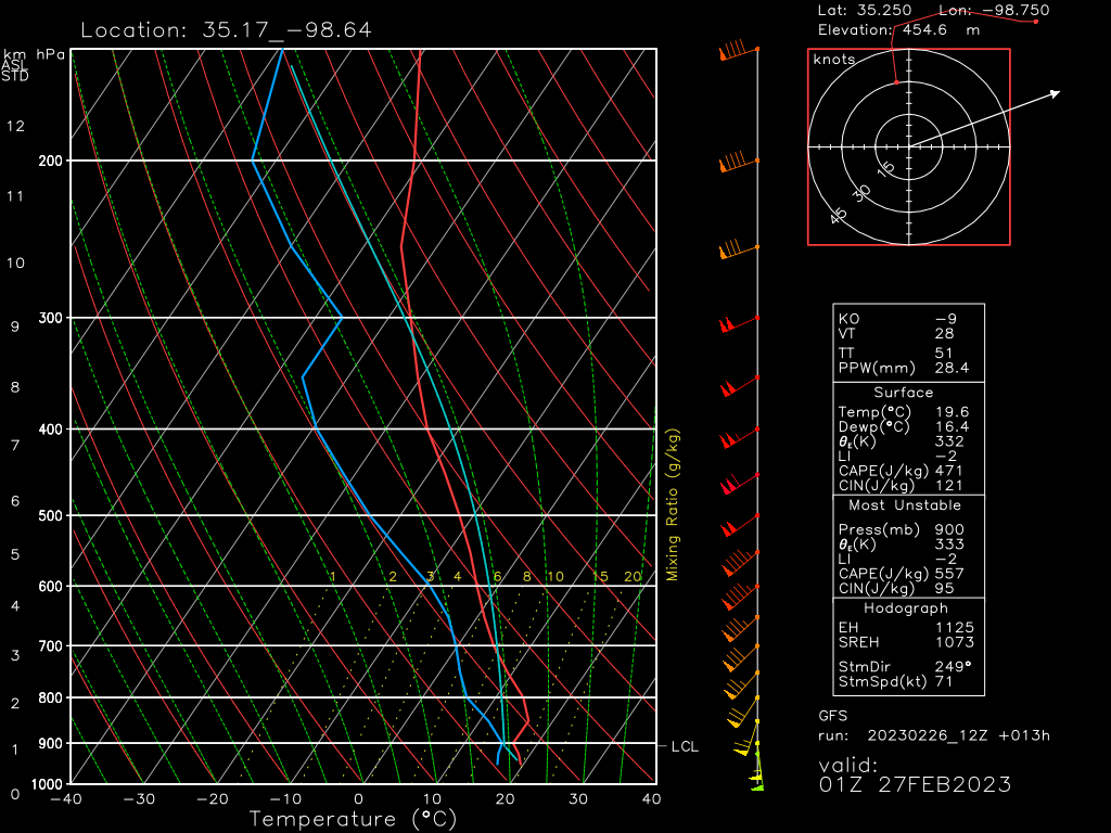
A forecasted sounding for the moderate risk area from the GFS which, admittedly, is probably missing the finer-scale details, still shows a potentially dangerous atmosphere.
Plenty of mid-level dry air is available to entrain into updrafts. Worse, the windspeeds within that layer are modeled on the order of 85 to 95 kts – a significant damaging wind threat!

If we look at hi-res modeling (the HRRR in this case), we see an insanely potent mid-level jet streak moving over the region tonight. Morning (6 am) observed soundings in the area in question showed 50-60 kts at the mid-levels already – and the jet hadn’t even started its approach yet.
Needless to say, the damaging wind threat is rather high today.

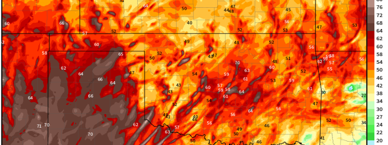
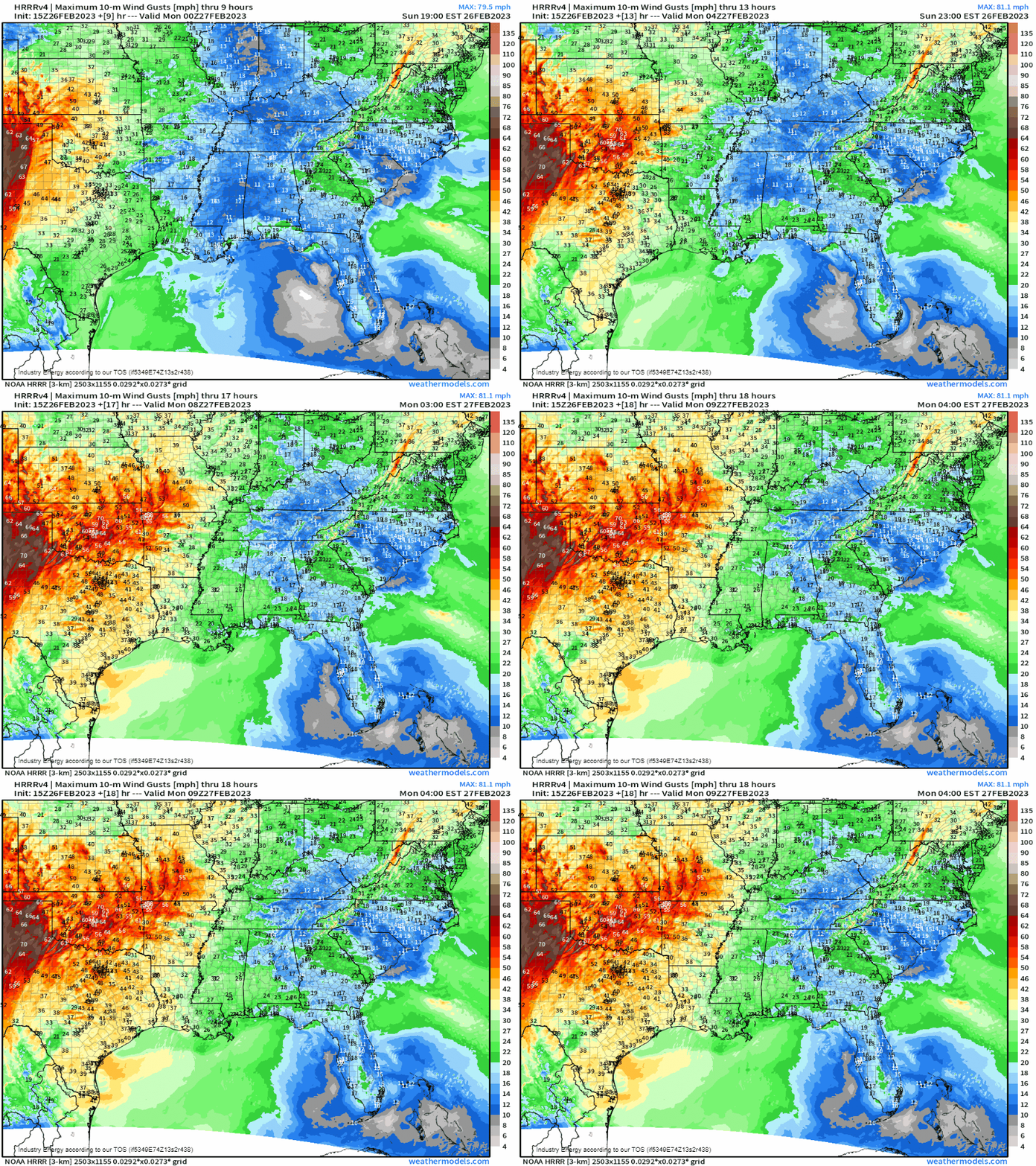
The Max Wind Gusts parameter can give us an idea of what’s expected. As it moves forward in time, we can make out sort of a bowing structure moving off to the northeast. Some gusts within this structure exceed hurricane force.
Take severe thunderstorm warnings seriously today and shelter if one is issued. Winds within these storms can be just as damaging as a lower-end tornado.

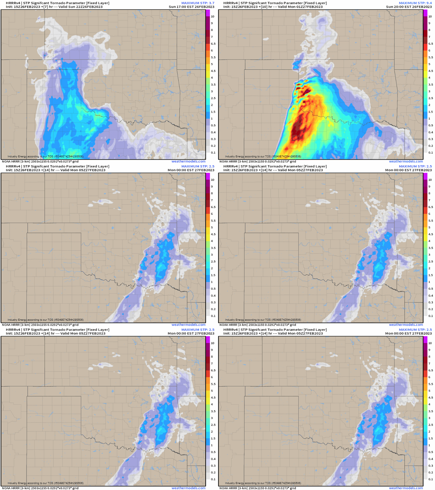
Speaking of tornadoes: due to the high amount of shear available, especially in the lower levels, we also see a threat for a few (strong) tornadoes. The threat for tornadoes will be at its most potent early in the event as supercells form off the dryline. However, they’ll remain possible embedded in the line itself as it progresses northeast.
Don’t focus only on the tornadoes, though. Remember that damaging winds will be a much more widespread threat.
Take Action:
- Severe weather is likely this evening over the Southern/Central Plains. Though a few tornadoes are possible, damaging winds will be by far the most widespread, potent threat.
- Convective initiation is expected later this afternoon. This event will persist after dark.
- Have multiple ways to receive warnings including one that is sure to wake you if your area is under a nighttime risk. Know your plan to shelter and be ready to use it.
- Due to the expected potency of the damaging wind threat, treat a severe thunderstorm warning like a tornado warning and take shelter!
- Stay tuned to your local NWS and broadcast meteorologists for more information about the threat and updated warnings as it unfolds in your area. This is what they do and they’ve got your back!
Stay safe!


