Weekend Severe Threat For The Plains States
Ready for more cold season severe weather?
Sunday has the potential to be day one of (potentially) a 2 day severe threat. Let’s take a look at what we know so far.
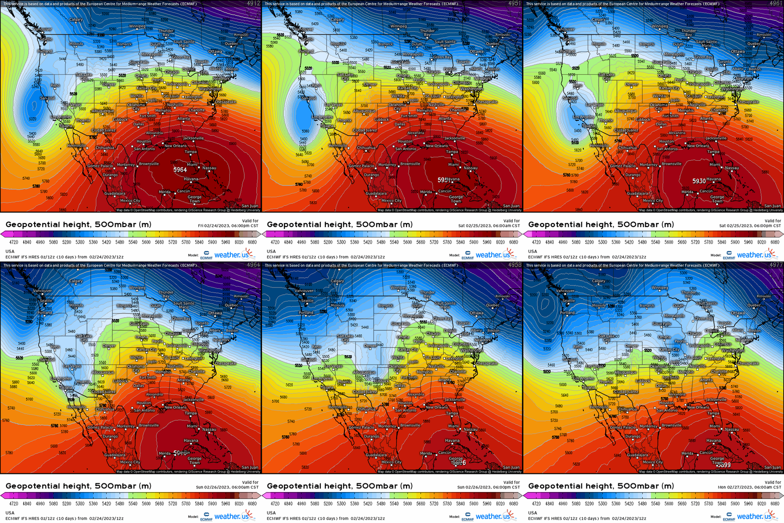
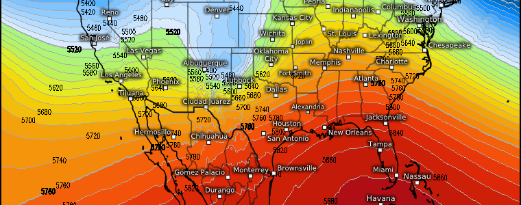
The trough that is currently facilitating blizzard conditions in the mountains of Central and Southern California will make it’s way eastward as we head into the early part of the weekend. By the second half of the weekend, a potent, negatively-tilted trough will be approaching the Plains states.
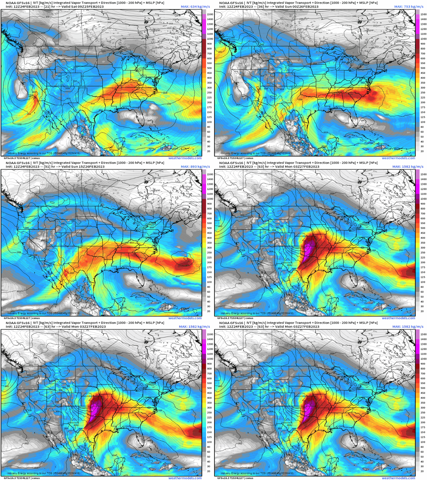
Moisture return, which is already underway to some degree in the more southern reaches of the target area, will increase considerably as the trough approaches early Sunday.
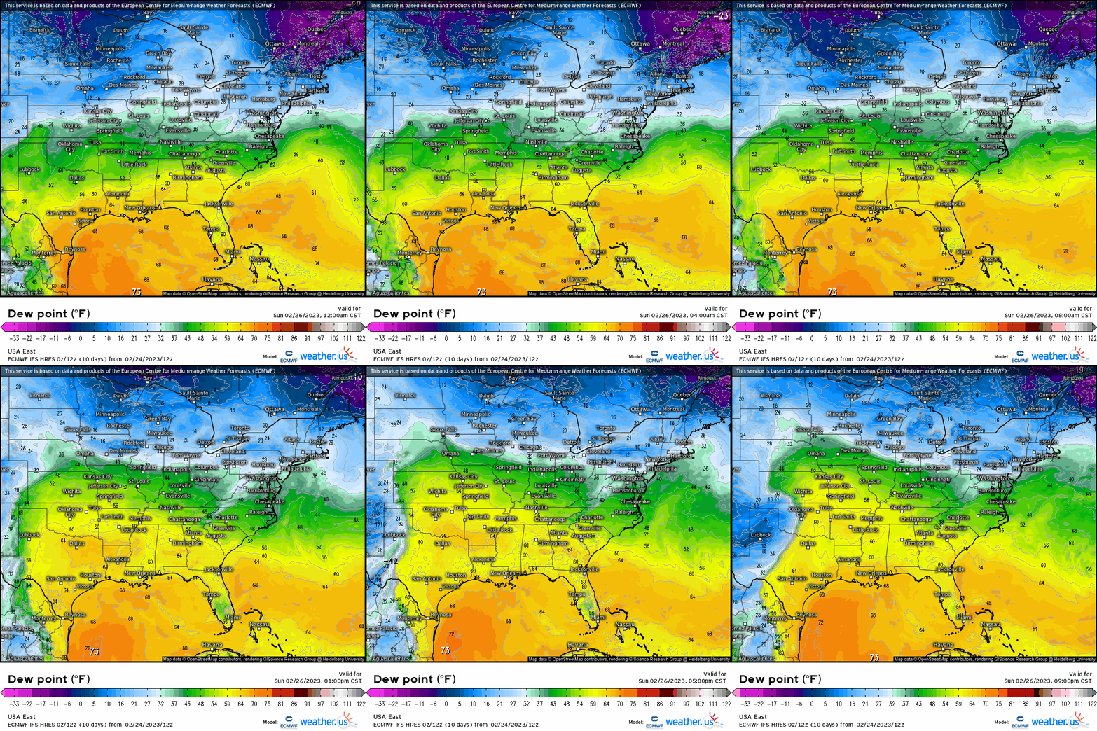
Moisture will overspread the Southern and Central Plains as the low-level jet increases throughout the day Sunday. Widespread dew points in the low to mid 60s will be found in the region in question.
As the front approaches from the west, a dryline will sharpen and push eastward. Some convective initiation, likely in the late afternoon hours, is expected as this occurs.
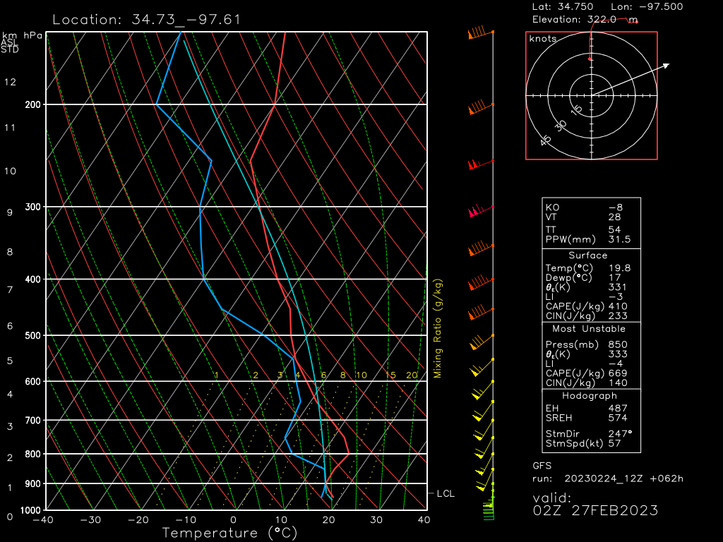
If we look at a forecasted sounding from the GFS for the area near the central Oklahoma/Texas border, we can get a peek into what our environment may look like at the time.
The first thing that jumps out at me is a large capping inversion. We’re going to need extra lift (dry line and cold front) and/or an increasing low-level jet to chip away at that cap and allow for storms to become surface-based. Current modeling does suggest that this will occur, with the cap eroding as the LLJ increases through the evening.
Both speed and directional shear are good in this sounding. Speed shear is adequate to organize updrafts while directional shear, especially in the lower levels, suggests some tornado threat.
Mid-level lapse rates above the cap are fairly steep, which could allow for a large hail threat.
Lastly, the presence of mid-level dry air and strong winds within that layer suggests a damaging wind threat as that air becomes entrained in the updrafts.
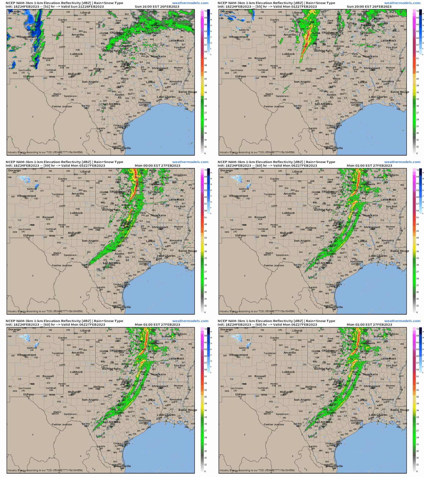
The first of the higher resolution models are just coming into range, so we don’t really have some of the smaller-scale details just yet. However, the NAM, which just barely runs through Sunday evening right now, supports convective initiation off the dryline in the late afternoon and storms increasing in strength as they move east into the most favorable environment.
We’ll have to monitor the forecast as the rest of the high res models come into range. Personally, that strong cap that is modeled gives me pause on just how widespread severe storms may be. I’m interested to see how the high res models handle it and its potential erosion as we move closer to Sunday.
Take Action:
- We’re still a couple days out and missing small-scale details that will fine-tune this forecast. If you’re in the region where severe weather is expected to occur, monitor the forecast as it evolves. Changes will occur between now and Sunday evening.
- Get your safe space ready in the event that you do need it. Have your plan to shelter ready to use in case it becomes necessary.
- Get your weather radio ready to go and have at least one other way of receiving warnings.
If any major changes occur to this forecast, I’ll publish an updated blog on Sunday morning. Stay safe!


