Wintry West, Summery Southeast
It’s Monday morning. We’re tired. We’re coming off a weekend of relatively tranquil weather.
Well, wake up and grab the coffee; it seems we have yet another busy period ahead.

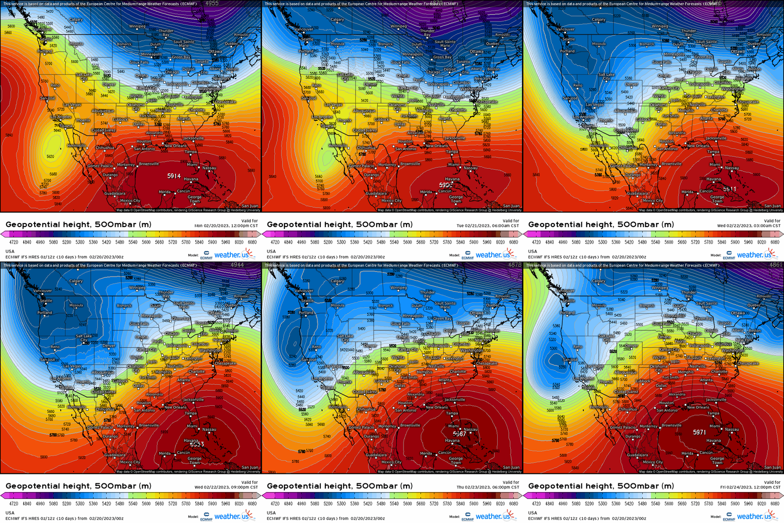
The flow will become much more amplified this week, bringing a wide range of sensible weather to the Lower 48. Deep troughing out West combined with a very slight stretching of the polar vortex (neutral AO) will produce stormy and very cold conditions.
In the East, the Southeast Ridge will amplify, producing much warmer than average conditions for many.
A storm track along the boundary between ridging and troughing will allow for several shortwaves to move through. In the warm sector, soggy conditions will prevail along with the chance for a lower-end severe weather event. In the cold sector, a major winter storm will first impact the Pacific Northwest before moving slowly across the northern part of the country. Heavy snow and significant icing will be possible for many.
But let’s go back to temperatures for a moment.

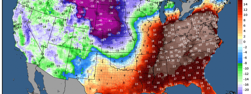
If you’ll watch the gif above, you’ll see the colder west/warmer east materialize and increase as the week wears on. In fact, this amplified pattern will likely produce record lows (west) and record highs (east) simultaneously around mid-week. While the West is experiencing the depths of winter with widespread temps in the 20s/teens/single digits, the East will feel much more like summer than late February.

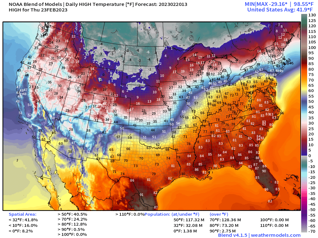
See what I mean? By Thursday, temperatures in the Southeast reflect a summer day while the Plains states are locked in the freezer.
In the warm sector, some cities could flirt with all-time highest temperature for the month of February. For example:
- Birmingham, AL – Highest Recorded for February = 83 degrees
- Atlanta, GA – Highest Recorded for February = 83 degrees
- Charlotte, NC – Highest Recorded for February = 82 degrees
- Nashville, TN – Highest Recorded for February = 84 degrees
- Orlando, FL – Highest Recorded for February = 90 degrees
I could go on, but I’m sure you get the picture – it’s gonna be warm.

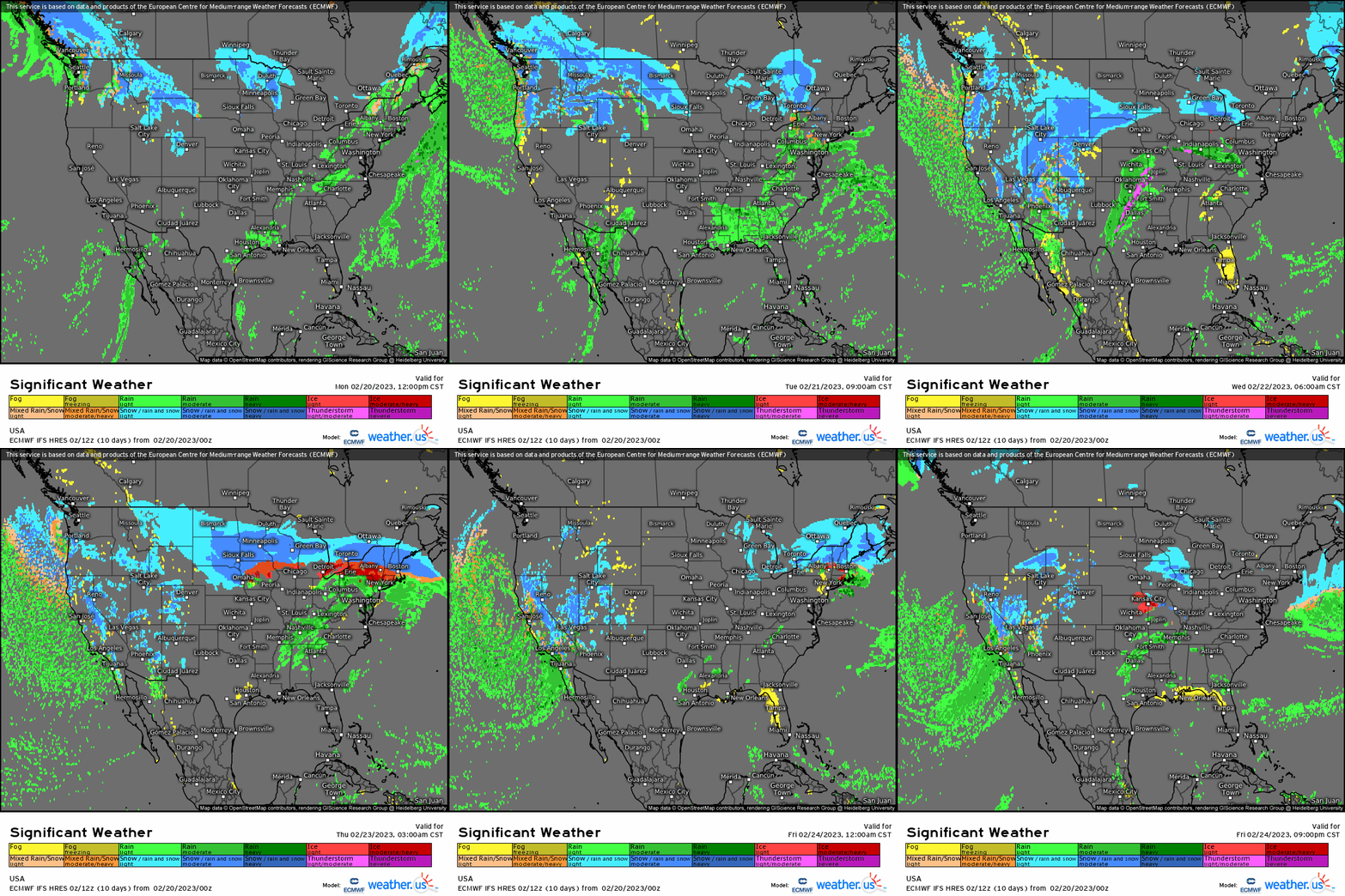
As far as precipitation goes, the above gif gives us a general idea of what to expect this week.
As I mentioned before, a winter storm will start in the Pacific Northwest and shift eastward as another shortwave approaches from the south. That shortwave will be responsible for heavy snow in the cold sector, potentially significant icing along the boundary between sectors, and the possibility of a few severe storms in the warm sector.
A more in-depth look at the winter storm portion of this week’s forecast will be available in Armando’s blog tomorrow!


