A Change Heading Into March?
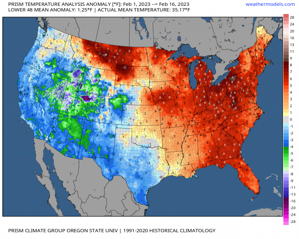
Since January 1st, we’ve seen remarkable warmth along and east of the MS river valley. It was mentioned that many places, especially east of the Appalachians, were in the top 5 finishing out first for record warmth. We’ve not changed the prevailing pattern still as we have now safely approached mid-month of February with a continuation of the below average west, above average east. Below, we see how many of the same places are above average. So does this look to continue? The short answer: yes.
Per the ensembles (here the GEPS), we see a prominence of ridging extending along the Southeast and East, with consistent below average heights continuing out across the West. This pattern verbatim results in generally below average west, and above average east …. so what’s the catch? Notice a deviation as we flip to March east of the Rockies, despite some resistance from ridging (a resilient feature typically in La Nina’s) across the Southeast. From here, let’s dive into the state of the Pacific here below using the GEFS hovmoller below!

As I always like to make it a reminder when diagnosing these unique plots below: green/blue are areas of upper level divergence (low pressure ), and yellows/oranges are regions of subsidence (high pressure). We are tracking the “envelope” of the MJO here through convection (thunderstorms along the Equator), since we know through atmospheric large-scale processes (i.e. potential & kinetic energy transformations along with latent heating) that influences the entire Pacific jet stream and rossby waves (i.e. troughs & ridges).
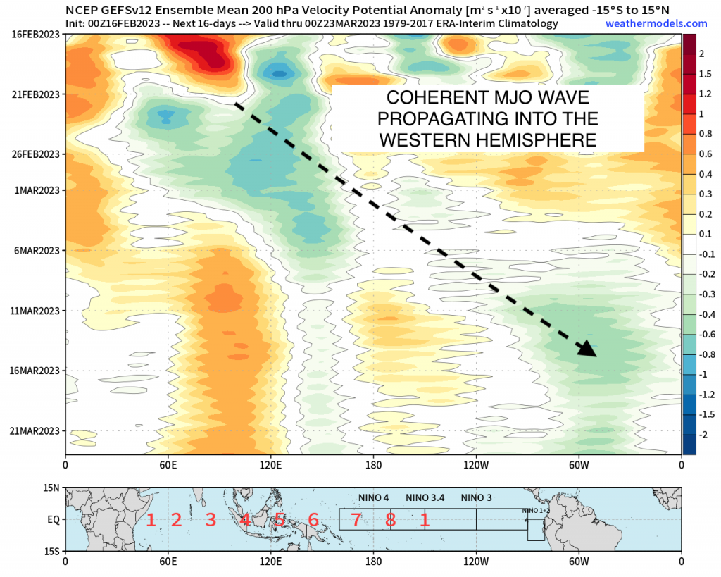
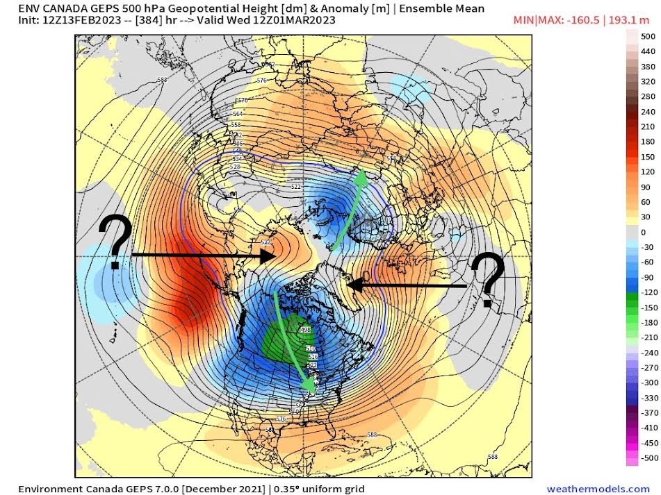
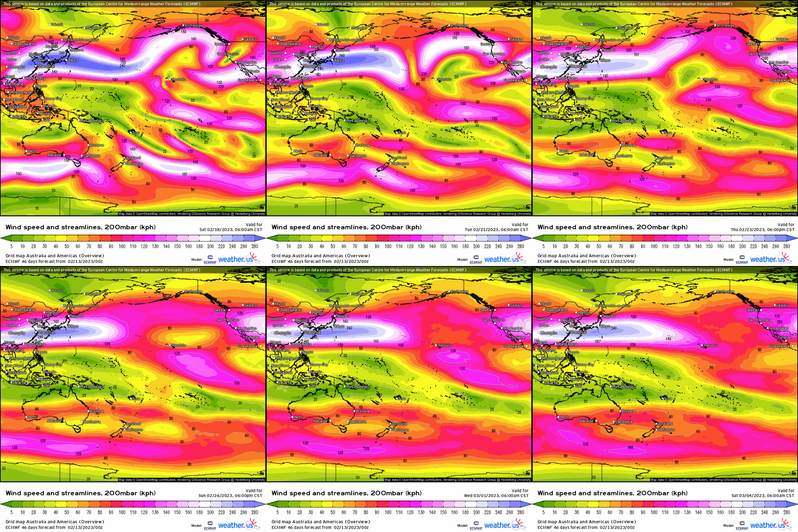
What the above is able to do, is allow for an alteration to the East Asia pacific jet, where initially we see the full extension into the West Coast; however, notice a gradual retraction while maintaining an notable jet streak that extends to about the International Dateline (180* W). As the MJO’s footprint (above) shifts into the Western Hemisphere over the next two weeks, what this allows is the quasi-stationary North Pacific Jet to now billow poleward, thanks to the left-exit region of the extended jet streak as cyclonic wavebreaking (i.e. trough’s developing, which form ridging downstream) manifests. We see this evolution below nicely via 5-day intervals of the GEPS comparing initial to the very tail end of February into March.
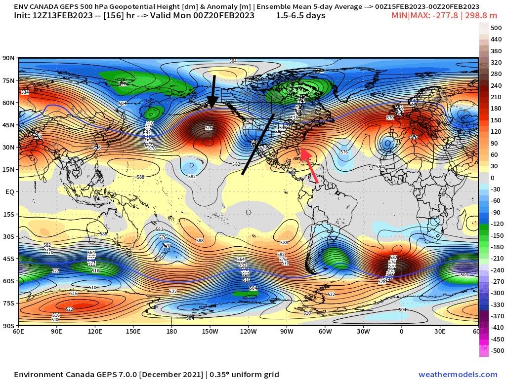
Initial:
- +EPO
- – PNA
- +NAO
Below is more of a canonical Nina pattern we typically see for February across the CONUS
End of month:
- -EPO/WPO
- +/- NAO
- – PNA
What we see here is that northern Pacific ridge push poleward, which can now facilitate colder air to filter into the CONUS. This pushes the colder air further into the U.S., which mitigates to an extent the southeastern ridging, though still looks like a higher confidence in that the colder air spills out west. With what has also happened with sudden stratospheric warming this week (my previous blog diving into that here), despite much uncertainty regarding the longer-term impacts, is in the very least pointing toward a more wintry look to the lower 48 as we head into early March. I do have a little more confidence in the latter just simply because a big pathway to high-latitude blocking (-NAO/-AO) is through polar vortex disruptions and this has certainly increased the probability of us seeing a return to it, or in the very least an episode. Obviously we shall see how that pans out!
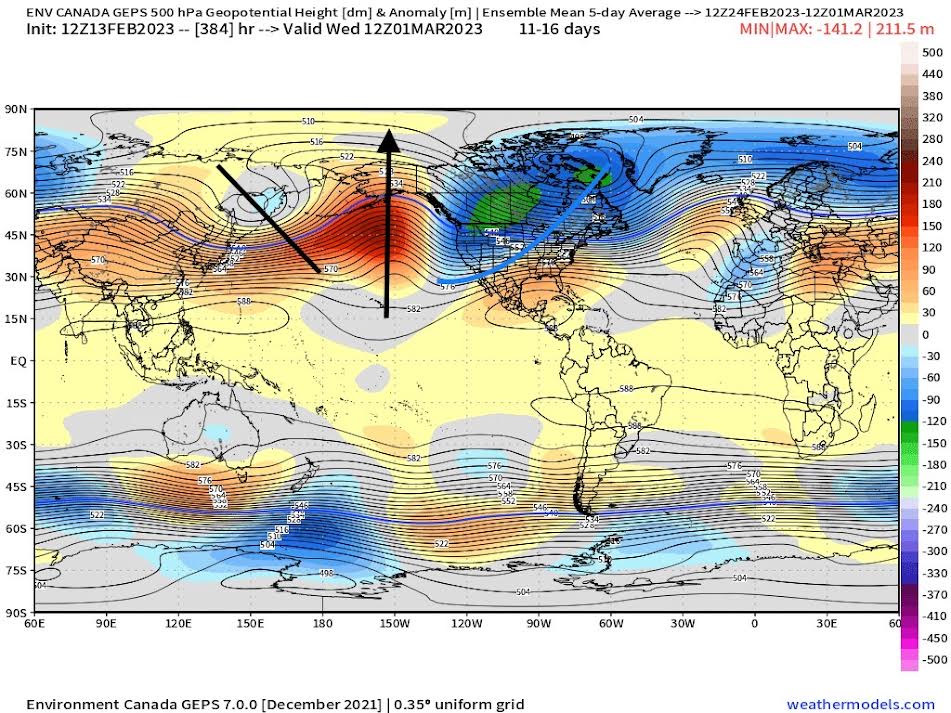
At this juncture, there are some hints that we may see a retrogression of positive heights from Scandinavia try to allocate toward Greenland. That’d result in high latitude blocking with the tropospheric polar vortex becoming dislodged into two main vortices with one focusing toward N.A., and the other toward Europe. There’s certainly a good bit of how it all plays out, but the premise behind this is that with the MJO’s progression and disruption from the troposphere impinging on the stratospheric polar vortex , there’s still a good way to go with winter as we look into March! Areas especially that have virtually seen no snow still can not completely shun the chances of wintry weather happening as much as it appears to be done. An interesting next few weeks ahead, and be sure to stay tuned since I’ll be covering how it pans out as we turn the page to March!
