A Continuing Parade Of Storms
The soggy pattern continues for California as another atmospheric river is once again aimed at the state this morning.
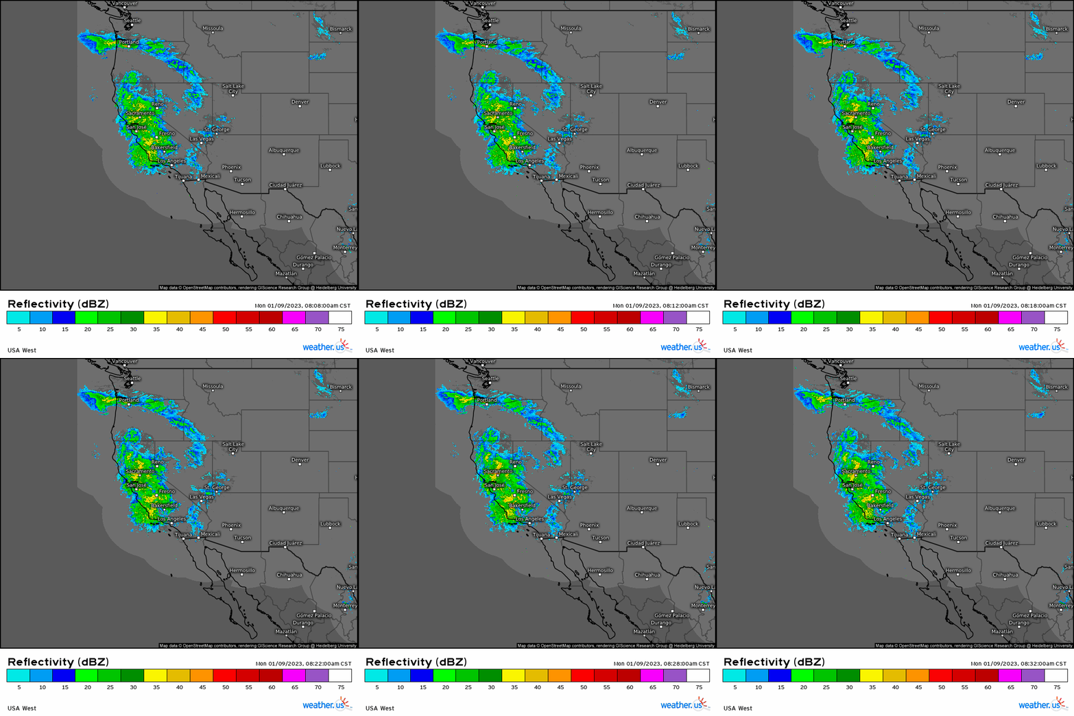
Heavy rain (and snow in the elevations) is steadily spreading inland at this hour.
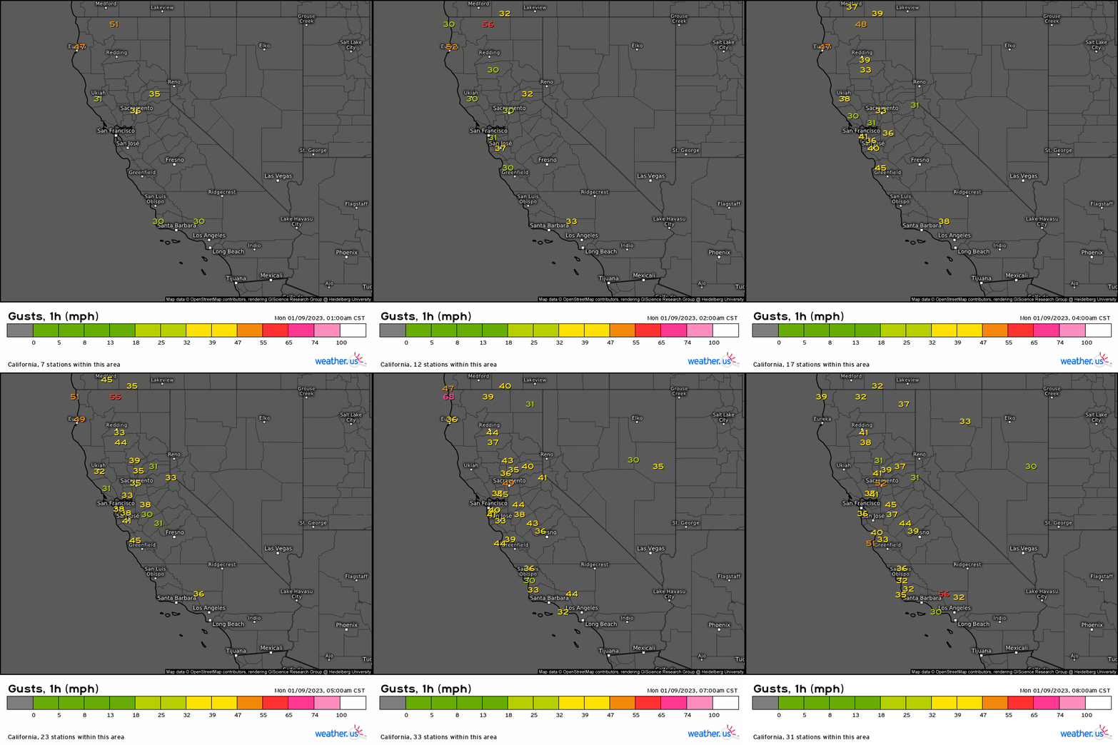
Additionally, winds have really picked up over the last few hours. Gusts in excess of 50 mph have been recorded at several stations in the state in the last hour.
As we know by now, oversaturated conditions and strong winds do not mix – expect trees to come down and power outages to result.
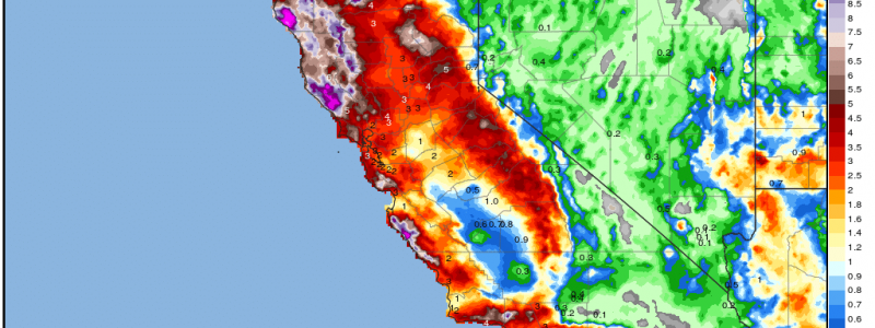
In the last two weeks since the switch “flipped” on the pattern for California just after Christmas, an incredible amount of rain has fallen.
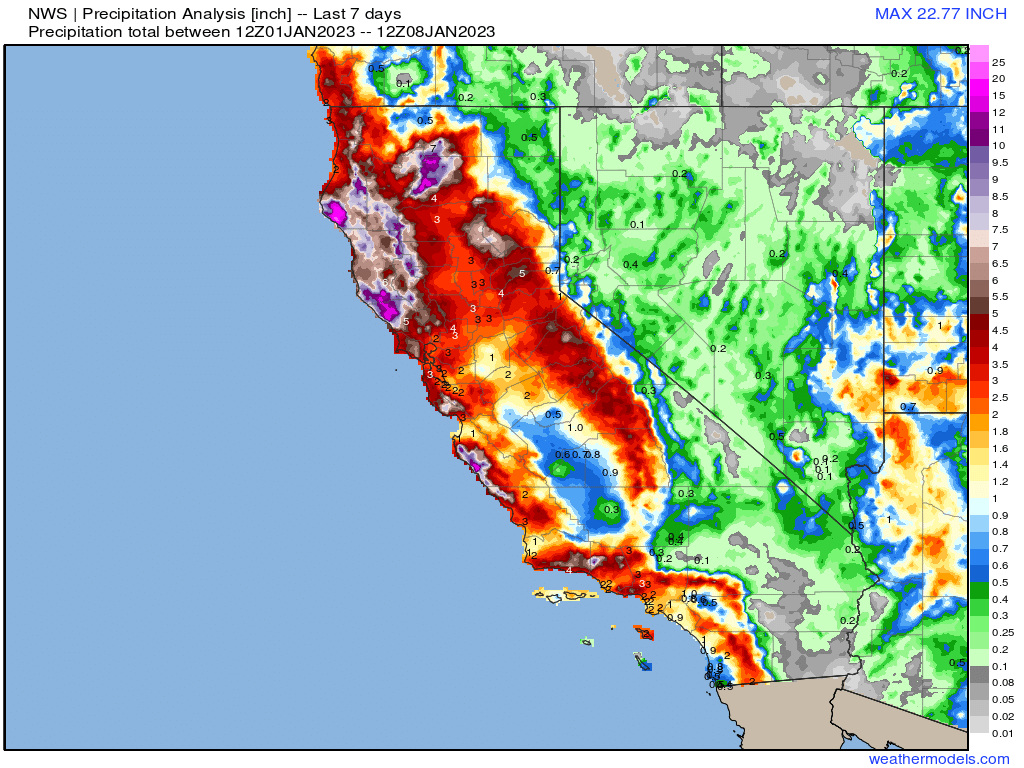
Displayed above is the 7-day rainfall totals for the state.
To put some of these totals into perspective, the average rainfall for January for northern coastal California is roughly between 3 and 6 inches, depending on how far north a specific city is. Some locations have exceeded or even nearly doubled their monthly average – and we’re not yet half way through the month.
We’ve been talking a lot about flash flooding, mudslides, and debris flows over the last week, but we’ve reached the point now where we need to also monitor the rivers.
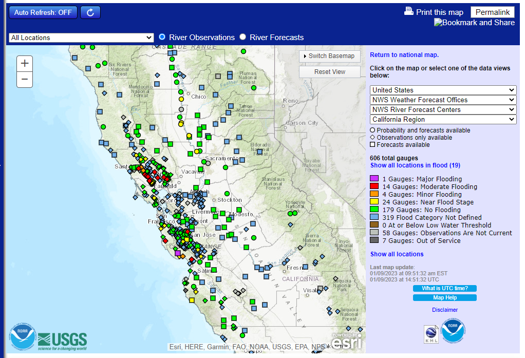
I tweeted out this same map yesterday morning. At that time only 2 gauges were in moderate flooding. With the most recent influx of water this morning, 14 gauges are now in moderate flooding. Additionally, one has reached major status. Many more are approaching flood stage.
River levels before this series of events were extremely low due to years of drought. The last two weeks of constant rain events and run-off has finally replenished them. We’ve now reached the point when neither the ground nor the river channels themselves can hold any more water.
Terrain plays a big role here. Not only do the mountains surrounding the coastal areas provide orographic enhancement of rainfall totals, they funnel any excess run-off downhill into the lower elevations.
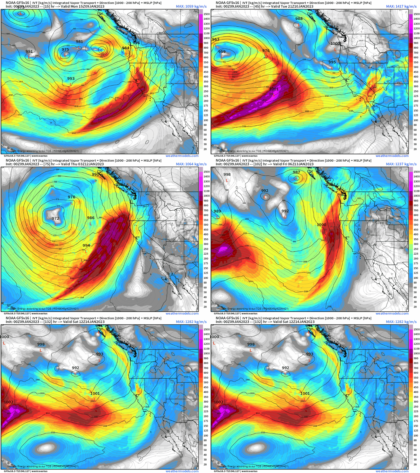
Unfortunately, this won’t be the last AR event to impact the state this week. Two more events seem poised to impact California before the week is out, though the event toward the end of the week seems to be more focused on Northern California than central and southern parts of the state.
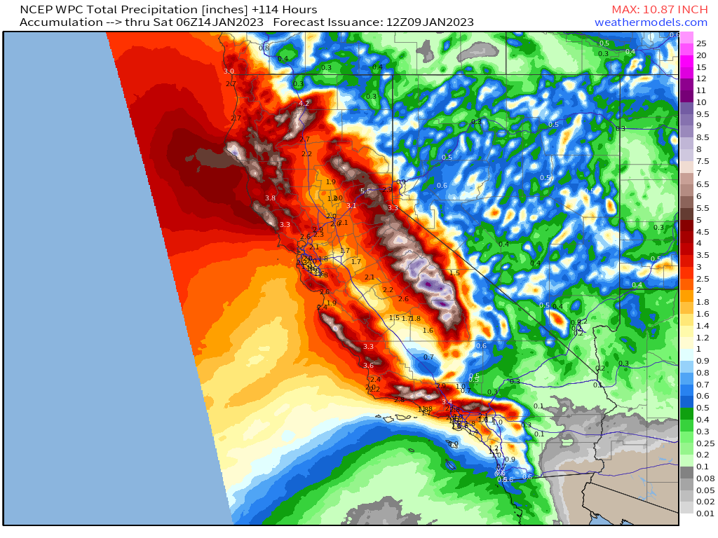
Either way, a widespread 3+ inches is expected across coastal portions of the state through Friday evening. Between river flooding, flash flooding, mudslides, and debris flows in burn scar areas, this could no doubt create and perpetuate a dire situation for some.
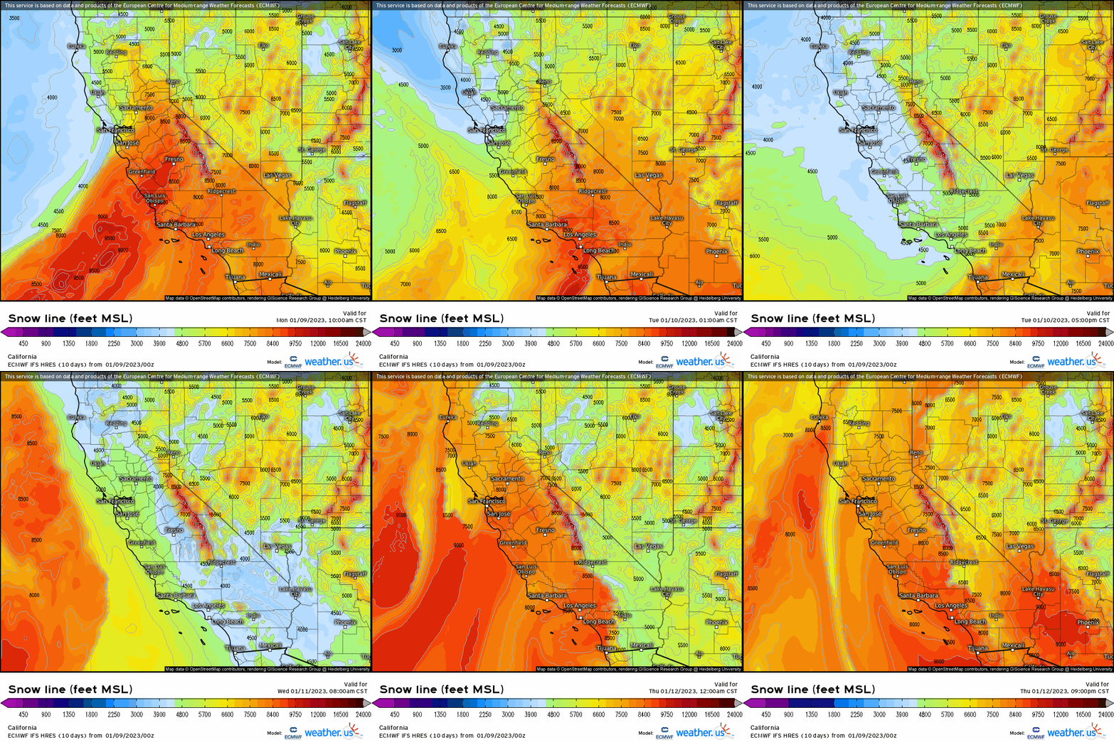
One other thing to watch that could exacerbate flooding: where the snow line sets up/migrates to. Each influx of warmer air pushes the snow line higher before dropping it back down again. So, if it had been snowing around 5000 ft but suddenly the snow line retreats to 8000 ft, there’s now rain falling on the snowpack between 5000 and 8000 ft. That rain will melt some of the snow, causing it become run-off and flow into the lower elevations/river basins.
It’s very important to be hyper-aware of the flooding situation if you’re local to these regions. If evacuation orders are issued, don’t wait to go. Keep your car packed and be ready to leave immediately.
Additionally, flooded roadways are not your friend. Six inches of water can cause a car to stop working while a foot of water can float most cars. Don’t risk it.
I’m sure by now many are wondering if there’s any end in sight to the parade of storms.
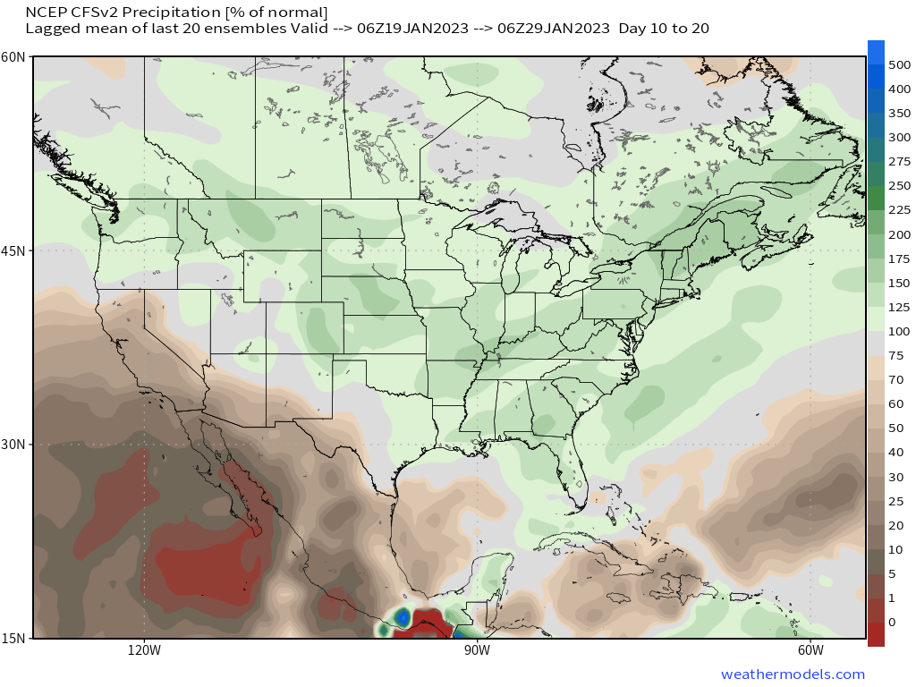
There is some hint in the medium-range that the screaming Pacific Jet facilitating this pattern will weaken and lift northward in 10 to 14 days. This would direct the storm track into the Pacific Northwest rather than the California coast and allow a chance to dry out.
However, the forecasted switch is still at least 10 days out and will have to be watched for flucuations.


How anomalous is the low-pressure system bringing this next round of precipitation? It looks like central pressure might briefly drop below 960mb. That’s hurricane strength, isn’t it?