Too Much Of A Good Thing?
For the first time in a couple of days, the radar is (nearly) clear over California. Days of heavy rain, high winds, and flooding woes have come to a halt – a very brief one, at least.
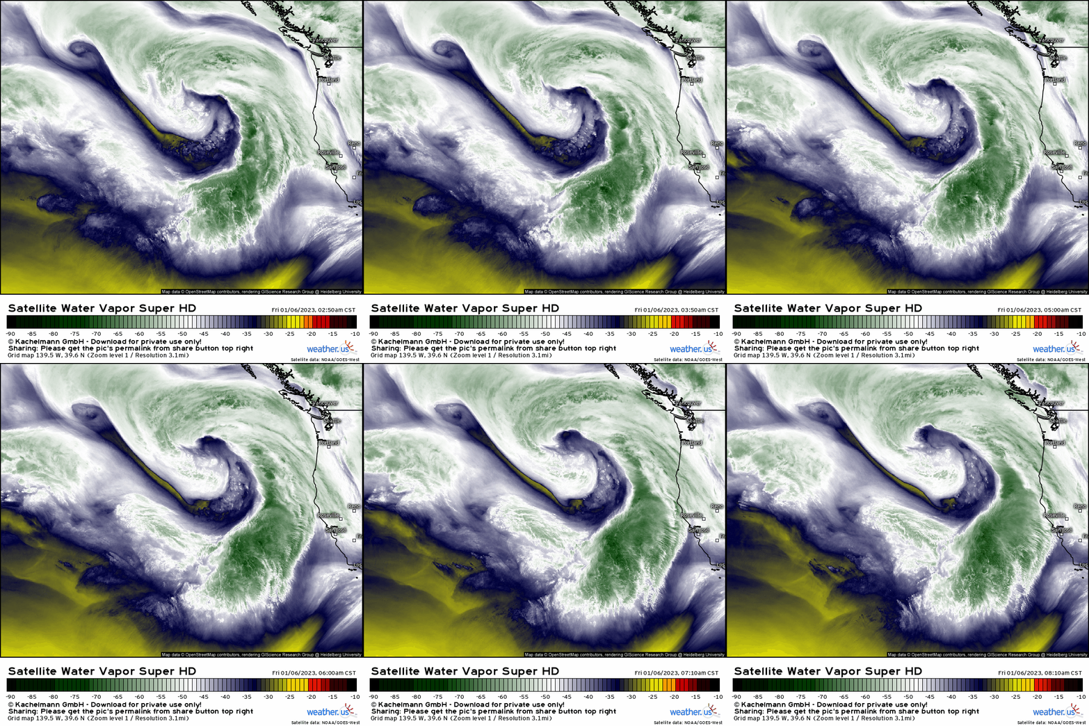
Persistent storminess is the name of the game for the West Coast, especially the northern half of California, at least through the next week.
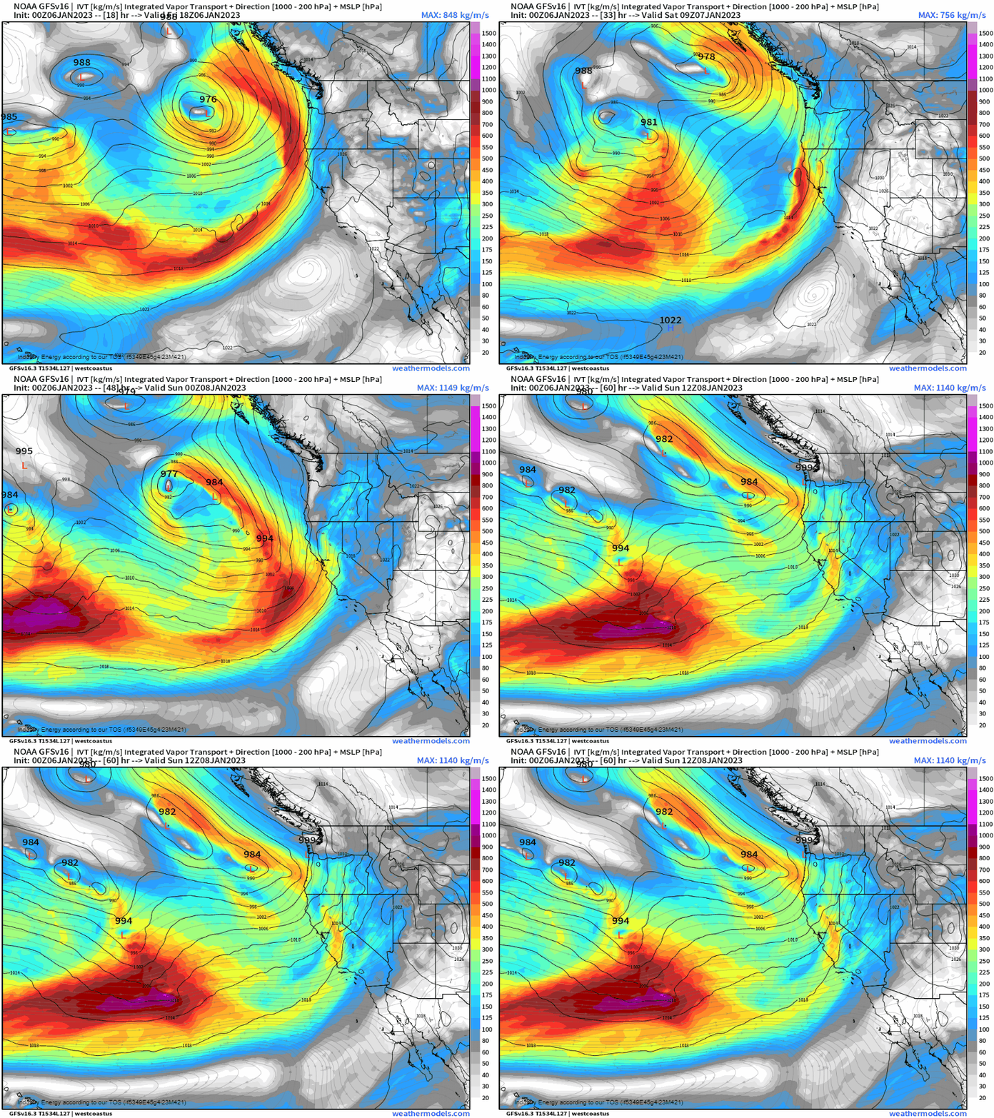
Over the course of the day, the main low responsible for the last couple days of wet, windy weather will lift northward. Later today into tonight, the tail end of the moisture associated with it will “come ashore” with more rain for northern California/some of the Pacific Northwest.
Behind this departing low wait two more lows, one of which is visible in the Water Vapor loop above. These lows will shift southeast, combine, and direct yet another firehose of moisture toward the coast later this weekend.
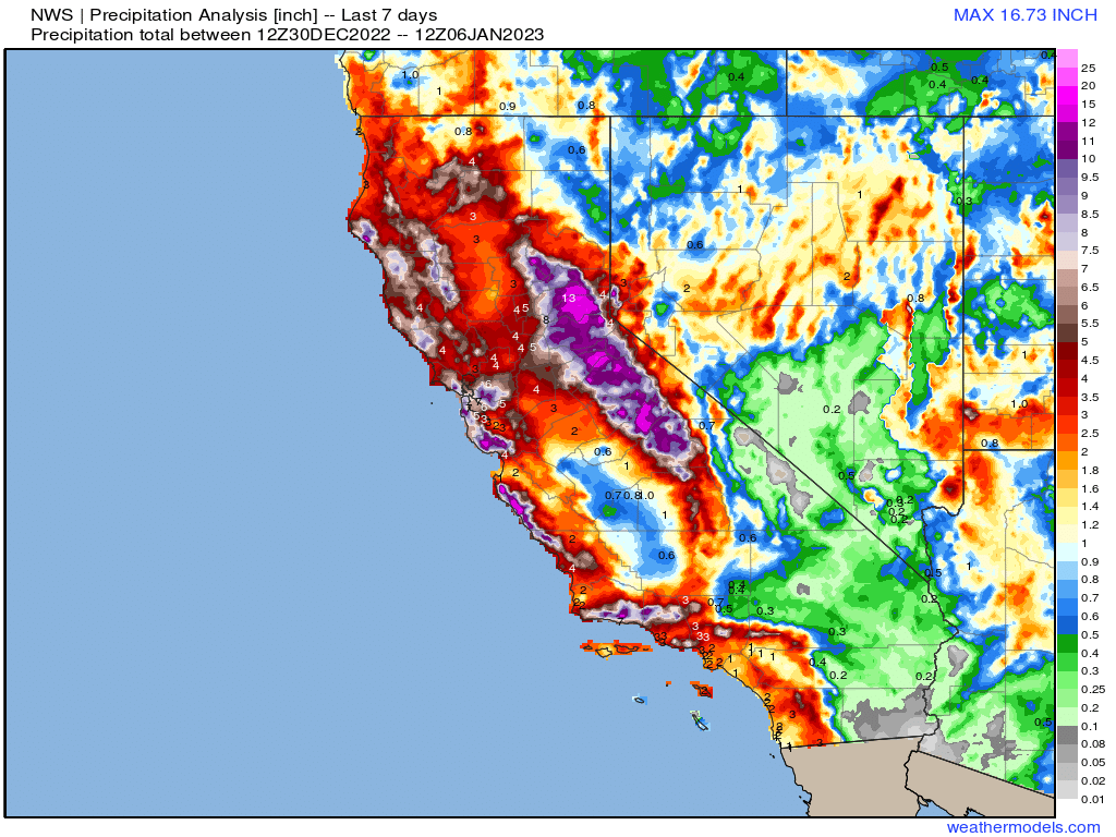
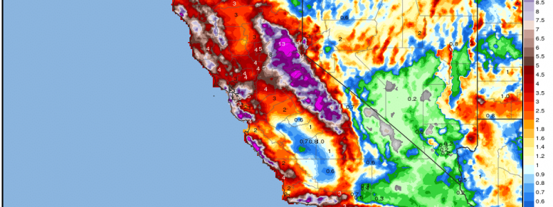
While more water is great news for the long-term drought in place, rainfall analysis suggests that in the last week alone, upwards of 10 inches of rain has fallen on parts of coastal California.
Note: The map above is valid through yesterday, and does not yet include any rainfall seen during the day Thursday. Totals are likely higher than displayed here. New data will be available this afternoon.
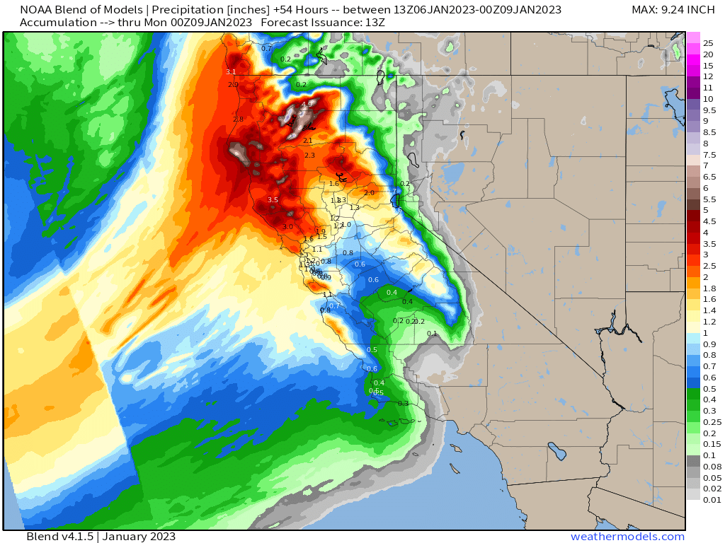
So, if flooding was a big issue in recent days, it stands to reason that it will only be exacerbated by yet another round of heavy rain.
Flash Flood Guidance values are still rather low, as expected. With potentially another 3+ inches of rain on the way for Northern California through the weekend, flooding concerns won’t be going away any time soon.
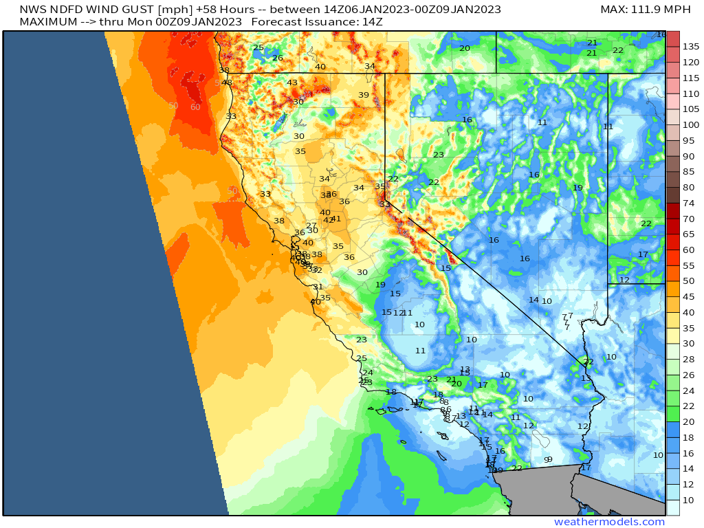
Winds will once again be an issue with this next wave of precipitation, though gusts are expected to be somewhat less than the most recent storm.
Still, wind damage and power outages are on the table through the weekend.
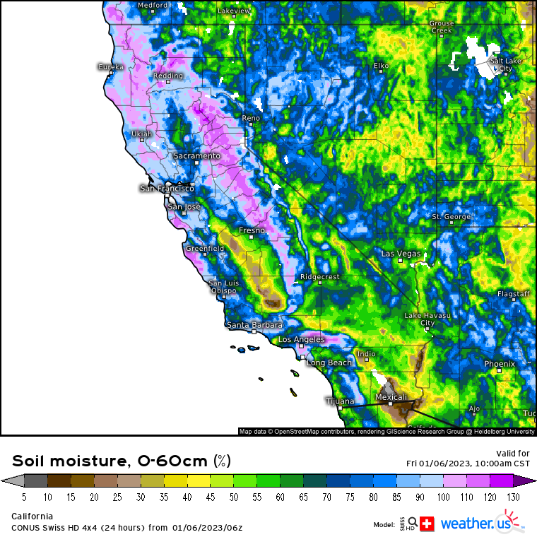
Soil moisture certainly hasn’t improved much during this brief lull in precipitation. In addition to facilitating flash flooding, saturated soils allow trees to fall more easily. So, with winds gusting to around 40 mph, expect more trees to come down, resulting in power outages and/or damage to structures.
As always, be mindful of what your area can handle in terms of water. Heed evacuation orders if issued and be ready to go as waters may rise quickly due to the already-saturated state of the land. Additionally, if a road is flooded, please don’t drive through it. As little as 6 inches of water can cause your car to stop functioning while a foot of water can float many types of vehicles. It’s not worth risking your life.
Unfortunately for this waterlogged region, this isn’t the last atmospheric river event. Another potent event is taking shape for the start of the week. Expect a blog discussing the forecast on either late Sunday evening or early Monday morning.


Excellent summary Meghan. Thank you.