New Year, New Severe Threat
I hope everyone had a wonderful, restful holiday season and is ready to jump right back into weather discussion as we have an active period ahead of us.
The new year is set to start off with a bang as Monday, Tuesday, and (to a lesser degree) Wednesday have potential severe weather in the forecast.
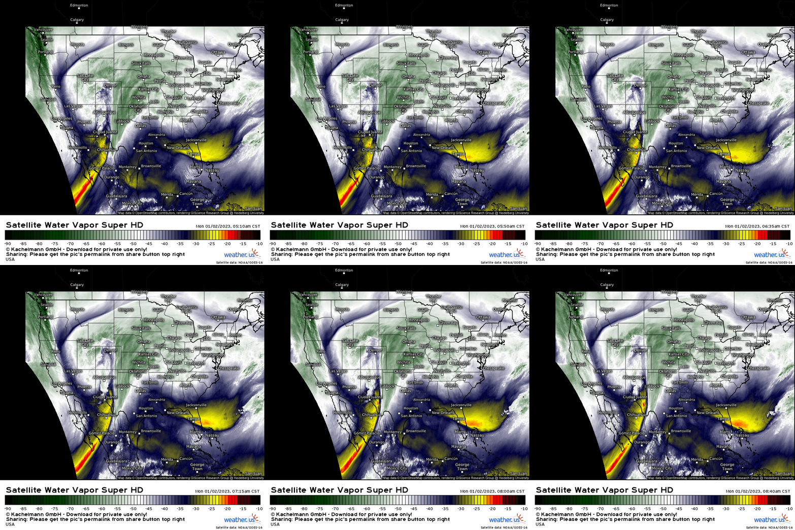
Using water vapor imagery, we can identify an upper level low digging eastward over the southwestern US. Ahead of it, we can easily see the northward flow of moisture.
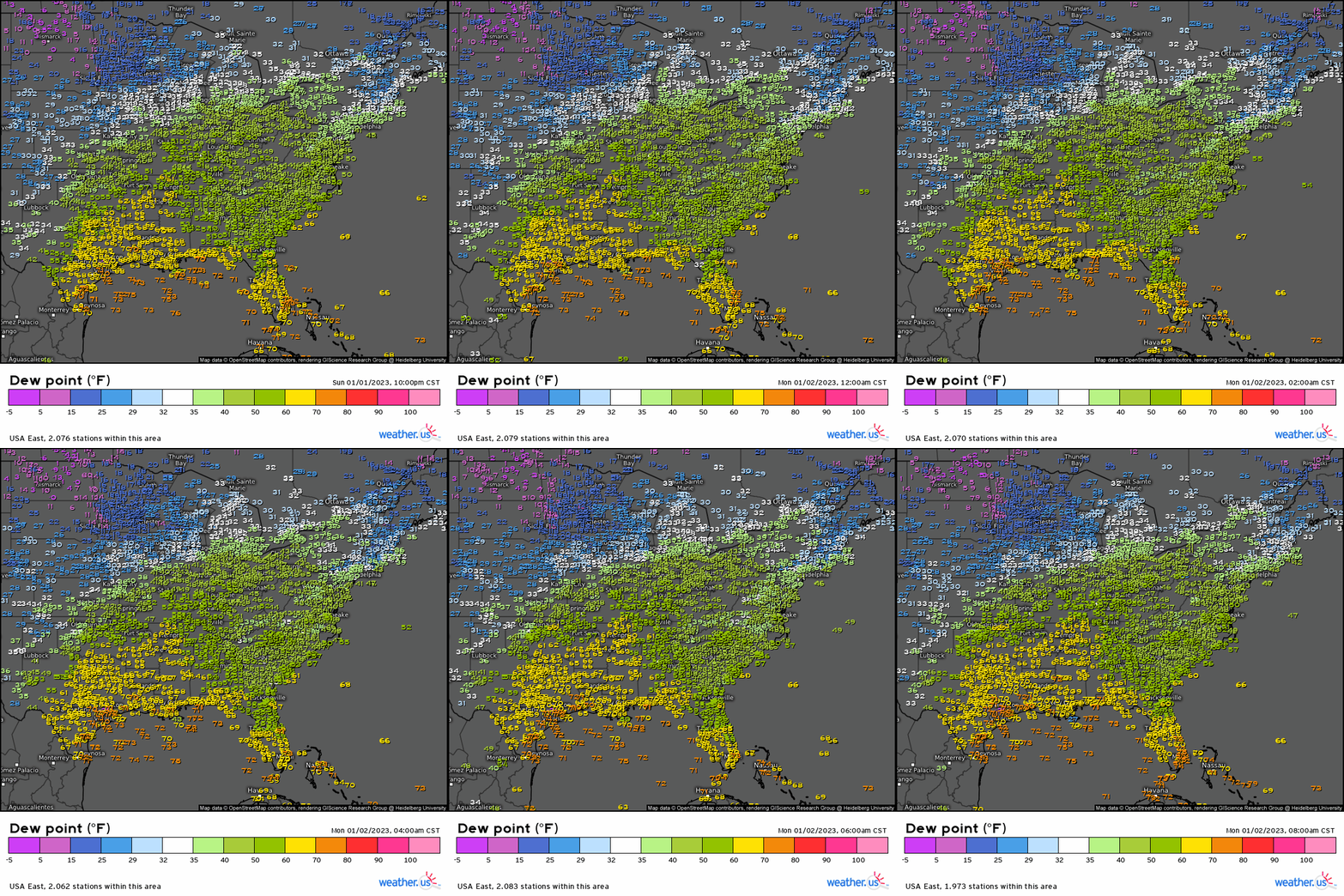
As a secondary visual, in an observation animation we can see higher dewpoints slowly creeping northward in the overnight hours. That’s the moisture we identified on the water vapor imagery.
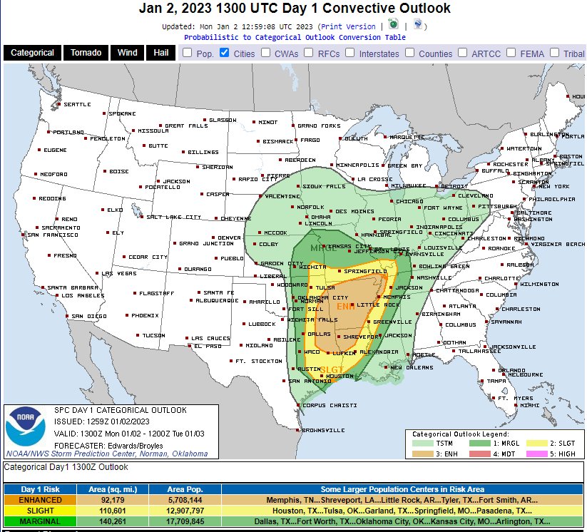
Today’s severe weather focus will be mainly on the Mid-South region.
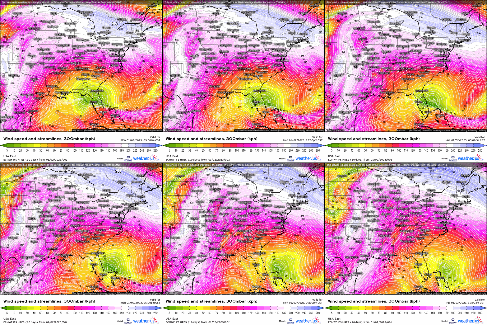
As we approach the evening hours, a strong jet streak will move over the Mid-South region. Upper level divergence will become increasingly apparent over this region.
In case you need a refresher, divergence aloft leads to rising air at the surface. As air speeds away aloft, it creates a void. The void must be filled, and air rises from the surface to do so. Uplift at the surface is an ingredient for severe weather.
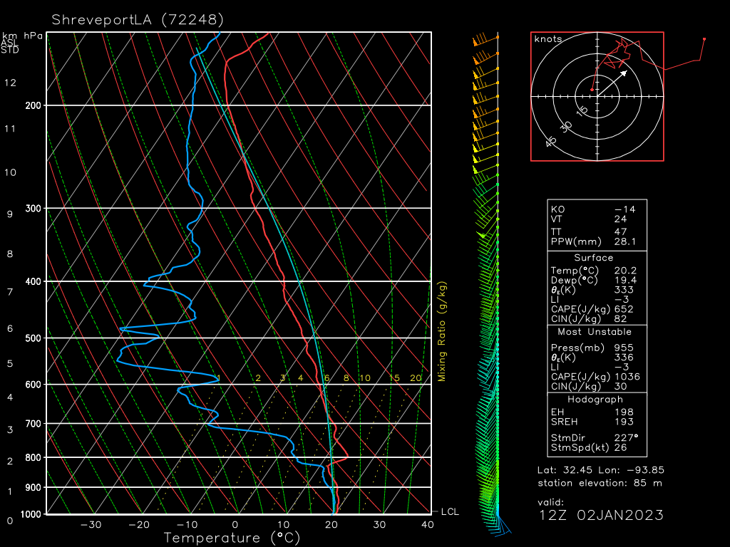
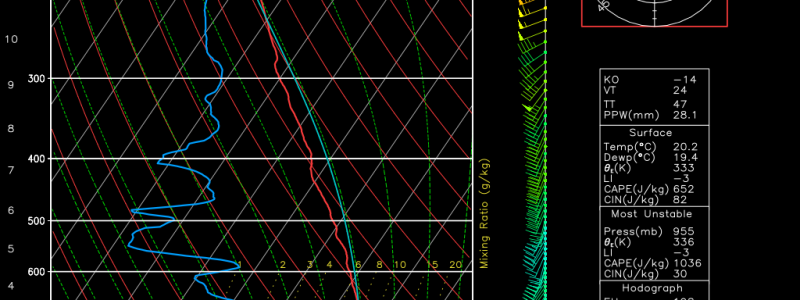
The sounding above is an observed sounding taken at Shreveport, LA and valid at 12z.
It is somewhat concerning to see that classic “loaded gun” look this morning. If you need a refresher on sounding types, check out a past blog on the topic.
What can we expect out of these conditions?
- An inversion is in place. We’ll need an influx of moisture, daytime heating, a lifting mechanism, or a combination of all three to break through the cap. This cap will serve to focus convection, allowing for more powerful storms to form earlier in the event.
- Good directional shear is materializing with winds backing from the southeast at the surface. Speed shear is lacking currently, however, that will change as the low-level jet ramps up and the upper level jet streak approaches.
- A very low LCL is currently in place, indicating moist lower levels.
- Dry air is available in the mid-levels. As this dry air entrains into updrafts, it results in evaporative cooling. Cooler air sinks to the surface, resulting in a damaging wind threat.
So, as we can see from the sounding, today has the potential to be a rather dangerous day. All modes of severe weather are possible, including a few strong tornadoes.
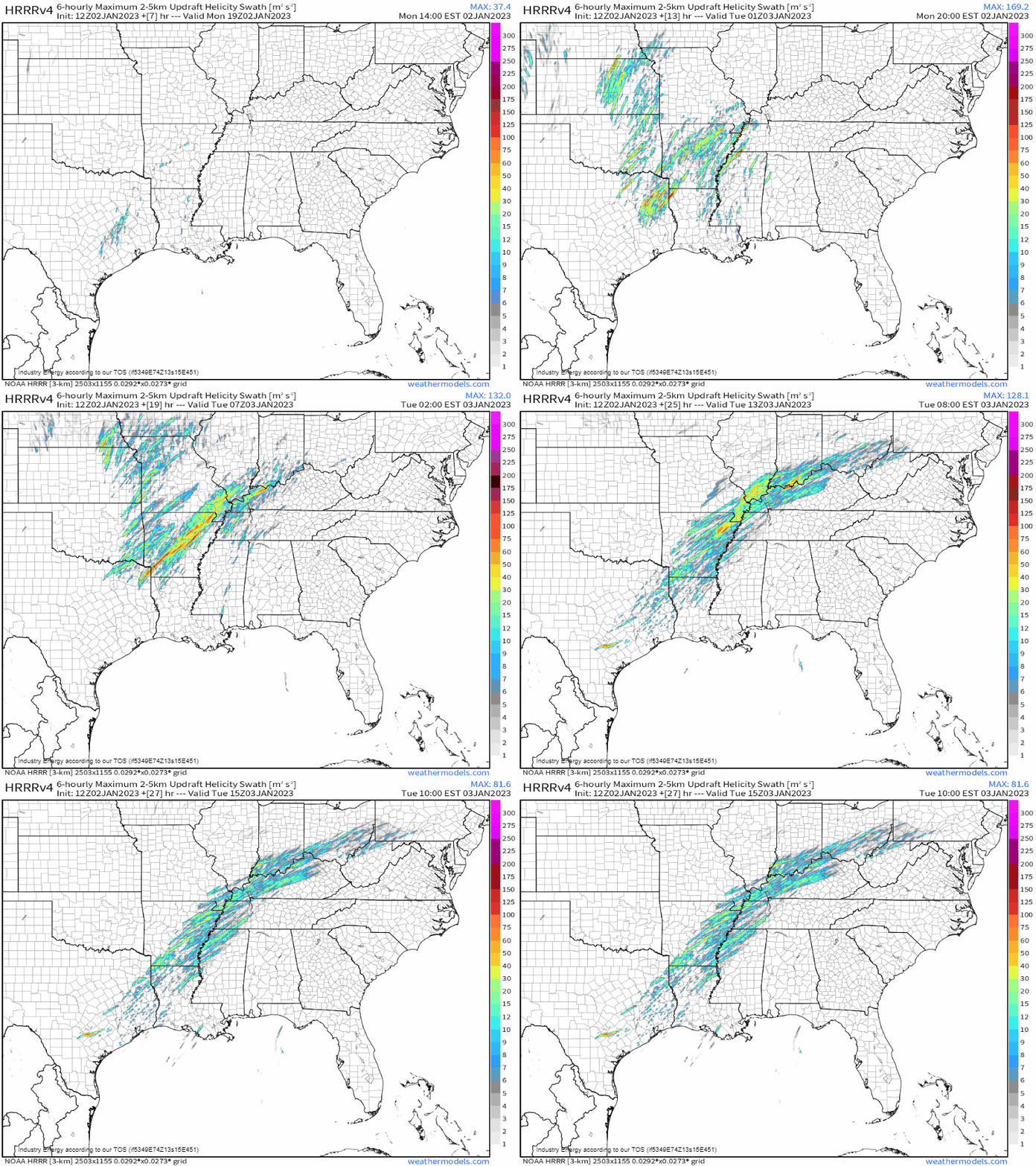
We can see this potential in the Updraft Helicity parameter.
Just a reminder, this particular parameter does not predict where/how many tornadoes will form. It merely shows the most likely regions in which rotating storms will form and persist. Whether or not those storms are able to then put down tornadoes remains unknown. BUT, the potential is there.
As we move into the evening hours, we see an uptick in the strength of the UH tracks, especially over northern Louisiana and Arkansas. This lines up with our “Enhanced” region on the SPC’s map.
However, notice the UH swaths outside of that region. Though they’re not particularly strong for the most part, they are still there.
What does that mean? Well, it goes back to the point I like to make about severe weather being possible in any defined area on the SPC map, regardless of scary color. All defined areas have some level of risk. Just because you don’t have the best ingredients doesn’t mean severe weather can’t materialize. Be aware, regardless of what color you’re under.
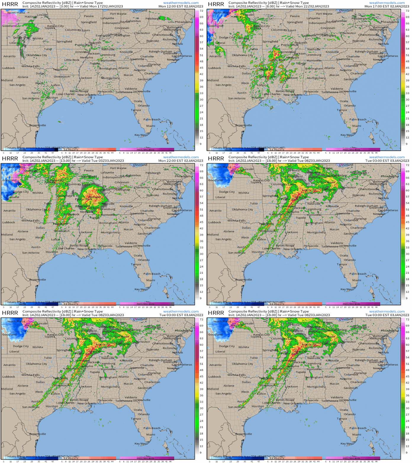
Convective initiation is expected in the early afternoon hours over the western portions of the risk area. Multiple rounds of storms in various forms (discrete, multicellular, linear) are expected along with varying hazards.
Let me emphasize that: multiple rounds are likely. Just because a severe storm may roll through your area in the afternoon does not mean you are done for the day. Remain weather aware and prepared into the overnight hours, especially those in the eastern edges of the defined risk area.
What you need to know:
- Multiple rounds of storms capable of all hazards are possible beginning this afternoon in the Mid-South region.
- Be prepared by making sure you have multiple ways to receive warnings and your safe space is ready to go. If you aren’t home when severe weather begins, know where you can shelter if a warning is issued.
- Shelter immediately if a warning is issued for your region.
- Remain weather aware through the overnight hours as multiple rounds are expected.
Today’s severe threat will gain steam once again tomorrow over the Deep South. We’ll discuss that event in tomorrow’s blog.


