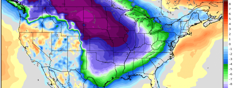
Arctic Air In The Forecast
Today’s tornado outbreak and yesterday’s severe weather may have some thinking, “Is it ever going to actually get cold? Where’s the Arctic air they were forecasting?”
While it’s true that the cold air that seemed set to creep in around mid-month has been delayed a little (as we discussed in this blog), it is coming.
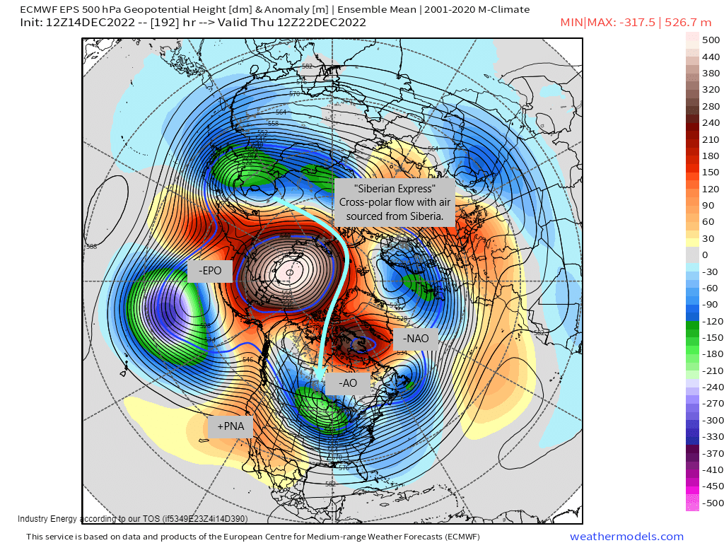
By the second half of next week, ensembles are in shockingly good agreement that the stars (or teleconnections, in this case) will all align for one heck of an Arctic blast. We will keep the current -AO and -NAO. The -EPO will amplify, allowing cross-polar flow. And finally, FINALLY, the PNA will trend positive. Result: the perfect set up for frigid temperatures east of the Rockies.
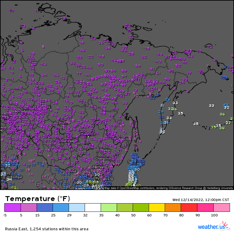
Once this cross-polar flow develops, the source region for our cold air will be none other than Siberia – hence the term “Siberian Express,” which you may or may not have heard recently in reference to the pending cold blast.
Temperatures in Siberia are currently around a balmy -50 degrees F.
Before you panic, remember that this air will modify as it moves. Since it will advect from a higher latitude to a lower latitude, it will warm.
But how much? That’s a good question. If there is a decent enough snowpack between Siberia and the Lower 48, it may not warm as much as it would otherwise.
We’ve all seen the maps floating around social media showing the deterministic run of a model (or two) where temperature anomalies are off the charts. Know this: It’s too early to take deterministic runs as gospel. We’re still just over a week out of the coldest air settling in. Additionally, this event is highly anomalous. Models will struggle hard to resolve the forecast in the days leading up to the actual event.
It is better to use ensembles at this point in the forecast to get a feel for just how potent this cold snap might be.
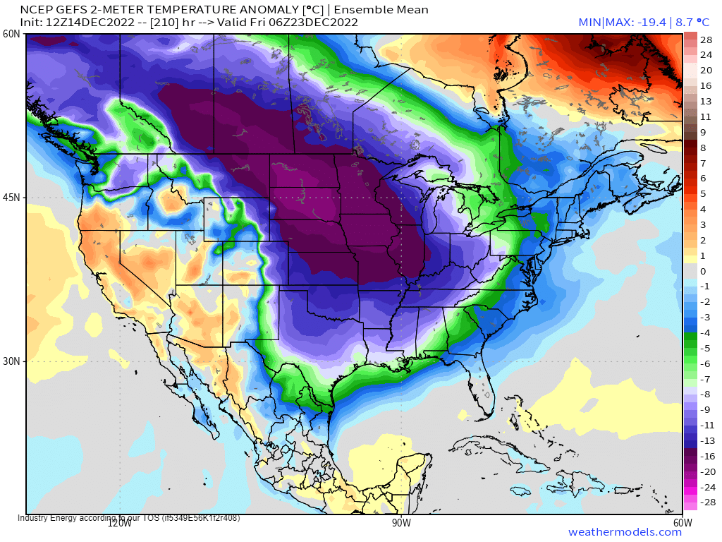

Ensembles are less extreme solutions than deterministic runs. They are the average of a bunch of runs together. So, when ensembles consistently show signals of a truly anomalous event, confidence is high in it occurring.
Both the GEFS and EPS have been shockingly consistent AND in general agreement on this signal so, while it’s never a total lock, there is a higher than normal probability of this “Arctic Outbreak” being one to remember.
We’ll fine-tune exactly how cold it’ll get in the coming days. However, perhaps start preparing now – especially if you’re in the southern parts of the Eastern US and aren’t used to multiple days of temps near or below freezing. Get those furnaces checked, etc.
What about snow, though? I know its on everyone’s mind (certainly mine).
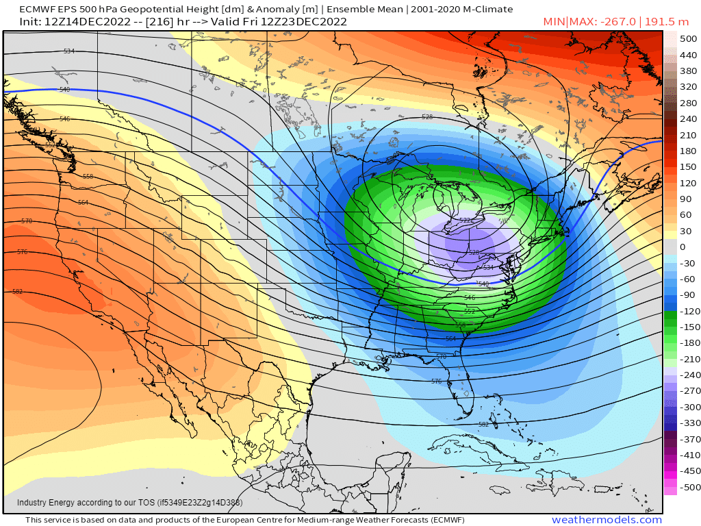
While nothing is even remotely set in stone yet, the +PNA developing means troughing will be over the Eastern US, resulting in at least a chance for a storm or two.
As of now, there is a signal on the ensembles for one around the 23rd/24th. Far too early for details such as precip type and locations but, if a cold air mass is in/coming into place, it may have potential. We’ll be watching the trends closely as we move into next week.


Ohio is going to get very cold and that’s called the polar lobes. My legs are used to the cold so I’m going to wear shorts because they’re comfortable and I like the cold&snow hitting my bare legs and I shovel snow in shorts too and I don’t wear tights just bare skin.