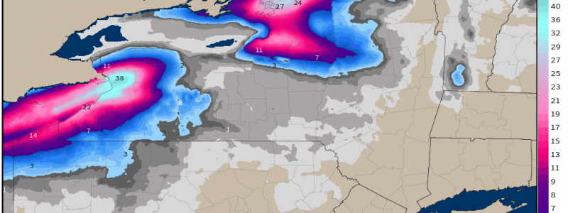
Too Much Snow?
How much snow is too much snow?
If you’re a snow lover, you likely have a higher number in mind than someone who can’t stand snow. But even those absolutely in love with snow have a limit. A limit that may be tested this weekend as the Lake Effect Snow machine cranks up.
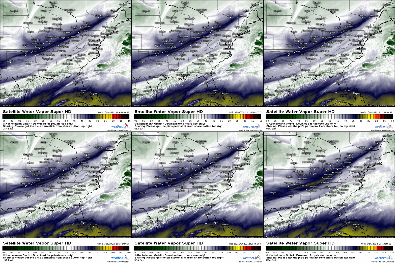
Currently, a trough is working its way east over the Great Lakes region. While temperatures out ahead of it are above freezing, some truly chilly air is behind it and will filter in throughout the coming hours.
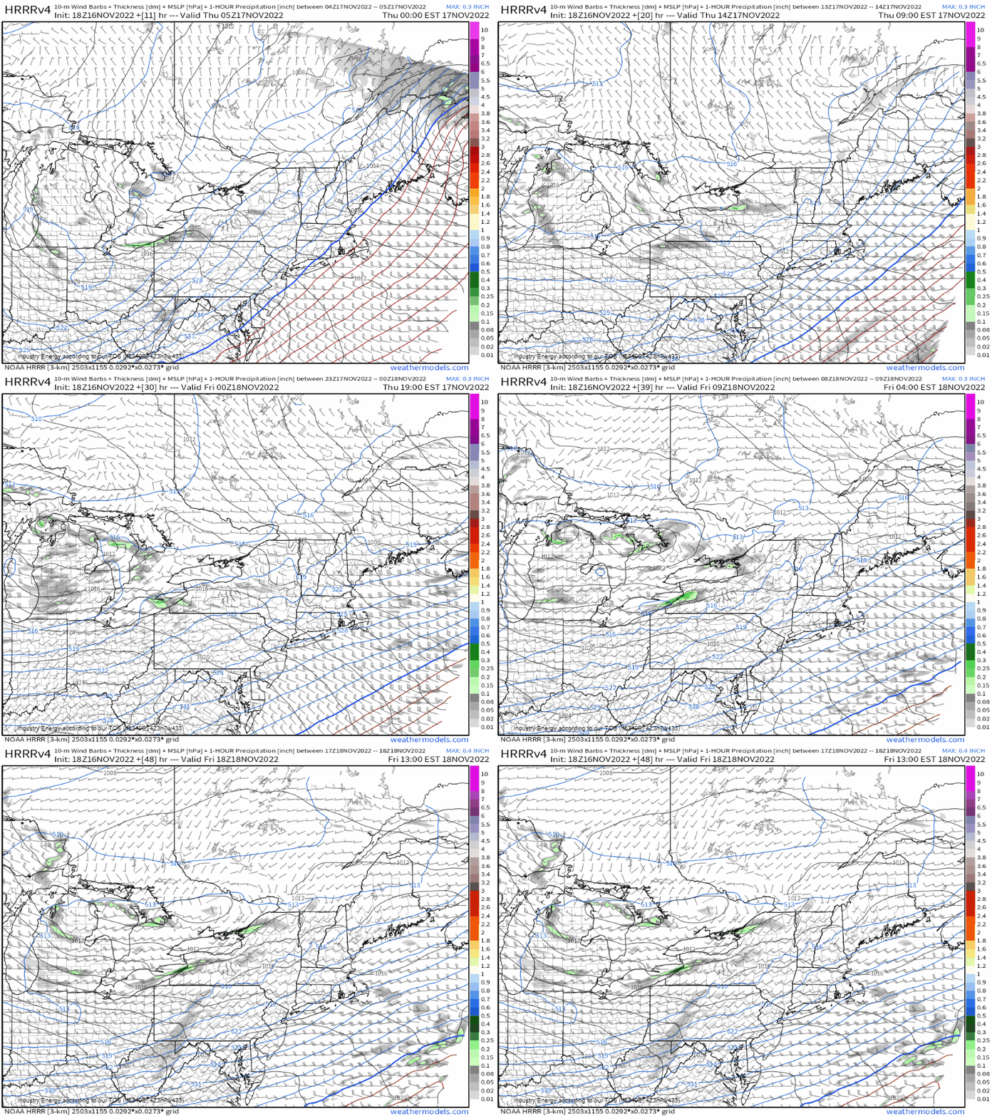
While lake effect snow will begin this evening for some as cold air, warm water, and favorable winds combine, the “main show” won’t truly kick off until Thursday evening.
What happens on Thursday evening? A persistent southwesterly flow over Lakes Erie and Ontario, record high lake temperatures, and a very cold air mass at the surface will combine to produce a particularly potent band of lake effect snow. A prolonged SW flow – like the one forecast for this event – allows the wind to blow in a long fetch across Lakes Erie and Ontario, increasing the potency of the bands. The location in which this band focuses as it persists through the weekend will likely be measuring their snowfall in feet when all is said and done.
I discussed how lake effect snow occurs in Monday’s blog, so we don’t need to rehash that. But, let’s look at the ingredients we have to work with that are expected to produce this monster of a snow band.
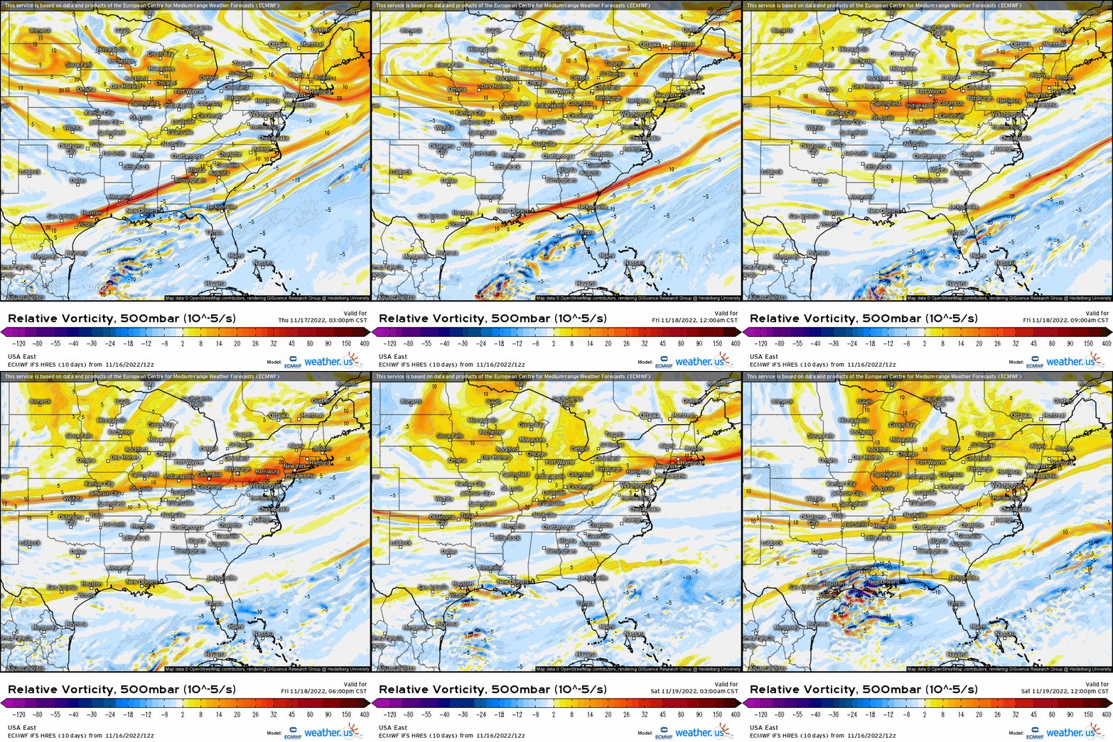
Synoptically, this event will get a boost or two as a few shortwaves roll through. These will provide extra lift and enhance the convection already occurring due to the temperature gradient between the surface and the air aloft.
Let’s pull a sounding and see what we have to work with in the mesoscale.
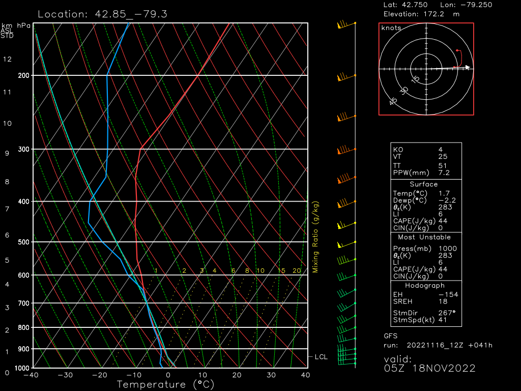
We need a few ingredients for the atmosphere to produce considerable lake effect snow:
- A minimum of 13 degrees C difference between the lake and the 850 mb level.
- Less than a 30 degree change in wind direction between the surface and the 850 mb. Shear diffuses the bands instead of focusing them.
- Deep layer of arctic air.
- Abundant low level moisture.
So, how does the sounding above stack up to the requirements? Let’s look:
- Currently, Lake Erie is between 50 and 53 degrees F in the vicinity of Buffalo, NY. That’s roughly 10 degrees C. On this sounding, the 850 mb level is roughly -9 degrees C. That’s a 19 degree difference between the lake and the 850 mb. It exceeds the requirement of a 13 degree difference
- Wind direction between the surface and 850 mb changes very little. In fact, it is nearly unidirectional. This meets the criteria of less than a 30 degree change in wind direction.
- As evidenced by the sounding, the entire column of air from the surface up is just about below the freezing point. Additionally, we discussed above that arctic air would be filtering in over the next day or so. This meets the requirement of a deep layer of arctic air.
- As for moisture, the column is near saturated through the 500 mb level. More importantly, the snow growth region (-12 to -18 degrees C) is saturated. Moisture won’t be an issue here.
So, we can see from this sounding alone that we have the ingredients for a considerable LES event. As the event wears on and the air becomes colder (once the arctic air mass settles in), there will be an even greater difference between the lake temperature and the 850 mb level. Lapse rates are important in LES events – a larger lapse rate lends to better instability, which is what drives lake effect snow.
Additionally, shortwaves can enhance these events through positive vorticity advection (enhanced lift). As mentioned above, a shortwave or two is forecast to spin through the region during this event.
Now, where exactly will these bands set up? That is THE question, isn’t it?
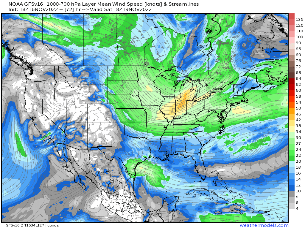
Typically, lower level winds control where lake effect snow goes.
In one of my forecasting classes, my professor taught us to find the level at which the air temp is -12 degrees Celsius. The wind direction at that level is the direction in which the banding will propagate.
So, if we go back to the sounding above, -12 degrees C is found near the 800 mb level. The wind direction here is WSW. This places cities like Buffalo, NY and Watertown, NY in the crosshairs.
The mean wind direction is VERY important in regard to where the banding sets up. A directional shift of only 5 degrees can dramatically change the forecast and impacts.
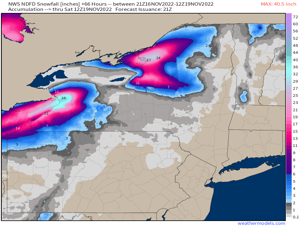
Based on the current analysis however, the consensus is that the wind will remain out of the WSW for an extended amount of time. While banding may wiggle around some, it is expected to mainly set up over Buffalo and Watertown. These locations have the potential to see crippling amounts of snow.
As with most LES events, the gradient will be tight. The largest amounts will occur just inland, where friction and convergence enhances lift. Amounts will drop off dramatically as we get further from the lake, however.
If you reside near the shore but northeast of Lakes Erie and Ontario, now would be a good time to prepare for a significant snowfall. If it pans out as forecast, local infrastructure could be crippled. Prepare to be unable to travel and for power outages as well.
We’ll keep you updated as the event kicks off and continues into the weekend!


